Near Record Warmth & More Heavy Rain…
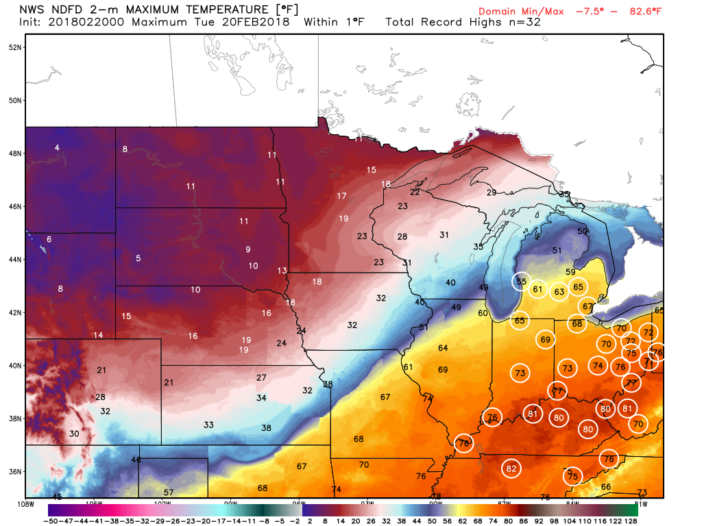
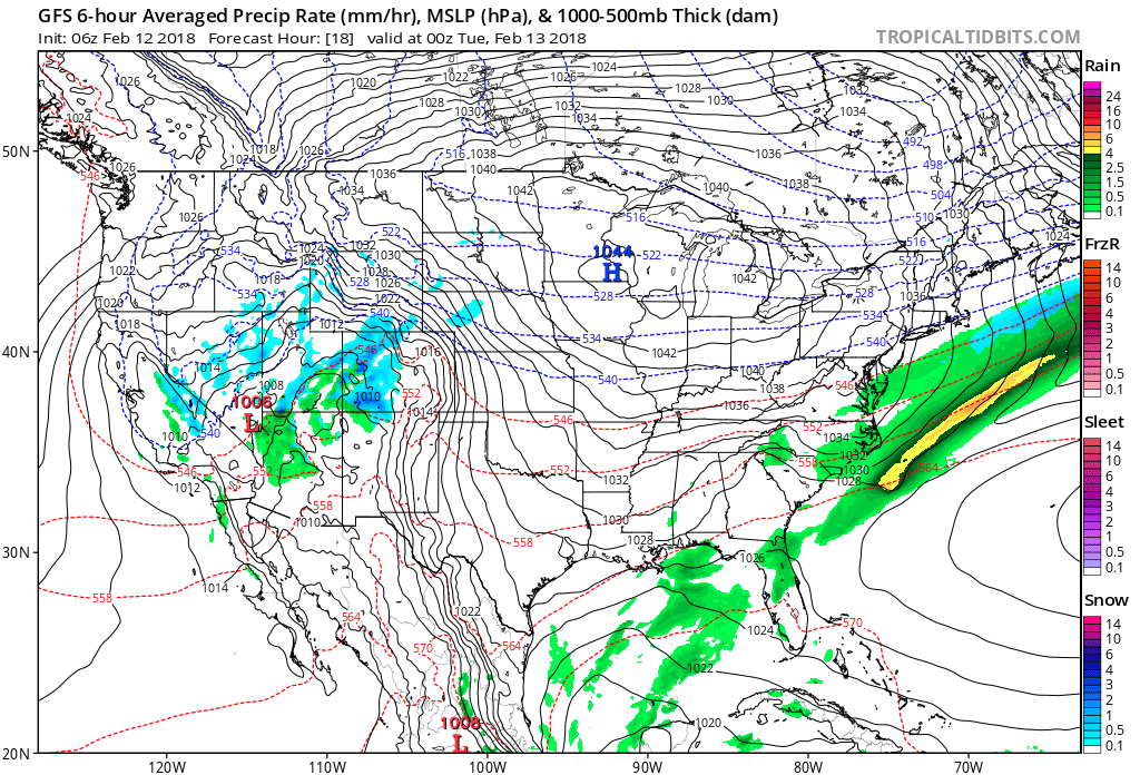
The big weather story Tuesday across central Indiana will be the near-record warmth. Typically it’s not until mid-May that average high temperatures climb into the lower to middle 70s, but we’re going to get an early taste of May tomorrow afternoon. Several records are in jeopardy of falling across the Ohio Valley Tuesday.
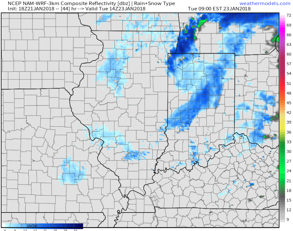
 Steadiest rains will fall across the northern third of the state Tuesday with scattered downpours through the morning and afternoon hours across central Indiana.

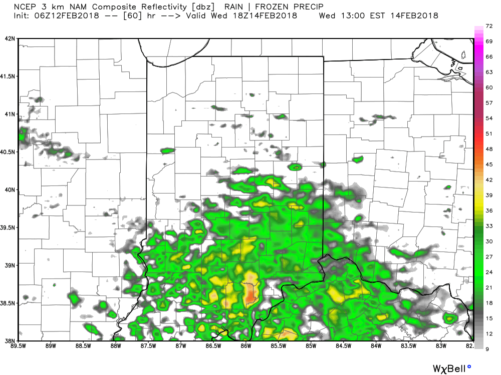
Heavier rain will overspread central Indiana late Tuesday night into Wednesday morning as the cold front settles south.
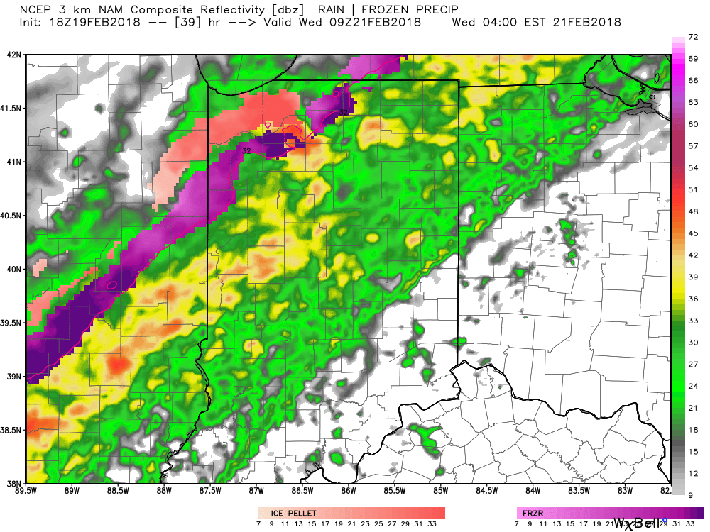
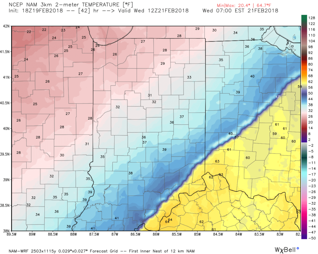
As the front continues to sink south, much colder air will quickly overspread the area. By the rush hour, many neighborhoods north of Indianapolis will already be around freezing. As moisture continues to stream northeast, areas of freezing rain will be possible on elevated and exposed surfaces Wednesday morning into the afternoon hours. With the recent warm, wet conditions, we don’t expect significant travel issues across central Indiana.
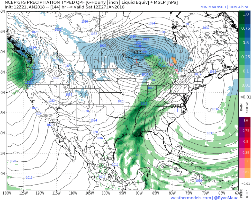
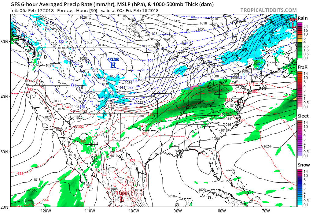
 After a quieter time of things most of Thursday, we’re tracking three additional waves of moisture Friday and through the weekend. At times, rain will be heavy, and we’ll certainly have to be on guard for water rise and increasing flooding issues as the weekend arrives.
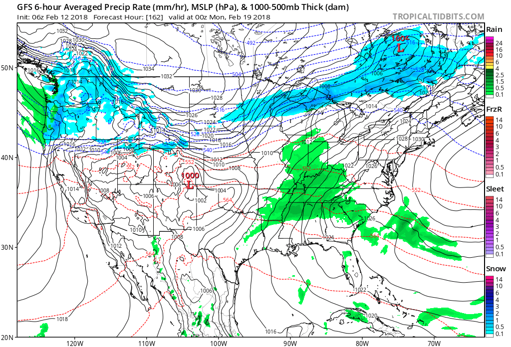
 By the time all is set and done Monday morning, we forecast additional widespread 3.5″ to 5″ rainfall totals with locally heavier amounts.
 Areas of fog and drizzle will continue this evening before a stronger southwesterly air flow pushes the low clouds and fog north during the overnight. As a cold front draws closer, steadier rains and perhaps even a clap of thunder (especially down state) will arrive Monday morning. Temperatures will remain nearly steady or even rise overnight into the lower 50s.
 The frontal passage, itself, will take place Monday evening and may feature a couple of gusty showers, especially across western and central portions of the state.
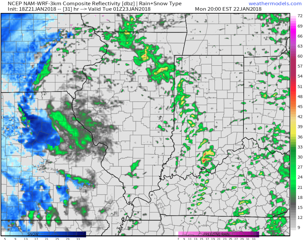 Temperatures will grow colder Monday night into Tuesday morning and precipitation will end as snow showers Tuesday.
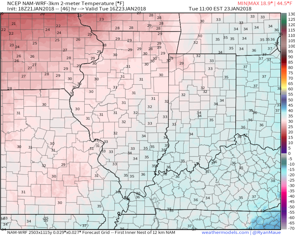
 High pressure will build in through midweek and provide dry conditions with increasing sunshine. The midweek stretch will begin seasonable before warming ahead of our next storm system.
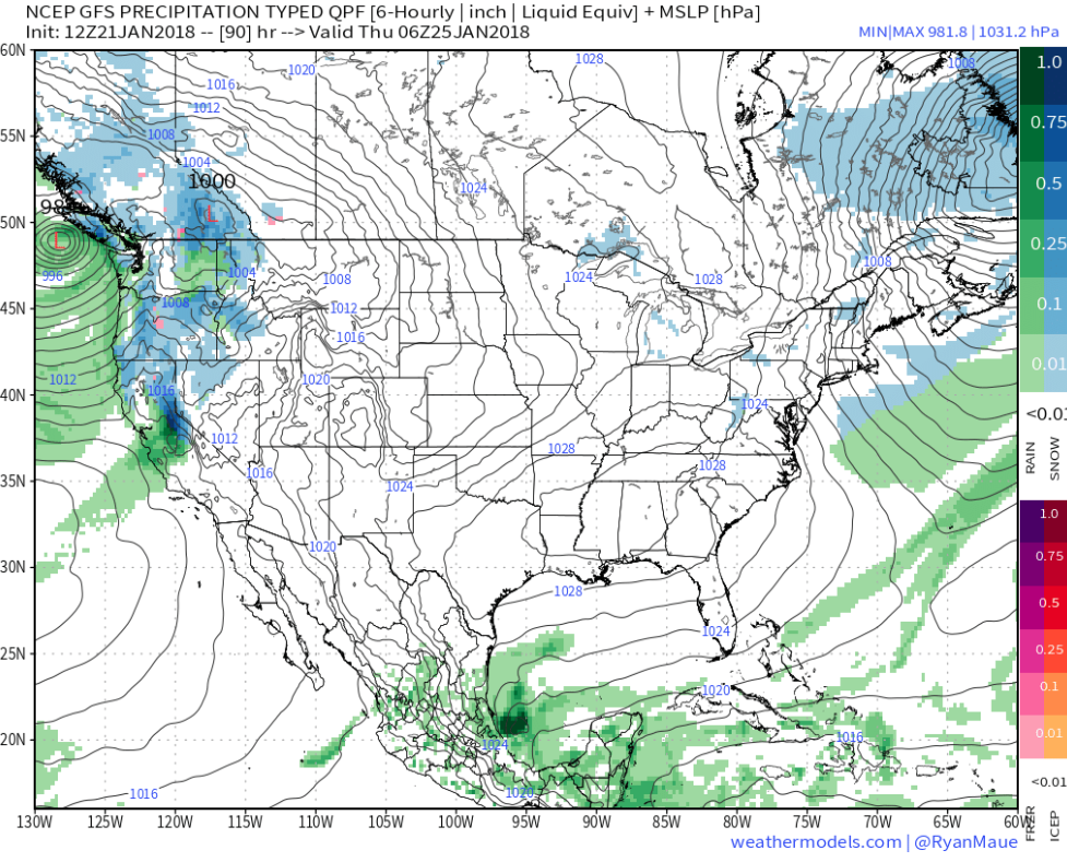 That next storm system will deliver rain as early as Friday evening into Saturday. We’ll note an increasingly gusty southwesterly breeze as we wrap up the work week, along with increasing cloudiness.