Category: 7-Day Outlook
This afternoon’s video update covers what will be a beauty of a close to the work week, potential strong to severe storms over the weekend, and a true feel of…
You must be logged in to view this content. Click Here to become a member of IndyWX.com for full access. Already a member of IndyWx.com All-Access? Log-in here.
Permanent link to this article: https://indywx.com/stormy-weekend-followed-by-an-autumn-ish-feel/
|
Thr.
|
Fri.
|
Sat.
|
Sun.
|
Mon.
|
Tue.
|
Wed.
|
|

|

|

|

|

|

|

|
|
61/ 80
|
58/ 82
|
65/ 83
|
70/ 85
|
70/ 85
|
54/ 70
|
51/ 70
|
|
– – –
|
Light
|
Light
|
Light
|
Light
|
Light
|
– – –
|
Today will be another beautiful day across central Indiana with low humidity, cooler than normal temperatures, and plentiful sunshine. Be sure to enjoy because we’re eyeing stormier times and increasing humidity for the weekend. Most of Friday will feature more pleasant conditions, but storm chances will increase Friday night and this is just the beginning of what will likely be a rather busy weekend, including multiple storm chances. We’ll have to fine tune timing of thunderstorm complexes as we move forward, but for now we may have to deal with a round of gusty (strong to severe not out of the question) storms Saturday morning and again later through the weekend. Severe threats this weekend include damaging straight line winds and large hail. A strong cold front will sweep the state late Monday and early Tuesday and help usher in a fall-like feel for the majority of next week! It’ll be hard to believe it’s mid July with the type cool air mass we’ll enjoy!
Permanent link to this article: https://indywx.com/weekend-turns-stormy/
Wed. Thr. Fri. Sat. Sun. Mon. Tue. 62/ 79 56/ 79 58/ 82 64/ 84 70/ 85 70/ 86 61/ 73 – –…
You must be logged in to view this content. Click Here to become a member of IndyWX.com for full access. Already a member of IndyWx.com All-Access? Log-in here.
Permanent link to this article: https://indywx.com/fantastic-midweek-weather-stretch/
Tue. Wed. Thr. Fri. Sat. Sun. Mon. 66/ 80 61/ 77 56/ 78 58/ 82 64/ 86 67/ 83 64/ 86 Moderate –…
You must be logged in to view this content. Click Here to become a member of IndyWX.com for full access. Already a member of IndyWx.com All-Access? Log-in here.
Permanent link to this article: https://indywx.com/fresh-air-set-to-return/
-
Filed under 7-Day Outlook, CFSv2, European Model, Forecast Discussion, NAEFS, Rain, Severe Weather, T-storms, Unseasonably Cool Weather, Weather Videos
-
July 7, 2014
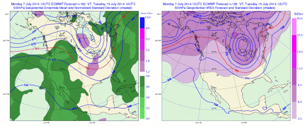
This evening’s video covers a potential round of thunderstorms Tuesday morning and takes a deeper look at the mid range. Yet ANOTHER unseasonably cool blast of air awaits on deck for mid-month and will provide a hint of early fall, per the EC ensemble run below for next week. This is just one piece of data amongst several pieces pointing towards a big mid-month cool down. Much more in the video update below!

Permanent link to this article: https://indywx.com/monday-evening-video-update-2/

