Sunday Morning Rambles: Focusing On Severe Weather…
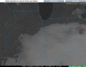
Low clouds and areas of fog will be slow to burn off this morning, but the sunshine should eventually return later this afternoon and evening, providing a phenomenal close to the weekend.
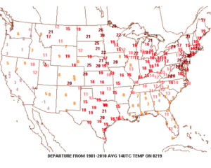
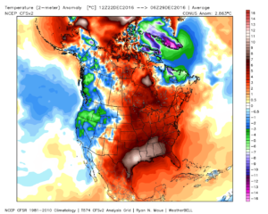
 Despite the lack of sunshine this morning, temperatures continue to run much milder than average. We’re currently running nearly 20° above where we should be at the 9a hour.
 A quiet start to the work week is ahead as high pressure dominates early on. That said, a weak storm system will scoot through the state Monday night and Tuesday morning and this will help offer up the chance of showers and perhaps a rumble of thunder.
 The next (more significant) storm system will pose a severe weather risk to close the week. We continue to keep a close eye on Friday and the Storm Prediction Center is as well, with western IL, IN, and western KY in their Day 6 Outlook. It’s still early, but the primary focus with the severe potential this storm may pose will be large hail and damaging straight line winds. Stay tuned as we continue to analyze the latest data.

 We’ll turn sharply colder Friday night and Saturday. Though it’ll feel much colder, we’ll really only “chill” to seasonal levels, including a gusty northwesterly breeze Saturday.
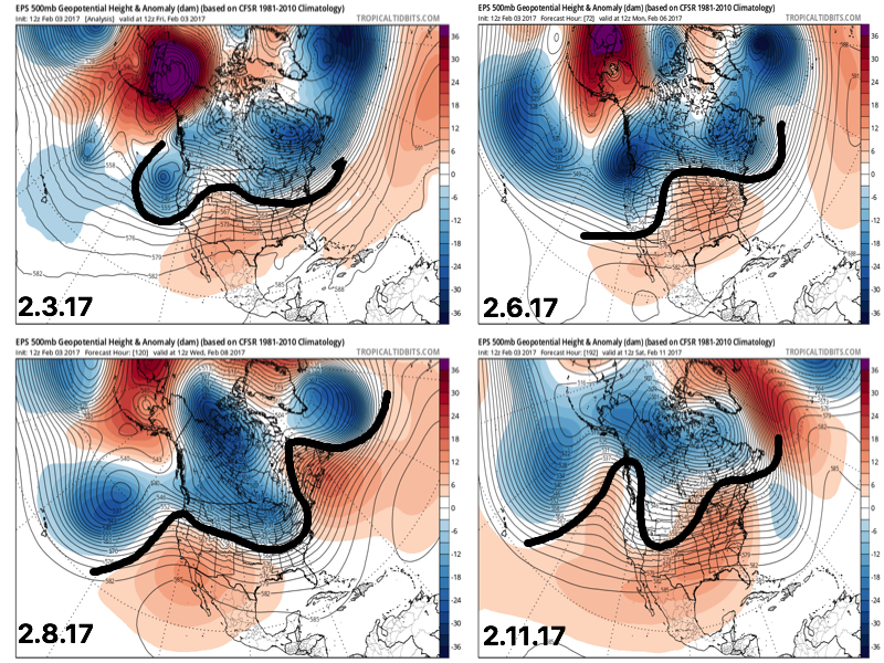
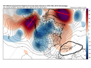
 Longer-term, we’re rumbling into a much more active weather pattern through the mid range period. As the mean trough sets-up position in the west, the ridge will flex it’s muscle across the east yet again during early portions of Week 2. This will set the stage for a repeat of what we deal with Friday and, accordingly, we’ll have to monitor early next week for portions of severe weather yet again.
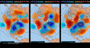
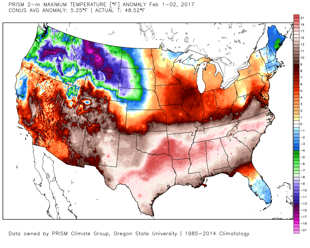 However the cold air won’t last and milder times will return by the second half of the weekend. This back and forth “tug of war” type regime will remain as cold and warmth (relative to average) continue to battle over the upcoming couple weeks. The latest European ensemble shows this nicely.
 This also favors a rather active pattern and confidence is high on a wetter than average period upcoming over the next couple weeks. See the GFS ensembles support this idea. A couple strong storms are also possible Tuesday.
 Unfortunately for snow lovers, the majority of significant moisture should fall as rain. Best snow chances appear to come with “backlash” wrap around snow showers and squalls Tuesday night into Wednesday morning. Accumulating snow is possible, but most amounts should be light. We’ll keep an eye on it.
 Longer-term, the fight continues deeper into the month. As
 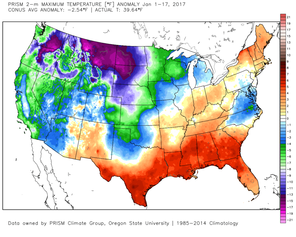 The second week of the month warmed significantly and continues, overall, for the next week.
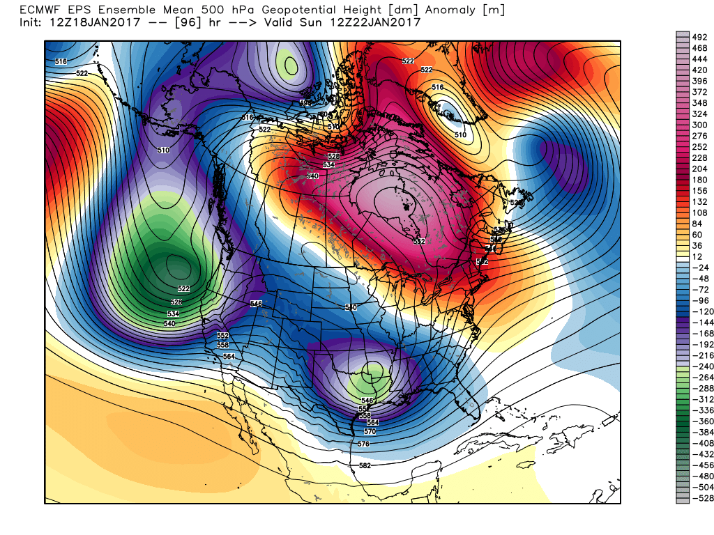
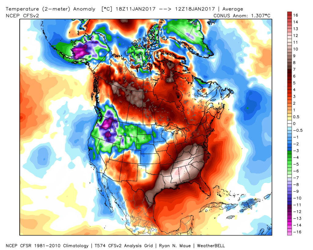 The mid-January warmth is attributed to a roaring PAC jet which is currently helping flood the country with temperatures much more like spring than the dead of winter. We continue to forecast 60+ this weekend across central IN.
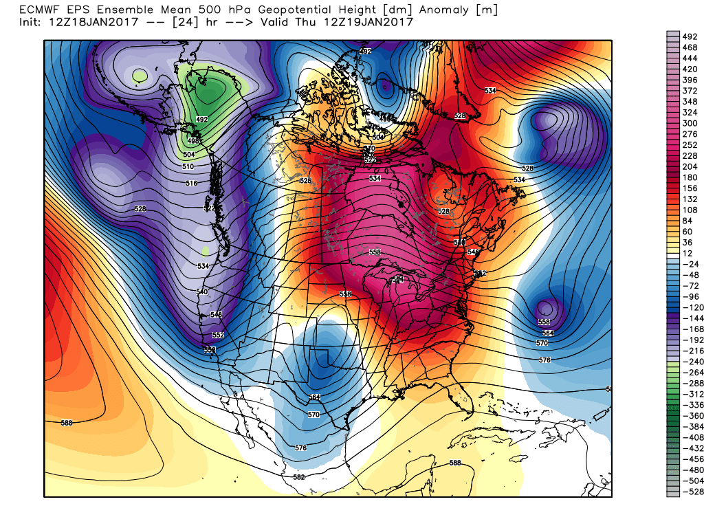 This Weekend:
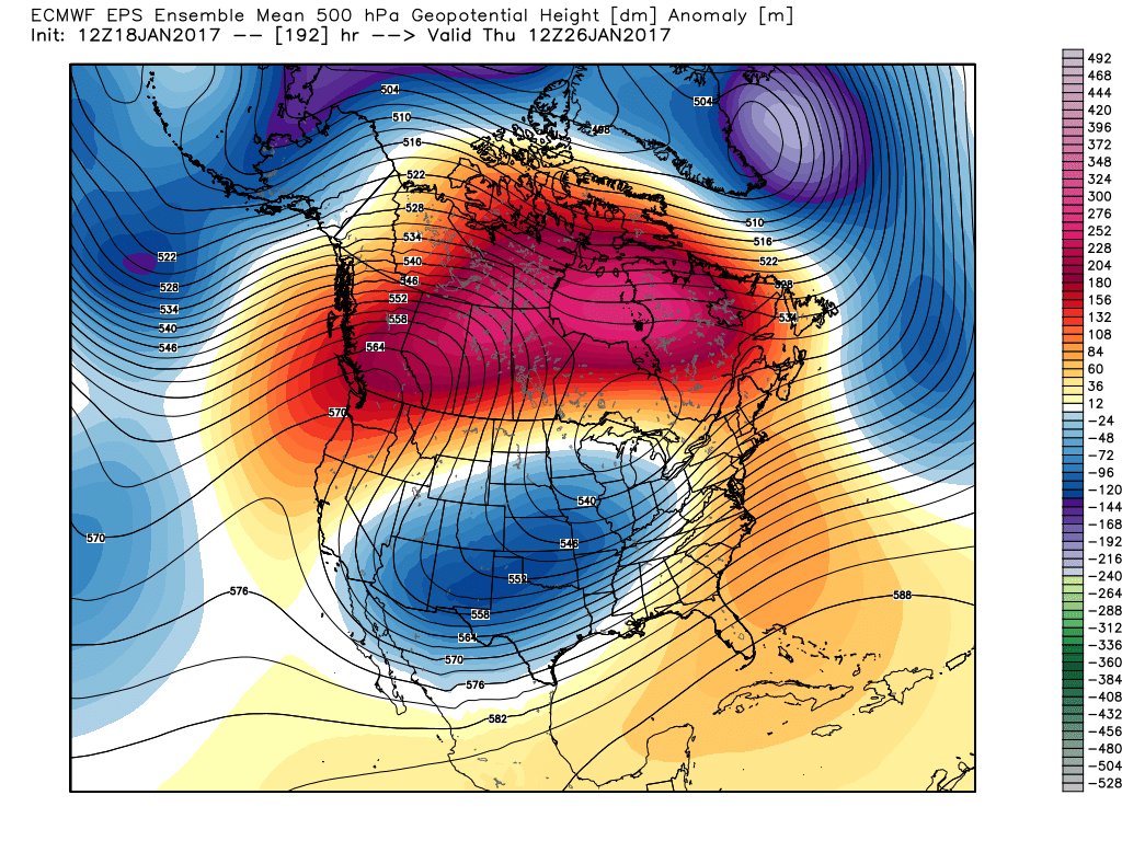
 Next Thursday:
 Next Weekend:
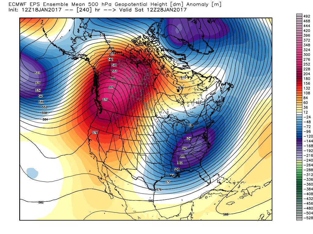 The pattern begins in the short-term with a look that will power anomalous warmth through the weekend, along with renewed rain chances Thursday night into Friday (another 1″+ for most), but begins to shift next week towards the colder look. The 2nd (weekend) storm system will be significant and poses a severe risk to the southeast region. Modeling has backed away on the heavy rain threat Sunday, but showers will be around early next week along with very windy conditions (40+ MPH gusts). Blocking is forcing the low south. By the time we get to next weekend, the pattern has done a 180 and in a position to drill unseasonably cold air back into the central and eastern portions of the country.
 By Day (10), the cold pattern is well established over the Lower 48. This is a coast-to-coast cold signal (heart of the cold centered over the west and central) depicted by the European ensemble, along with other modeling.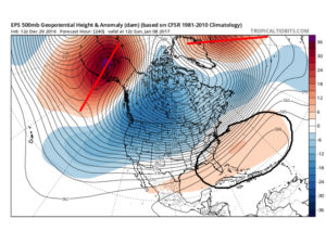
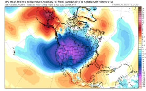 Teleconnections support a cold pattern returning.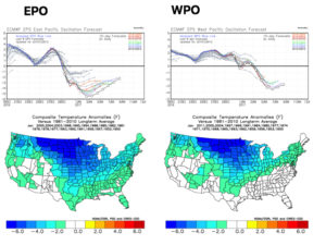
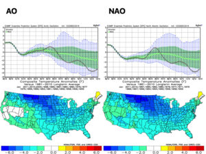
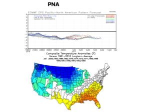 The agreement amongst teleconnections is nice to see and ups confidence in the overall direction of where this pattern is heading in regards to colder than average times looming. The negative PNA correlates nicely with the SE ridge that continues to make itself heard from time to time over the next few weeks. It should also be noted that the phases of the Arctic Oscillation (AO) and North Atlantic Oscillation (NAO) become more of a factor for mid and late winter.