Still Warm, But Much More Active…

So far, May-to-date has run well above average in the temperature department (+8.5°) and below average from a precipitation perspective.  While we’ll continue to run much warmer than normal through the second half of the month, we’ll begin to make up for “lost time” in the rainfall department, and that starts this week.

Daily chances of showers and thunderstorms are included in your latest 7-day and, at times, storm complexes will likely reach strong to severe levels as disturbances ride the periphery of an upper level ridge off to our south.  It certainly won’t rain the entire time over the upcoming week and we’ll still enjoy more dry hours than wet and stormy.  That said, for a region running around 1.5″ below average, the more active times will be a welcome sight for many.  By next Sunday, we expect many area rain gauges to accumulate 1.5″ to 2.5″ of rain with locally heavier amounts.

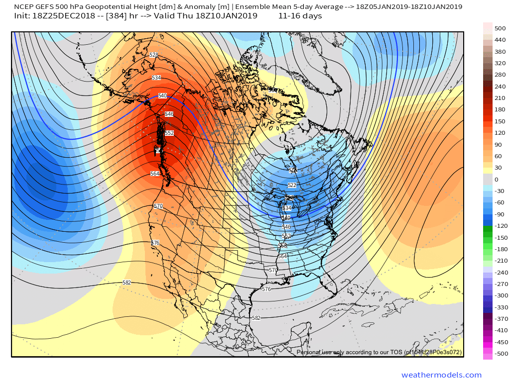
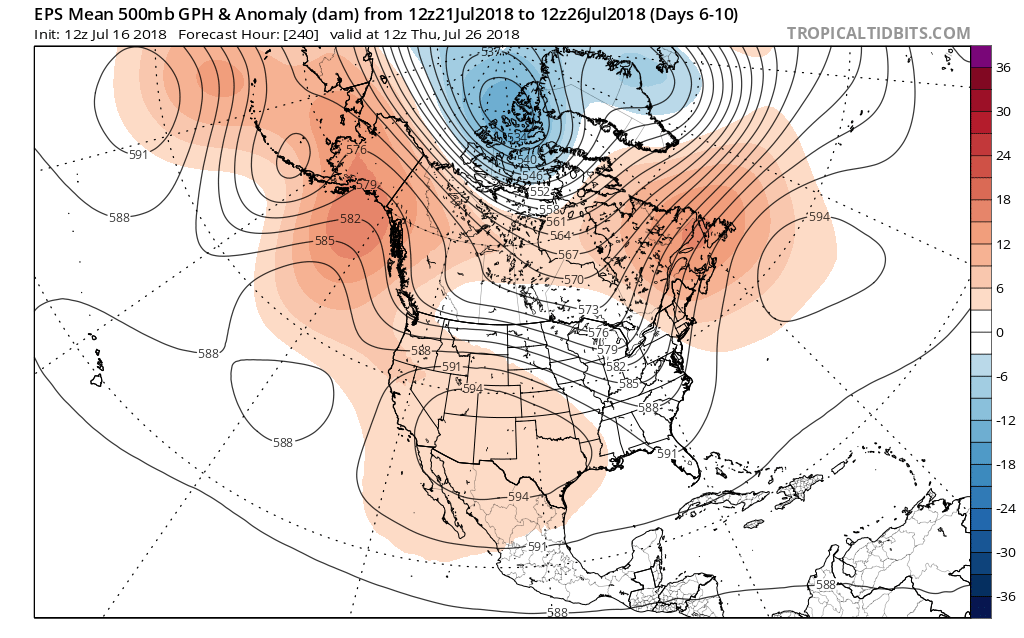
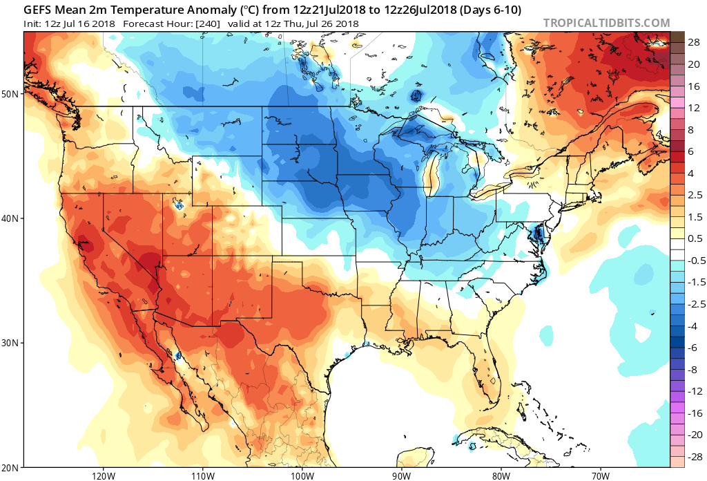
Warmth will continue to dominate through the next couple of weeks.
For a change, above normal precipitation is expected over the upcoming week.

Warmth Dominates; Timing Out Storm Chances Over The Upcoming 10-Day Period…

After a month-to-date temperature anomaly map that looks like this:

…and a year-to-date that looks like this:

…sustained warmth is music to the ears of many Hoosiers!  Thankfully, the balance of the upcoming (10) days will feature warmer than average conditions, as illustrated by the latest European ensemble data.

This will include multiple days with high temperatures rising into the 80s over the upcoming 10-day stretch (Tuesday and Wednesday and again next Monday through Wednesday).

As for storm chances, dry times will continue to dominate Tuesday with plentiful sunshine. Clouds will begin to increase Wednesday and we can’t rule out an afternoon shower, but most should still remain dry.  Thursday and Friday will offer up the best chances of getting wet, including embedded thunder.

As for rainfall totals, it still appears widespread amounts will check-in in the half inch to one inch range, but a few locally heavier amounts can be expected.

Models continue to dry us out in time for the weekend and all of those important Cinco de Mayo/ Derby plans.  An increasingly sunny sky will be with us along with highs in the middle 70s Saturday afternoon!  Can you say “perfection?”

Looking ahead, I’m not sold we won’t have to deal with showers Sunday as a disturbance moves nearby (low confidence forecast from this distance).  More widespread showers and thunderstorms will arrive on the scene late next week…

We also note the majority of longer range guidance trending warmer for May. We’ll have some updated thoughts on that later this week!

Now We’re Talking…

The work week has opened on a gloomy note.  Thankfully, improvements are on the way as we look ahead!  Despite a small “setback” Friday (scattered shower chance), the majority of the upcoming 10-day period will feature a warming trend and an overall drier than average theme.

Weak high pressure will build into the Ohio Valley through midweek and will result in an increasingly sunny sky Wednesday-Thursday.

Temperatures will remain cooler than average, but that late-April sun will feel mighty nice, especially after a couple days of “showery” overcast and 50s.

Models are trending drier as we look ahead to Friday’s system and we tend to agree.  While we can’t rule out a few showers Friday, this won’t be a significant event (0.10″ for those that do see rain).

High pressure will quickly build in thereafter and lead to the best weather weekend so far this spring.  Saturday and Sunday should feature plentiful sunshine both days.  Morning lows will be chilly (upper 30s to lower 40s for most), but daytime highs will zoom into the 60s both days.

As we look ahead, warmth will continue to build as we open May.  Lower 80s seem to be a good bet as we move into next week, but before we get into sustained warmth, another “setback” or two seems to be a good bet.  We note the EPS showing this nicely as cooler anomalies return by Week 2.

It remains a drier than overall pattern over the upcoming couple weeks.  The next storm of any significance is slated for an arrival late next week (Thursday time frame).

Turning Significantly Warmer Towards The End Of The 10-Day Period…

The upcoming 10-days will run cooler than normal, overall, but it’s the cool on the front end that will be most noticeable before a nice warming trend develops towards the weekend and into early parts of Week 2.

After a chilly work week (relative to average), 60s will return this weekend and temperatures will zip into the lower and middle 70s early next week, before approaching 80° by the middle of next week.

Despite the showers that will impact central Indiana today, it’s mostly a dry pattern over the upcoming 10-day period.  Additional rain chances will continue Tuesday (scattered, nuisance-level) and with a frontal passage Friday. With that said, 10-day rainfall will only run between one half and three quarters of an inch for most of the region.

The majority of the Ohio Valley will run drier than normal through the period.

Midweek Weather Rambles: Calmer Times On The Horizon…

I. It’s a state divided this afternoon with winter across the northern third of the state (most are in the 30s), seasonable spring conditions central (low-mid 60s), and 70°+ downstate. Unfortunately, we’ll all turn colder tonight and as low pressure scoots east across the Ohio Valley, it’ll help pull a swath of wet snow across the northern half of Indiana after midnight through the predawn hours Thursday.  Further north and northeast, a wet accumulation of an inch or less can be expected.

II.  We’ll turn cooler to close the week, but with an increasingly sunny time of things, we forecast a very pleasant open to the weekend.  High pressure will remain in control of our weather into early next week.  Really the only item of interest will be a gusty easterly breeze at times Sunday into Monday.  We’ll watch a storm system get shunted south and stay dry here.  Overnight lows will remain chilly through the weekend.

III.  The next opportunity for meaningful precipitation should arrive the middle of next week (Tuesday-Wednesday) time frame, and even this doesn’t look like a big deal.  From this distance, it seems like 0.10″ to 0.25″ will come from that system.

IV.  As we look ahead, the relative cold looks to relax as we put a wrap on April and open May.  Additionally, we also note the EPS painting much of the northern tier into the Ohio Valley with a drier than normal signal.  Sure looks like conditions are finally improving for #Plant18 to get underway in earnest…