Updated 01.04.24 @ 6:46a Enjoy the last couple of quiet days while you have them. Skies will slowly brighten later today, but otherwise anticipate mostly cloudy and seasonably cold conditions.…
You must be logged in to view this content. Click Here to become a member of IndyWX.com for full access. Already a member of IndyWx.com All-Access? Log-in here.
Today’s 12z guidance continues to reflect quite an active and stormy period of weather kicking off this weekend, continuing through mid-January. This is a byproduct of all of the high latitude blocking that develops over the span of the next 6-10 days.
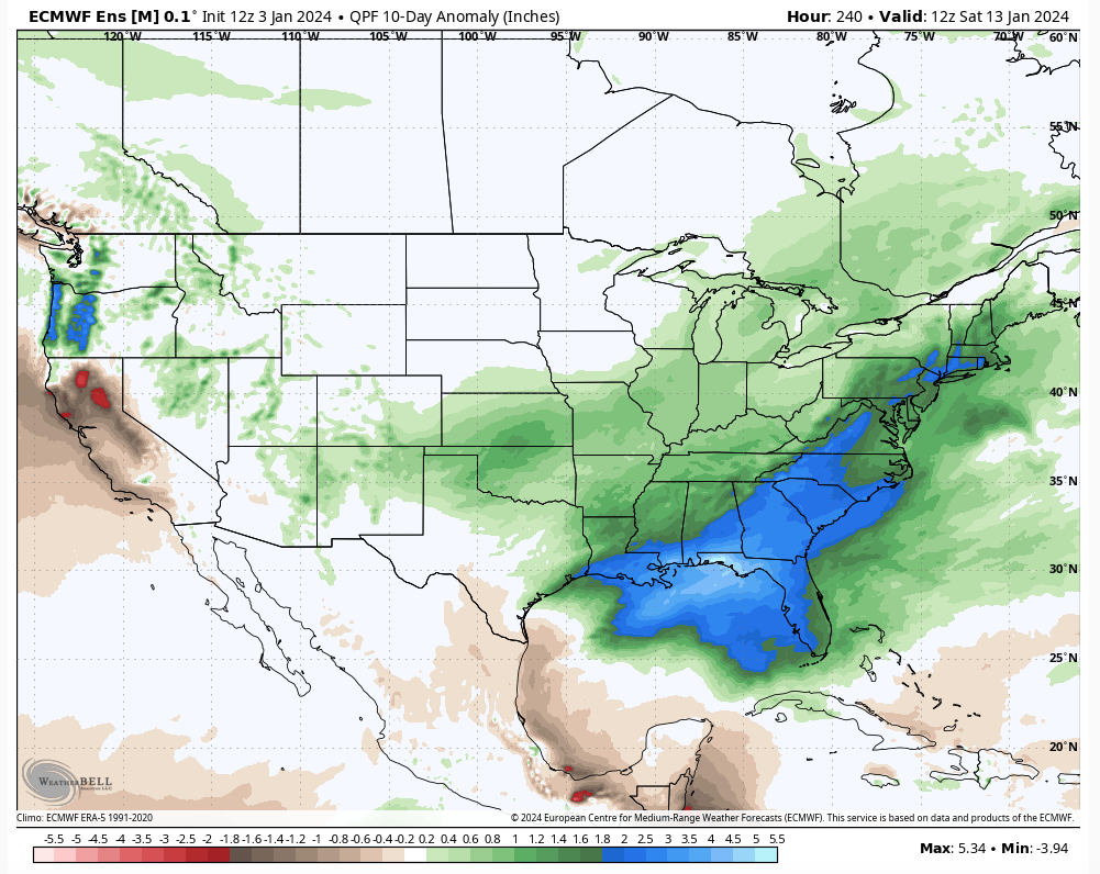
The negative PNA is putting a real wrench in any one of these “meaningful” area of low pressure systems, Saturday’s excluded, from being totally on the wintry side. Look for above normal precipitation over the upcoming 6-10 days with plenty of mixing events going on.
Speaking of that, we don’t have any changes to our thoughts on the first two systems:
Saturday- light snow should overspread the region through the morning hours with light accumulation, primarily on grassy and elevated surfaces. We’ll firm up snow numbers over the next 24 hours. Note, additional light snow, potentially mixed with light rain, should fall Saturday night into Sunday as upper level energy scoots across the state.
Monday night/ Tuesday- after a calm open to the work week, clouds will increase Monday PM and give way to a wintry mix of rain, sleet, and snow across the state Monday night into Tuesday morning. As warm air advection kicks into high gear, the wintry mix will transition to a cold rain for central and southern IN. Further north, it’s a tougher call with mixing issues hanging on longer. Heavy precipitation and strong/ gusty winds can be expected Tuesday. We all turn colder Tuesday night with rain transitioning back to wind-whipped snow/ snow showers that will continue Wednesday with additional light accumulation expected.
Wednesday night/ Friday- another potential significant area of low pressure will impact the region during this particular time period with additional heavy precipitation (likely another mixed bag event) and strong winds.
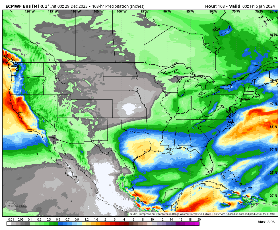
Well above normal precipitation is expected across a large chunk of the East over the upcoming 10 days.
The initial dump of bitterly cold, arctic, air will target the West through the 6-10 day period before making an attempt to bleed east (likely in modified fashion) during this period. Per our longer range discussions, the MJO will have the primary say in our late January pattern and we’ll have fresh long range thoughts posted prior to week’s end.
I hope you and your family are enjoying an incredible New Year’s Day! What a game we have on our hands at halftime in the Rose Bowl.
I post this in flight back to home base from ushering in the new year in the beautiful Berkshire mountains. Our regularly scheduled client video discussions will return tomorrow morning. I trust you’ve been following along with both short and long term pattern ideas daily over the past week.
The immediate term opens with quiet and unseasonably calm conditions while the end of the upcoming 10-day stretch will end much colder. The transition between start and finish will turn much more hectic around these parts as we track not one, but two storm systems between this weekend and early next week. While there’s no doubt we’ll trend colder than average by Day 10, questions abound with just how cold we go. Should we get a snowpack down, subzero is on the table.
Speaking of the aforementioned more “hectic” pattern, this kicks into gear over the weekend. While modeling likes more of a suppressed track at this distance, thinking here is that guidance will start to pick up on a more organized northern piece of energy, or surface low reflection, that will accompany the primary Gulf low. I suspect a secondary, organized, shield of precipitation into the OHV region Friday night into Saturday. Will that be enough to put our neck of the woods into a winter storm risk during this timeframe? Too early to call at this distance, but given where the PNA, EPO, and Greenland Block that will be starting to mature, I’d recommend keeping an eye on what will likely be an eventual click or two northwest as the week goes along. It’s likely either a “snow or no” type situation here with storm #1, as opposed to having to worry about rain or mixing issues.
As for storm #2 early next week, our early idea takes the primary low into the OHV before a secondary low “takes over” along the eastern seaboard. The energy transfer likely brings just enough mild air north into the central Ohio Valley to create more of a rain to snow type scenario, locally. The coldest air of the season so far will likely follow in the 10-15 day.
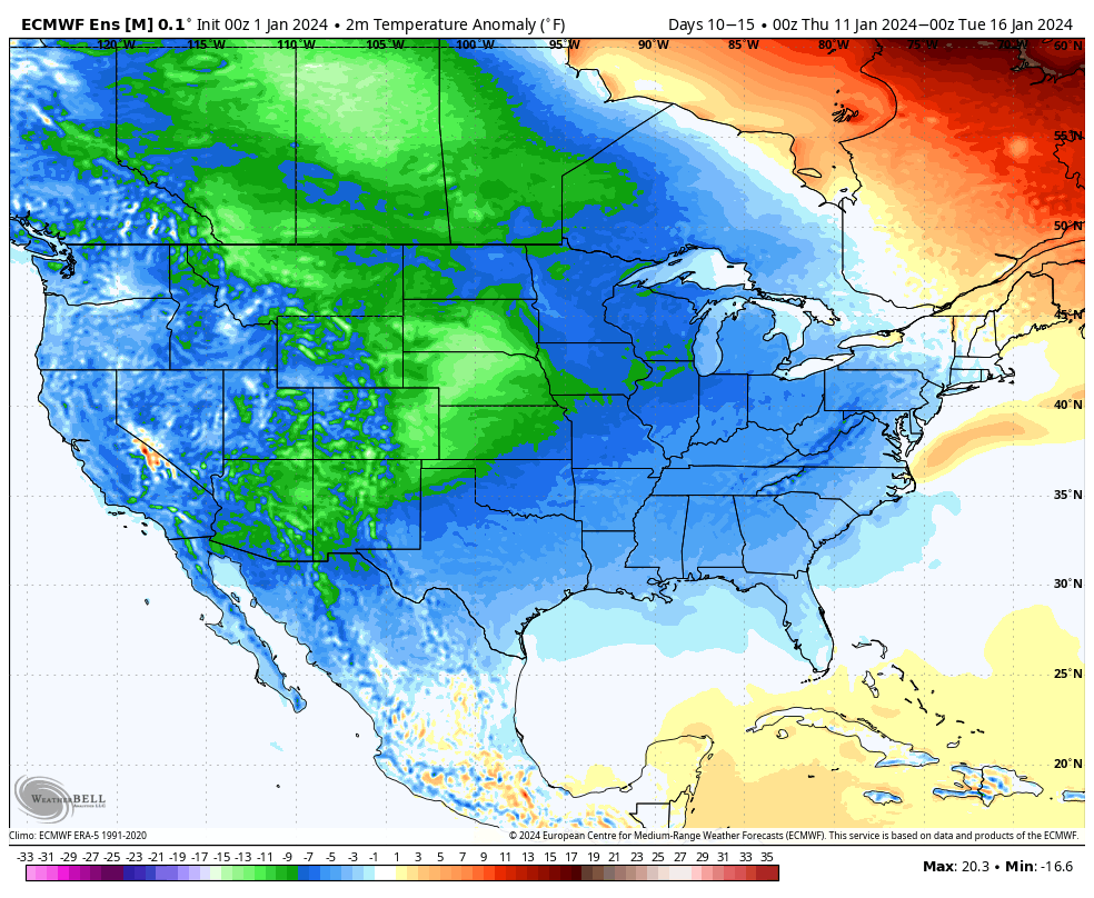
Speaking of the 10-15 day, the look above is an absolute textbook upper air pattern not only for cold, but continued opportunities of winter weather here as we rumble into mid-January. By this point, other long term pattern drivers, such as the NAO and AO (of course to go along with the MJO, PNA, and EPO) will be factored in to where we head not only for the 2nd half of the month, but into late winter and spring. Recent trends certainly suggest the colder options are gaining traction. Today’s European Weekly update reflects a more persistent stretch of high latitude blocking I can remember o/ the past few winters. This ups the ante for a stormy stretch into and through the heart of winter. Given the longer term NAO and MJO look, I’d suspect the colder threat (relative to normal) is on the table into spring this year.
From our family to yours, we’re wishing you a joyous and prosperous 2024, filled with health and happiness!
The weather pattern through Friday is simply about as quiet as one could ask for by early January standards. High pressure will keep us dry and seasonably chilly. A weak disturbance will drift across the northern Great Lakes Wednesday evening into Thursday morning and could set off a few light snow showers, but even if this does take place, we’ve already wasted more pixels than needed. 🙂
A calm, quiet start to the new year is on tap.
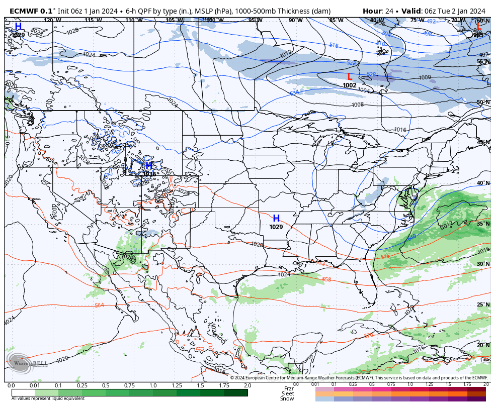
Things begin to change this weekend as low pressure organizes in the western Gulf of Mexico with a trough extending north into the central Plains. Both features will move east and then head up the eastern seaboard over the weekend. The all-important question here has to do with the northern energy. Do we get a reflection of a surface low into the Ohio Valley and associated heavier precipitation, or are we mostly bypassed off to the south (thanks to the primary low taking control)? Stay tuned. This picture should become much clearer over the upcoming 24-48 hours. Sensible weekend weather here ranges from an all out winter storm to nothing more than light snow.
Another storm will follow early next week. Finally, a big ole batch of arctic air will likely expand into the region in the 10-15 day period. By that point the question will become just how cold can we go? A lot of that will have to do with what, if any, snowpack we have down by that time. Are we just colder than average by mid January standards or talking sub-zero stuff?
Needless to say, enjoy the quiet times while we have them. A fresh Client video will be posted first thing in the morning with more details on this and more.
First, if you didn’t have a chance to see our thoughts after the European Weeklies came in, you can check that out here.
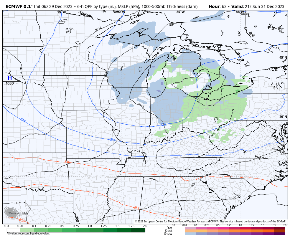
After the snow across portions of western and southern Indiana the past couple days (thank you for all of the reports, by the way), the next feature we’re tracking has to do with a clipper system that will dive southeast across the upper Mid West and into the Ohio Valley New Year’s Eve. This will certainly be moisture-starved, but should have just enough to work with to generate snow flurries and scattered snow showers by late Sunday morning, continuing in off an on fashion into the afternoon and evening.
A weak clipper system will offer up a few snow showers New Year’s Eve.
That’s really all there is to track, locally, over the upcoming 7-day period. The predominant storm track will shift off to the south during this time frame as an active, El Niño induced, southern jet takes hold. The one potential feature of interest is out towards the end of next week. We’ll keep an eye on it, but as of now, it looks like the phasing of energy will take place just a little too far east for anything of “excitement” here.
Temperatures will continue to cool closer to seasonal averages and perhaps a bit below normal over the upcoming 10-14 days. Greatest cool anomalies will be located across the western and southern tier during this timeframe.