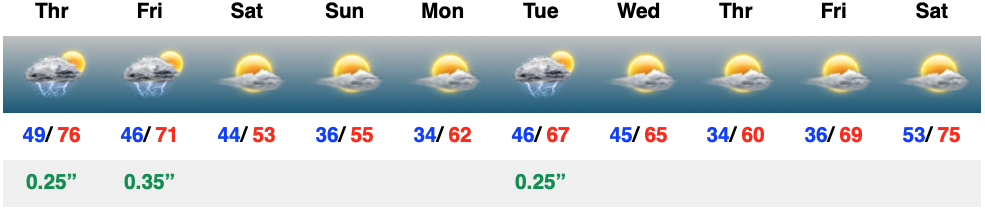
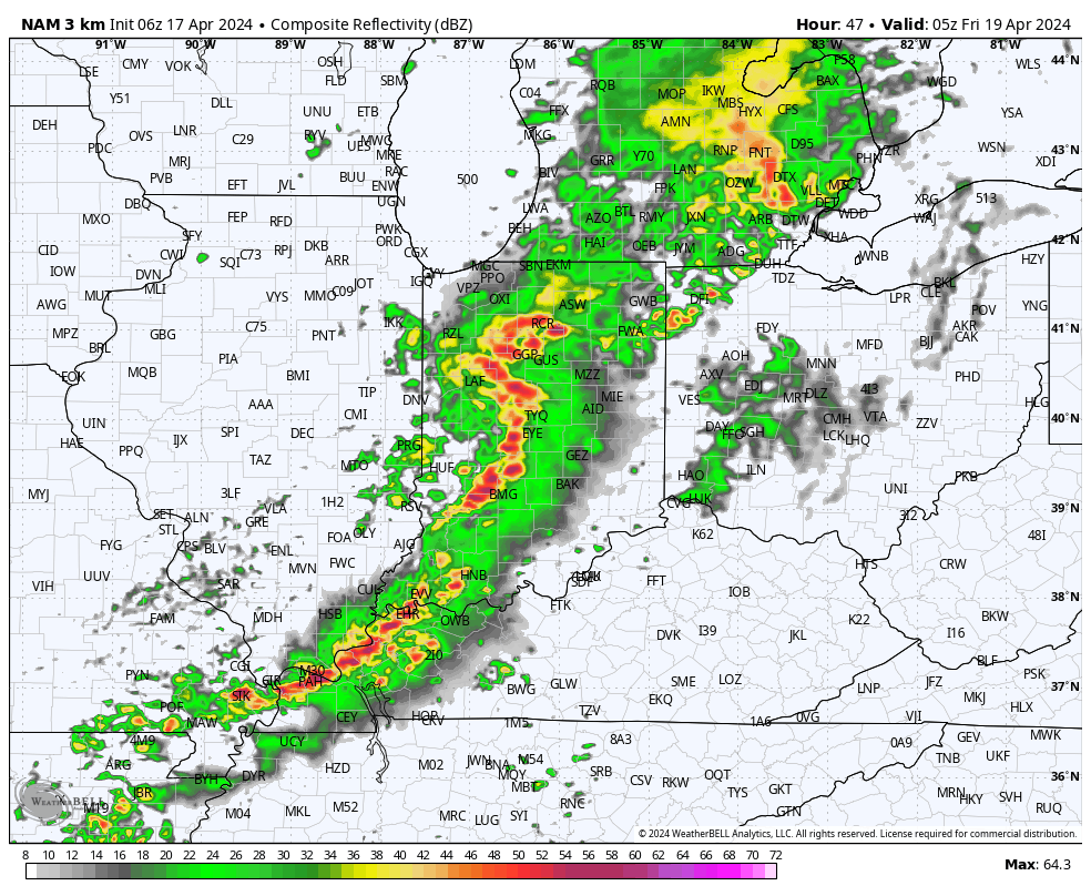
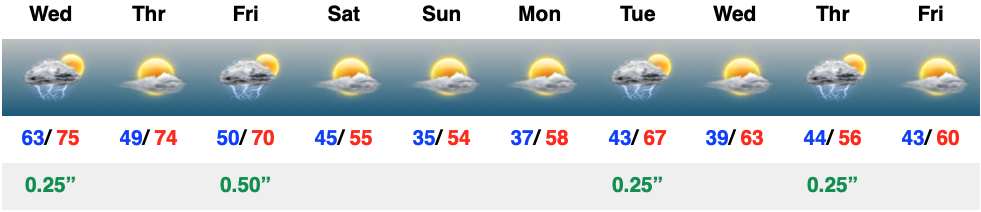
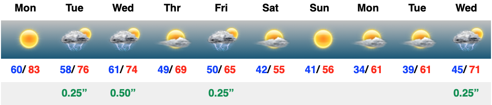
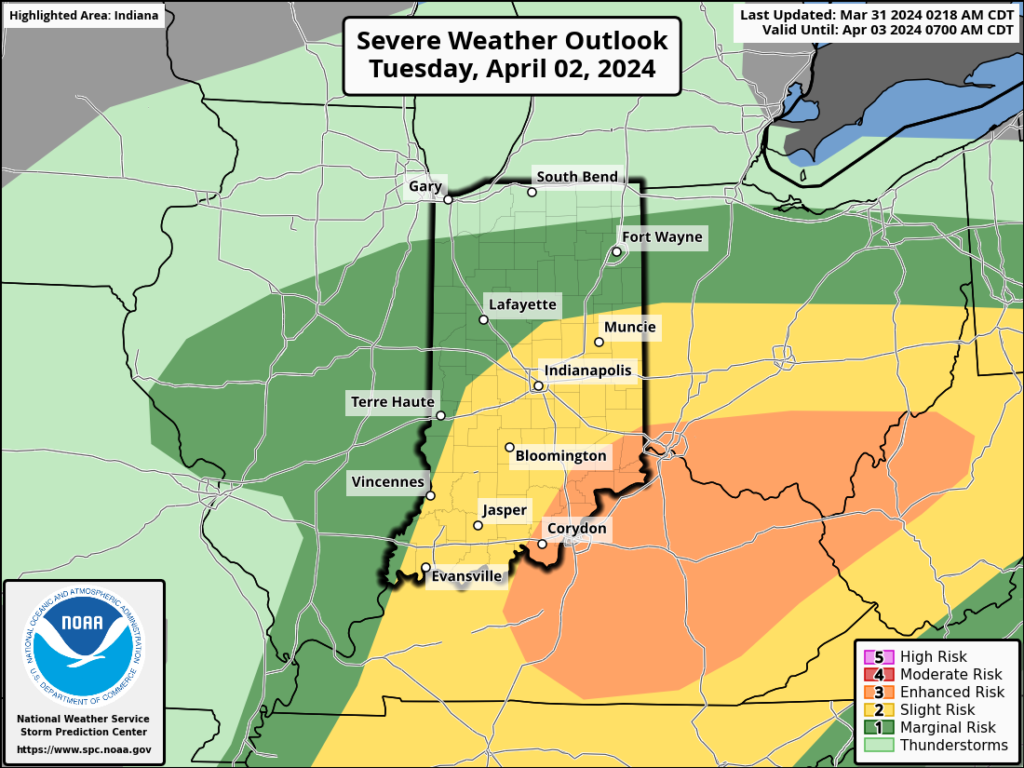
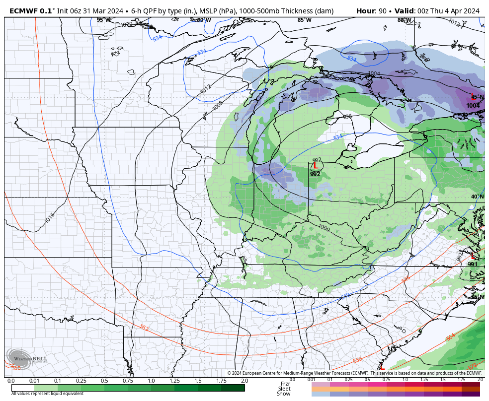
The day will start off quiet, but won’t end that way. We’re monitoring the threat of strong to severe storms later this evening, continuing into and through the overnight hours. The good news? All of these will be off to our east prior to heading out the door to work or school Friday morning. Then we can concentrate on a refreshingly cool weekend with sunshine returning.
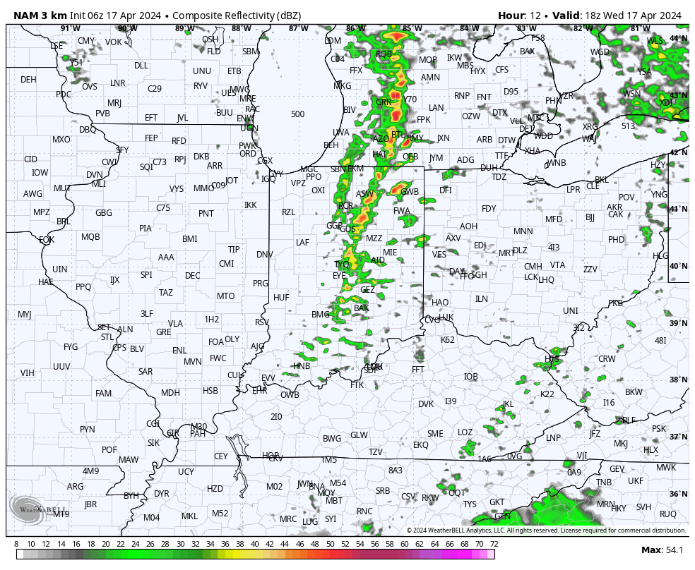
While we’re still tracking storm potential today, there are a lot of questions around where these will initialize. Thinking here is right around the city, itself, and then points northeast (better chance of stronger storms for places like Fort Wayne and Muncie than Indianapolis-proper).
Storms should develop around or just after lunchtime (around 1p, or so) across central Indiana and then race off to the east. Damaging straight line winds are of greatest concern with the stronger storms. Non-thunderstorm wind gusts of around 40 MPH can also be expected today.
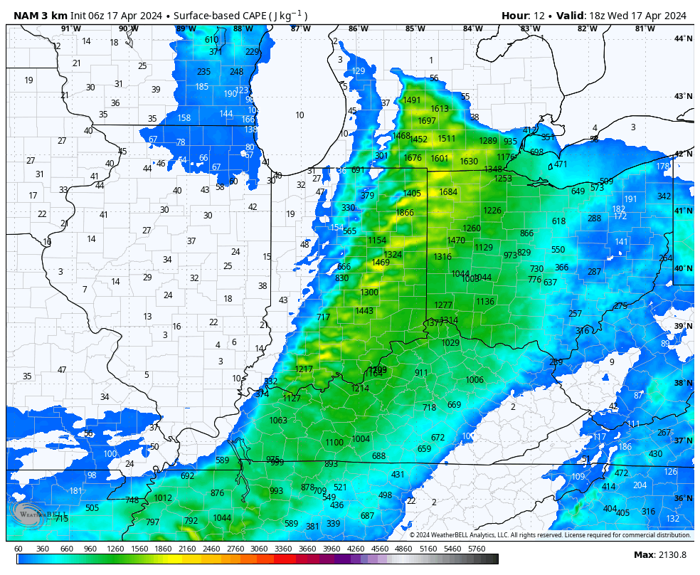
Instability levels are marginal at best today which, thankfully, should prevent widespread severe weather, locally.
A more stable airmass will quickly arrive tonight and remain in place through the daytime Thursday.
Our next round of storms, some of which will likely be gusty, will blow into town overnight into the predawn hours Friday.
High pressure is still slated to build in to allow for a much calmer (and cooler) weekend. Keep an eye on the potential for frost both Sunday and Monday mornings.
It doesn’t get any better around these parts this time of year than what we experienced Monday. Unfortunately, today marks the return of unsettled weather that will continue through midweek. The reward after going through a few days of rain/ storms? An incredible weekend, complete with a return of sunshine!
We couldn’t ask for better weather to kick off the new work week. Plentiful sunshine, temperatures heading for the 80s, and a generally light, variable wind will make it tough to work indoors today. Rain and storm coverage will grow in the coming days…
The upcoming immediate term will be headlined by a multi day heavy rain and severe weather episode. A stalled frontal boundary will serve as the pathway for multiple waves of low pressure to ride along through Tuesday. In addition to a heavy rain and flooding threat (primarily targeting immediate central and north-central Indiana), we’ll also likely have to deal with (3) rounds of severe storms. We’ll allow our short-term products to handle those severe threats, but just know all modes of severe are on the table with the greatest emphasis being on large hail with this setup. Should a couple discrete cells develop near or just south of the boundary then an elevated tornado threat would ensue. Again, we’ll have a fresh post hoisted later this afternoon or evening on that.
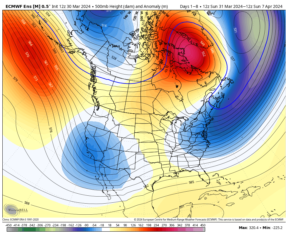
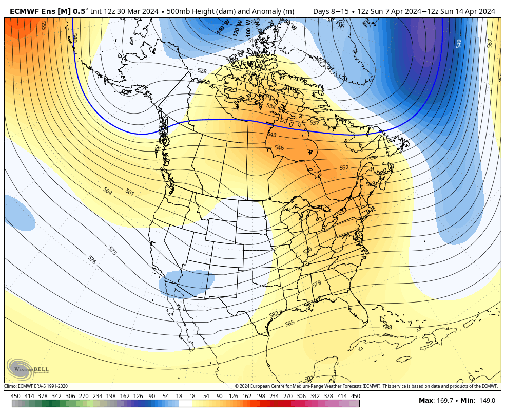
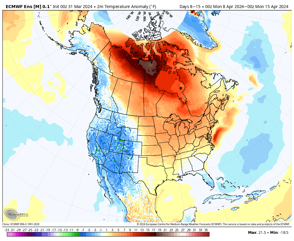
Overall, there’s no change in the idea of an active pattern continuing from Week 1 (image 1 below) into Week 2 (image 2 below).
The cooler pattern behind our early week storm system will reverse in significant fashion Week 2. – Transitional regime at its finest.
Week 1 temperature anomalies
Week 2 temperature anomalies
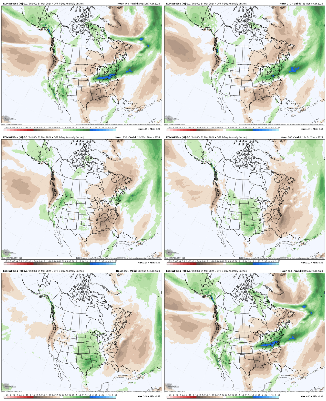
The busy nature of the pattern is reflected in the upcoming 2 week precipitation anomalies.
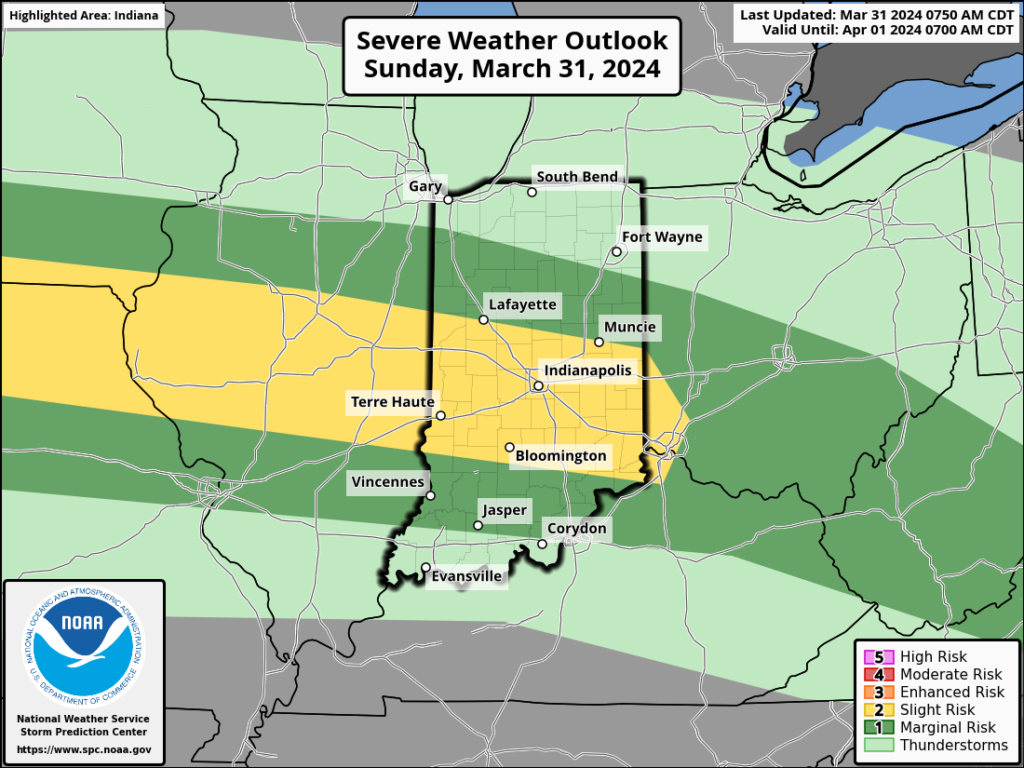
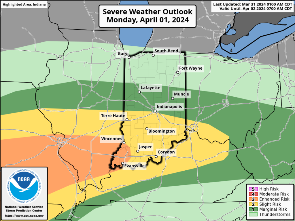
Severe weather will be possible at least across a portion of our immediate viewing area starting this evening and continuing daily through Tuesday.
Colder air will crash in here Wednesday and as an upper low swirls overhead, wet snow will develop. Snow may even fall heavily enough to accumulate on grassy surfaces in spots Wednesday night into Thursday morning.