Updated 03.09.24 8:14a
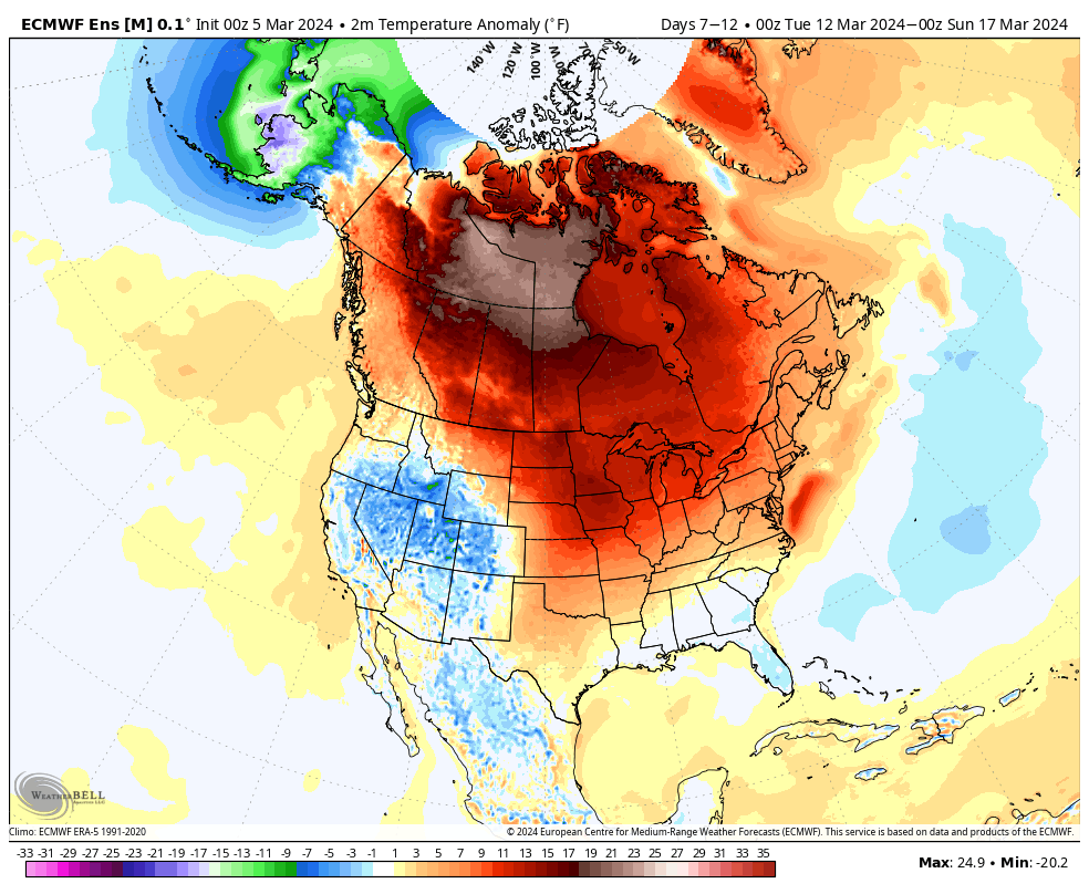
It’s been a very warm March. So far, Indianapolis is running nearly 13° above the average month-to-date.
In the short-term (Week 1), the pattern will remain on the milder side of normal.

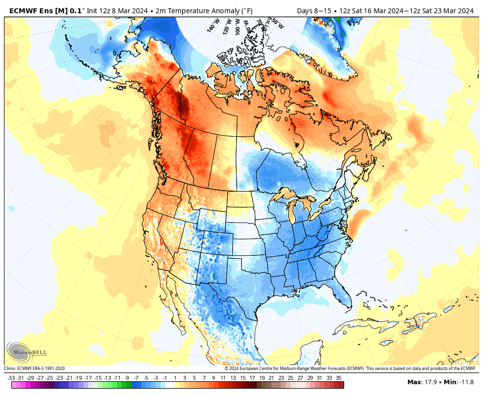
That all begins to change as we move into Week 2.
This is largely driven by the MJO sprinting through the traditionally warm phases for this time of year into the colder Phase 8 late month.
The temperature composite analog for MJO Phase 8 in March during an El Nino season:
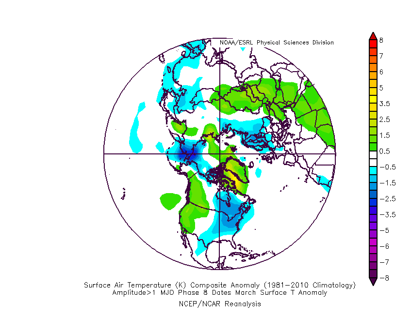
Strikingly similar to what we see above on the Week 2 charts, huh?
The teleconnection suite aligns towards a cold look by Week 2.

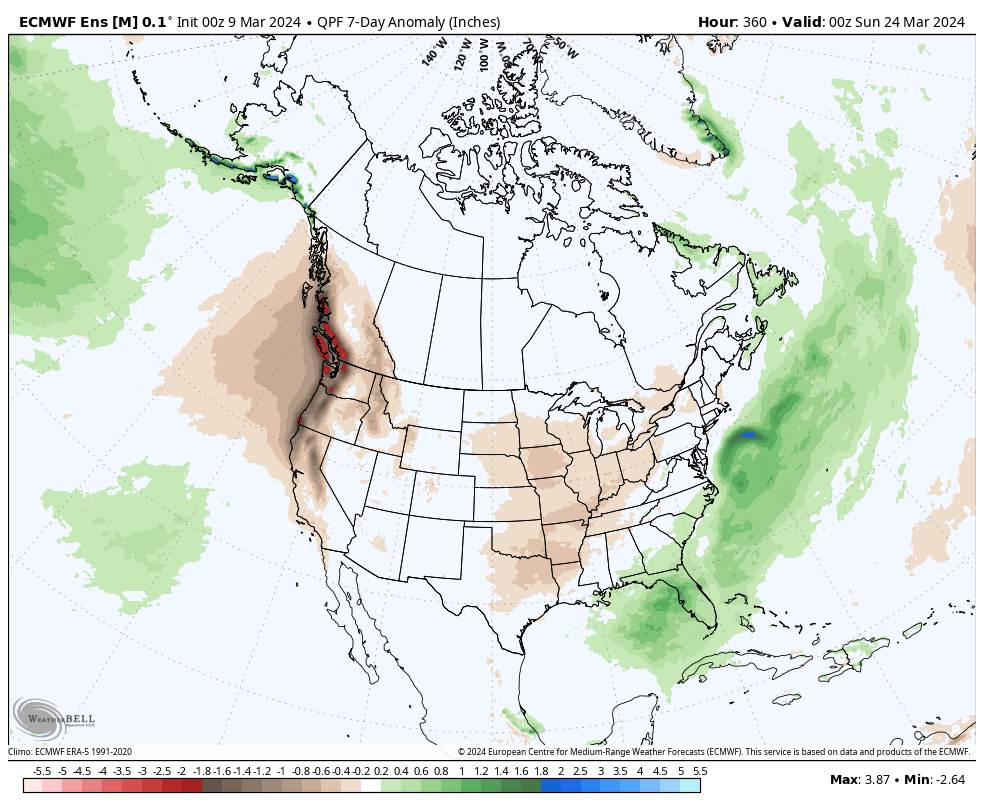
A potentially more significant storm system looms late next week or over St. Patrick’s Day weekend to usher in the pattern change. Otherwise, with a colder pattern than normal settling in Week 2, this will also likely lead to a drier airmass and subsequent opportunity to dry out after a wetter than normal open to March (also of note is that we’re running a little more than 1″ above normal, year-to-date).
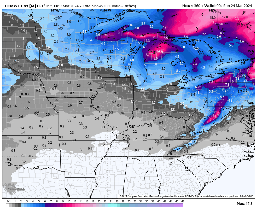
No way to be specific with details from this distance, but given the look to the overall pattern, I’d be surprised if we end the month without an opportunity of a little wet snow with the colder transition.