Updated 01.21.23 @ 1:54p
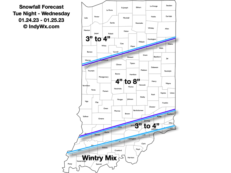
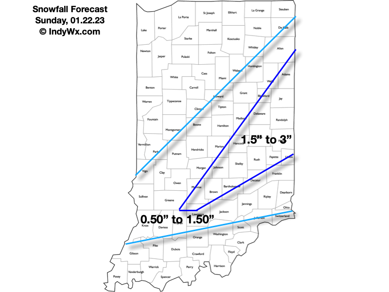
The first in a series of accumulating snow events will move in Sunday morning followed by another (heavier) event Tuesday night and Wednesday, with accumulating snow continuing late into the upcoming work week. In short, we don’t have any changes from this morning’s video discussion, but did want to add some specific snow numbers behind our ideas. First thing first and that’s Sunday:
Mostly cloudy skies this evening will lower and thicken during the overnight and snow is expected to break out across western IN between 3a and 4a, reaching the city, itself, between 5a and 6a. Snow should reach peak intensity between 7a and 10a in the city before the steadiest snow pushes east. Lighter snow is expected to continue into the early to mid afternoon hours. Despite marginally cold air and relatively warm surfaces for the time of the year, slick roadways are expected Sunday morning as the snow increases in intensity. Plowing and salting will likely be required before the snow intensity diminishes from west to east Sunday afternoon.
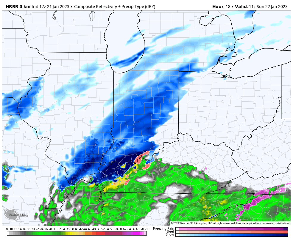
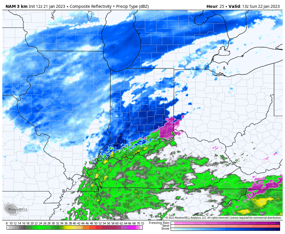

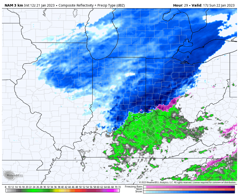
Temperatures will be in the lower 30s while the majority of the snow falls so this will be a heavier, wetter snow than the champagne powder we dealt with pre-Christmas. Also a friendly reminder to discredit any sources trying to show you a kuchera snowfall map with this event (or the next event for that matter). These will both likely be much closer, if not even a little less, than 10:1 ratio type snow events- perfect for a snowball fight or building a snowman!
Sunday’s snowfall forecast:
A few lingering early flurries are possible Monday, otherwise the bulk of the daytime Monday and Tuesday should be precipitation free. We may even see some sun work back into the picture during this timeframe. As we push into Tuesday evening, clouds will once again lower and thicken and give way to snow lifting in from the southwest after 11p to midnight.
Low pressure will take a “textbook” track from LA Tuesday evening, west TN Wednesday morning, southeast of the OH river Wednesday afternoon and into Ohio by Wednesday evening. Long time Hoosiers know that spells snowy excitement throughout the region and sure enough, we expect an area-wide moderate to heavy snow event.
Now, this won’t be some sort of blockbuster type storm (remember, this kind of pattern doesn’t support such), but the low will be plenty strong enough to tap into the Gulf moisture and throw it north into an airmass that’s just cold enough to support another wet, heavy (paste-like) snow event Tuesday night through Wednesday. As the storm moves off to the northeast, snow will become a bit more powdery Thursday into Friday morning with some additional light accumulation expected in the colder airmass.

Tuesday night – Wednesday snowfall forecast:
