Updated 01.16.23 @ 6:40p
You must be logged in to view this content. Click Here to become a member of IndyWX.com for full access. Already a member of IndyWx.com All-Access? Log-in here.

Jan 16
Updated 01.16.23 @ 6:40p
You must be logged in to view this content. Click Here to become a member of IndyWX.com for full access. Already a member of IndyWx.com All-Access? Log-in here.
Permanent link to this article: https://indywx.com/2023/01/16/video-old-man-winter-you-now-have-our-attention/
Jan 16
Updated 01.16.23 @ 11:17a
We’ll have a more detailed video discussion posted this evening but wanted to highlight an opportunity for perhaps a more intriguing winter weather setup in the 8-10 day period.
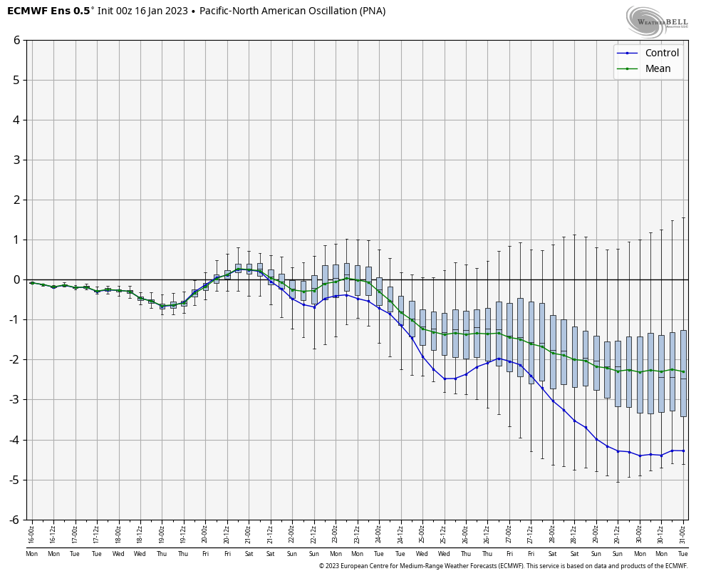
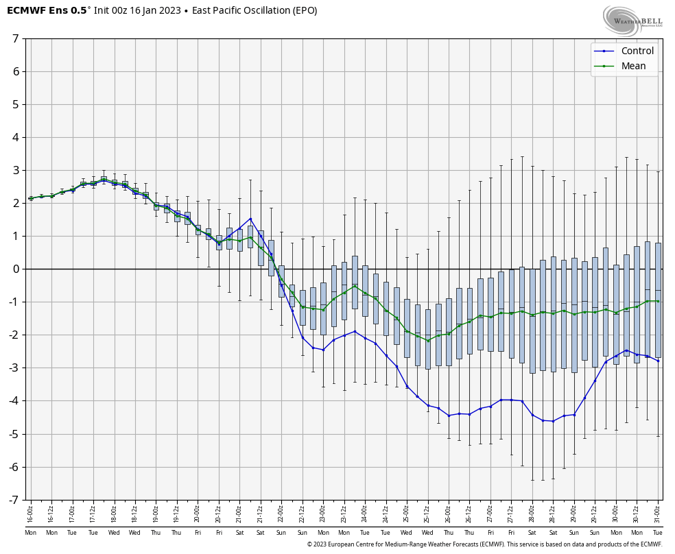
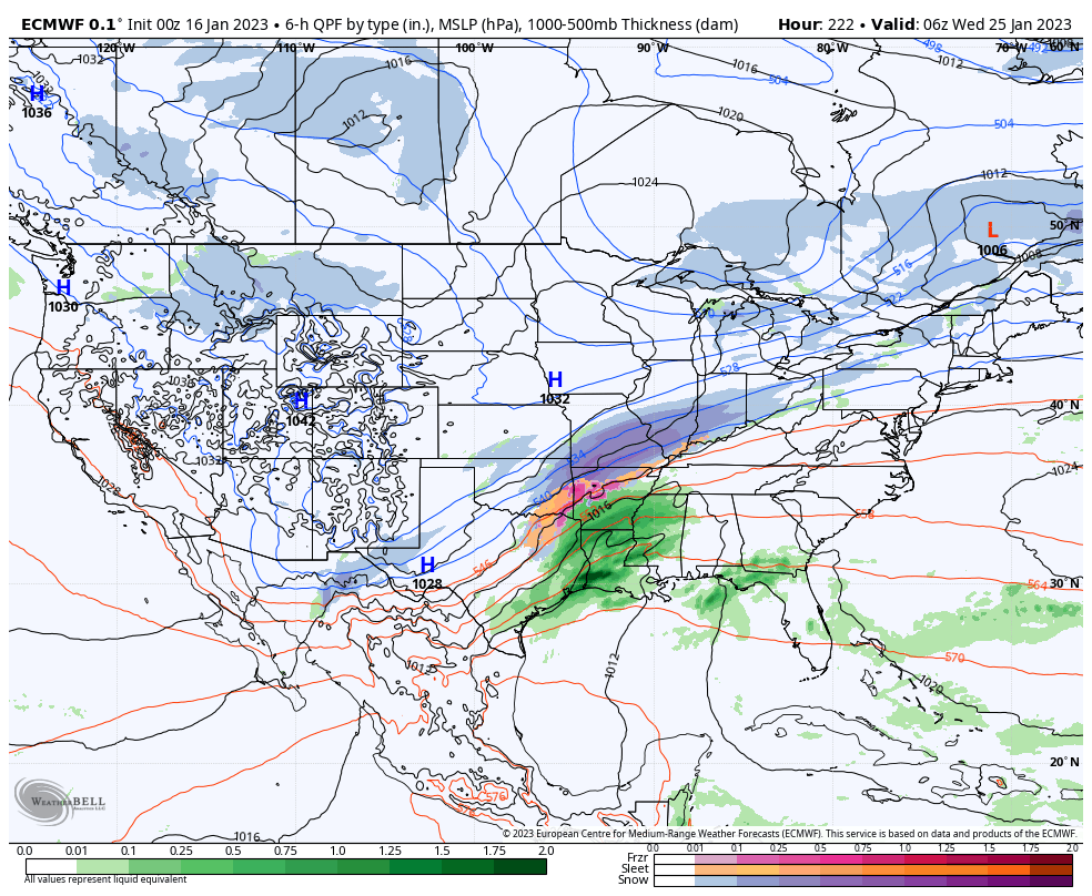
While the time period is too far out for specifics, it does appear as if the pattern will become more favorable for cold and moisture to “marry.” It’s not necessarily a setup for a blockbuster storm, but rather a series of waves of moisture riding northeast along a pressing cold airmass moving southeast. The combination of the PNA (negative) and EPO (negative) means there should be enough resistance from the southeastern ridge to lead to this being more of an Ohio Valley and interior Northeast threat vs “suppression depression.”


For now let’s just circle next weekend into early the following week to see if more of the models begin to catch on to this threat, similar to what the European model is already suggesting perhaps…

More later today!
Permanent link to this article: https://indywx.com/2023/01/16/window-opening-for-a-wintry-threat-in-the-8-10-day-period/