Updated 12.18.22 @ 2:09p
You must be logged in to view this content. Click Here to become a member of IndyWX.com for full access. Already a member of IndyWx.com All-Access? Log-in here.

Dec 18
Updated 12.18.22 @ 2:09p
You must be logged in to view this content. Click Here to become a member of IndyWX.com for full access. Already a member of IndyWx.com All-Access? Log-in here.
Permanent link to this article: https://indywx.com/2022/12/18/video-makings-of-a-memorable-winter-storm/
Dec 17
Updated 12.17.22 @ 7:11a
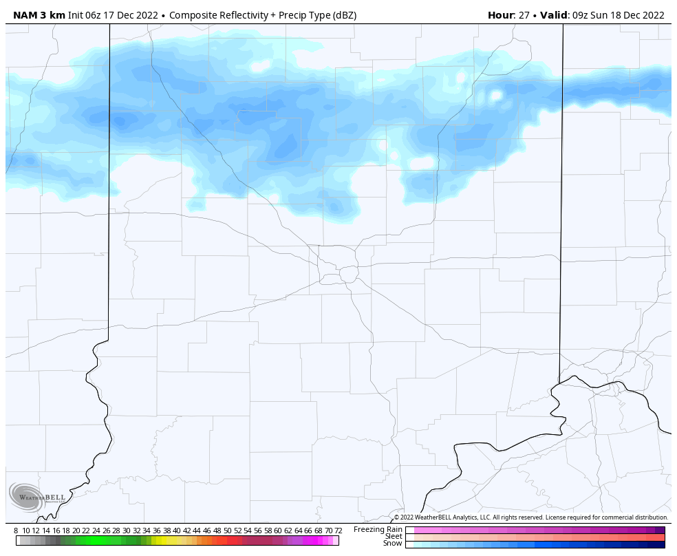
Just enough upper level energy will linger around the region to help generate occasional snow flurries or light snow showers into Sunday morning. Like the past 24 hours, these won’t amount to much if any accumulation.

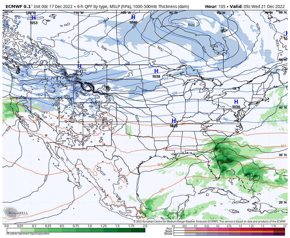
High pressure will then dominate our weather through the early and middle part of the work week with dry and seasonably cold conditions.

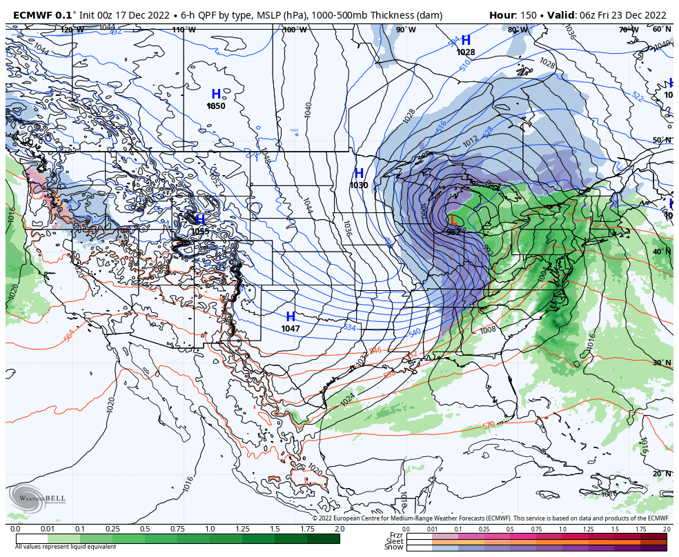
By this point, all eyes will be on the developing winter storm in the Plains. We expect snow to overspread the region Thursday (possibly beginning as a brief period of rain), continuing, potentially heavy at times, through the day on Friday. This still has the potential to be a significant, if not severe, winter storm but we’re still a couple days away from being able to talk specifics in respect to snowfall totals. Another item to note will be the wind. Blowing and drifting will likely be a major problem by Friday, into Christmas Eve. If there’s anyway to move travel to Wednesday, we’d highly recommend it.

A nasty shot of bitterly cold arctic air will plunge into the region Christmas weekend. How do highs in the 0s to low 10s sound and overnight lows below 0°? Wind chill values of 20° to 40° below zero (not a typo, unfortunately) are on the table.

Permanent link to this article: https://indywx.com/2022/12/17/light-snow-showers-today-pre-christmas-winter-storm-precedes-dangerous-cold-next-weekend/
Dec 16
Updated 12.16.22 @ 7:48a
You must be logged in to view this content. Click Here to become a member of IndyWX.com for full access. Already a member of IndyWx.com All-Access? Log-in here.
Permanent link to this article: https://indywx.com/2022/12/16/lr-update-into-mid-january-short-term-focuses-on-accumulating-snow-prospects-next-week/
Dec 15
Updated 12.15.22 @ 8:07p December month-to-date has opened up much differently than expected (at least here) from way back in the summer. Long time subscribers of IndyWx know that’s when…
You must be logged in to view this content. Click Here to become a member of IndyWX.com for full access. Already a member of IndyWx.com All-Access? Log-in here.
Permanent link to this article: https://indywx.com/2022/12/15/thursday-night-rambles-pre-christmas-storm-potential-and-beyond/
Dec 15
Updated 12.15.22 @ 7:45a
You must be logged in to view this content. Click Here to become a member of IndyWX.com for full access. Already a member of IndyWx.com All-Access? Log-in here.
Permanent link to this article: https://indywx.com/2022/12/15/video-players-align-for-potential-of-a-significant-pre-christmas-winter-storm/
Dec 14
Updated 12.14.22 @ 7:43a
You must be logged in to view this content. Click Here to become a member of IndyWX.com for full access. Already a member of IndyWx.com All-Access? Log-in here.
Permanent link to this article: https://indywx.com/2022/12/14/video-colder-transition-in-the-pattern-is-met-with-rain-and-gusty-winds/
Dec 13
Updated 12.13.22 @ 9:48p
You must be logged in to view this content. Click Here to become a member of IndyWX.com for full access. Already a member of IndyWx.com All-Access? Log-in here.
Permanent link to this article: https://indywx.com/2022/12/13/potential-pre-christmas-winter-storm-mjo-impacts-on-the-january-pattern/
Dec 13
Updated 12.13.22 @ 7:43a
You must be logged in to view this content. Click Here to become a member of IndyWX.com for full access. Already a member of IndyWx.com All-Access? Log-in here.
Permanent link to this article: https://indywx.com/2022/12/13/video-timing-the-arrival-of-rain-white-christmas-chances-continue-to-grow/
Dec 12
Updated 12.12.22 @ 2:50p
You must be logged in to view this content. Click Here to become a member of IndyWX.com for full access. Already a member of IndyWx.com All-Access? Log-in here.
Permanent link to this article: https://indywx.com/2022/12/12/video-monday-afternoon-update-on-the-2nd-half-of-december/
Dec 11
Updated 12.11.22 @ 6:45a
For fans of cold, wintry weather, we’re heading towards a truly special pattern. Add in the timing of this taking place just before the holidays and that will create additional excitement for many.
A midweek frontal system will usher in the much colder changes. Unlike several of the FROPAs over the past couple weeks, the airmass behind this front will be significantly colder and have staying power. Wrap around moisture and upper level energy will likely generate snow showers/ squalls through the weekend with light snow accumulation.
That then takes us to Christmas week (where is time going?!). While still a bit too far out for specifics, it’s been several years from seeing the kind of setup between an active OHV storm track with the cold air in place. A couple of systems will likely be on the playing field, both of which, will have the potential of delivering accumulating snow. Chances of a White Christmas remain well above normal.
By the end of the Week 2 period, truly bitter cold air will likely get involved with the pattern, especially with an expanding snow pack. This is a classic look for nasty arctic air (below zero type stuff) by late Week 2/ early Week 3.
Buckle up, we’ve got a wild and fun wintry ride on our hands into and through the holidays.


I will be on the road Monday morning so expect delayed posting. I’ll have a client video discussion online by mid to late afternoon.
Permanent link to this article: https://indywx.com/2022/12/11/stormy-first-then-the-arctic-hounds-come-barking/