
Updated 12.10.21 @ 7:29a
Type: Severe weather event

What: Severe weather outbreak
When: 12a to 8a Saturday, 12.11.21
Severe Risks: Damaging straight line winds and tornadoes
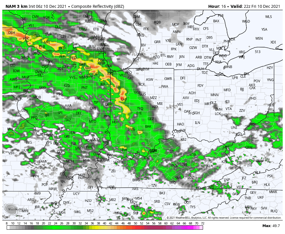
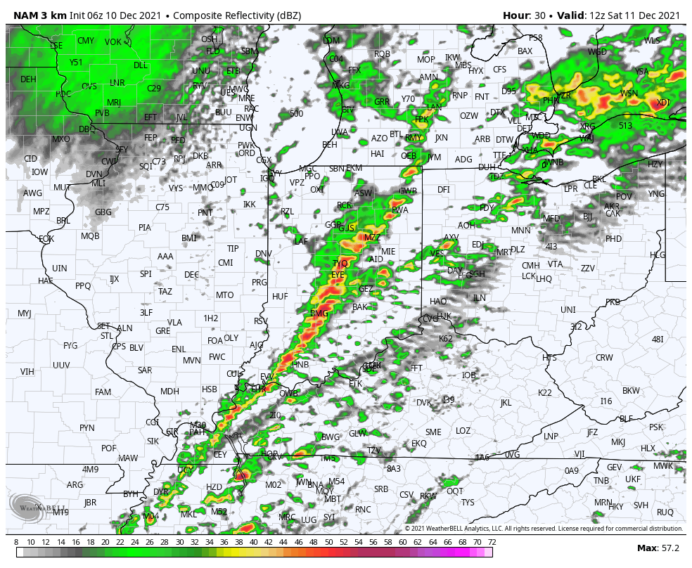
Summary: A strengthening surface low pressure system will lift northeast out of the central Plains this morning into the Great Lakes region by Saturday morning. A strong cold front will trail the area of low pressure and press east across Indiana Saturday morning. Ahead of the front, unseasonably warm and humid air will be drawn north to encompass most of the state. We’ll really notice a surge in moisture levels as we progress through the afternoon and evening hours. Dew points will rise from the 40s now into the lower and middle 60s all the way north to include central Indiana during the overnight and predawn hours Saturday. While CAPE (convective available potential energy) will be in question, which is typical with late fall/ early winter severe set-ups, the concern here is that we’ll be able to, unfortunately, make up for that with the influx of moisture and abundant shear.
Showers and perhaps a rumble of thunder (nothing severe) will increase by evening across central portions of the state, but it’s not until we get closer to midnight that stronger storms should get triggered. The focal point of this particular severe weather episode will fall within the 12a to 8a range. Initially, we believe there will be the opportunity of discrete super cells ahead of what should become a rather robust squall line that will move across the state (west to east) between 6a and 8a Saturday. The potential is present for all modes of severe weather, but given the dynamics in play, we’re most concerned for the potential of damaging straight line winds and tornadoes. It’ll be important to ensure you have a means of getting the latest warnings that will likely be issued tonight (be sure to set those weather radios alerts to “on”). Add in the fact that this event will take place when most people are sleeping, coupled with the likelihood of storms racing off to the east and northeast, it wouldn’t be a bad idea to give your neighbors and loved ones a friendly heads up of the developing weather situation later tonight so they, too, can prepare.

Confidence:High
Next Update: Friday afternoon- video