
Updated 06.11.21 @ 7:50a
Before we look ahead to the 2nd half of this month and early July, our weekend will start off with the same oppressive humidity and tropical feel we’ve dealt with all week. Additionally, another round of “splash and dash” thunderstorms can be expected today and Saturday — most notably occurring during the afternoon and evening hours. With all of that said, coverage of storms should be less today and Saturday than what the rest of the week has included.

While some neighborhoods won’t see a drop of rain, others could see a quick 0.50″ to 1″ due to the moisture rich environment in place across the region. Officially, we’ll call for most central Indiana rain gauges to pick up between 0.25″ and 0.75″ over the course of the upcoming 48 hours. Sunday continues to look like a mostly dry and very warm day (remember, you can always see our most up-to-date 7-day outlook for central Indiana on the home page). We continue to target a frontal passage Tuesday that will offer up a surge of much lower humidity for the balance of the upcoming week.
As we look ahead, there are a few interesting drivers that should battle it out as we progress through the 2nd half of June and look ahead to the Independence Day holiday (where is time going?).

I. East Pacific Oscillation (EPO)- forecast predominantly negative over the upcoming couple of weeks. Cool signal.
II. Pacific North American Pattern (PNA)- pops positive in the short-term (cool signal) before returning negative late month (warm signal).
III. Madden-Julian Oscillation (MJO)- forecast in the “null” phase in the short-term, but does look to get a bit more amplified as we close out the month of June and open up July. Phase 1 late June correlates to near/ slightly above normal temperatures across the Ohio Valley. Phase 2 in early July features widespread cool weather from the central Plains and points east and south.
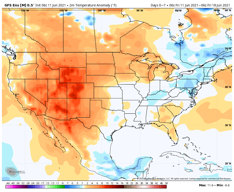
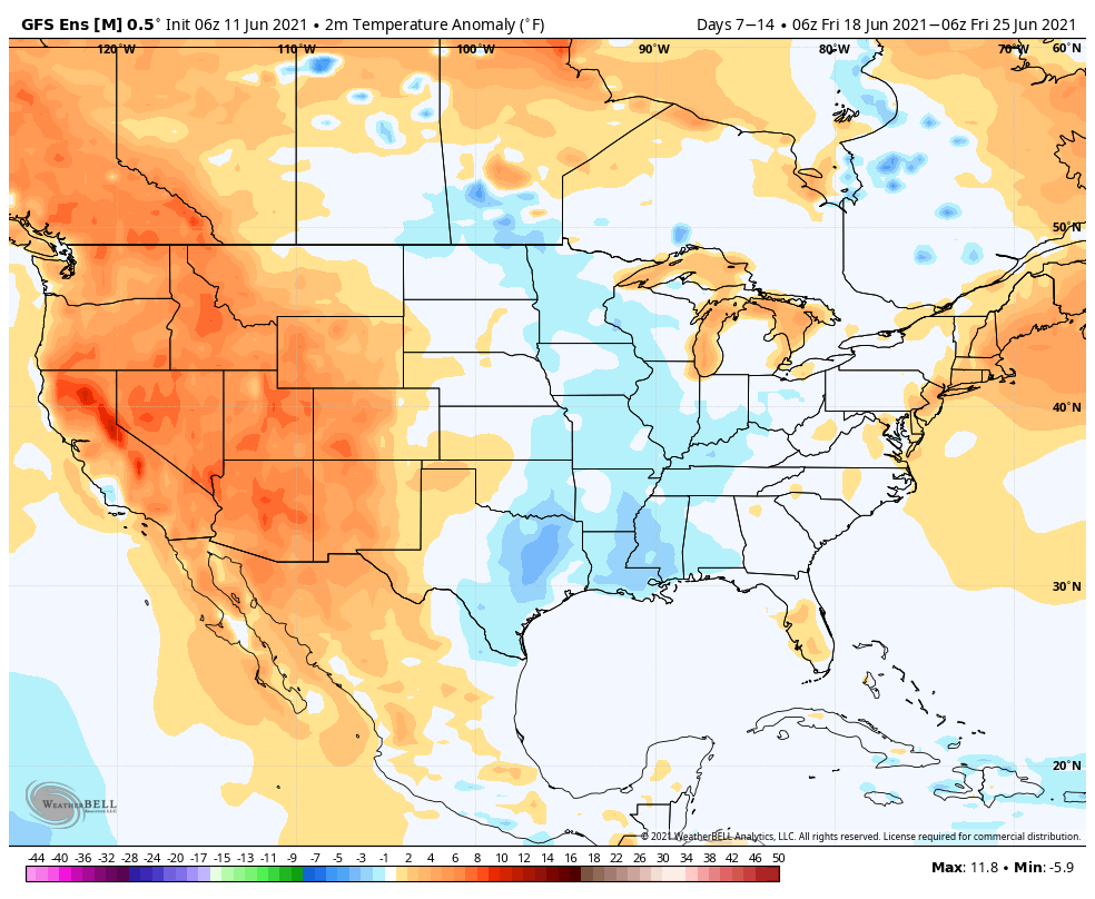
Given the above, it would seem the cooler period next week will moderate as we move into Week 2, but given the fight between the PNA and EPO, I don’t envision any sort of significant or long-lasting heat, locally, as we wrap up the month of June. A combination of ensemble guidance would tend to agree with this.
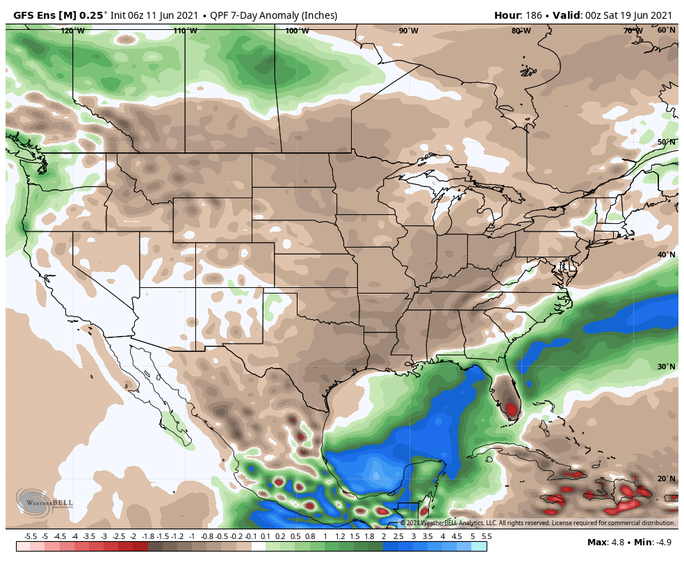
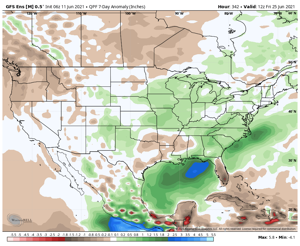
After a drier stretch through the short-term, it looks like the pattern will turn more active to close out the month. On that note, we’re also continuing to keep close eyes on potential tropical “mischief” next week in the Gulf of Mexico. The general consensus early on is that tropical moisture would potentially impact the central and eastern Gulf and interior South late next week/ next weekend, but this is still early.
As we move forward, we’ll keep close eyes on the MJO activity. Should things get into Phase 2 (as suggested above), this will lead to a large part of the country cooler than normal for the Independence Day holiday… Stay tuned.