Updated 07.26.21 @ 8a
You must be logged in to view this content. Click Here to become a member of IndyWX.com for full access. Already a member of IndyWx.com All-Access? Log-in here.

Jul 26
Updated 07.26.21 @ 8a
You must be logged in to view this content. Click Here to become a member of IndyWX.com for full access. Already a member of IndyWx.com All-Access? Log-in here.
Permanent link to this article: https://indywx.com/video-targeting-an-unseasonably-cool-open-to-august/
Jul 25
Updated 07.25.21 @ 8:44a
You must be logged in to view this content. Click Here to become a member of IndyWX.com for full access. Already a member of IndyWx.com All-Access? Log-in here.
Permanent link to this article: https://indywx.com/video-heat-and-humidity-builds-to-open-the-week-tracking-a-strong-cold-front-late-week/
Jul 24
Updated 07.24.21 @ 7:23a


Forecast Period: 07.24.21 through 07.31.21
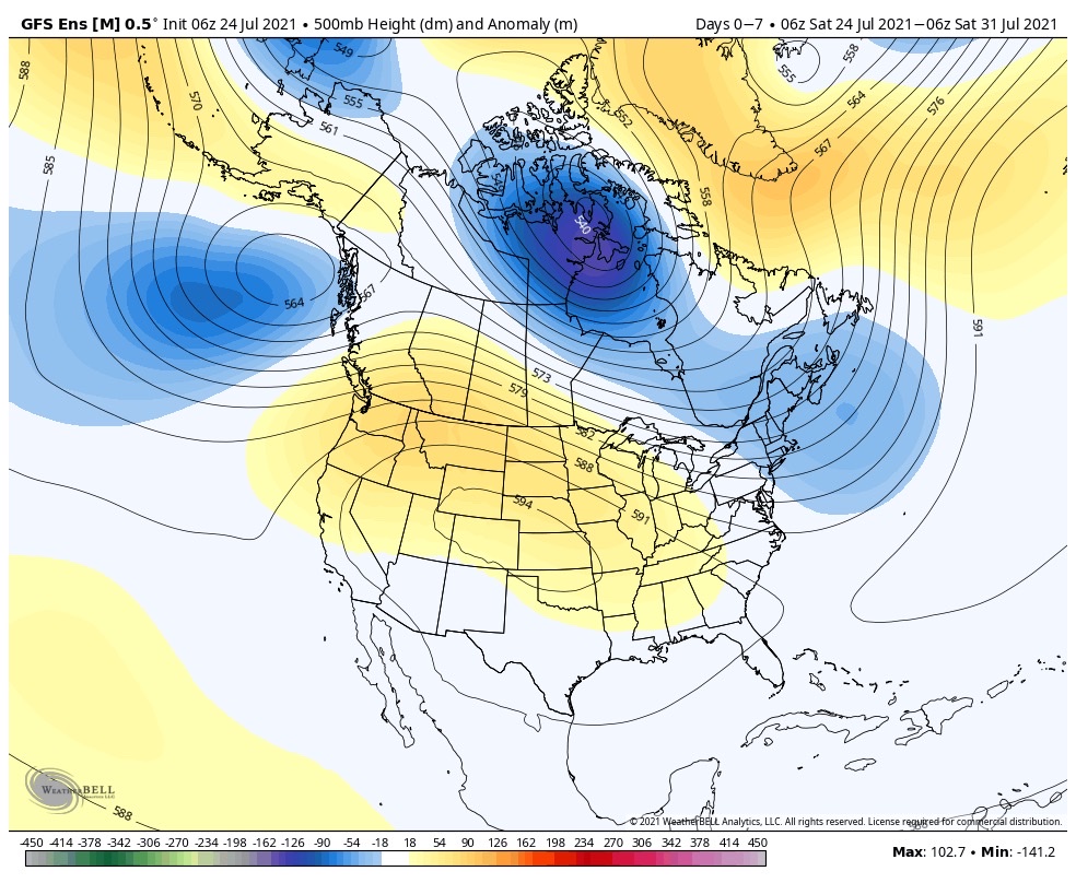
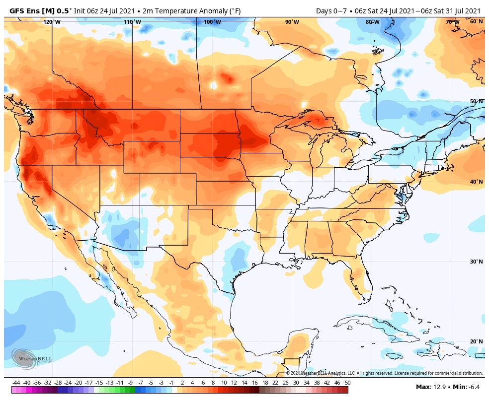
The upcoming 7-day period will place the Great Lakes and Ohio Valley in a northwest flow aloft. This is a notorious pattern for “ridge riding” thunderstorms to roll right into the general region (and sometimes during the hours not typical for storms this time of year – overnight and early morning). While it’s impossible to say exactly when and where these potential storm clusters may track, we’ll keep a watchful eye on the short term period through midweek across our general area. Sometimes these storm clusters are capable of more widespread damaging wind. While the most persistent, serious heat will be well off to our northwest, we can expect a few hot days to open the forecast period (low 90s) before we cool significantly late next week and into next weekend.
Permanent link to this article: https://indywx.com/weekly-agwx-and-severe-weather-outlook-40/
Jul 23
Updated 07.23.21 @ 7a
You must be logged in to view this content. Click Here to become a member of IndyWX.com for full access. Already a member of IndyWx.com All-Access? Log-in here.
Permanent link to this article: https://indywx.com/video-splash-hotter-stretch-on-deck/
Jul 22
Updated 07.22.21 @ 7:35a
We’re in the midst of the “dog days,” however Summer ’21 has been anything but hot around these parts. July is running 2° below normal, month-to-date, and stretches of hotter weather have been transitional at best.
While the upcoming 6-10 days, as a whole, will offer up an opportunity for heat to build east, we don’t believe this hotter stretch will have staying power as we get deeper into August. Here’s why:
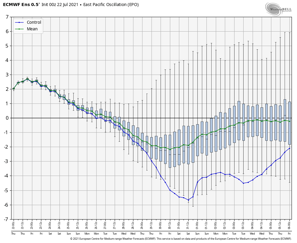
EPO: Note the rather dramatic reversal forecast over the upcoming couple of weeks. We go from a strong positive (now) to a strongly negative EPO state to close out July and open August. While there’s lag here (hence, the hotter days won’t arrive in earnest until early next week), the negative trend to open August will likely drive significant cooling from the Plains and into the Ohio Valley as we move through the first 10 days, or so, of the month.
MJO: While there are several questions pertaining to what phases the MJO will “camp out” in August, one thing that seems to be becoming clear is that we aren’t going to get stuck in the hot phases. Depending on if we recycle or head into the null phase, it sure seems like the MJO will favor the seasonable to cooler than normal phases through the bulk of the month.

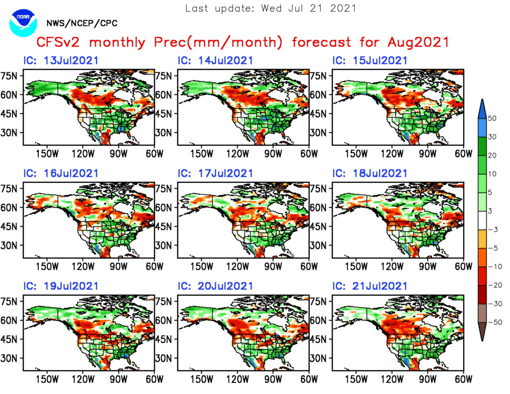
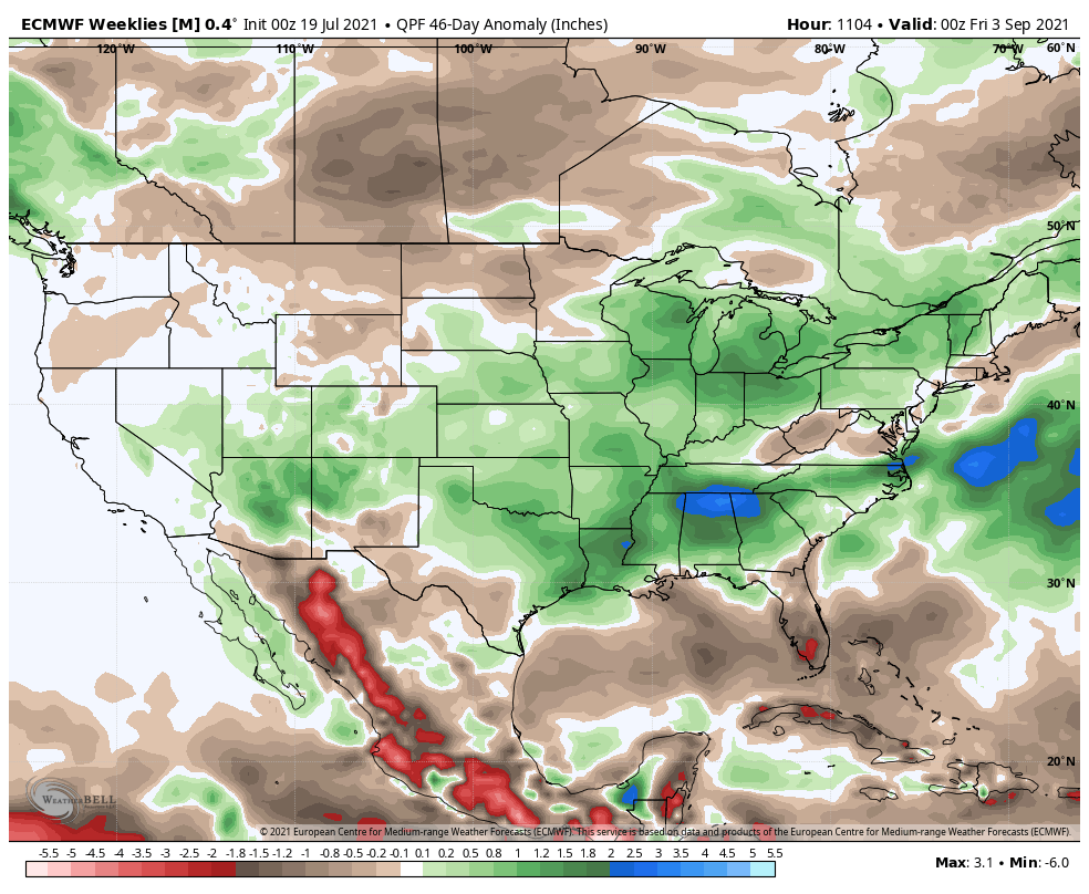
Wet Ground: Long-time viewers of IndyWx.com know that we lean heavily on the precipitation pattern from May through July to at least serve as an ingredient in building our August forecast. Drier stretches of weather during these months can really “feedback” this time of year and serve to lead to hot closes to meteorological summer and open to meteorological fall. While it’s not the be all, end all, the opposite can usually be said for wetter years.

While August, has a whole, has a cooler than normal look to it, the upcoming 6-10 days will feature true summer heat as the ridge temporarily builds east. Several days next week will likely top out in the 90° to 92° range with plenty of humidity.
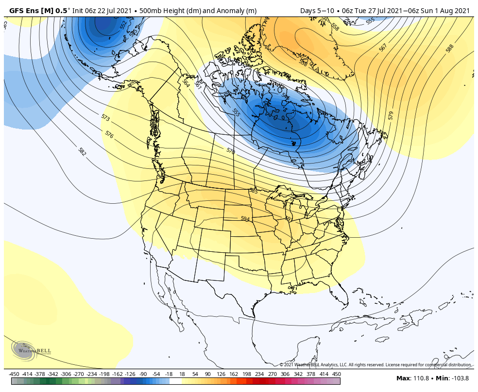
The feeling here though is that the ridge will pull back and open the window up for cooler (relative to normal), more unsettled weather to return as we get through the first full week of August. In fact, note how the latest longer range guidance is already loading up on the precipitation for the remainder of summer.
Our complete August Outlook will be out next week.
Permanent link to this article: https://indywx.com/long-range-update-window-closes-almost-as-soon-as-it-opens-for-period-of-hotter-weather/