July 29, 2020 archive

August Outlook: Does The Refreshing Start Run The Duration?

Average August temperatures in Indianapolis feature highs falling from 84° to begin the month to 83° by months end, while average lows drop from 65° to 62°. We average 3.13″ of rain for the month as a whole.

There’s been a lot of chatter recently from local weather sources around how recent Augusts have run cooler than normal. Simply put, that’s not the case. Looking back to 2015, we’re running a clip of “every other year” running cooler than normal, locally.

As we look at August 2020 and the last month of meteorological summer, there are reasons to buy stock into cooler prospects, especially through the 1st half of the month. While there will likely be a rebound late month, it may not be enough to tip the scale towards the warmer side of normal.

Note the recent trends of the CFSv2. While never overly warm for our particular region, the model is expanding the cool for the month and pressing the relative warmth to the coasts.

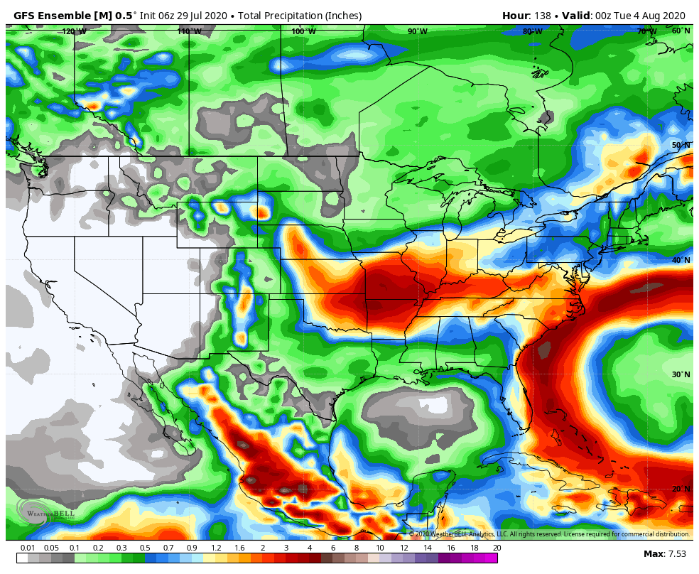
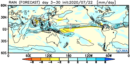
Interestingly, the model is also developing a more consistent wet look.

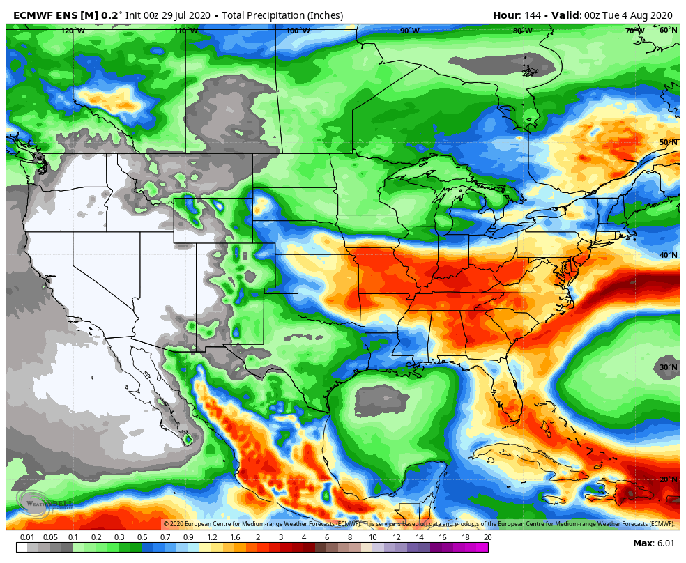
The latest European Weeklies have a similar (but not identical) look:

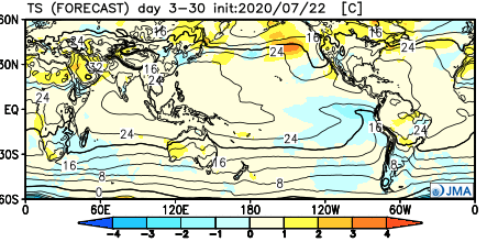
The JMA is in the same boat, as well:

A positive PNA is anticipated to rule through the majority of the month:

The wild card, as is always the case this time of year, will be the tropics. There’s reason to buy into the idea (outlined in previous discussions and videos) that the “heart” of the season will be hyperactive and that begins during the month of August. Obviously, it’s impossible to talk landfall/ inland impacts, but those with interests to the GOM (Gulf of Mexico) and East Coast should closely monitor the tropics through the month, and for that matter, into the fall months.

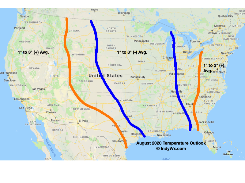
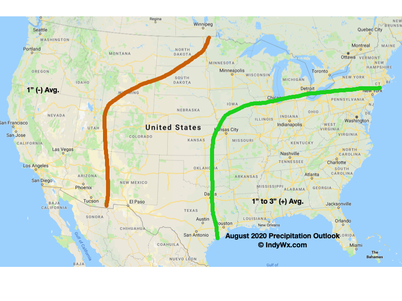
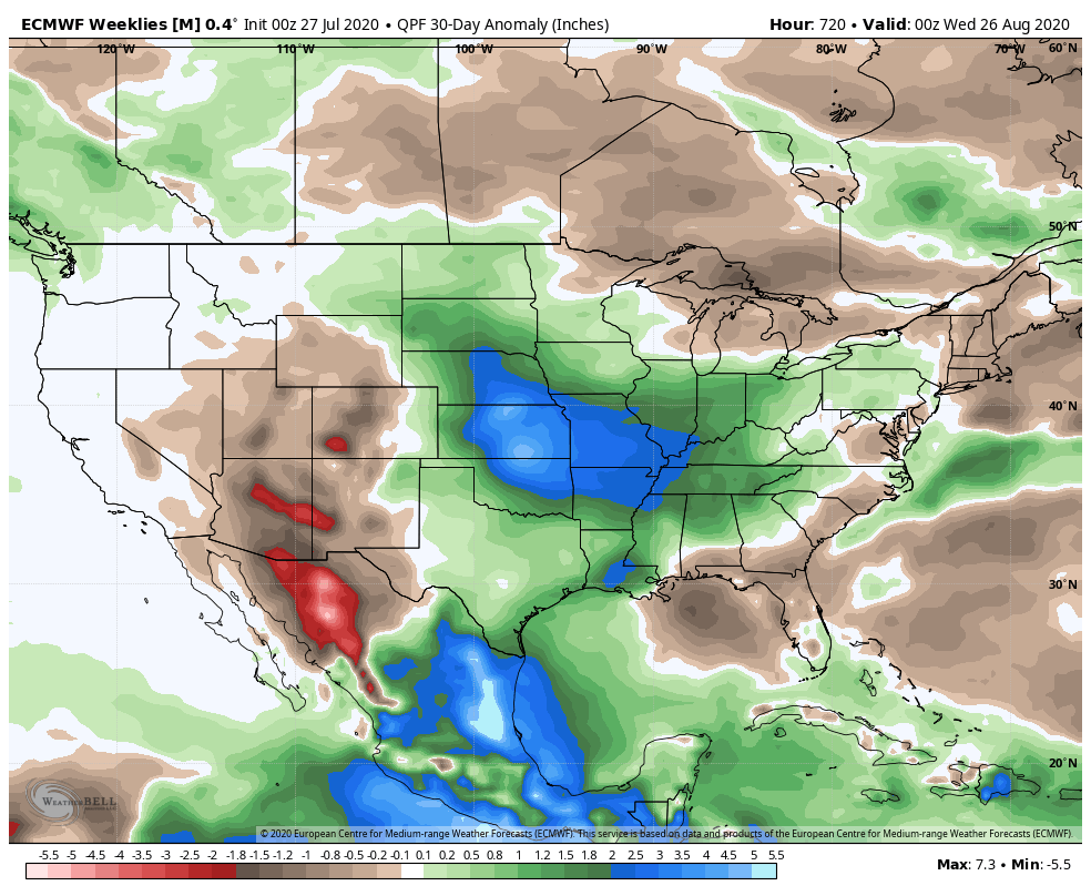
Officially, we expect a much wetter than normal month across central Indiana along with average temperatures. The cooler than normal 1st half of the month will likely be met with moderation (compared to normal and in the means) late month to balance things out close to average. Our official August forecast is below.

Permanent link to this article: https://indywx.com/2020/07/29/august-outlook-does-the-refreshing-start-run-the-duration/

Weekend Rain Chatter…

Before we dig in further around our complex weekend setup, we’ll have our official August Outlook posted later this evening. All in all, we don’t have any changes to our early ideas, but will have the complete discussion posted a bit later today.

We have one more very pleasant and refreshing (by late-July standards) day dialed up before the pattern turns more hectic to close the work week and head into the weekend.

As we move into Thursday, a cold front will drift south into central Indiana. This will serve as the focal point for increased coverage of showers and thunderstorms, even as early as tomorrow morning, but more so during the afternoon and evening. We expect 50-60% coverage of rain on Thursday.

Note how the boundary sinks south Thursday night and Friday morning. This should result in drier conditions Friday as the north and northeasterly wind takes hold. As it is, we’ll forecast a partly to mostly cloudy sky Friday with most, if not all, of central Indiana remaining dry.

As all of this is taking shape, surface low pressure is expected to begin strengthening in northeast OK Friday morning. This area of low pressure will then ride the boundary east, northeast into the weekend. That’s where things begin to get a bit more tricky. Some of the data brings the front back north over the weekend (subsequently allowing this area of low pressure to track further north over IN). Other data keeps the low just to our south and east. Despite the disagreement amongst model data, we’ll remain consistent with our forecast of more widespread, more concentrated rain returning to central Indiana Saturday afternoon into Sunday. We still think this time period will produce between 1″ and 1.5″ of rain for most of the region.

Showers and embedded thunder, along with unusually cool temperatures would continue into early parts of next week with this pattern.

Despite some of the differences within the operational guidance, the GFS and European ensemble mean, both suggest wet times are ahead for our area during the aforementioned period.

Make it a great Wednesday! More later!

Permanent link to this article: https://indywx.com/2020/07/29/weekend-rain-chatter/

IndyWx.com