High pressure will supply another fantastic day of weather including plentiful sunshine. Humidity levels will remain low today as highs top out in the upper 80s (in case you’re wondering, the average high for July 14th is 85°). Most of our Wednesday will also be nice, but that begins to change Wednesday night…
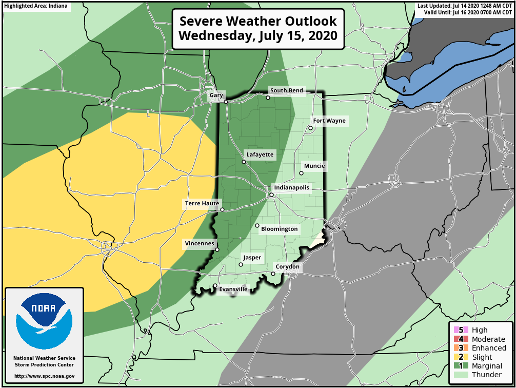
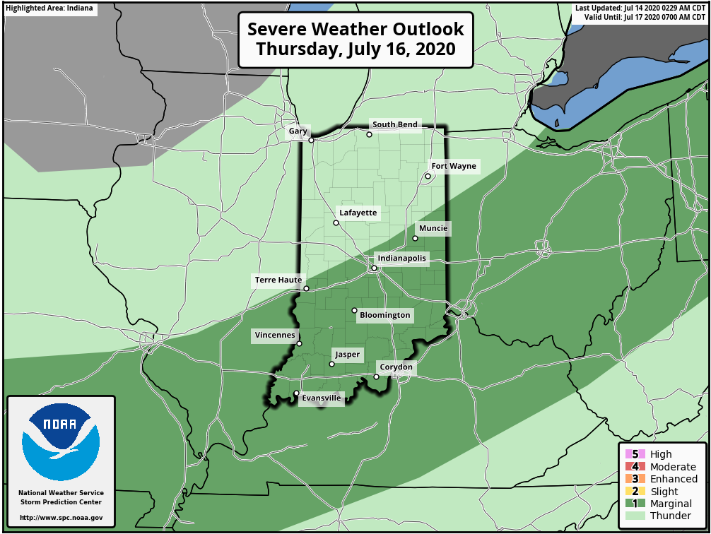
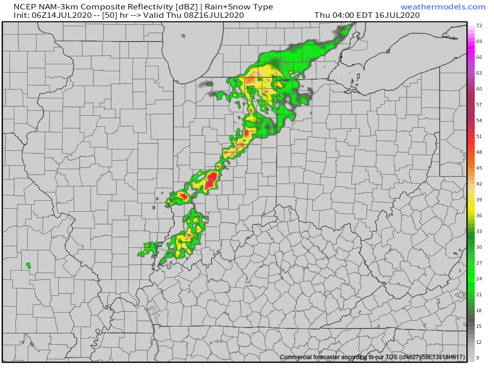
The Storm Prediction Center includes central Indiana in a ‘marginal’ risk of severe weather both Wednesday and Thursday. This is to account for the potential of a strong-to-severe complex of thunderstorms moving across the state during the overnight period.


This is all thanks to an approaching low pressure system and associated frontal boundary. Eventually, the low pressure system will “wash out” but the boundary will linger in the vicinity, keeping the threat of strong to severe storms across southern and southeastern Indiana during the daytime Thursday.
The vast majority of central Indiana will likely have to deal with thunderstorms late Wednesday night into the predawn Thursday. Given the ingredients in place (50 knot low level jet and dew points that should be approaching 70°) Wednesday night, embedded strong-to-severe thunderstorms are expected. The biggest concerns will be damaging straight line wind potential with these storms.

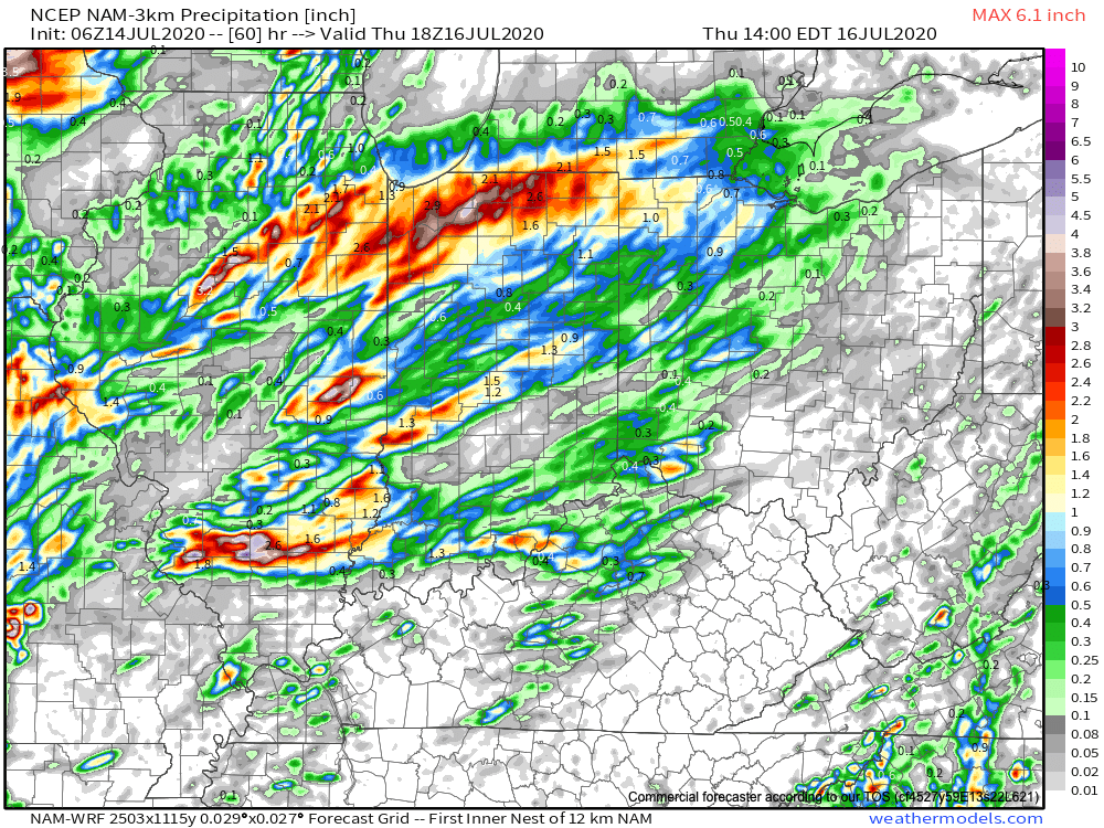
Locally heavy rain will also be likely as moisture levels rise overnight into Thursday. A quick 1″ of rain can be expected for most of central Indiana with locally heavier amounts where the stronger storms track.

We’ll have more on this and the pattern ahead with our evening video update a bit later. Make it a great Tuesday!
