
As we look ahead to the August pattern, it’s becoming increasingly apparent that the EPO, or East Pacific Oscillation, is trying to take control.
During positive phases of the EPO, warmer anomalies are usually noted across the eastern United States, whereas negative phases tend to promote cooler anomalies through the central into the eastern portion of the country. While the correlation is greatest in the fall and winter, the EPO phase can also have a say in the summer pattern.
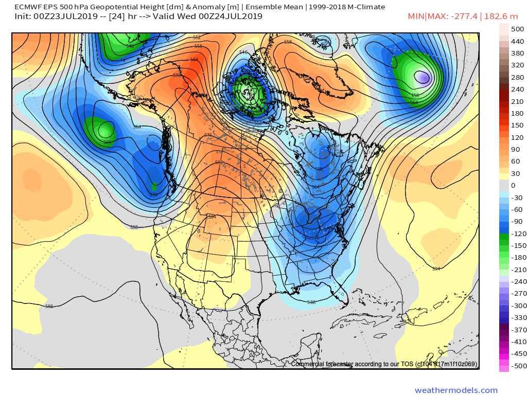
As we look ahead at the forecast EPO and upper level pattern, note the similarities:
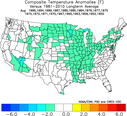
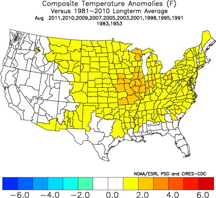
First, here’s what a negative and positive EPO would typically yield from the perspective of temperature anomalies:
Here’s the forecast EPO into the first week of August.
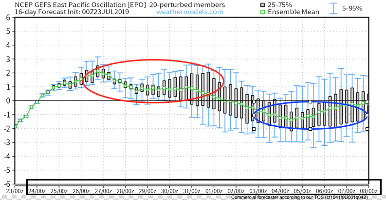
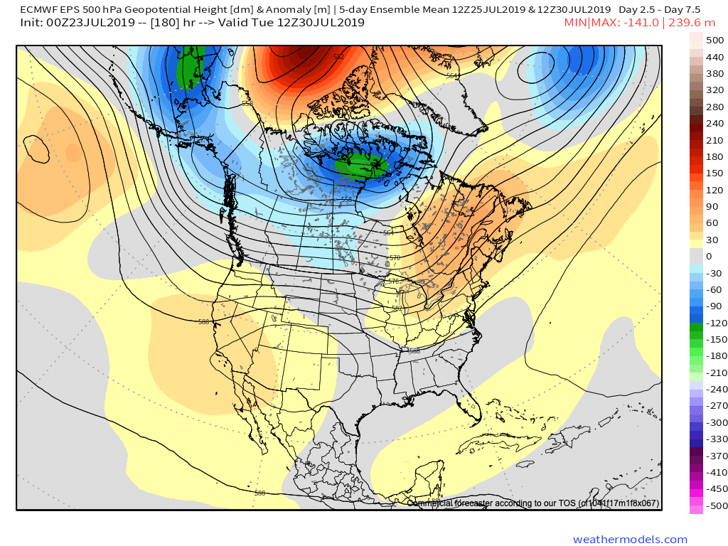
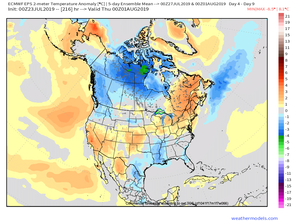
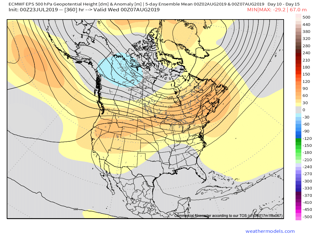
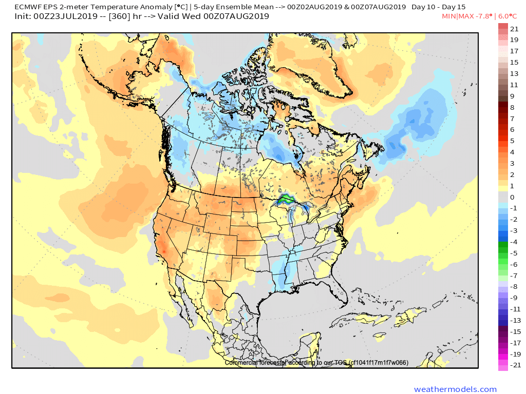
Note how closely the modeled upper air pattern (and associated surface temperatures) follow suit:
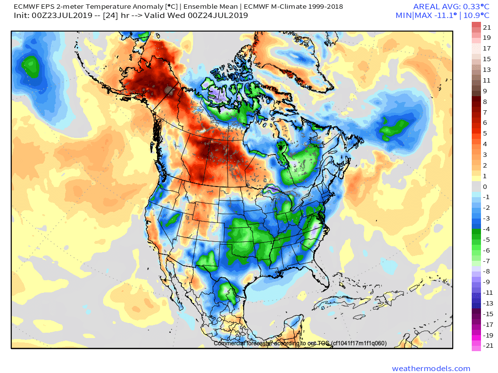
Present (negative EPO)
July 27th – Aug 1st (positive EPO)
Aug 3rd – Aug 8th (negative EPO)
(While we can’t show it here, it’s interesting to see the latest European Weeklies keep the EPO predominantly negative to significantly so through the bulk of August and into September).
So what’s the moral of the story? We believe after a period of transitional heat this weekend into early next week that temperatures will return to seasonal levels in early August, along with an increase in rain/ storm threats as the northwest upper air flow sets up shop. Our official August forecast will be issued early next week.