
You must be logged in to view this content. Click Here to become a member of IndyWX.com for full access. Already a member of IndyWx.com All-Access? Log-in here.
July 20, 2019 archive
Permanent link to this article: https://indywx.com/2019/07/20/video-big-changes-on-deck-looking-into-august/
Jul 20
Weekly #AGwx And Severe Weather Outlook…
Forecast period: 07.21.19 through 07.28.19
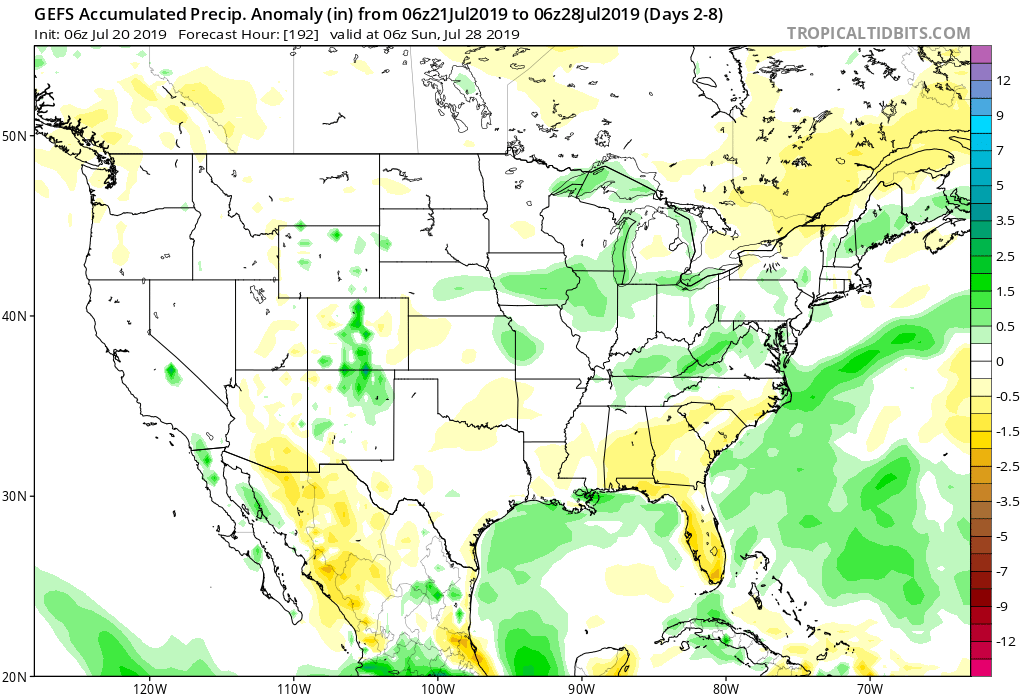
7-Day Precipitation: Rainfall is expected to run near average through the period.
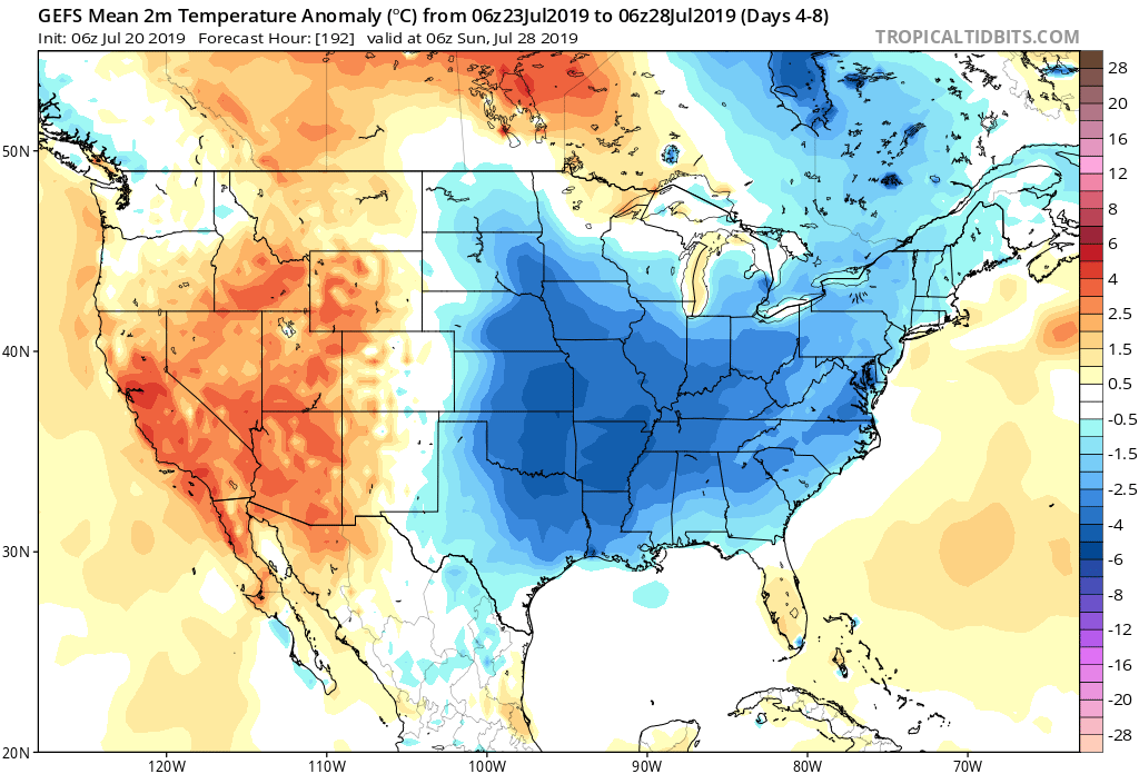
7-Day Temperature Outlook: Temperatures are expected to run below average through the forecast period.
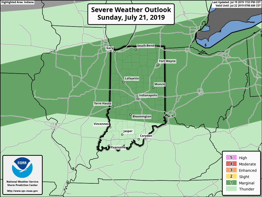
Severe Outlook: A strong cold front will slice into the unusually hot and humid air tomorrow afternoon and likely spark an increase in overall thunderstorm coverage. A few storms may become severe with large hail and damaging winds. Otherwise, after Sunday, severe weather isn’t expected through the remainder of the forecast period.
Summary: Hang in there, friends. Today will be the last ridiculously hot and humid day before we start to note relief. Sunday will still be hot and plenty humid, but will be the start of a cooler regime that will take hold in earnest by early parts of the work week. Before that, a cold front will spark scattered to numerous thunderstorms Sunday afternoon and evening and a few of these could become strong to severe. Linger upper level energy will keep shower chances in our forecast Tuesday with the much cooler temperatures. As we look forward, the next organized chance of rain and thunderstorms will come next weekend as another cold front sweeps through the Ohio Valley along with reinforcing pleasantly cool air behind the boundary.
Permanent link to this article: https://indywx.com/2019/07/20/weekly-agwx-and-severe-weather-outlook-7/