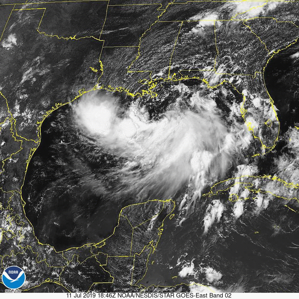
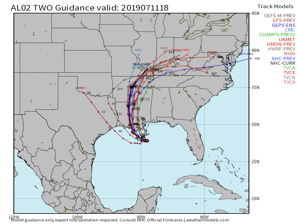
Barry has officially formed in the north-central Gulf of Mexico. As of the 5p (eastern time) advisory, he remains very disorganized with 40 MPH winds and a pressure of 1003 mb. With that said, conditions remain conducive for strengthening over the upcoming 24-36 hours and it’s still very possible that Barry makes landfall as a minimal hurricane along the central Louisiana Gulf Coast Saturday morning.
Computer model guidance is in very good agreement in brining Barry ashore along the central LA coast and then tracking inland through eastern LA and AR before “curling” through SE MO, southern IL and on into southern portions of the Ohio Valley during the early to middle part of next week.
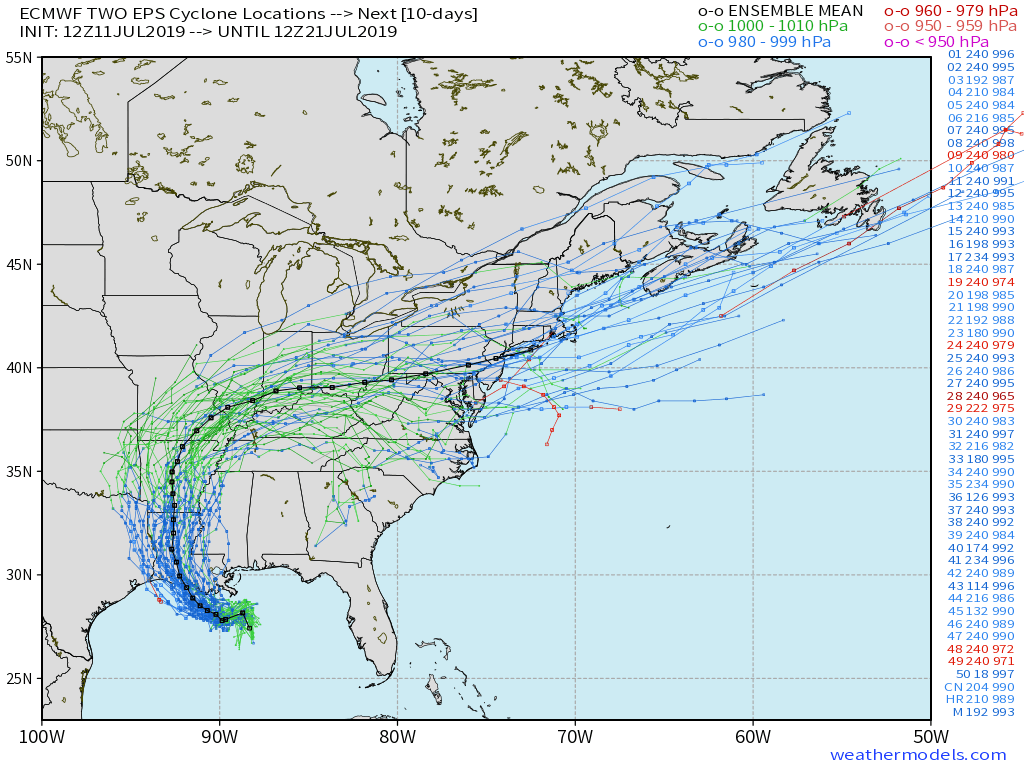
While confidence continues to rise on at least portions of the Ohio Valley getting in on the heavy rain from Barry’s remnants, we caution that there will inevitably be tweaks ahead to the forecast.
The brunt of the heavy rain/ wind will be on the eastern side of Barry as he makes landfall this weekend, and continue to the be the case as the remnants move north. As the system makes the turn to the east, the greatest heavy rain threat will be associated on the southern side of the system.
With that said, from this distance (still 5 days out from OHV impacts) the greatest concern for heavy rain once inland will run from eastern LA and AR, western TN, KY, and southern IN/ OH. Most of the significant impacts are expected to remain south of Indianapolis from this distance.
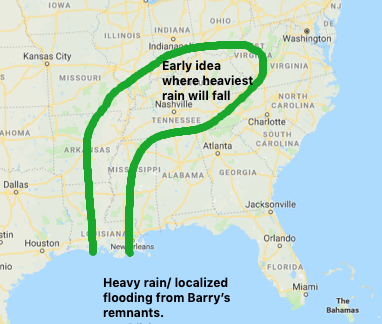
Within this highlighted zone above, rainfall amounts of 4″ to 8″ seem likely from LA, AR, and into western TN. Amounts of 1″ to locally 3″ will be possible across far southern IN and OH.
We don’t envision having to deal with wind issues up this way.
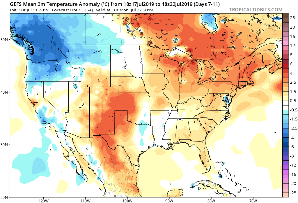
Once Barry’s remnants depart, the hottest air of the season will build in across the Ohio Valley by the 2nd half of next week. This will be one of those “pathetically hot” air masses, featuring overnight lows of 75-80 (not a typo) and daytime highs in the middle 90s. Yes, heat indices over 105 can be expected. (Much more on the long range pattern, including expected cool down, can be expected in the morning).