Through the first few days of July, it’s off to a scorching start across the Mid West, Ohio Valley, and into the Southeast. Officially, Indianapolis is running more than 4 degrees above normal through the first (4) days of the month.
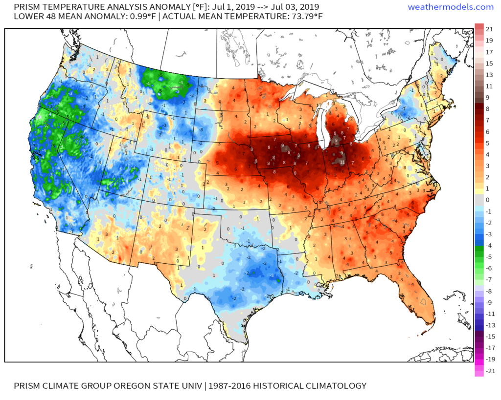
As we look ahead, we wanted to review the latest data to see if the expected cooler pattern is still on deck as we approach mid month.
The short answer is yes, but after we review the upcoming 500mb transition, we have further evidence for a cooler (or at least “less hot”) change. Note how the European ensemble paints a picture of the upper ridge being directly overhead in the current term towards more of a NW flow aloft by Days 10-15.
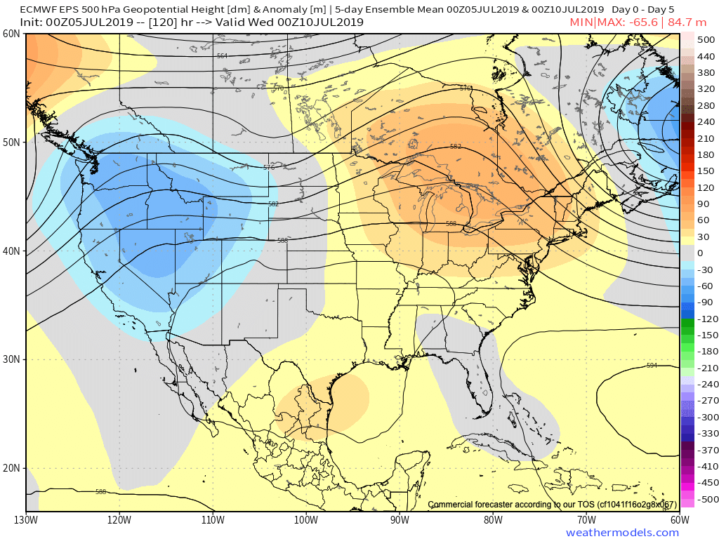
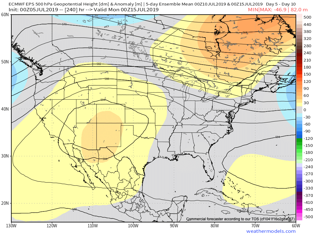
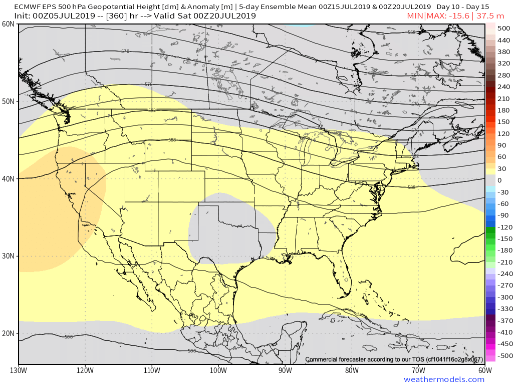
This should result in a transition to a temperature pattern that turns more seasonable and at times even cooler than normal as we rumble into the mid-July period. The other item of note is that we’ll have to be watchful for the potential of northwest to southeast tracking clusters of storms with the heat ridge back to the southwest. This threat will come after a drier period of weather that develops the 2nd half of this weekend into much of next week.
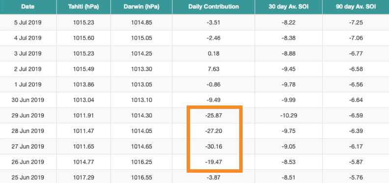
Does the data line up with what other pattern drivers would suggest? Well, the recent big hit to the SOI would back up the idea that a trough and associated cooler pattern looms around 10-15 days after the fact (sometime around the 9th-14th time frame).
Finally, the MJO moving from Phase 1 to Phase 2 this time of year would also suggest the cooler idea has merit.
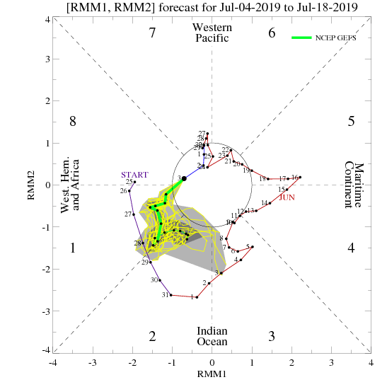
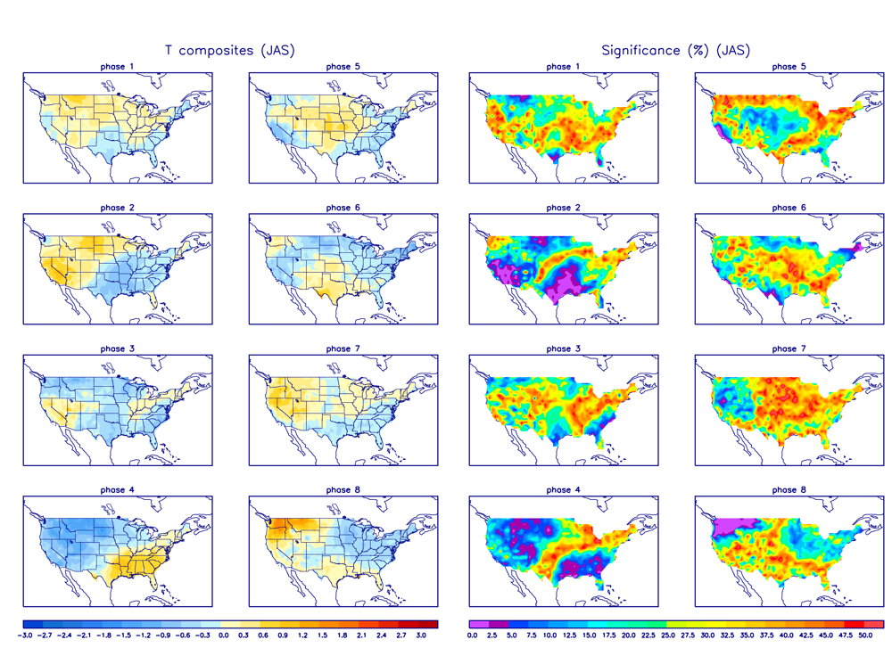
With all of that said, we continue to believe we’re on a track for a pattern that will promote a backing off of the significant heat in the days (and weeks) ahead. Especially as mid-July approaches, the temperature pattern should turn seasonable to slightly cooler than normal while the ante is also upped for the chance of multiple storm complexes to impact the area in that NW flow aloft.
