
The Storm Prediction Center has expanded the Slight Risk of severe to encompass more of central Indiana as of the latest update:
 Concern is on the increase for the potential of strong to severe thunderstorms to impact central parts of the state Wednesday evening and night. That said, there are questions with how quickly the atmosphere will be able to recover from morning cloudiness and scattered thundershowers.
Forecast radar shows scattered showers and embedded thunder scooting through the state Wednesday morning, especially between the hours of 9a and noon.
 Current thinking leans towards a brightening sky through the mid and late afternoon hours which will help destabilize things for potentially a “more significant” event Wednesday evening and night (bracketing the hours of 6p to midnight from west to east).
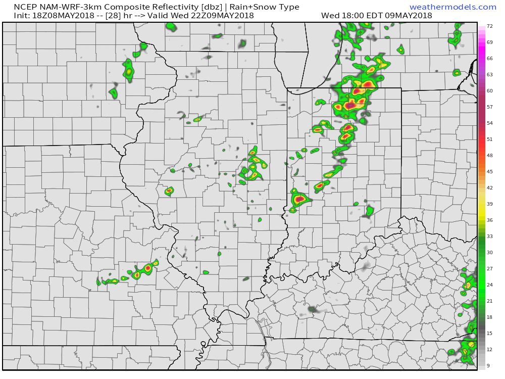
We note the latest high resolution forecast radar guidance shows rather explosive development as we near the 6 o’clock hour.
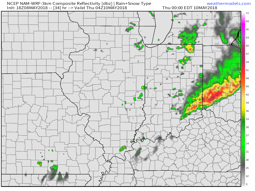
 Storms are expected to exit off to the east by midnight:
 The primary concern that severe thunderstorms may deal central Indiana lies around damaging straight line winds and large hail, however, it should also be noted current parameters also suggest a couple of storms could spawn a tornado.
Bottom line, it’ll be important to keep close tabs on tomorrow’s forecast updates and ensure you have a means of receiving the latest information around watches and warnings that will likely come.