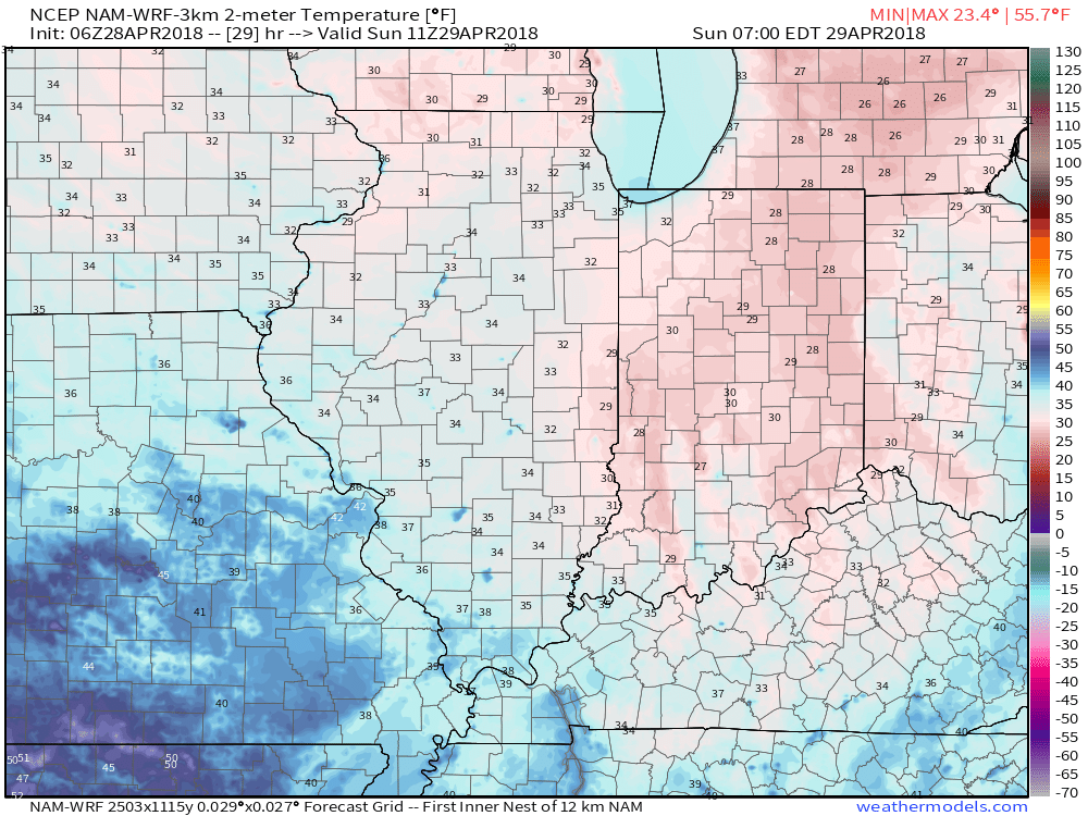
I. A cold front blew through the state last night and we’ll deal with a gusty northerly breeze throughout the day. At times, periods of low clouds will be with us, especially into the early afternoon hours. As skies clear and winds diminish tonight, a hard freeze is likely for most of central Indiana, including the potential of setting a new record low in Indianapolis (record low for Sunday is 31°).
 II. High pressure will build in for the second half of the weekend and remain in control of our weather through the first half of the work week. Dry conditions will remain along with a significant warming trend.
 III. We’ll actually go above normal (for a change) through the early and middle parts of next week, including highs around 80° by Tuesday!
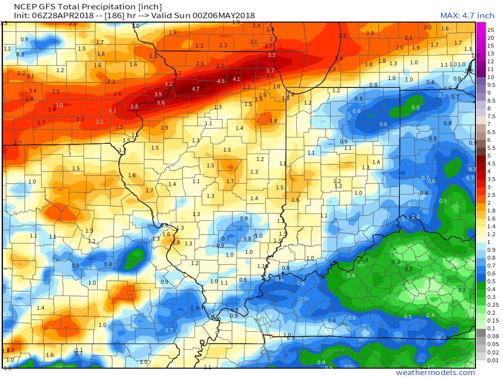
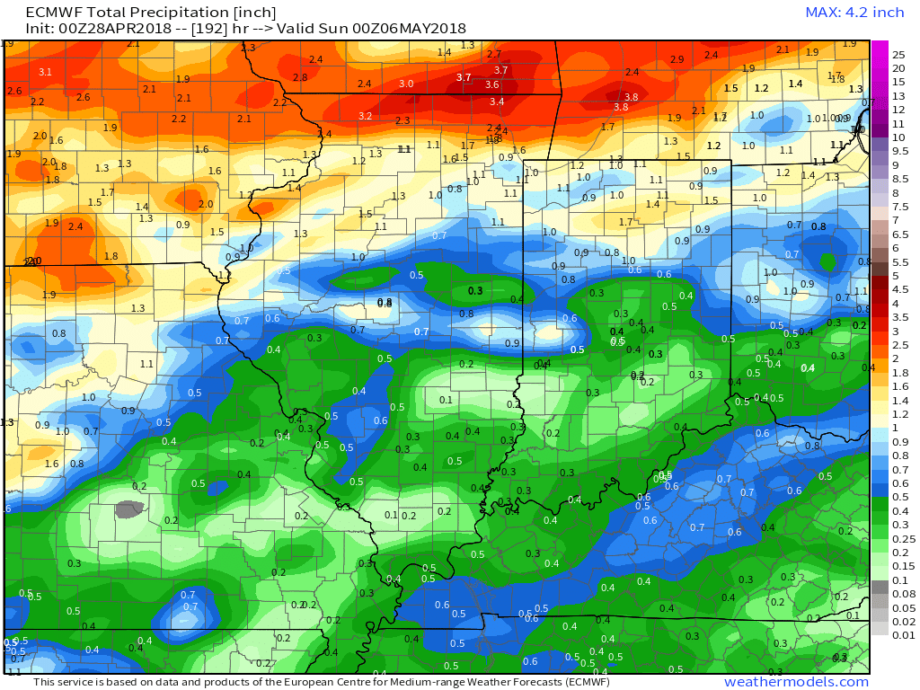
 IV. Unsettled weather returns for the second half of the work week. Models differ on rainfall totals, but we’ll include mention of 7-day totals in the 0.75″ to 1.25″ range- most of which falls Thursday and Friday.

 V. Cooler than normal temperatures will return for Week 2 so be sure to enjoy the warmth while we have it next week.

