May 22, 2016 archive
This content is password protected. To view it please enter your password below: Password:
You must be logged in to view this content. Click Here to become a member of IndyWX.com for full access. Already a member of IndyWx.com All-Access? Log-in here.
Permanent link to this article: https://indywx.com/2016/05/22/client-long-range-video-update-7/
 Highlights:
- Dry open to the week
- Warming up and turning humid
- Storm chances mid week on
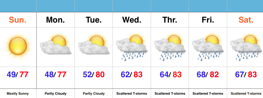
Beautiful Open To The Week…High pressure and a dry air mass will result in lots of sunshine to open the week. After a chilly first few weeks of May, we’ll see improvements in the mercury this week. A dry air mass will still result in cool overnight lows through Tuesday morning, but we’ll shift to a much more humid regime for mid and late week. Additionally, temperatures will continue to climb into the lower 80s for highs. Prepare to sweat.
The increased moisture and an approaching frontal boundary will help ignite scattered showers and thunderstorms for the second half of the week. We also have a close eye on Wednesday for the potential of strong to severe thunderstorms. While it won’t rain the entire time, prepare for “splash and dash” showers and storms into the important Memorial Day/ Indy 500 weekend…
Permanent link to this article: https://indywx.com/2016/05/22/feeling-like-summer-3/

