May 8, 2016 archive
This content is password protected. To view it please enter your password below: Password:
You must be logged in to view this content. Click Here to become a member of IndyWX.com for full access. Already a member of IndyWx.com All-Access? Log-in here.
Permanent link to this article: https://indywx.com/2016/05/08/long-range-client-video-update-and-a-word-on-summer/
 Highlights:
- Cool Mother’s Day
- Periods Of Rain And Storms
- Another Cool Blast Looms
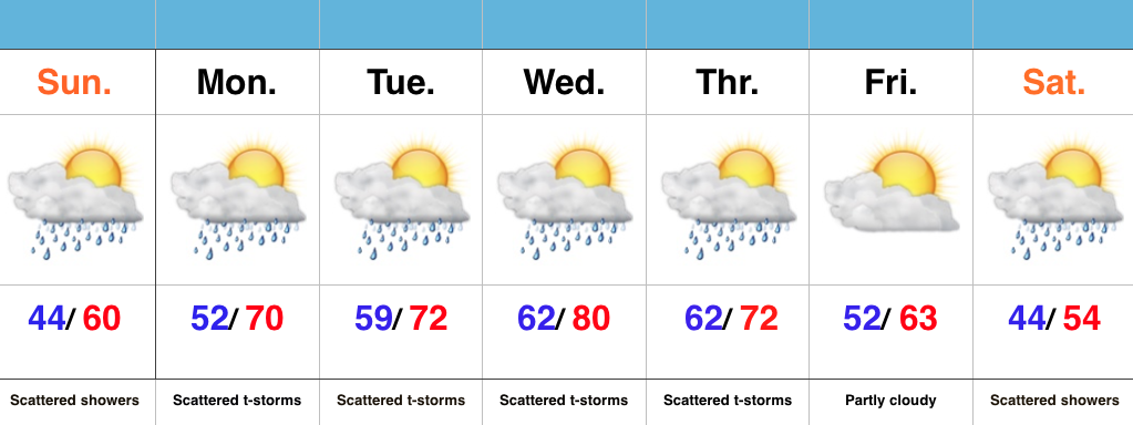
Have The Rain Gear Handy; Don’t Put Away Those Coats…A “wavy” frontal boundary will remain in our general vicinity over the next few days and be responsible for offering up periods of showers and eventually thunderstorms (as warmer, more humid air surges in Monday). It’s a “rinse and repeat” pattern this week as daily shower and thunderstorm chances continue. Models are in agreement on rain amounts of 1.5″-2″ between now and Thursday night, with locally higher amounts.
Eventually, a cold front will sweep through the state Thursday evening and set up a MUCH cooler than normal weekend. Instability-driven showers are possible Saturday, but the big story will be the unseasonably chilly air over the weekend into early next week.
Permanent link to this article: https://indywx.com/2016/05/08/unsettled-week-another-cool-blast-looms/

