August 2014 archive
|
Wed.
|
Thr.
|
Fri.
|
Sat.
|
Sun.
|
Mon.
|
Tue.
|
|

|

|

|

|

|

|

|
|
56/ 77
|
56/ 78
|
53/ 80
|
60/ 85
|
65/ 84
|
67/ 82
|
63/ 83
|
Evening Shower Chance…A frontal boundary will push through the region this evening and while moisture will be limited overall, don’t be surprised by an increase in cloudiness and an isolated shower as the front moves through. Overall, we’re looking at a beautiful day, along with continued below normal temperatures.
Nice Late Week Stretch…The late week stretch will be dominated by high pressure and slowly moderating temperatures. We’ll start well below normal, but temperatures will creep back to seasonable levels over the weekend.
Unsettled Times Ahead…More unsettled times are ahead late in the weekend into next week. We still have details to iron out, but we’ve introduced rain into the forecast as early as Sunday. Some of the rain may become heavy at times early next week. Stay tuned.
7-Day Precipitation Outlook:
- 7-Day Rainfall Forecast: 0.50″-1.00″
- 7-Day Snowfall Forecast: 0.00″
John Salewicz captured this shot of an autumn looking sky Tuesday morning as unseasonably cool air was pouring in. Thank you, John!


While moisture will be limited overall, don’t be surprised if a few showers dot the landscape this evening as a reinforcing push of cool air blows in.
Permanent link to this article: https://indywx.com/2014/08/13/shower-chance-this-evening/
|
Tue.
|
Wed.
|
Thr.
|
Fri.
|
Sat.
|
Sun.
|
Mon.
|
|

|

|

|

|

|

|

|
|
59/ 70
|
54/ 76
|
55/ 78
|
56/ 80
|
60/ 82
|
65/ 82
|
69/ 88
|
Fall-Like Breeze…The second of two cold fronts moved through central Indiana overnight. A weak trough of low pressure is yet to pass, but will do so this afternoon and may be accompanied by a couple of showers. Otherwise, we’ll enjoy a stiff northwesterly breeze today and it’ll feel very much like early fall out! The humidity of yesterday is long gone and we’ll really begin to notice the drier feel to the air this evening.
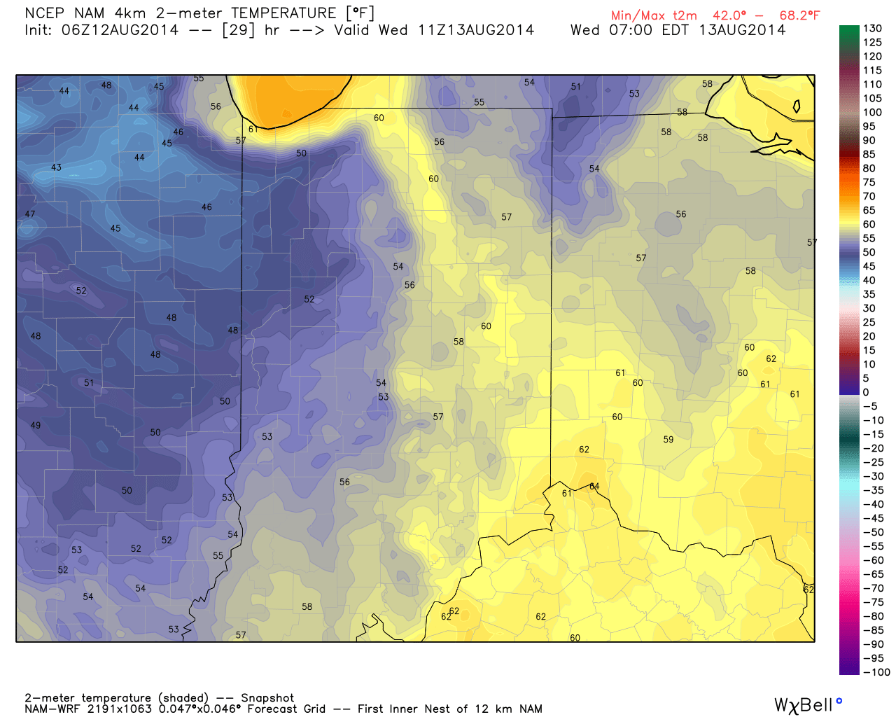
Dry skies and early fall-like temperatures will continue Wednesday. Some may even start the day in the upper 40s away from the city, especially across western suburbs.
Weak Cold Front…A weak cold front will blow through Thursday, but moisture will be limited. While an isolated shower is possible, we chose not to even bring out the shower icon for Thursday, as these will be just that- “isolated.” Most will remain dry and unseasonably cool.
Warming Up…Temperatures will begin to moderate going into the weekend and push to above normal levels early next week. We’ll keep a close eye on the weekend as past forecast model runs suggested some rain may enter the picture Sunday. Most recent runs keep us dry through the weekend, but key on a storm system late Monday into Tuesday with possible beneficial rainfall.
7-Day Precipitation Outlook:
- 7-Day Rainfall Forecast: 0.25″-0.50″
- 7-Day Snowfall Forecast: 0.00″

Fall-like temperatures are ahead over the next couple days. We forecast an official low in the city tonight in the middle 50s, but some upper 40s can be anticipated across western and northwestern suburbs.
Permanent link to this article: https://indywx.com/2014/08/12/fall-like-feel/
-
Filed under 7-Day Outlook, Fog, Forecast, Forecast Discussion, Forecast Models, Heavy Rain, HRRR, Rain, Summer, T-storms, Unseasonably Cool Weather, Unseasonably Warm
-
August 11, 2014
|
Mon.
|
Tue.
|
Wed.
|
Thr.
|
Fri.
|
Sat.
|
Sun.
|
|

|

|

|

|

|

|

|
|
68/ 80
|
60/ 74
|
54/ 76
|
55/ 79
|
58/ 80
|
58/ 82
|
64/ 85
|
Air You Can Wear…We’re awaking to lots of fog and very muggy conditions. Dew points remain in the upper 60s and lower 70s (very oppressive)! A shower or thunderstorm will be possible really at any time today, but most likely this afternoon as the first of two cold fronts drops into the region. Similar to yesterday, locally heavy downpours will certainly be possible with all of the moisture in the air.
A secondary cold front will blow through Tuesday with a continued chance of scattered showers and thunderstorms. We’ll get in on a much cooler and drier air flow Tuesday evening and this will set the stage for a very pleasant rest of the work week, including below normal temperatures into the weekend.
Warming Up; Chance Of Storms…Temperatures will moderate and we’ll introduce showers and thunderstorms into your forecast Sunday. Early thinking on next week suggests a potentially unsettled (stormy) one, but warmer than average.
7-Day Precipitation Outlook:
- 7-Day Rainfall Forecast: 0.50″-1.00″
- 7-Day Snowfall Forecast: 0.00″

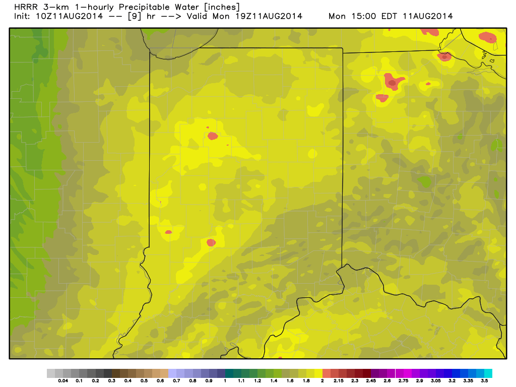
Precipitable water values will once again approach 2″ today and assist in locally torrential downpours around the region.
Permanent link to this article: https://indywx.com/2014/08/11/feeling-tropical-now-but-cooler-air-coming/
-
Filed under 7-Day Outlook, Flooding, Forecast, Forecast Discussion, GFS, Heavy Rain, HRRR, NAM Model, Rain, T-storms, Unseasonably Cool Weather, Weather Videos
-
August 10, 2014
Scattered to numerous showers and thunderstorms continue to impact central Indiana, along with localized flash flooding (precipitable water values are currently above 2″ in spots and suggest localized very heavy…
You must be logged in to view this content. Click Here to become a member of IndyWX.com for full access. Already a member of IndyWx.com All-Access? Log-in here.
Permanent link to this article: https://indywx.com/2014/08/10/unsettled-couple-days-ahead-before-a-taste-of-fall-by-mid-week/
Cooler than normal air masses have been lined up this summer as frequently as airliners waiting to land at Atlanta-Hartsfield airport. With that said, it’s only fitting that we’re targeting…
You must be logged in to view this content. Click Here to become a member of IndyWX.com for full access. Already a member of IndyWx.com All-Access? Log-in here.
Permanent link to this article: https://indywx.com/2014/08/10/another-cool-period-looming-before-we-crank-the-heat/
|
Sat.
|
Sun.
|
Mon.
|
Tue.
|
Wed.
|
Thr.
|
Fri.
|
|

|

|

|

|

|

|

|
|
65/ 80
|
65/ 82
|
64/ 83
|
57/ 74
|
54/ 75
|
56/ 79
|
59/ 82
|
Widely Scattered Showers, But Most Remain Dry…Most concentrated rain and heavier rainfall totals will remain confined to southern portions of the state as an area of low pressure continues to impact the region. Here across central Indiana, look for lots of clouds, but little in the way of concentrated rain over the weekend. A widely scattered shower is possible today and Sunday, but most will remain rain-free. We officially call for a high around 80 today and in the lower 80s Sunday, but want to stress there will be a wide range in highs both days across central Indiana (due to cloud cover).
Early Week Cold Front…A cold front will sweep the state late Tuesday. Ahead of this boundary, scattered showers and thunderstorms will be possible Monday afternoon. Low pressure will form along the frontal boundary over Indiana Tuesday before moving northeast into the Great Lakes. This may aid in better coverage of showers and thunderstorms locally on Tuesday. Otherwise, we’ll note a wind shift and cooler, drier air pouring back into the area Tuesday evening.
Beautiful Mid/ Late Week Stretch…A beautiful stretch of weather is on deck for the middle and latter portion of next week. Early fall-like conditions can be expected Wednesday and Thursday, before temperatures begin to moderate Friday.
Looking a bit past the 7-day forecast shows our next storm system taking aim on the region next weekend.
7-Day Precipitation Outlook:
- 7-Day Rainfall Forecast: 0.50″-0.75″
- 7-Day Snowfall Forecast: 0.00″

Widely scattered showers will be possible this weekend across central Indiana. More concentrated, heavier, rain is on tap across southern portions of the state.
Permanent link to this article: https://indywx.com/2014/08/09/lots-of-clouds-around-but-not-much-rain/
-
Filed under Forecast, Forecast Discussion, Forecast Models, Heavy Rain, HRRR, Rain, Summer, Unseasonably Cool Weather, Unseasonably Warm, Weather Videos
-
August 8, 2014
Good evening and happy Friday! Tonight’s video looks at the weekend weather, another push of cool air next week, and touches on the long range looking at late August and…
You must be logged in to view this content. Click Here to become a member of IndyWX.com for full access. Already a member of IndyWx.com All-Access? Log-in here.
Permanent link to this article: https://indywx.com/2014/08/08/another-shot-of-cool-air-next-week-but-is-a-warmer-period-looming-late-month/
|
Fri.
|
Sat.
|
Sun.
|
Mon.
|
Tue.
|
Wed.
|
Thr.
|
|
|

|

|

|

|

|

|
|
63/ 74
|
61/ 79
|
63/ 82
|
61/ 82
|
58/ 80
|
54/ 75
|
52/ 78
|
Easterly Flow, Drier Air…An area of low pressure will track across southern portions of the state. High pressure across the eastern Great Lakes will continue the easterly flow across central Indiana and greatly limit the northward extent of heavy rain. While we’ll see a few showers across central Indiana today, the heavy rain will remain across the southern 1/3 of the state. Otherwise, cloudy skies and easterly breezes will keep temperatures close to 10 degrees below normal here.
More Sunshine This Weekend…We’ll maintain a mention of a scattered shower both Saturday and Sunday, but this is nothing to cancel any outdoor plans over. Periods of sunshine will also build in and lead to a nice weekend, overall.
Early Week Cold Front…A cold front will sweep the state Tuesday and could have a couple showers and thunderstorms along it. The big story though won’t be rain and storms, but instead another push of cooler than normal air for late week.
7-Day Precipitation Outlook:
- 7-Day Rainfall Forecast: 0.50″-0.75″
- 7-Day Snowfall Forecast: 0.00″

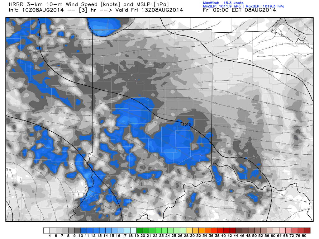
A drier easterly flow, courtesy of high pressure to our north, will continue to “eat away” at the northward rainfall progress today.
Permanent link to this article: https://indywx.com/2014/08/08/rain-eater/
Tonight’s video update discusses the rainy scenario setting up for some on Friday and looks ahead to next week’s big push of cool air. Don’t look for much in the…
You must be logged in to view this content. Click Here to become a member of IndyWX.com for full access. Already a member of IndyWx.com All-Access? Log-in here.
Permanent link to this article: https://indywx.com/2014/08/07/rainy-for-some-friday-another-big-push-of-cool-air-next-week/
Less than 24 hours away from portions of the region experiencing a heavy rain event, we still have a wide range of rainfall numbers. This morning’s water vapor image clearly…
You must be logged in to view this content. Click Here to become a member of IndyWX.com for full access. Already a member of IndyWx.com All-Access? Log-in here.
Permanent link to this article: https://indywx.com/2014/08/07/digging-into-the-data/


