
|
Sat. |
Sun. |
Mon. |
Tue. |
Wed. |
Thr. |
Fri. |
|
|
|
|
|
|
|
|
|
54/ 81 |
59/ 71 |
45/ 64 |
44/ 70 |
46/ 75 |
48/ 78 |
53/ 80 |
Stormy Night Ahead For Some…Most of today will feature plentiful sunshine and warm southwest breezes. While we’ll enjoy a mostly dry day time, storms will ignite to our north and a couple of these could reach severe levels across northern Indiana later this evening. These storms will sink south into central Indiana during the late evening/ overnight period. While a strong to severe storm is possible across central Indiana, the overall trend will be a weakening one as the storms shift south.
We’ll maintain a mention of a shower Sunday (most of the day will remain dry), otherwise look for a cooler day as winds shift to the north behind our cold front.
Cool Start; Warm Finish…The work week will get off to an unseasonably cool start as highs only reach the middle 60s Monday. The week ahead will be another dry one and temperatures will slowly rebound through the week, as well. Highs by Friday will reach the 80 degree mark, or above, for many.
Speaking longer term, the overall October pattern is one that looks warmer than normal to us here at IndyWx.com, but more on that in the days ahead.
Upcoming 7-Day Precipitation Forecast:
- 7-Day Rainfall Forecast: 0.25″ – 0.50″
- 7-Day Snowfall Forecast: 0.00″
John Salewicz caught this beautiful sunset shot Friday evening in Zionsville. Thanks, John!

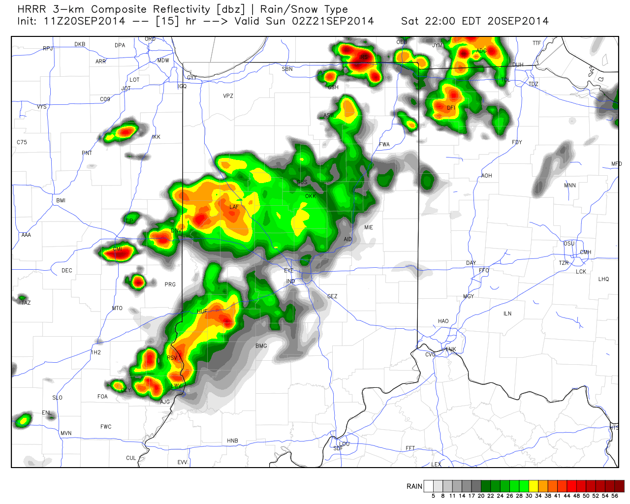
While storms will likely be in a weakened state dropping into central Indiana, a couple strong storms are still possible late tonight.


