Scattered Strong Storms This Afternoon For Some…

Screen Shot 2016-05-12 at 7.28.35 AMHighlights:

  • Scattered Showers And Storms
  • Turning Much Cooler
  • Unsettled Early Next Week

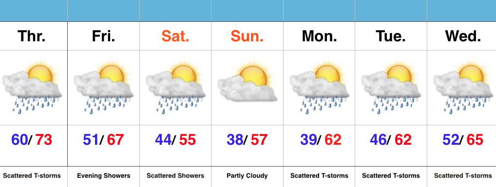
Have The Jackets Ready…The first of two cold fronts will sweep through the state this evening and help spark scattered strong to severe thunderstorms this afternoon and evening across mostly the eastern half of the state.  A secondary cold front will move through here Friday evening with showers Friday night into early Saturday.  It’s this second front that packs the much cooler air.  Jackets will be required this weekend, and scattered light showers will remain in our forecast Saturday.

As we push into the new work week, things appear to be rather unsettled (what’s new)?  An area of low pressure will push towards the region Tuesday into Wednesday and will increase rain and embedded storm chances.  It won’t rain the entire time, but we’ll want the rain gear handy.

Turning Much Cooler To Close The Week…

Screen Shot 2016-05-10 at 6.52.10 PMHighlights:

  • Warm and humid mid week
  • Turning much cooler for the weekend
  • Unsettled times remain

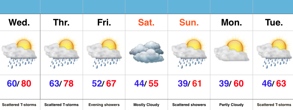
Jackets Required This Weekend…Wednesday’s coverage of showers and thunderstorms will likely be less than today, but will still require a mention of “scattered” coverage in our forecast.  Some locally heavy downpours are possible, but like today, heavy rain totals won’t be uniform.  Better coverage of showers and thunderstorms will move in early Thursday in association with a cold front.  Once that cold front passes, expect a northwest wind shift and a much cooler feel of things to wrap up the work week and head into the weekend.

A weak disturbance will provide showers late Friday into the early morning hours Saturday, but this won’t amount to significant rain totals.

Cool times remain into early and middle parts of next week, with our next chance of significant rain slated for Tuesday.

Tuesday Morning Rambles…

1.) The month of May has gotten off to a chilly start and given the period of unseasonably chilly air that looms later this week, it’s safe to say these cool anomalies will grow even cooler. 
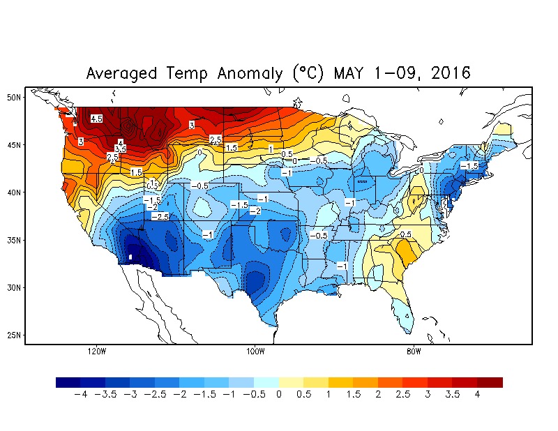
The coolest day looks to be Saturday with highs only in the mid 50s.


2.) In the shorter term, we’re keeping an eye on strong-severe thunderstorm potential this afternoon and evening across southern and central parts of the state. Large hail and damaging straight line winds are of greatest concern, but a quick spin-up tornado can’t be ruled out.
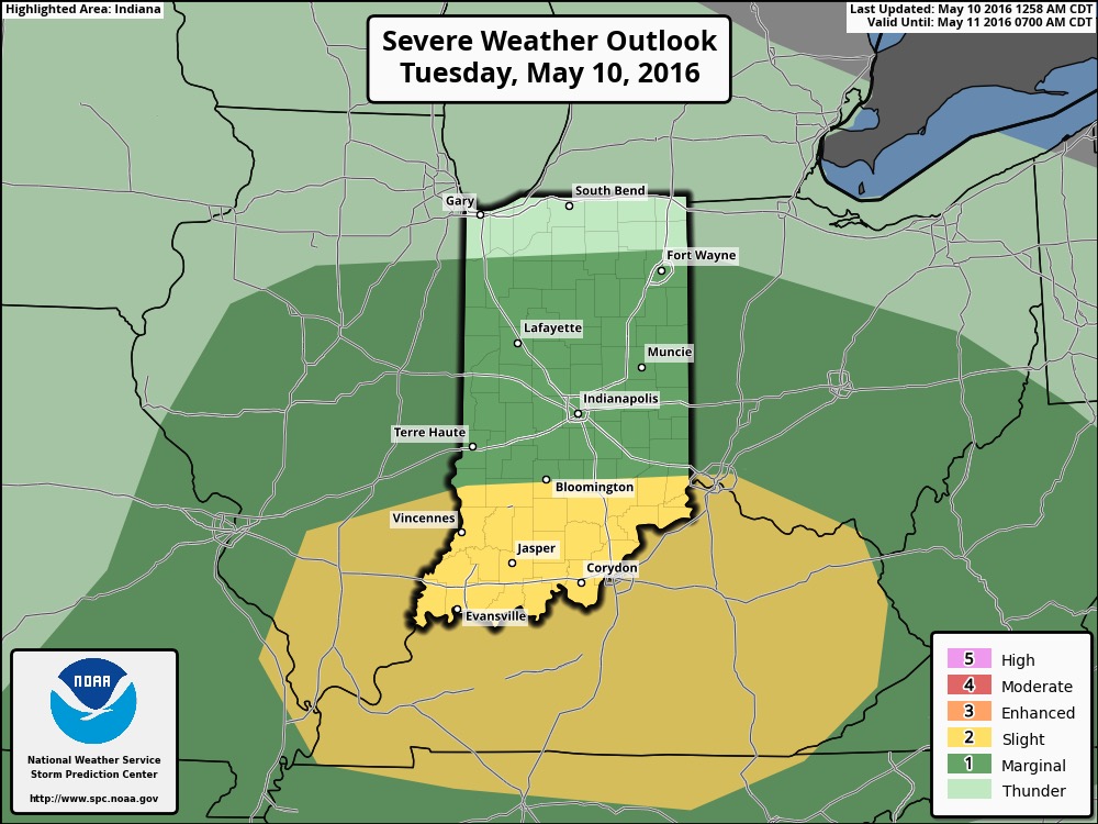

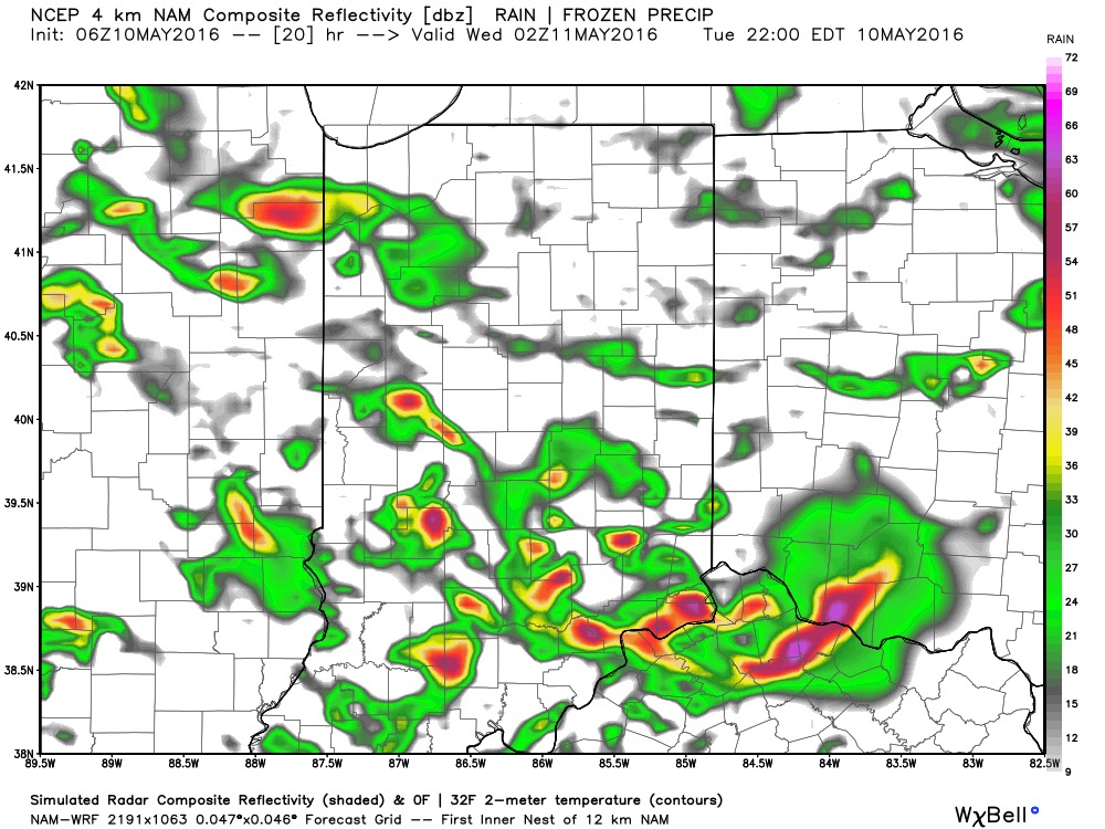

Not everyone will see heavy rain amounts today, but a few neighborhoods may deal with localized flooding issues as slow moving heavy storms potentially train over communities. Where this happens, 2″+ rain totals are a good bet by midnight.


3.) Forecast models remain in a state of disagreement concerning late this weekend into early next week. The GFS is particularly bullish on the idea of wet (heavy rain threat), chilly times whereas the European is much drier (and warmer). We’ll keep an eye on things and hope for consistency this afternoon. Speaking of this afternoon, we’ll have our updated 7-day posted later today! Make it a great Tuesday.