
 Highlights:
- Storms to start the work week
- Heat and humidity build
- Heat doesn’t last
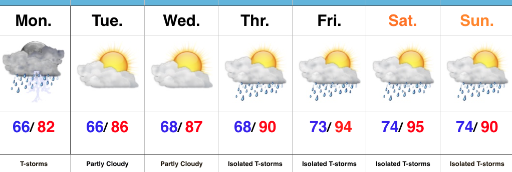
Renewed Storm Chances Later Today…Alarm clocks weren’t needed today as a big complex of storms and heavy rain rumbled through the state during the pre-dawn hours. Many neighborhoods received a quick 2.5″+ during the overnight and predawn hours. As we write this, renewed thunderstorms are firing to our west and will impact portions of the state later this afternoon. Additional hefty rains are a good bet for some.
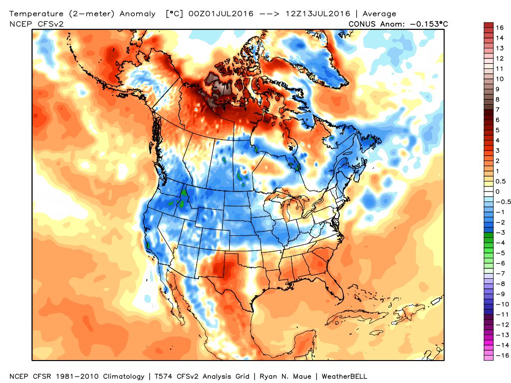
We’ll dry things out as we rumble through the mid week stretch and while isolated storms are possible to close the week, most folks should remain dry as a big ole’ upper ridge builds over the mid west. The big story will be intensifying hot, humid weather- centered on Friday-Saturday. Heat indices will approach 100-105 degrees during this time frame, as well. The good news is that forecast data points to the associated hot dome backing west and setting up shop over the Rockies to close the month and open August. Accordingly, the hottest anomalies will shift west, as well. We’ll be left with a NW flow aloft providing a cooler and unsettled stretch to close the month of July and open August.
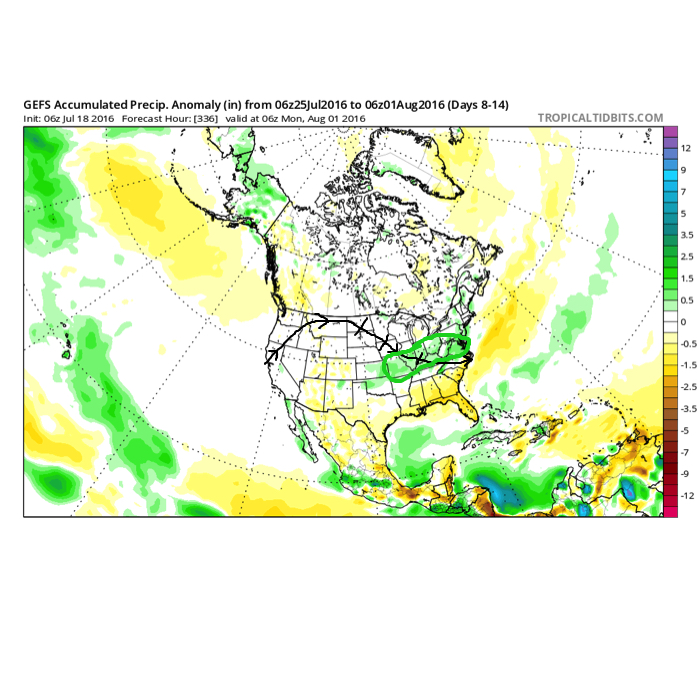
The pattern to close July and open August should look rather familiar to what we’ve seen the majority of summer. NW flow aloft with frequent rain/ storm chances. Courtesy: TropicalTidbits
Upcoming 7-Day Precipitation Forecast:
- Snowfall: 0.00″
- Rainfall: 0.50″-1.00″
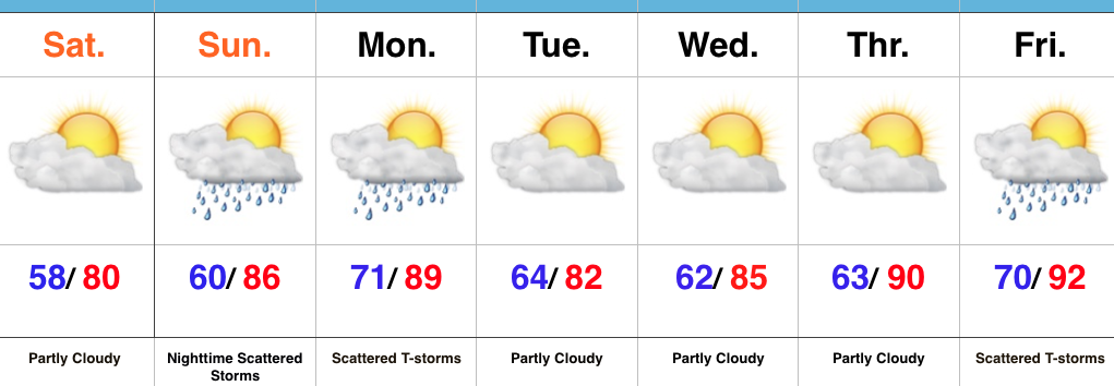
 Ensemble data continues to suggest that the mean ridge position (hot dome) develops over the eastern portion of the country early next week before slowly retrograding northwest with time.
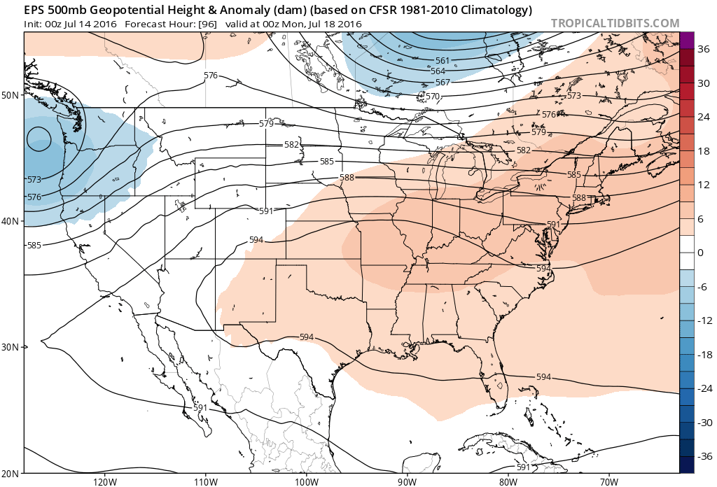 By the middle and latter portions of next week, the hot dome is set up in a position that will yield an extended stretch of hot temperatures across the state, including multiple mid-90 degree highs across central IN.
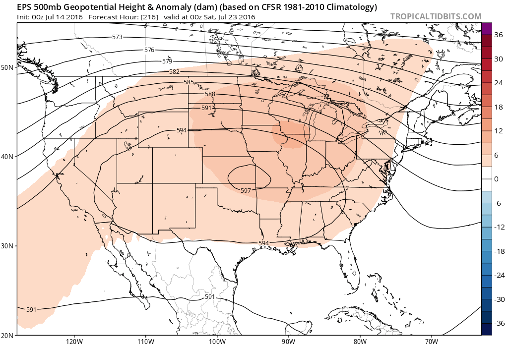
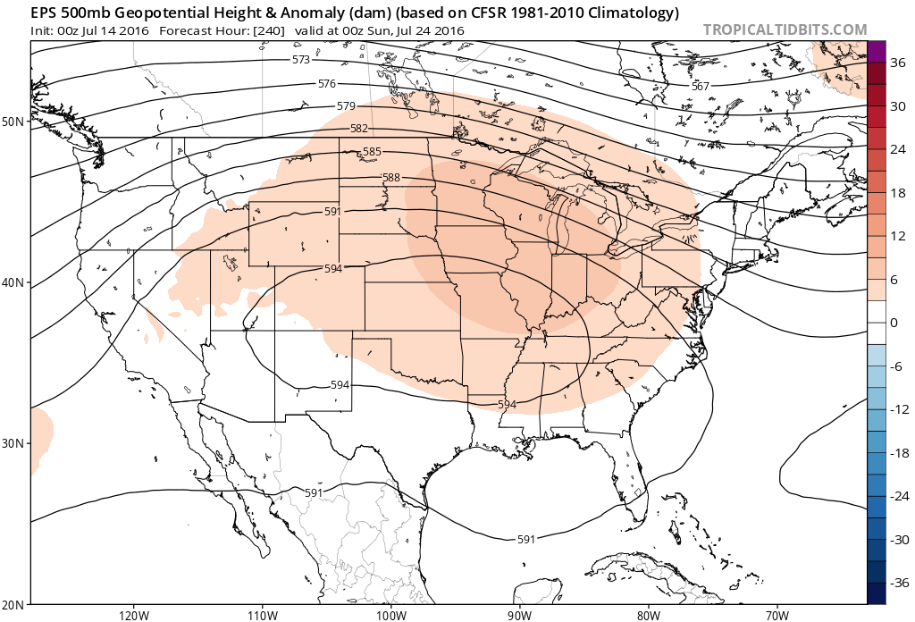 Given the current look of the ridge position, this would also be a rather dry pattern, as well, as the storm and rain track would shift north across the Canadian border into the northern Great Lakes states. (Follow that 588 line above for a good indicator of the storm track).
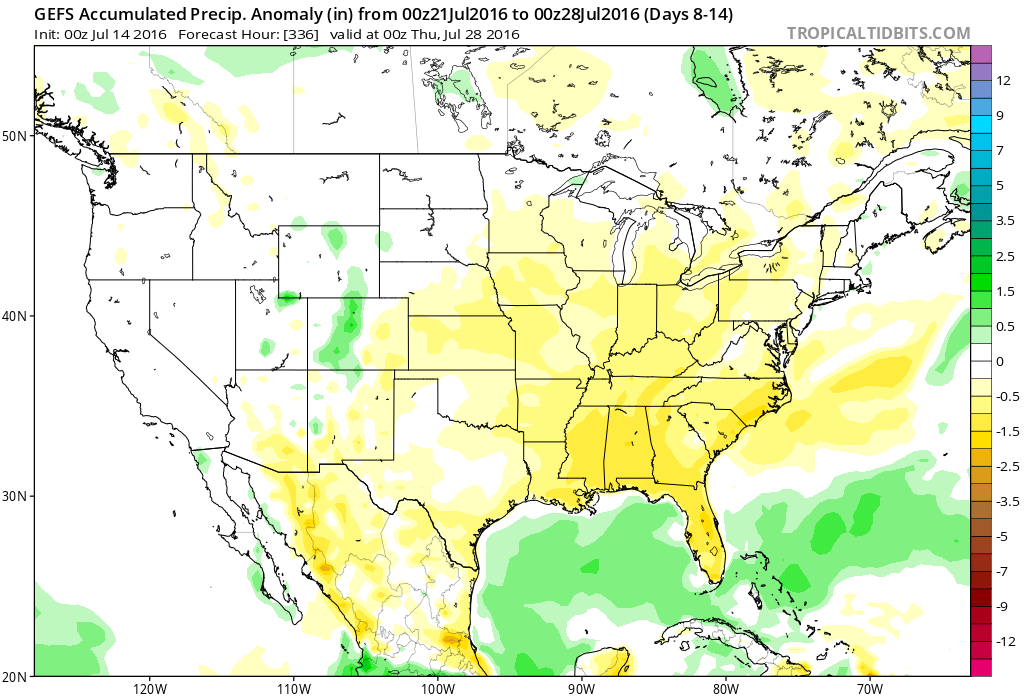 One always has to be careful in trying to predict the timing of the ridge breaking down/ overall placement this time of year (models can struggle), but for now it appears as if we really heat things up and dry things out as we move through next week- especially the middle and latter portions of the week.