Uneventful Weather; Warming Up Late Week…
Highlights:

  • Dry weather this week
  • Briefly cooler mid week
  • Weekend warm-up

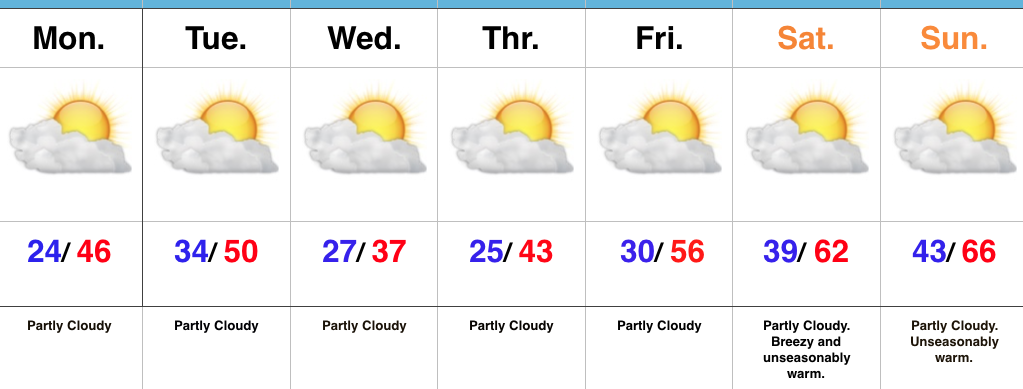
Sunglasses Required…We’re opening the work week with crystal clear blue skies and cold temperatures. Mostly sunny conditions will give way to increasing high level cloudiness this afternoon/ evening as a storm system passes by to our south.  That increase in cloudiness is about as “exciting” as it gets this week in the weather department.  Reinforcing chilly conditions will dive south into the region Tuesday night into Wednesday, but we’ll remain precipitation-free.

Like so many other cold blasts this winter, the chill won’t have staying power and we’ll get back to a moderating trend heading into the weekend.  Many places will likely come close to 70° by the second half of the weekend as dry conditions remain. Enjoy friends!

Upcoming 7-Day Precipitation Forecast:

  • Snowfall: 0.00″
  • Rainfall: 0.00″

High Pressure Supports A Quiet Week; Colder Then Warming Again…

Quick post from the road on this Sunday morning before a more extensive update tonight. 

High pressure will build into the Ohio Valley and support a quiet week, overall. 


A “pop” of cold air will flow into the state on gusty northerly winds Tuesday night and set-up a cold midweek stretch. 


Highs will fall into the 30s Wednesday and Thursday with lows in the upper teens to lower 20s. However, like so many other cold shots over the past 6 weeks, it’s of the “in and out” variety. By late week, southwest winds are developing and helping temperatures moderate going into the weekend. 


We should remain dry next weekend before a more significant storm system arrives during early portions of Week 2. With dry conditions, a strengthening southwest flow and strong upper ridge, highs next weekend will approach 65°-70°.  

With two weekends in a row of spring-like weather in February we sure have to believe we’ll have to pay for the nice conditions late month into March before true sustained spring conditions can take hold…

Pleasant Start; Nighttime Showers…

Highlights:

  • Sunshine gives way to showers
  • Colder mid-week
  • Warmth returns

Showers Arrive Tonight…The weekend is off to a pleasant start, but clouds will increase this afternoon and light showers will follow by evening, continuing into early Sunday morning.  Rainfall amounts won’t be impressive, with most around one-quarter inch.  It’ll be an unseasonably mild weekend, with highs today pushing close to 60° and early highs Sunday around 50° before cooler air spills in for the second half of the weekend.

The majority of the upcoming work week will be precipitation-free.  A dry cold front will pass Tuesday evening and this could result in a couple of snow flurries or light snow showers.  As of now, the better coverage of snow showers appears to be to our east for our friends in Ohio.  We’ll turn colder Wednesday and Thursday, but have no fear as moderating temperatures will quickly return as we roll into next weekend.  In fact, the period just beyond the current 7-day looks downright spring-like, including highs that may push close to 70° early in Week 2.

Upcoming 7-Day Precipitation Forecast:

  • Snowfall: 0.00″
  • Rainfall: 0.25″ – 0.50″

Friday Morning Notebook: Warmer Times This Weekend…

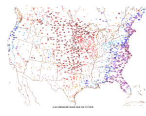
Happy Friday, friends.  We’re still cold this morning, but a look at the change in temperatures compared to 24 hours ago shows the milder trend that will be with us through the upcoming weekend.  Highs today will reach the upper 40s and 55-60 Saturday.

Winds will turn strong and gusty out of the southwest this afternoon, noted by the tightly packed isobars (lines of equal pressure) along with considerable mid and high level clouds.

Clouds will lower and thicken Saturday and we may also have to deal with periods of fog, as well.  Showers and drizzle will lift into town as the day progresses, especially by afternoon and evening.
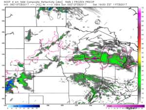
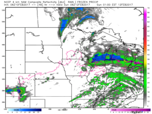
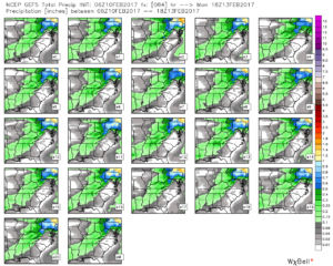
We don’t expect heavy rain this weekend.  In fact, model data continues to really back off on expected totals.  The general consensus is between 0.15″ and 0.25″ across central Indiana.
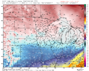
After a mild Saturday, cooler (but not cold) air will ooze into the Ohio Valley Sunday.
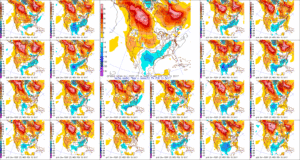
Resurgent cold air will blow into town during the middle and latter portions of the upcoming work week.  Highs will return to the 30s with overnight lows in the lower 20s.  We’ll likely add scattered snow showers into the mix as well.
Bitter Feel Today…

Screen Shot 2017-02-09 at 7.43.52 AMHighlights:

  • Frigid Thursday
  • Milder, but wet this weekend
  • Turning colder next week

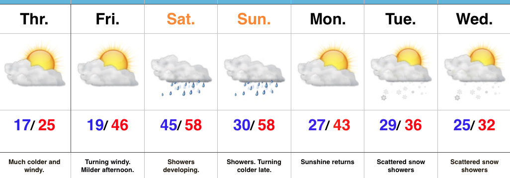
Bundle Up…Temperatures are running much colder than this time 24 hours ago with most waking up to the teens.  Throw in a strong and gusty NW wind and the ‘chill factor has fallen to as low as zero for many neighborhoods this morning.  Thankfully, sunshine should be with us this afternoon.

Our wind flow will shift around to the southwest and usher in a milder brand of air by Friday afternoon.  Eventually, that flow will also be an increasingly moist one, as well, and showers will develop Saturday, continuing into Sunday.  We expect the cold front to slip through the state Sunday night and allow colder air to return.

Questions abound early-mid next week.  Whether or not we can get a piece of energy to dig in and create wintry “fun and games” is yet to be determined.  Modeling is going back and forth on that idea, versus, multiple, weaker waves capable of producing scattered snow showers in the colder air mass.  We’ll continue to monitor things.

Upcoming 7-Day Precipitation Forecast:

  • Snowfall: Dusting – 1″
  • Rainfall: 0.25″ – 0.75″