Awesome Weekend Weather Continues; Changes Ahead Next Week…
 Highlights:
- Spring-like weather rolls along
- Shower chances return
- Strong t-storm potential
- Different tune next weekend
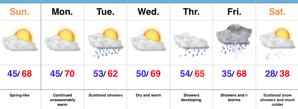
Is This February? Our stretch of unseasonably pleasant, spring-like, weather will continue for the second half of the weekend and as we progress into the early stages of the work week. Find a way to get outside the next couple of days (that’s an order ;-)).
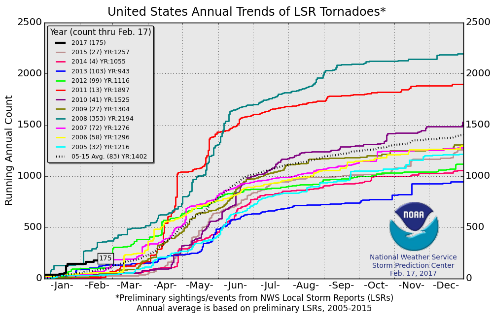
A weak weather system will scoot through here Tuesday and serve to increase our cloud cover, along with a few scattered showers. Dry conditions return Wednesday, but by then all eyes will be on an approaching stronger storm system that will provide increased shower coverage by Thursday and strong to severe thunderstorm potential Friday. Speaking of severe weather, we think this spring will offer up a busy severe weather season. We’ll have additional updates on the severe potential as time gets closer, but just keep a mental note Friday could be a busy weather day.
We’ll abruptly transition back to winter Friday night and the air will grow cold enough a week from today to allow scattered snow showers to fly in a gusty northwesterly breeze next Saturday.
Upcoming 7-Day Precipitation Forecast:
- Snowfall: Trace – Dusting
- Rainfall: 0.50″ – 1.00″
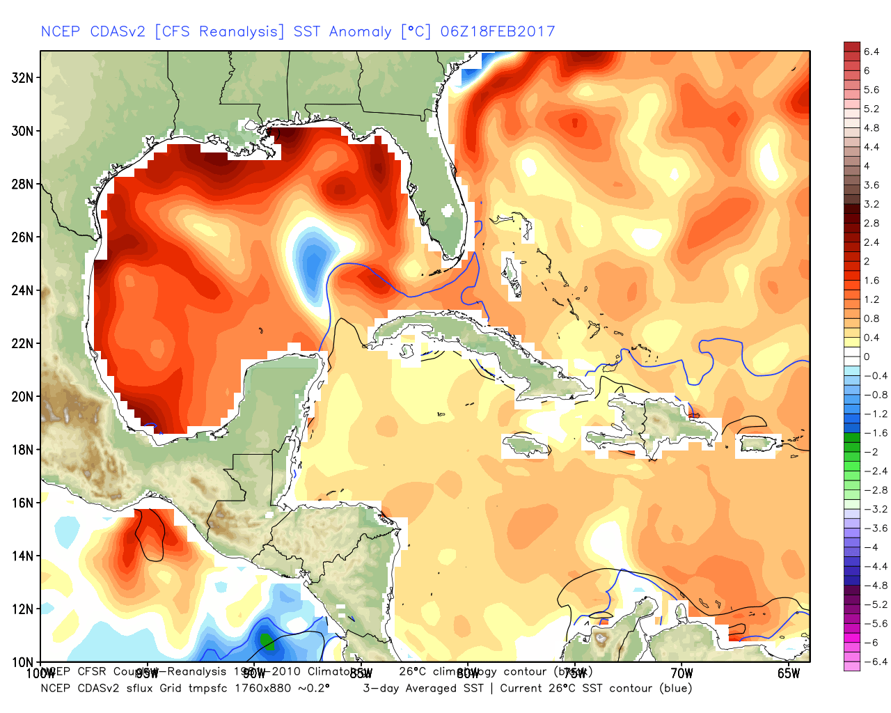
 The Gulf of Mexico is boiling warm (running 1°-3° C above normal) and this will aid in transporting moisture-rich air north. As storms eject out of the Rockies and Plains, one would tend to believe anomalously warm dew points and precipitable water values will be available.
 The JMA Weeklies show an active stretch developing as we progress through the next few weeks.
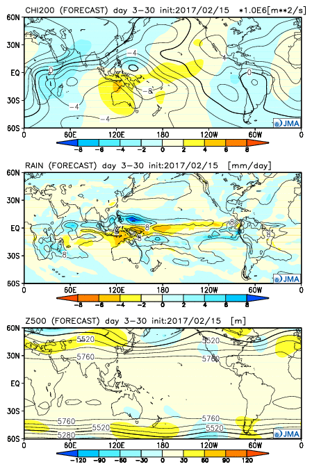 As we rumble deeper into the spring months, the mean trough position should be located across the west. The end result should be a mean storm track that runs into the Ohio Valley- courtesy of resistance from an eastern ridge (that warm water in the Gulf and East Coast screams the mean ridge position should be located across the east coast). Confidence is greater than normal on a busy severe weather season.
 Highlights: