
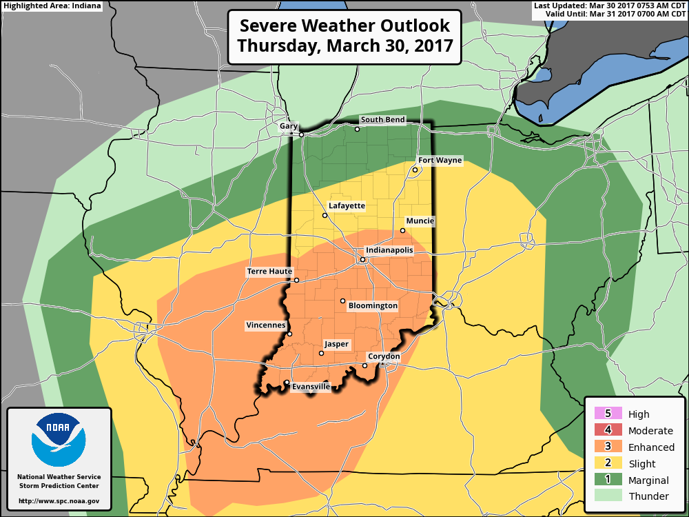
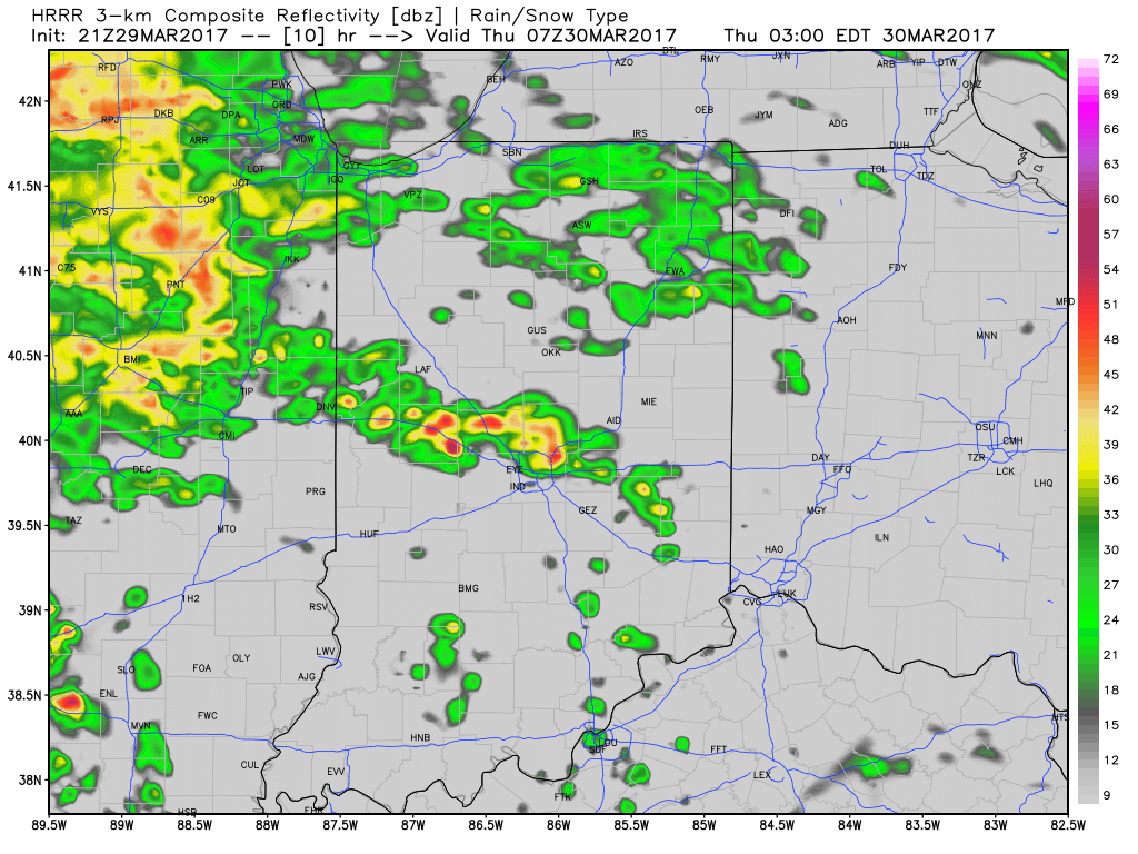
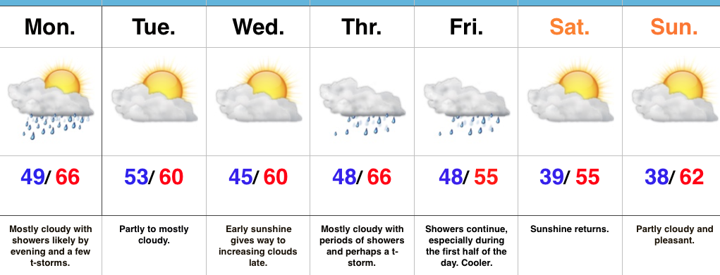
1.) Morning showers and thunderstorms continue to impact north-central Indiana this morning and given the look to downstream trends on radar and satellite, it would seem like it’s going to be tough to get into any sort of significant sunshine this afternoon. This is great news as it’ll limit severe potential. That said, we still can’t rule out a severe thunderstorm this evening with large hail and damaging straight line winds of greatest concern. The updated (9a eastern) outlook from the Storm Prediction Center continues the “enhanced risk” for the southern half of Indiana.
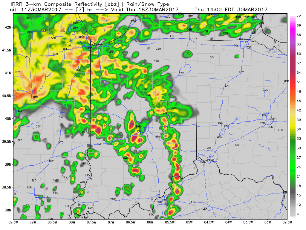
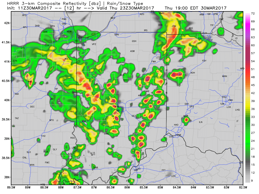
 2.) We bracket the hours of 2p-8p (couple hours earlier from yesterday’s thinking) as the period of potential most widespread strong to severe thunderstorms across central Indiana, and the HRRR forecast radar shows what the radar may look like this evening. Have a means of getting the latest warnings.
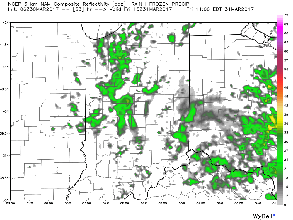
 3.) Scattered showers will continue into Friday morning before drier air arrives during the evening hours.
 4.) This drier trend Friday PM is one that will continue into the weekend. High pressure will supply mostly dry weather through the entire weekend (small shower chances return Sunday evening), including sunshine.
 5.) Another active period of weather awaits next week, including multiple rain chances early and late week. The latter storm looks to be the bigger event with heavy rain and thunderstorm potential Wednesday into Thursday. 7-day rain numbers check in between 1.5″-2″ with locally heavier amounts.
 6.) The story becomes a chilly one next weekend, and models suggest central Indiana may be dealing with frost and freeze conditions by next Saturday or Sunday morning.
 Multiple rounds of showers and thunderstorms will likely impact central Indiana through the mid and late morning hours Thursday.
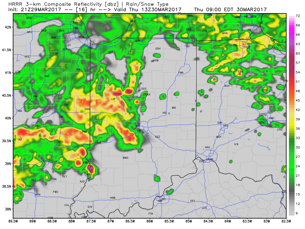 As we press into the early afternoon hours, model data suggests we see a “lull” in the stormy weather and potentially even a few breaks in the cloud cover. This would serve to “up the ante” in regards to the prospects of severe weather potential Thursday afternoon, particularly mid and late afternoon through the evening hours. Accordingly, the Storm Prediction Center continues to highlight central Indiana for the risk of severe weather Thursday.
 In fact, given a look at the most recent data, I wouldn’t be surprised to see the “enhanced” risk area expand further north in future updates. This would also include all modes of severe weather (large hail, damaging straight line winds, and potentially a tornado). As things stand this evening, we bracket the hours of 4p and 10p Thursday for the greatest potential of severe weather.
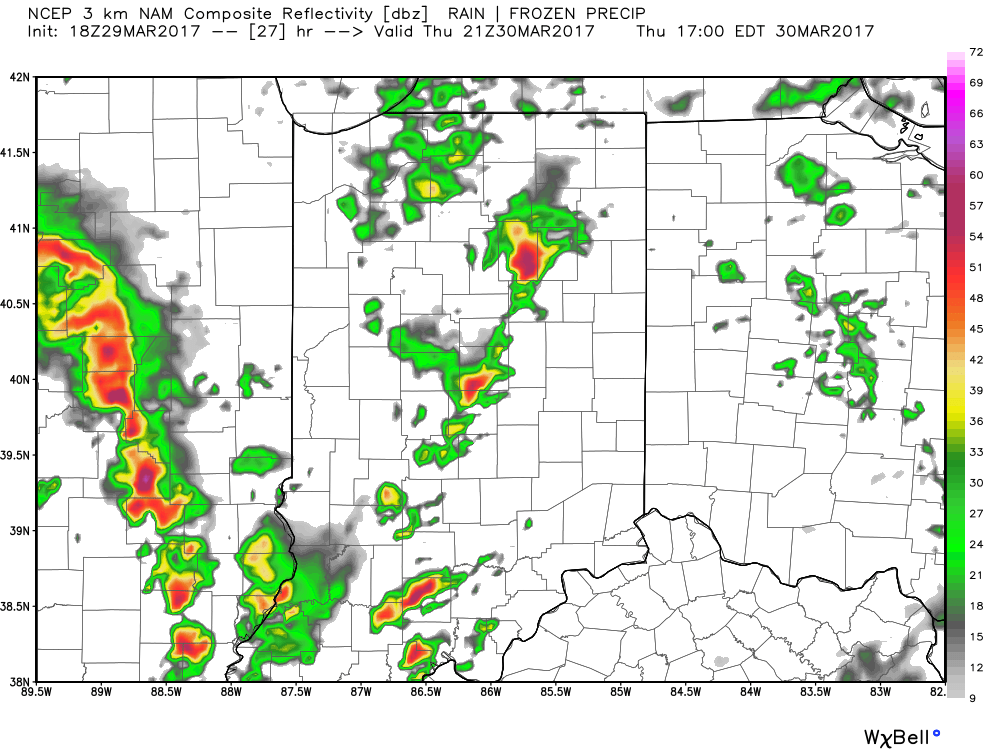 As we push into the overnight hours Thursday into Friday, unsettled weather will continue, but we’ll get rid of the severe potential. “Nuisance” type showers will continue into the first half of Friday before drier air arrives Friday afternoon and evening. This drier theme will settle in for the weekend and provide a very pleasant open to April.
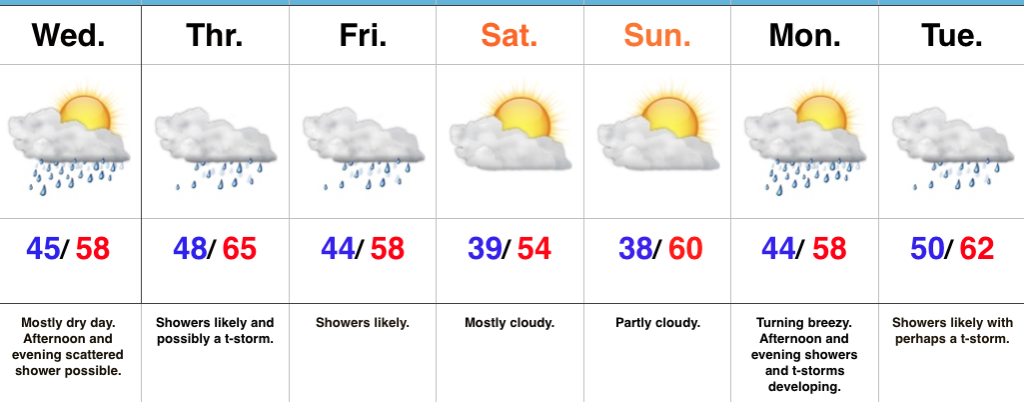 Highlights:
 Precipitation is running above normal, locally, to the tune of nearly 1″ month-to-date. Heaviest rains have fallen across southeastern Indiana over the past (30) days.
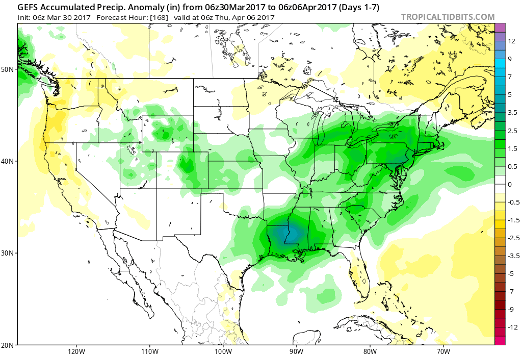
 A look at precipitation anomalies across the mid west, month-to-date:
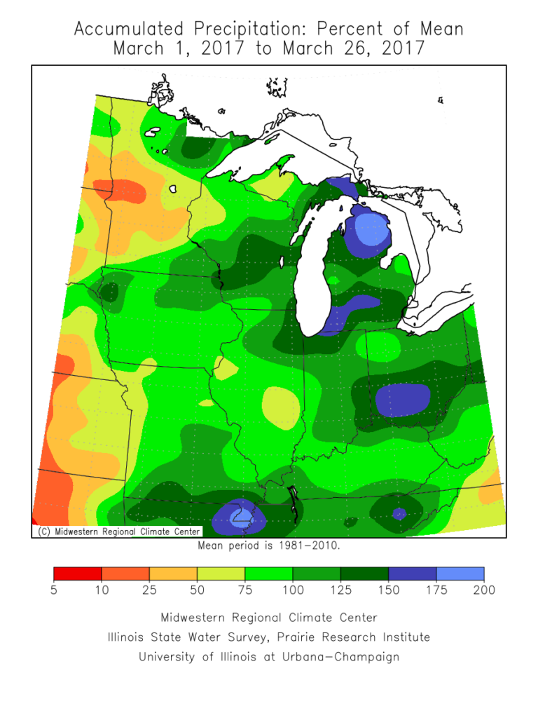 As we progress through the upcoming (10) days, a transient weather pattern will persist. This will keep forecasters busy, but it should also be stressed it’s not all a “doom and gloom” type pattern, either. There will be plenty of dry time over the upcoming period, including drier conditions building in tomorrow (Tuesday) into a good chunk of Wednesday.
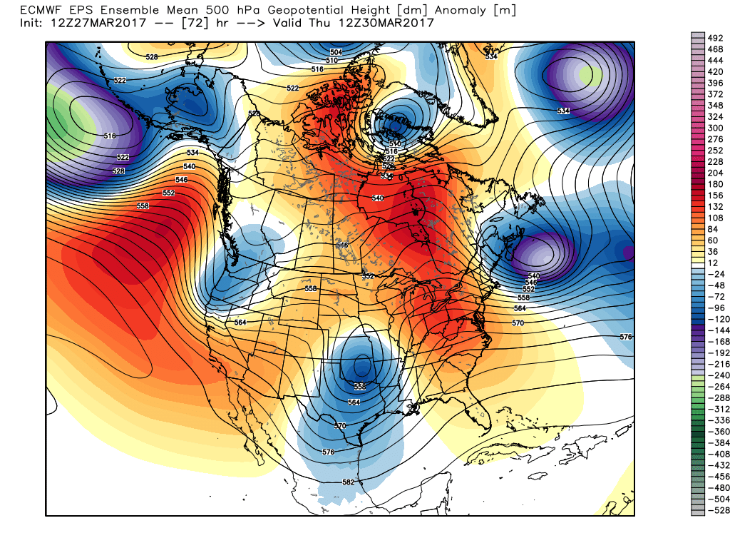
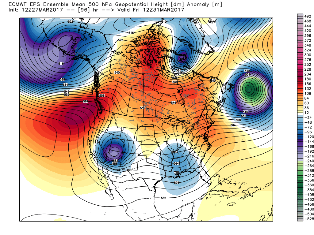 However, timing is our friend this go around as upper ridging develops over the upcoming weekend. Not only will we dry out, but we’ll also enjoy increasing sunshine as the weekend progresses.
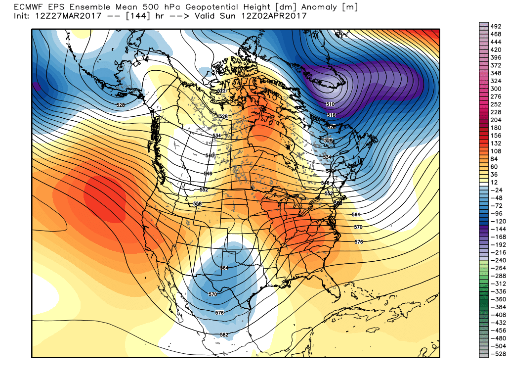 That said, looking further down the pipe line, another (potentially more significant) storm system looms during the 8-10 day period. This would fall in the April 3rd-4th time frame. From this distance, models are bullish on hefty rainfall totals with this storm system and we’ll keep a close eye on things as time draws closer.
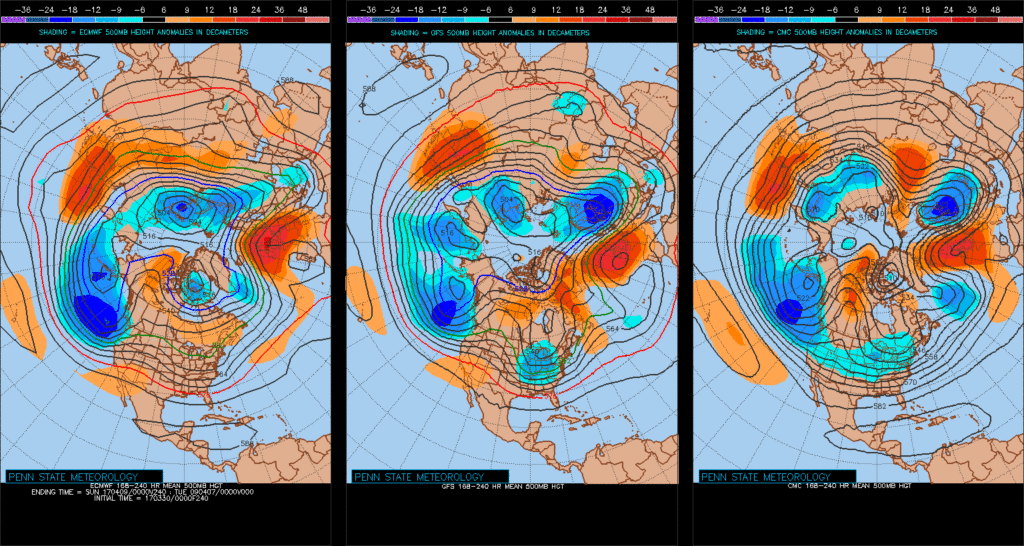
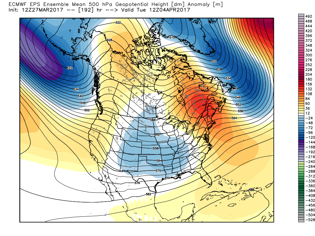 Speaking of April, our overall thoughts for the fourth month of the year (where does time go?) would imply a warmer than average month and active (wetter than average). Relative to average, we feel we still may have some chill to traverse early month, but there’s also some indication we could bust into an early summer-like feel mid and late month. With the mean trough position west and ridging east, we’ll have to also be mindful for the potential of an active severe weather month- especially mid and late month. Overall, the CanSIPS idea below is one we would agree with from a mean 500mb perspective.
 Highlights: