
You must be logged in to view this content. Click Here to become a member of IndyWX.com for full access. Already a member of IndyWx.com All-Access? Log-in here.
Permanent link to this article: https://indywx.com/video-hot-humid-weather-gives-way-to-better-storm-chances/
Jun 11
Model Data Remains Consistent On A More Active Pattern Returning…
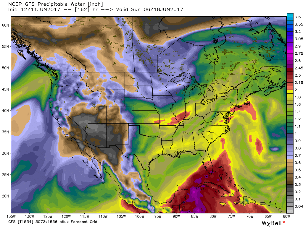
Today’s 12z model suite is in and it remains consistent on a more active weather pattern returning to the delight of many Hoosiers! A blend of the GFS and European 10-day rainfall numbers print out 2″ for Indianapolis. The GFS ensemble ‘mean’ (a blend of 21 individual members) agrees.
 Best overall coverage of showers and thunderstorms should come in (3) waves over the upcoming 10-day period:
- Wednesday into Thursday
- Saturday into Sunday
- Middle parts of the following week
While we don’t see any sort of uniform type rains in the upcoming period, the “smattering” of storms should help most neighborhoods get in on the rainy “goods” at one time or another over the upcoming week and a half. Keep in mind, we’re in mid-June now and it’s mighty difficult to ask for anything much more than scattered storms this time of year on through late-summer…unless a tropical entity gets involved. That’s just the way this time of year is. With that said, localized torrential downpours are a very good bet from time to time, beginning as early as mid-week, as precipitable water values approach, or exceed, 2″ (about as moisture-rich as you can ask the air mass to get around these parts) into the upcoming weekend.
 As I type this outside on the back porch this evening, I hear the sounds of sprinklers in full-force through the ‘hood. Thankfully, Mother Nature will help save on the water bill later this week. Longer-term, you’ll hear us use the word “transient” many times this summer when discussing the overall weather pattern. Thankfully that tends to result in a fairly busy time of things. Before you know it, college football season will be back (83 days until my beloved Auburn Tigers kick-off), those wetter autumn storms will return, and thoughts will begin to shift to winter (they may have already started here :-))- not that we’re trying to rush summer away or anything…
Permanent link to this article: https://indywx.com/model-data-remains-consistent-on-a-more-active-pattern-returning/
Jun 11
Hot And Humid; Storms Chances Return…
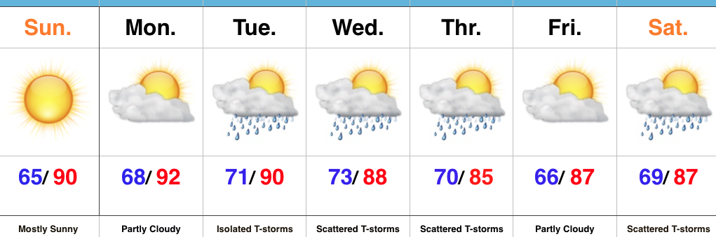 Highlights:
- Dry conditions continue
- Hot and turning humid
- Storm chances return
Tropical Feel Develops…Pleasant air is on borrowed time and we’ll begin to notice an increasingly muggy feel to the air as early as this afternoon. Dew points will reach oppressive levels Monday into Tuesday (70° and above). With the increased moisture, isolated thunderstorms will develop Tuesday, but most should still remain rain-free. Better shower and thunderstorm coverage will be noted Wednesday into Thursday as a frontal system moves through the state. This won’t be a “uniform” rain, but locally heavy downpours can be expected in the stronger storms. As dry as we’ve been, we’ll take what we can get. It’s a start, at the very least, towards a more active second half of June.
We’ll dry things out briefly Friday before another storm system approaches next weekend. Early indications would suggest next weekend’s storm system will provide more widespread shower and thunderstorm activity.
Tropics: Interesting times appear to be looming in the Gulf of Mexico as we push into the last couple weeks of the month. Models continue to paint various scenarios on potential early season tropical development and any one solution can’t be bought just yet. That said, the overall pattern does seem to want to promote some tropical “mischief” in the coming 10 days, or so.
Upcoming 7-Day Precipitation Forecast:
- Snowfall: 0.00″
- Rainfall: 0.75″ – 1.00″
Permanent link to this article: https://indywx.com/hot-and-humid-storms-chances-return/
Jun 10
Developing Hot Pattern Doesn’t Last; Cooler And Wetter Times Loom…
Through the short-term, there are two words that will sum up Indiana’s weather: Dry and Hot. We’re entering a stretch where the overall weather pattern will promote an expanding hot dome in the coming days, and put many communities across the state solidly in position to break the 90° mark on multiple days.

Expanding upper ridge means hot times loom late weekend into early next week.
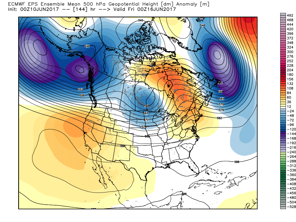
However, this increasingly hot and dry pattern will be a transient one. This morning’s European model shows the evolution to cooler and increasingly wet, unsettled times nicely as we progress into the 6-10 day period.
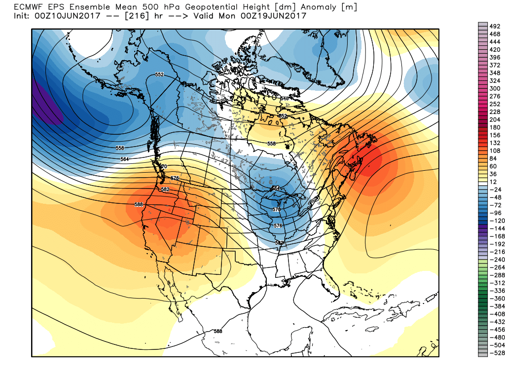
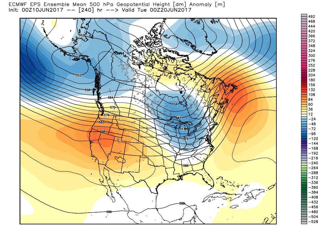
The GFS ensemble would also agree in the overall pattern shift back to cooler and unsettled conditions as early as mid-late next week.
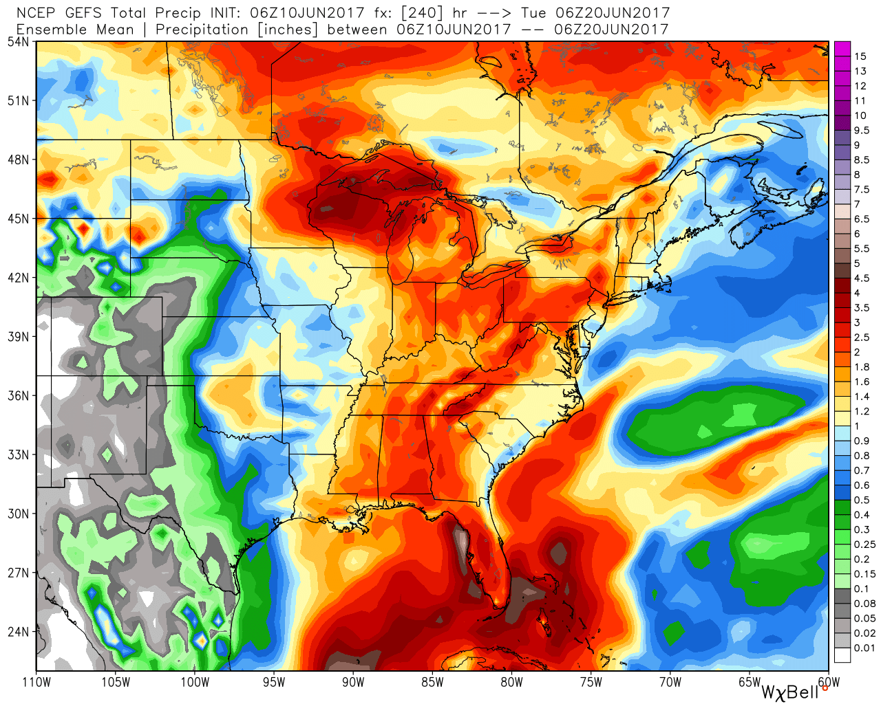
The 10-day GEFS ‘mean’ is a beautiful sight as moisture returns.
Updated 7-day out later this afternoon! Enjoy a beautiful Saturday, friends!
Permanent link to this article: https://indywx.com/developing-hot-pattern-doesnt-last-cooler-and-wetter-times-loom/
Jun 08
VIDEO: Ready to heat things up this weekend?
You must be logged in to view this content. Click Here to become a member of IndyWX.com for full access. Already a member of IndyWx.com All-Access? Log-in here.
Permanent link to this article: https://indywx.com/video-ready-to-heat-things-up-this-weekend/
