
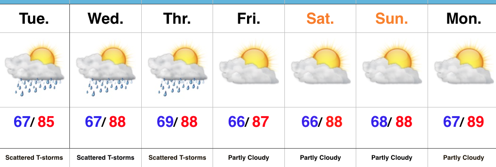
 Highlights:
- Scattered t-storms
- Dry weather returns
- True summer-like feel
Unseasonably Warm Weather Continues…Similar to the past 24 hours, scattered showers and thunderstorms will dot the central Indiana landscape through midweek. As has been the case, there will continue to be “haves and have nots” over the next couple of days. Some neighborhoods will get lucky with localized slow moving downpours while others miss out entirely. All in all, it’s a very summer-like regime- both from a temperature/ humidity standpoint, as well as a precipitation perspective.
As we flip the page and head into the upcoming weekend, dry times will return. A big ole upper level ridge will balloon over the mid west and eastern portion of the country and this will serve to lead to a continuation of summer-like warmth- certainly well above average. It sure won’t feel like fall as we officially welcome in the new season Friday.
Upcoming 7-Day Precipitation Forecast:
- Snowfall: 0.00″
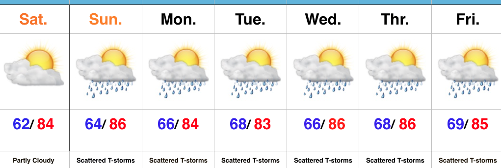
- Rainfall: 0.25″ – 0.50″ (locally heavier totals)
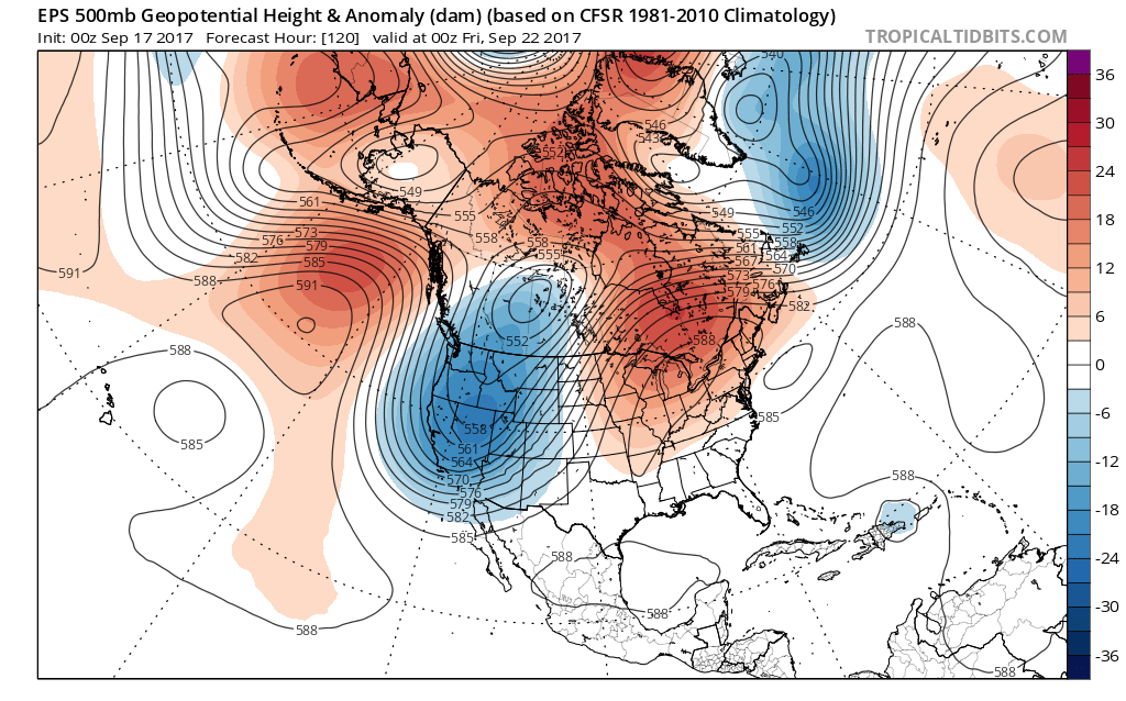
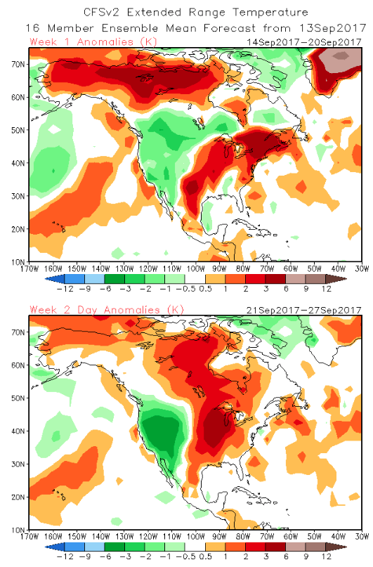
 That will flip around in big time fashion this week as a highly amplified pattern takes hold. The mean trough position will shift into the west and lead to an early taste of winter, including mountain snow. Meanwhile, our region will make up for lost time in the summer department, including highs generally in the mid to upper 80s (around 10° above average).
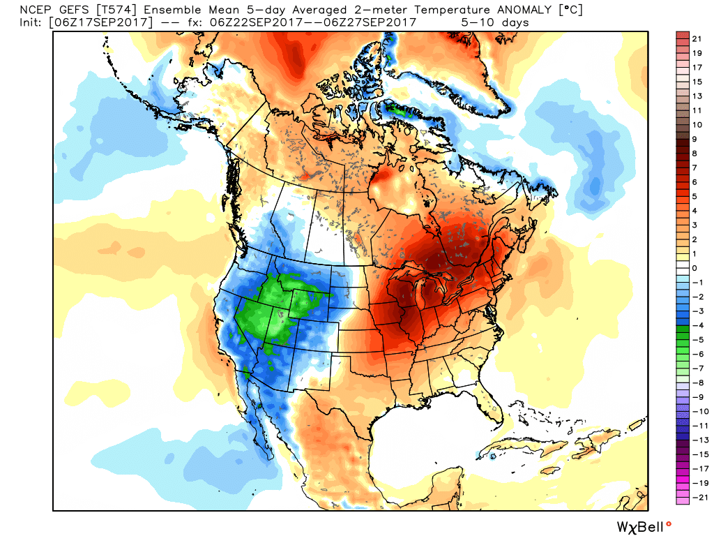
 Daily chances of widely scattered afternoon and evening thunderstorms will be with us beginning today through the majority of the upcoming week. Everyone won’t get wet, but there will be a couple of localized heavy downpours on area radars at times. As dry as we’ve been, we’ll take what we can get.
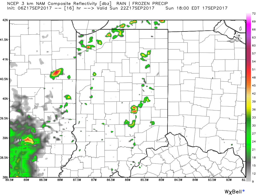 Eventually, the pattern will “relax” (at least briefly) out towards Day 10. This will feature a more seasonable regime returning to the region, along with better chances of more widespread rains as a cold front approaches. We’ll also have to keep a close eye on additional tropical threats to the southeast region…
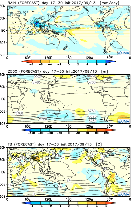
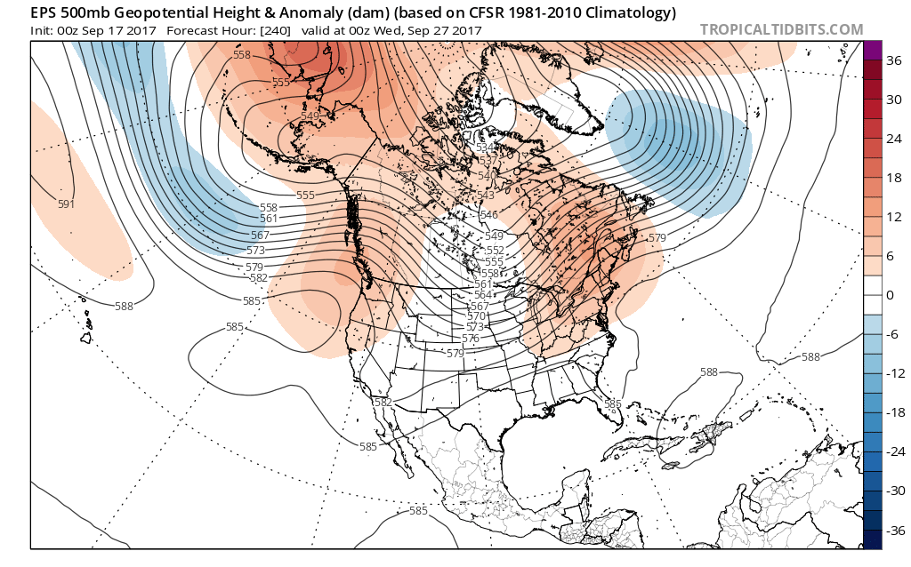
 Highlights:

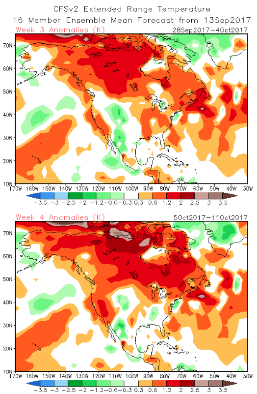
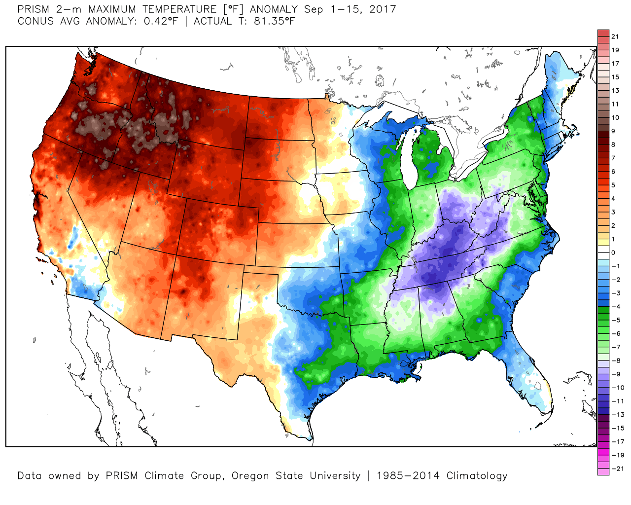
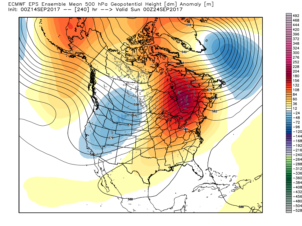 This will deliver temperature anomalies 5° to 10° above average as we traverse the back half of the month, including highs in the mid-to-upper 80s.
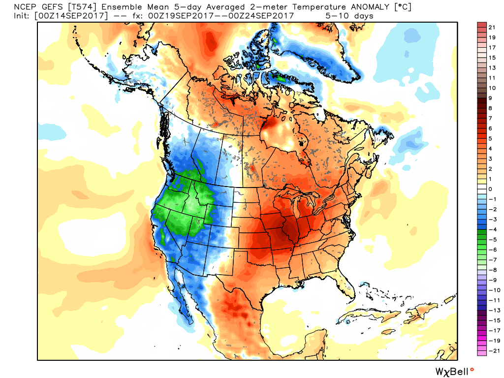 Meanwhile, our friends out west (where it’s been warm, month-to-date) will begin to experience early winter-like conditions, including high elevation snowfall across the central and northern Rockies.