I. Areas of light snow and freezing drizzle will continue into the overnight hours and on into Wednesday morning. Watch for slick spots overnight-Wednesday morning.
II. Clouds will finally begin to erode Wednesday night and set us up for plentiful sunshine Thursday. Along with the increasing sunshine, a southwesterly air flow will develop and assist with providing a new “warming” trend as we close the work week. Mid-40s are ahead Thursday and lower-50s Friday. A “big hair warning” is officially in effect Friday as winds gust between 30-40 MPH Friday. 🙂
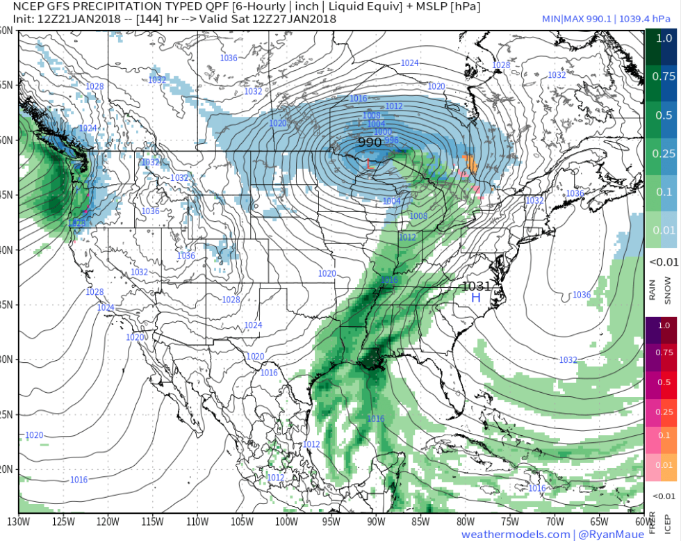
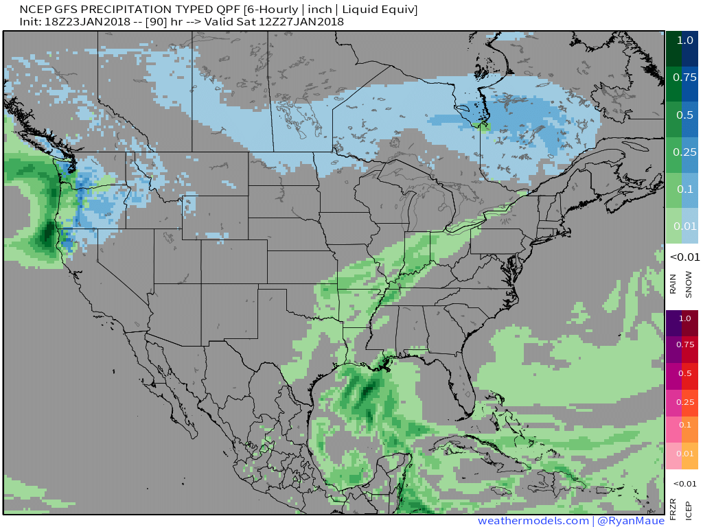
III. Our next storm system arrives on the scene overnight Friday into Saturday with light rain.
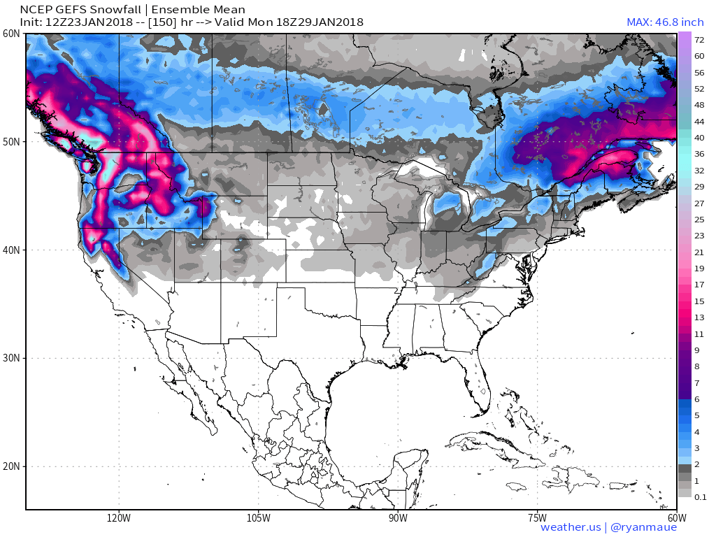
IV. We’re also monitoring the possibility of a “sneaky” snow maker Sunday night into Monday in a fast northwest flow. Light snow will impact portions of the Ohio Valley, but we’ll have to fine tune things over the next few days with respect to specific track and placement of the swath of accumulating snow. Stay tuned!
 I. Another round of showers will pivot through central Indiana later this evening ahead of a cold front. Once the cold front sweeps through the state, temperatures will fall during the overnight and grow cold enough to allow precipitation to transition to wet snow showers Tuesday as upper level energy rotates through the Ohio Valley.
 II. High pressure will settle overhead through midweek and while we’ll “chill” to near seasonal levels Wednesday, the rebound will begin Thursday and we’ll climb into the 50s for highs Friday, complete with an increasingly gusty southwest breeze.
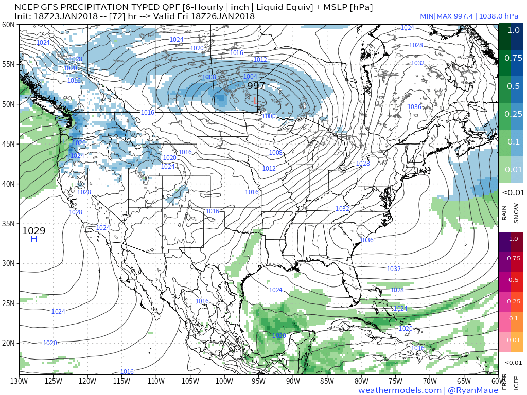
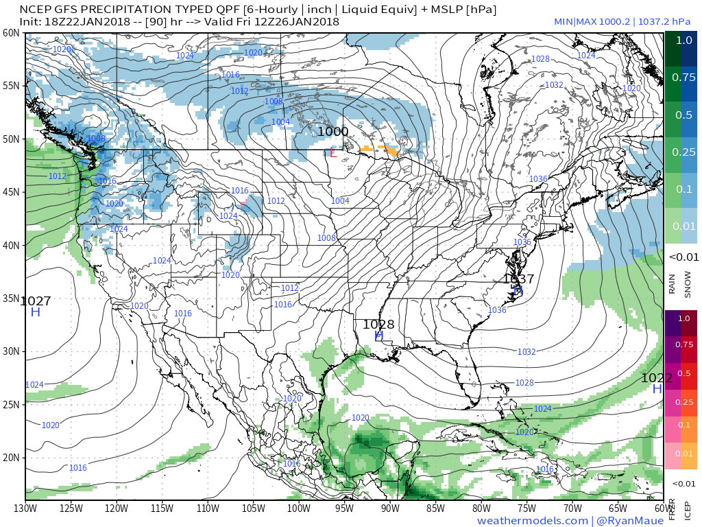 III. Our next storm system will approach late Friday night into Saturday with rain and gusty winds. Models differ on rainfall amounts and we’ll split the difference for now (in general we forecast between 0.25″ to 0.50″, but we’ll keep a close eye on data over the next few days).
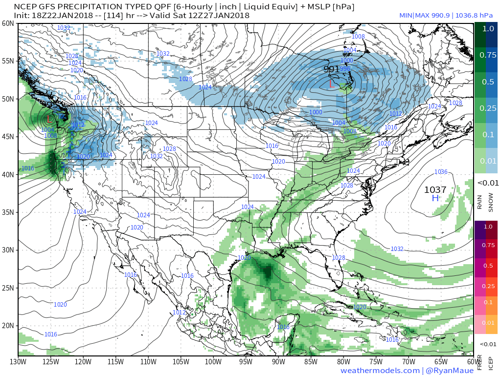 IV. We’ll turn cooler for the second half of the weekend, but the overall pattern is a transient one into next week and overall milder than average. That said, things will begin to change in big time fashion as we rumble into February. Winter is a long ways from being over…
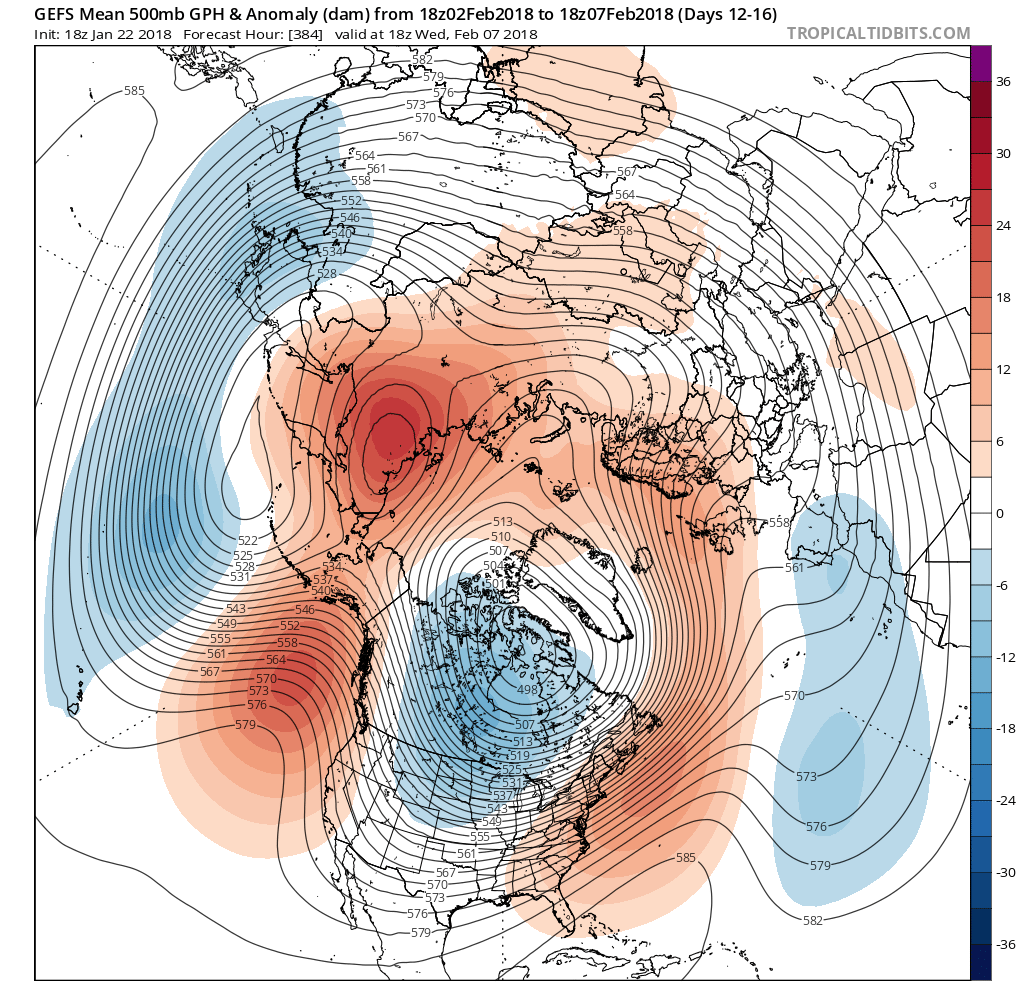
 Areas of fog and drizzle will continue this evening before a stronger southwesterly air flow pushes the low clouds and fog north during the overnight. As a cold front draws closer, steadier rains and perhaps even a clap of thunder (especially down state) will arrive Monday morning. Temperatures will remain nearly steady or even rise overnight into the lower 50s.
 The frontal passage, itself, will take place Monday evening and may feature a couple of gusty showers, especially across western and central portions of the state.
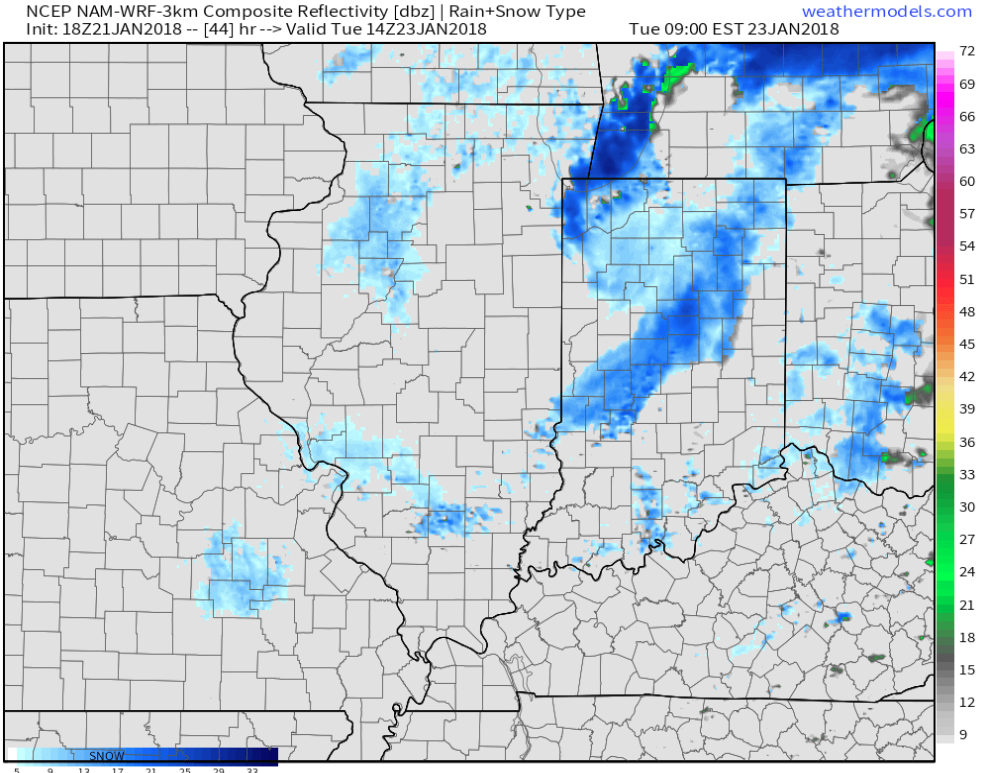
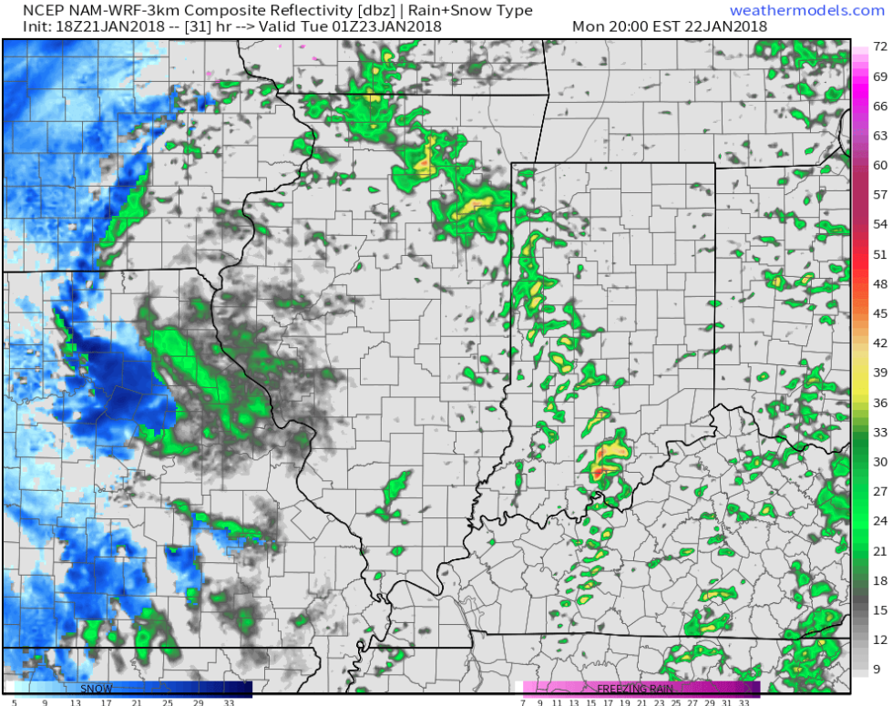 Temperatures will grow colder Monday night into Tuesday morning and precipitation will end as snow showers Tuesday.
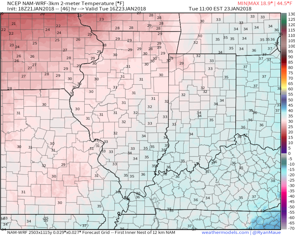
 High pressure will build in through midweek and provide dry conditions with increasing sunshine. The midweek stretch will begin seasonable before warming ahead of our next storm system.
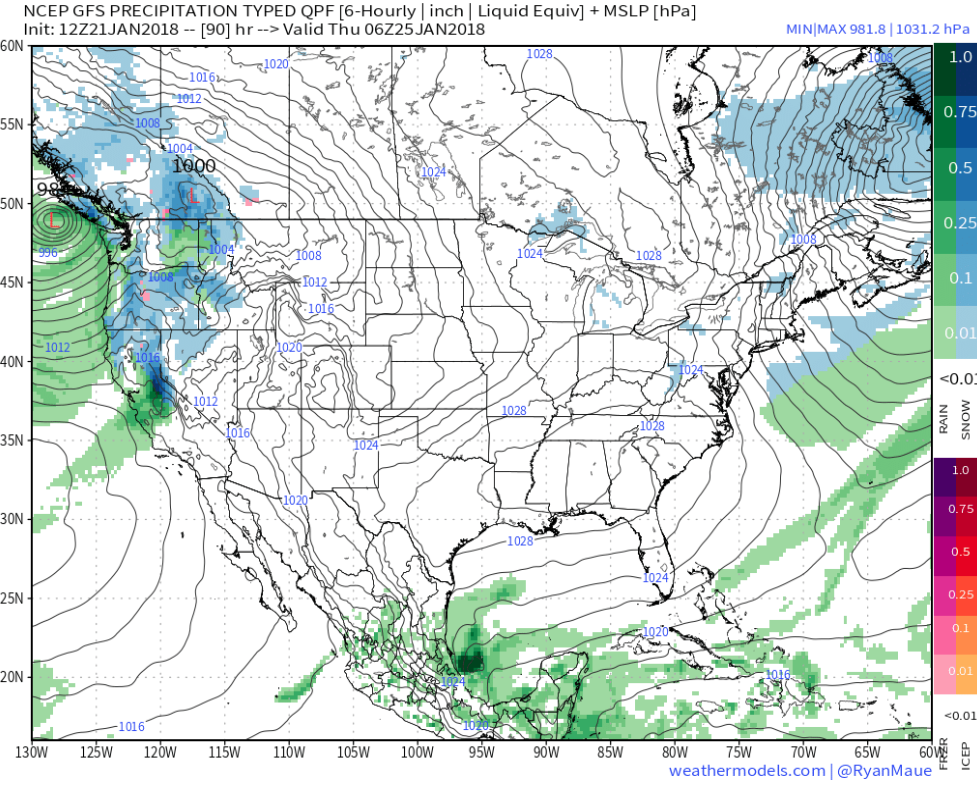 That next storm system will deliver rain as early as Friday evening into Saturday. We’ll note an increasingly gusty southwesterly breeze as we wrap up the work week, along with increasing cloudiness.