
You must be logged in to view this content. Click Here to become a member of IndyWX.com for full access. Already a member of IndyWx.com All-Access? Log-in here.
Permanent link to this article: https://indywx.com/video-snowy-for-some-late-march-talk/
Mar 06
Weekend Mischief…
The block continues to do it’s dirty work. An active pattern will continue for the foreseeable future and models will struggle handling the all-important specifics until a couple days before the event(s)- if not the day of.
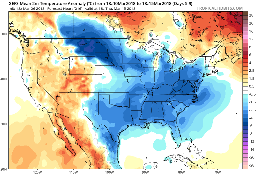
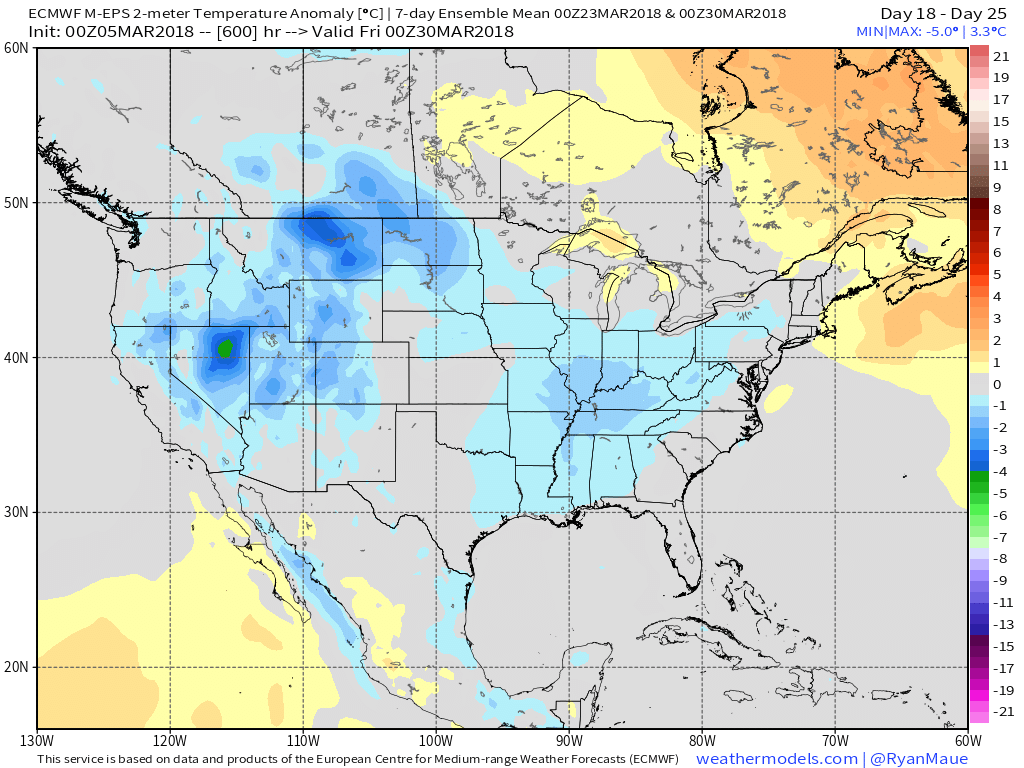
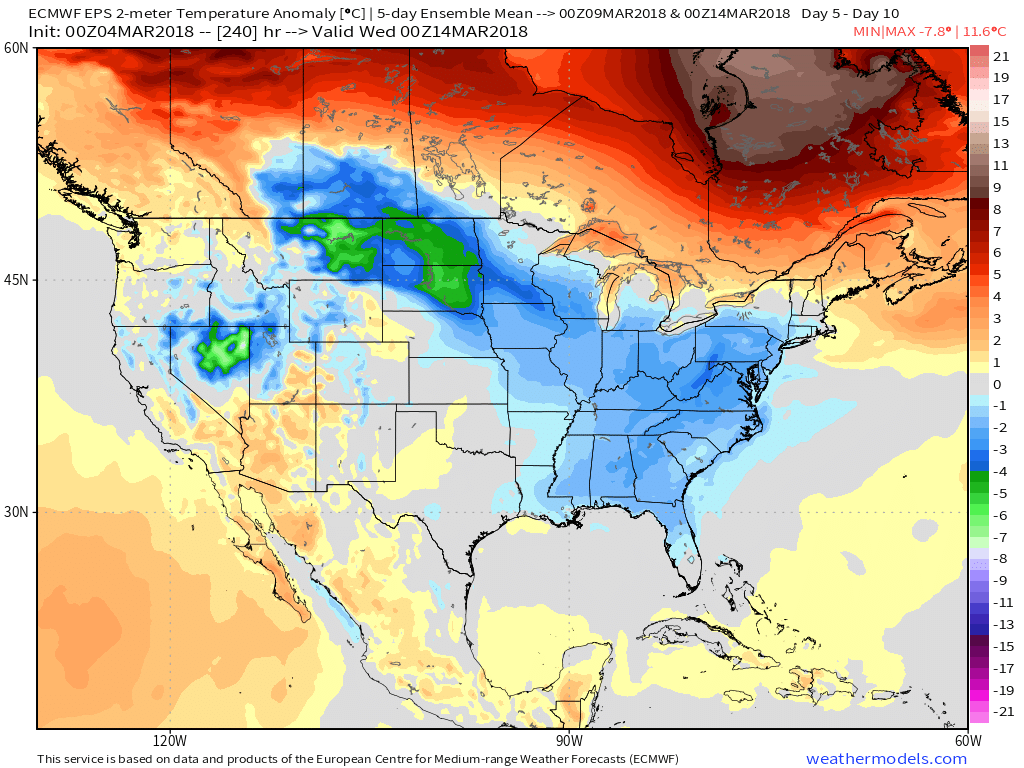
 The first few days of March have gotten off to a warmer than average start, but the coming 5-10 days will run colder than average across a large portion of our region.
 Perhaps of more importance, and a greater focus, locally, is the potential one of these storms will slow down and intensify into something more significant than a 12-24 hour period of snow showers and squalls. The first contender arrives over the upcoming weekend, but with this being 4-5 days out, confidence remains low.
We note the latest GFS continues to “string out” the energy. The end result would be the potential of some mixed rain and snow showers late weekend into early in the work week, but nothing much more than that.
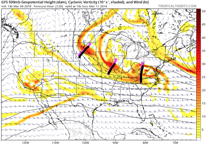 However, it’s important to understand model biases from this distance. So often, the GFS can rush things along in the medium range, only to later correct as time draws closer. If things slow, the associated energy will merge and result in the possibility of a significant, if not major, late-winter storm for portions of the Ohio Valley. As it is, a few of the GEFS ensemble members show this potential.
 Unfortunately, there’s no way to be more specific from this distance. It’s easy to see both arguments (for and against a more significant storm) from this point, but with high latitude blocking in place (an ingredient missing most of the time from this winter, and several of the past few winters), we most certainly need to keep close tabs on subsequent model runs. Long-time Hoosiers remember when storms of significance actually did, indeed, impact the area. 🙂
It won’t take much in this pattern for things to slow down enough for a non event to become a big event…
Permanent link to this article: https://indywx.com/weekend-mischief/
Mar 06
Tuesday Morning Rambles: Snow Arrives Tonight; Tricky Weekend…
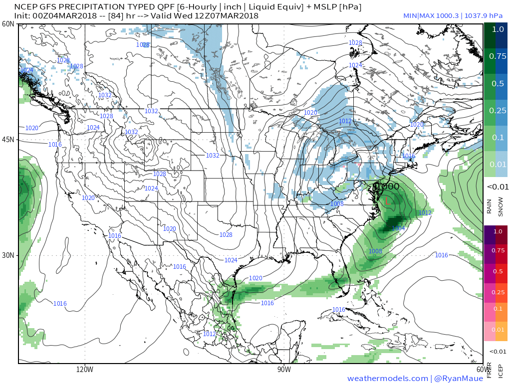
I. Upper level energy will pinwheel across the region tonight into Wednesday and result in helping rain showers (this afternoon and evening) transition to snow showers (tonight and Wednesday).
A couple of heavier snow squalls could result in a quick coating to less than 1″ of snow for some areas overnight into Wednesday.

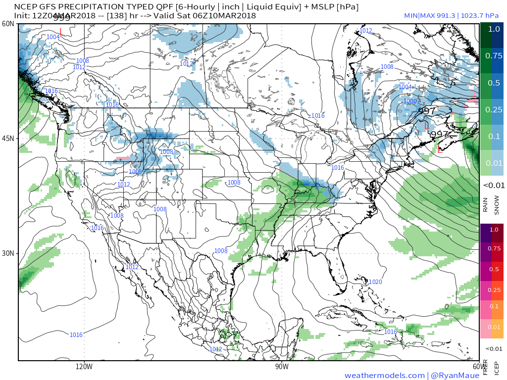
 II. The next item we continue to monitor has to do with an initial piece of energy that will scoot across the Ohio Valley Friday. This is ahead of a more significant storm that will likely develop over the weekend and models continue to fluctuate on how they handle things. For now, we’ll maintain a rain/ snow mix Friday, but simply can’t get more specific than that. There are ways this could deposit a stripe of accumulating wet snow for some of the region, but it’s premature to try and nail down where this may occur.
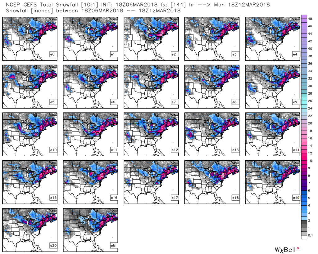
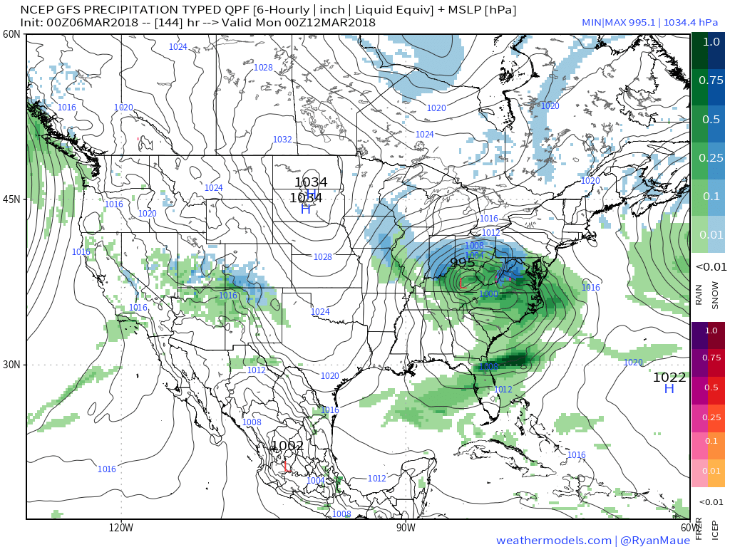
 III. We also have to continue to keep a close eye on what transpires Sunday. We favor one surface low tracking along the Ohio River into the Appalachians before a secondary low takes over along the Mid Atlantic coastline Monday. Again, a swath of wet snow north of the low’s track Sunday into early Monday.
 IV. While we should see warmth eject out of the southern Plains in the Week 2 time frame, the large majority of data says this will only be temporary and that cooler than normal temperatures will persist through the balance of the upcoming several weeks. With late season high latitude blocking in place it’s hard to disagree with that idea. Once blocking sets up (especially late in the season), it can be like “pulling teeth” to get any sort of sustained warmth. Just an idea here.

Courtesy of weathermodels.com

Courtesy of weathermodels.com
Courtesy of weathermodels.com

Courtesy of weathermodels.com
Permanent link to this article: https://indywx.com/tuesday-morning-rambles-snow-arrives-tonight-tricky-weekend/
Mar 05
VIDEO: Active Week Of Weather Ahead…
You must be logged in to view this content. Click Here to become a member of IndyWX.com for full access. Already a member of IndyWx.com All-Access? Log-in here.
Permanent link to this article: https://indywx.com/video-active-week-of-weather-ahead/
Mar 04
Never Over ‘Till It’s Over…
The period outlined is March 6th through March 20th. As the block continues to mature, we think this timeframe will produce at least one (if not a couple) opportunities for “meaningful” accumulating wintry precipitation across the Ohio Valley and features below normal temperatures.

 Model data continues to show this idea has merit and now we’ll have to handle the individual storms as they come. As we’d expect late in the winter, challenges abound, but this is a pattern that has potential. Can we turn potential into reality? That’s the question that will be answered over the next couple weeks.
During the upcoming week, snow showers will fly Wednesday, but this doesn’t appear to be a big deal. With vigorous upper level energy tracking across the region, it should be sufficient enough to generate scattered snow showers and potentially a couple more intense squalls (especially across eastern portions of the state) Wednesday.
 The next item on the agenda will arrive Friday afternoon into Friday night. It, too, should spread snow across a portion of the Ohio Valley. With this being in the Day 6 time period, expect fine tuning as we move through the upcoming week.
 Finally, a third system will impact the area about this time next week, and it’s this system that appears to be the most significant of the group. Far too early to get detailed, but it certainly warrants our attention.
 The overall pattern we’ll “enjoy” over the next couple of weeks is one that’s been lacking for the better part of the past few winters. With blocking in place, storm systems trying to lift into the Great Lakes will be “forced” south and result in an active time of things around these parts- including the east coast, as well, over the better part of the upcoming 10-15 days.
Understanding that storms this time of year have to get several things to “line up” just right to result in an impactful event, it’s far too early to signal winter’s over…
Permanent link to this article: https://indywx.com/never-over-till-its-over/
