
As part of some exciting and significant enhancements that we’re looking forward to announcing later this fall, we’re going to be including more content that’s typically only been going out to private clients. Some of that content includes our ‘medium range notes’ that go out each evening, included in the sample below.
As we look at the medium range period, or the 6-10 day time frame, the pattern flip to a cooler and more active regime is clear. Both the respective GFS and European ensemble members (below) see the significant changes that will be with us as we put a wrap on July and look ahead to welcoming August. Note the upper ridge retrograding west.

Image source: Tropicaltidbits.com
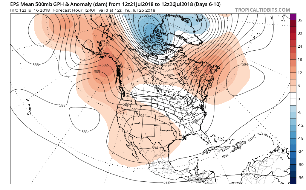
Image source: Tropicaltidbits.com
Not only will this help drive a significantly cooler pattern, but a wetter one to boot. We note data reflecting wetter than average times returning for the upper Mid West, Great Lakes, and Ohio Valley during the upcoming 6-10 day period. It appears as if much-needed moisture will be returning to central Indiana.

Image source: Tropicaltidbits.com
Also note the dramatic flip to cooler times.
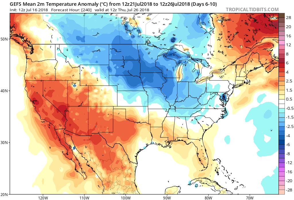
Image source: Tropicaltidbits.com
Storms Of Significance:
Of note during the period, we’re targeting a storm system that will likely deliver unsettled weather to central Indiana over the upcoming weekend, continuing into the Days 6-7 time period. This is followed by another storm system that will deliver unsettled conditions Days 9-10, including reinforcing cooler than average temperatures.
As always, IndyWx.com features daily blog and video updates that include details around the short-term period.
Forecaster: BM
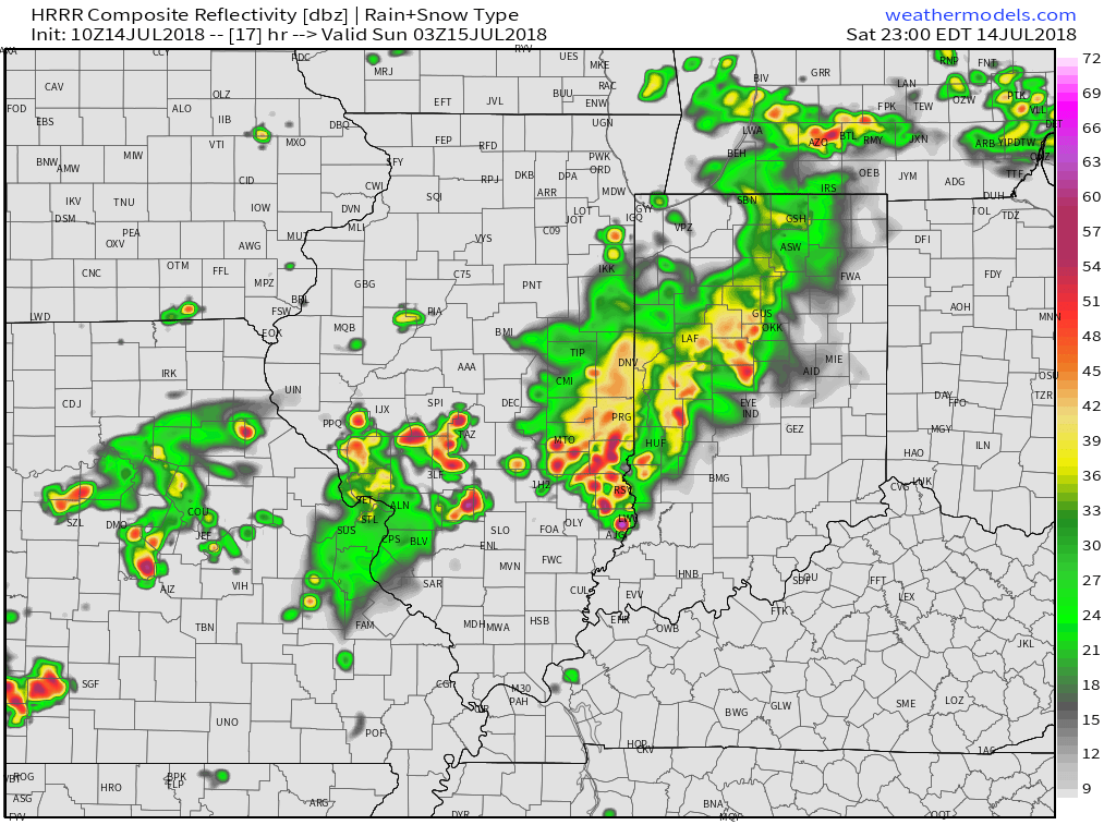
 We’ll notice thunderstorms becoming more numerous for our friends in Illinois through the afternoon and evening, but central Indiana should remain mostly dry until tonight. Forecast radar products want to bring these storms into the state after the 7p to 8p time frame. We’ll keep close tabs on radar trends this afternoon.
 (Again, with high moisture content, any thunderstorm that passes through your neighborhood will be capable of producing torrential rainfall). For that matter, the same story can be said with storms that develop Sunday and Monday, as precipitable water values will remain around 2″ until the front sweeps through the state.
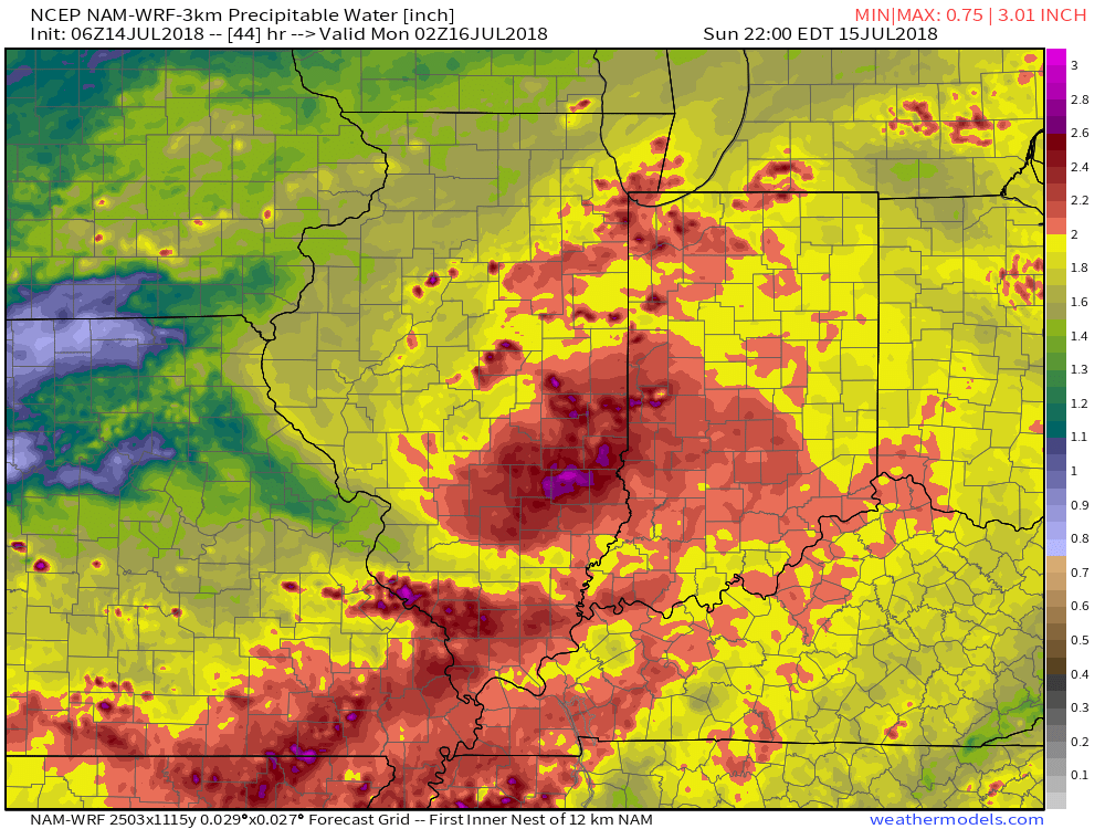
 Overall, dry conditions should prevail until late next weekend when a secondary, even stronger, front will make a run at the region. We’ll ramp storm chances back up ahead of this expected front and the air mass behind the boundary in the Week 2 time period will be even cooler than we we’ll enjoy the middle part of the upcoming week.
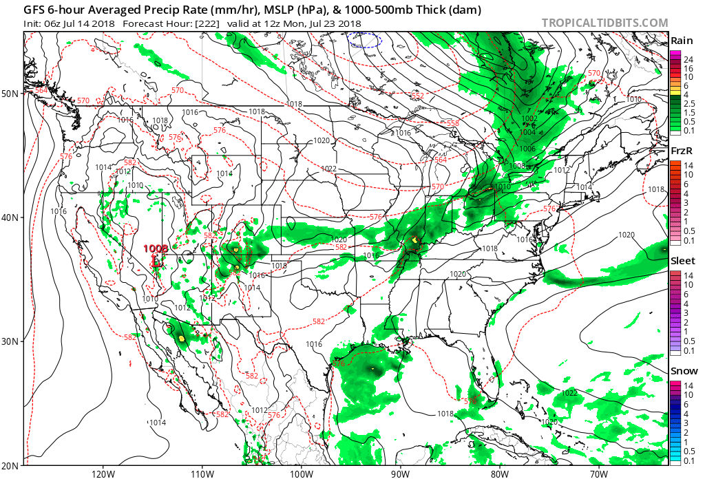 Speaking of cool, the pattern continues to look vastly different as we put a wrap on the month than what we’ve grown accustomed to over the past couple of weeks. Note the dominant trough the models show setting up shop over the Mid West…
