Updated 07.13.21 @ 7:15a
You must be logged in to view this content. Click Here to become a member of IndyWX.com for full access. Already a member of IndyWx.com All-Access? Log-in here.

Jul 13
Updated 07.13.21 @ 7:15a
You must be logged in to view this content. Click Here to become a member of IndyWX.com for full access. Already a member of IndyWx.com All-Access? Log-in here.
Permanent link to this article: https://indywx.com/video-one-more-stormy-afternoon-before-a-drier-stretch-of-weather-for-midweek-early-look-at-the-august-pattern/
Jul 12
Updated 07.12.21 @ 7:20a
You must be logged in to view this content. Click Here to become a member of IndyWX.com for full access. Already a member of IndyWx.com All-Access? Log-in here.
Permanent link to this article: https://indywx.com/video-storms-with-locally-heavy-rain-fire-back-up-pattern-drivers-over-the-next-couple-weeks/
Jul 11
Updated 07.11.21 @ 8:18a

Forecast Period: 07.11.21 through 07.18.21
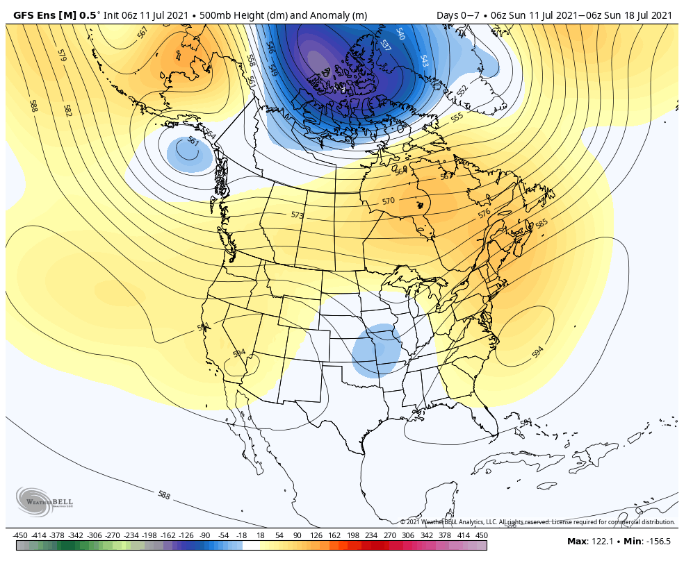
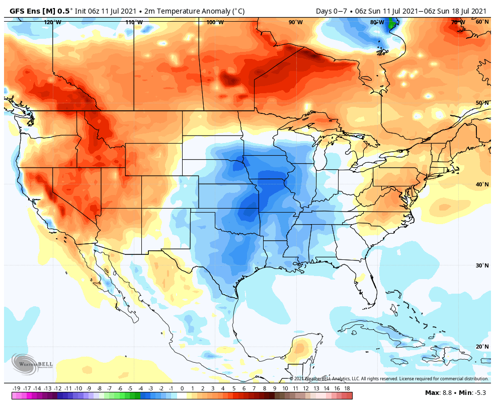
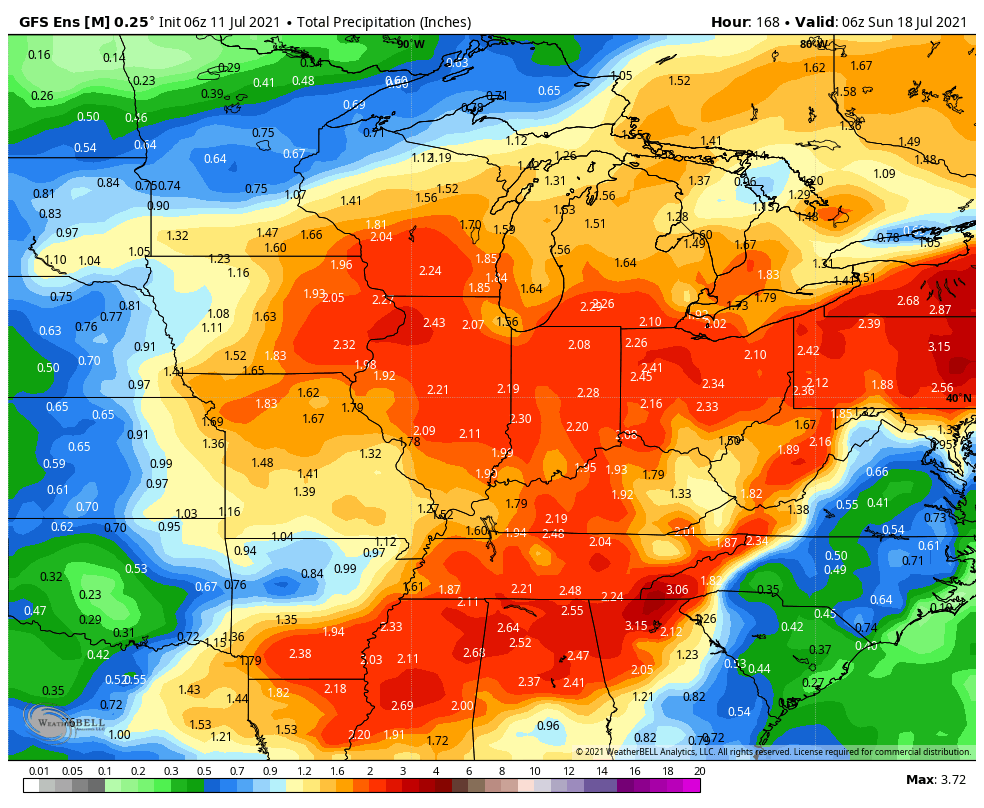
A persistent and rather stagnant upper pattern will remain in place through the upcoming 7-day forecast period. A cut off upper low that will be responsible for our unsettled conditions to open the work week will lose it’s influence on our weather as it gets absorbed in the westerlies by midweek. This will result in coverage of showers/ storms going from “numerous” (now through Tuesday) to “isolated” Wednesday and Thursday. Don’t get used to the drier trend though as a new trough will settle into the Plains during the 2nd half of the week, increasing coverage of showers and thunderstorms yet again Friday through next weekend. With such a rich, tropical airmass in place, the threat of localized flash flooding will remain high.
Permanent link to this article: https://indywx.com/weekly-agwx-and-severe-weather-outlook-38/
Jul 10
Updated 07.10.21 @ 6p
You must be logged in to view this content. Click Here to become a member of IndyWX.com for full access. Already a member of IndyWx.com All-Access? Log-in here.
Permanent link to this article: https://indywx.com/video-unsettled-weather-remains-locked-in/
Jul 10
Updated 07.10.21 @ 6:44a I’m on the road back to home base this morning. Just a quick heads up our video package won’t be posted until early afternoon. Talk soon,…
You must be logged in to view this content. Click Here to become a member of IndyWX.com for full access. Already a member of IndyWx.com All-Access? Log-in here.
Permanent link to this article: https://indywx.com/saturday-morning/
