Changeable Weather; Late Week Ice Threat…
 Highlights:
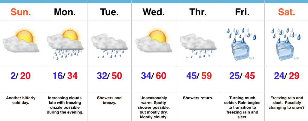
- Another bitter day
- Moderating temperatures ahead
- Late week ice threat looms
Bitter Cold Gives Way To Moderating Temperatures…The first half of the forecast period is easy, but we caution big time headaches loom and details are far from etched in stone once to the second half of this forecast period.
First thing’s first and that’s today. Look for a continuation of bitterly cold air, but slow moderation will be noted this afternoon: Not AS bitter and lighter winds. We may even crack the 20 degree mark! I know, break out the swim suits, right?! This moderating trend is setting the tone for a more significant jump in the mercury later in the week. Before a “taste of spring” arrives, we’ll have to deal with a brief opportunity for freezing drizzle Monday evening. Temperatures will zoom to around 50 Tuesday and around 60 for mid week. Showers will be with us off and on- focused on Tuesday and Thursday for most widespread coverage.
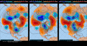
Then comes the “fun.” A strong, sprawling arctic high will push south into the northern Plains Friday. At the same time, “resistance” from the southeast ridge (that can be thanked for the spring-like feel here Wednesday and Thursday) will result in the arctic front only slowly being able to push south. Ripples of energy, or waves of low pressure, will move along the arctic boundary and result in periods of widespread precipitation Friday into the weekend. As the cold, dense arctic air oozes south, we have concern for icing- freezing rain and sleet Friday into Saturday. Depending on how things evolve, this may continue into Sunday, as well. If you have travel plans this weekend, please keep a close eye on the developments in the forecast from Friday on. Stay tuned.
Upcoming 7-Day Precipitation Forecast:
Snowfall: 1.00″
Rainfall: 1.50″ – 2.00″
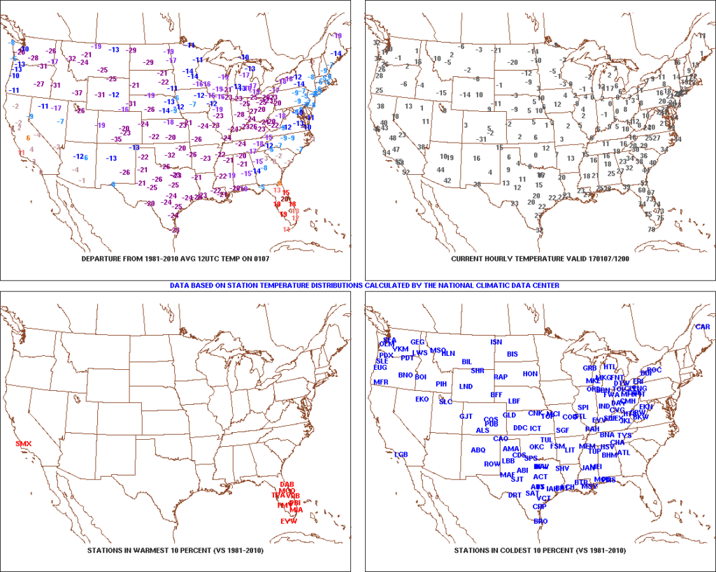 2.) Expanding Snowpack: 65.4% of the country is covered in snow this morning. The cold, arctic high suppressed the winter storm threat south as we alluded to in previous posts. Places across the Deep South that aren’t used to wintry precipitation are waking up to snowy and icy conditions this morning, including MS, AL, GA, SC, and into the Mid Atlantic. Heavier snowfall accumulated across east TN, including 5″-8″ in the high country. Heavy snow also fell through western and central NC and Blizzard Warnings are up in rare areas including VA Beach this morning.
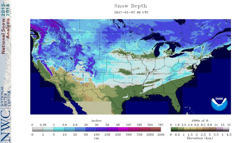 3.) Moderating Temperatures: Our air flow will back around to the southwest and this will help temperatures begin to moderate early next week (around freezing Monday and all the way to around 50 Tuesday). As the moderating trend gets underway, we may have to deal with a brief period of freezing drizzle/ freezing rain Monday evening.
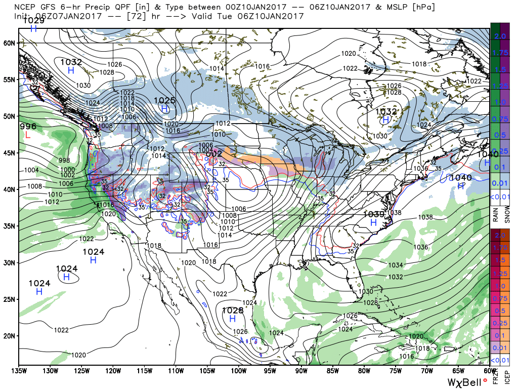 4.) Rainy Midweek: A more significant surge of moisture will arrive midweek and result in periods of moderate to heavy rain Wednesday PM into Thursday. Potential is present for 1″+ during this timeframe.
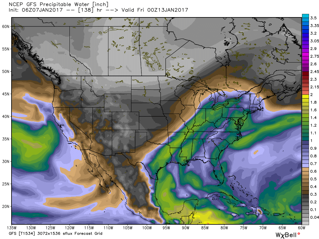 5.) Weekend Wintry “Fun And Games?” A tremendous battle will take place next weekend between a strong and sprawling arctic high pressure system and the southeast ridge. In between it’ll be fascinating to watch things unfold, and as you’d imagine, that includes Indiana. Despite the southeast ridge flexing it’s muscle, the concern here is that the shallow dense arctic air will “ooze” south and present an icy set-up for portions of the Ohio Valley and Mid West for the weekend. We still have some time to watch this, but the potential of significant icing is very much present for some and this will require a close eye through the week.
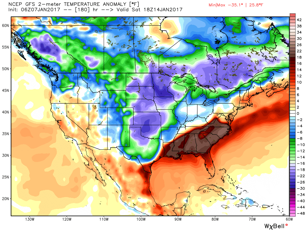
 This is, of course, is in stark contrast to December 2015.
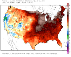 As we move forward, an active pattern awaits between now and the end of the year. This comes after a few days to catch our breath, including moderating temperatures leading up to Christmas.
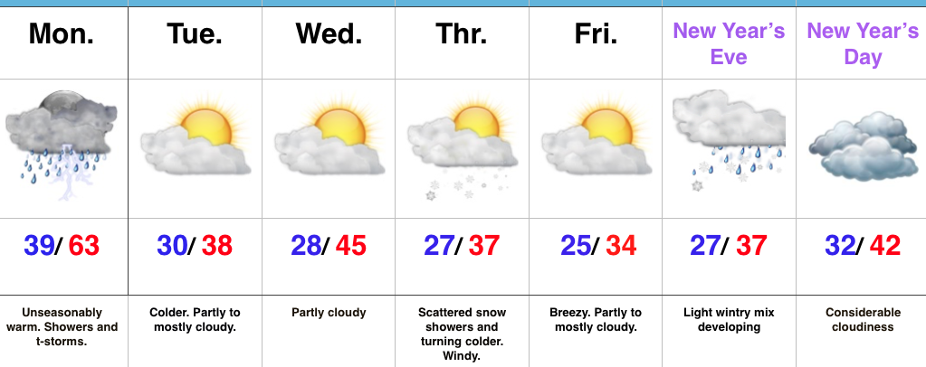
 Christmas Eve will feature overcast skies with areas of fog and drizzle, but the majority of the concentrated rain should fall south of the region. Santa’s ride into central IN should be uneventful, weather-wise.
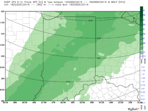 Temperatures will fall through the day Monday and we should run much closer to seasonable temperatures next week. A couple of additional storm systems will have to be monitored for rain and snow prospects the middle of next week and again around New Year’s Eve/ Day. Initially, we’ll be rather mild, but there may be more in the way of cold air readily available to make the storm system around New Years “more interesting” from a wintry perspective.