 Highlights:
- Much colder than average
- Snow prospects to open the week
- Busy pattern continues
Locked In A Cold Pattern…The stretch of spring-like, unseasonably warm, conditions we enjoyed through most of February and to open March will be all but a distant memory once to this time next week. A major reversal to a colder than normal pattern is now with us and will feature lows into the teens on a few nights over the upcoming week.
Additionally, we continue to highlight the fast-moving northwest flow aloft. This kind of regime wrecks havoc on forecast models and, accordingly, we have lower than normal confidence in the specifics late in the work week. Stay tuned.
Before we get to late week, we have a disturbance (that will eventually help feed a blockbuster Nor Easter) that will deliver snow as we open up the work week. This time of year, snow intensity and time of day mean a world of difference between an accumulating event, or not. Snow should overspread central Indiana before sunrise Monday and will likely accumulate before the higher sun angle takes over and lighter snowfall rates result in a lack of daytime accumulation. As reinforcing cold air filters in Monday night, additional light accumulation will be possible in scattered heavier snow showers that will continue into Tuesday. All-in-all, this doesn’t appear to be a huge event, but a few slick spots will be possible Monday morning before that higher March sun angle gets to work. We’ll keep a close eye on things.
Moving forward, we’re confident on the overall colder than normal pattern that will continue into Saint Patrick’s Day, but, as mentioned above, fine tuning will be required with the potential of a late week storm system to contend with.
Upcoming 7-Day Precipitation Forecast:
- Snowfall: 1″ – 3″
- Rainfall: 0.25″ – 0.50″
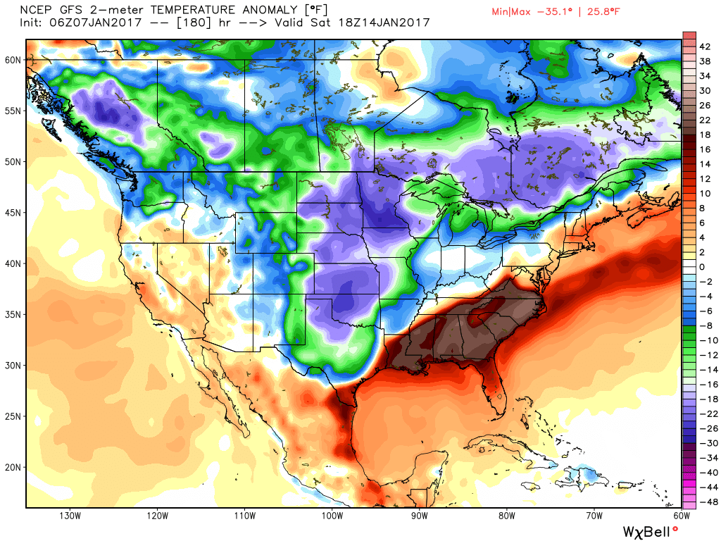
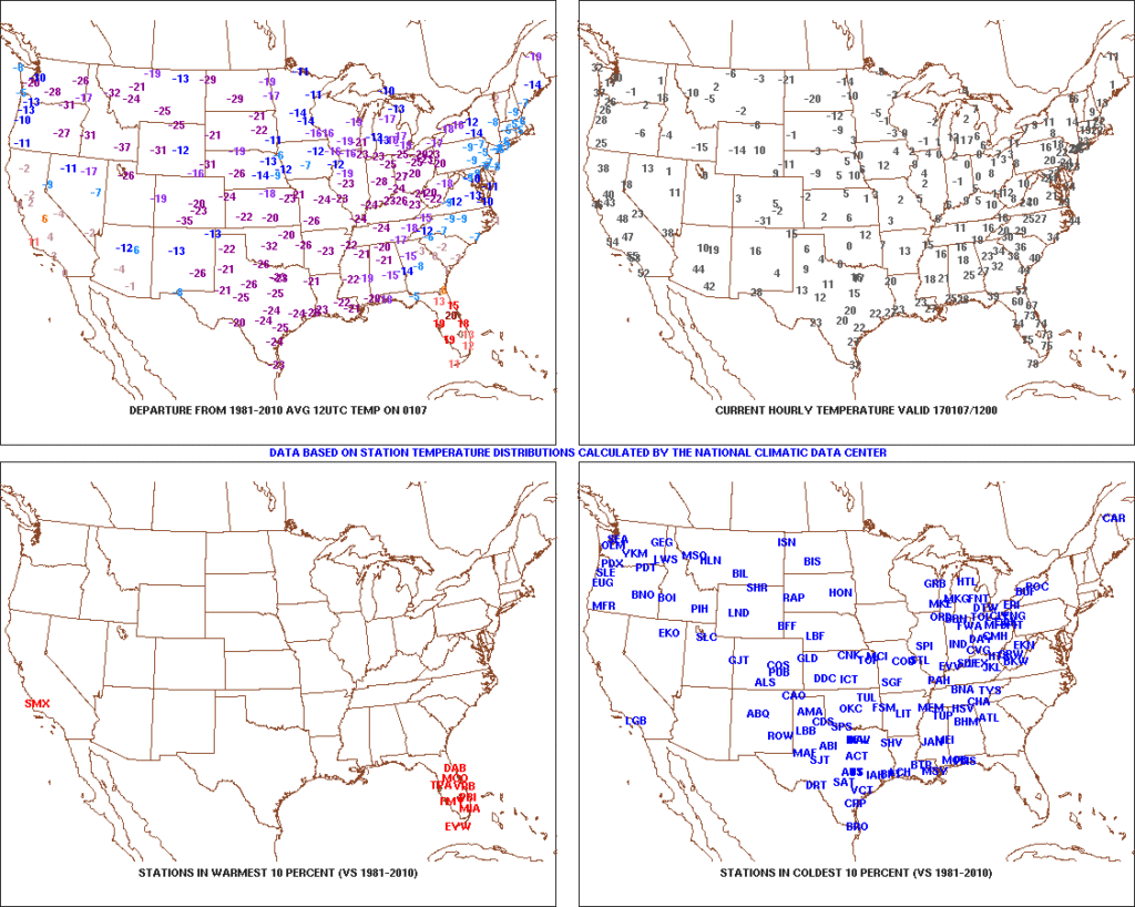 2.) Expanding Snowpack: 65.4% of the country is covered in snow this morning. The cold, arctic high suppressed the winter storm threat south as we alluded to in previous posts. Places across the Deep South that aren’t used to wintry precipitation are waking up to snowy and icy conditions this morning, including MS, AL, GA, SC, and into the Mid Atlantic. Heavier snowfall accumulated across east TN, including 5″-8″ in the high country. Heavy snow also fell through western and central NC and Blizzard Warnings are up in rare areas including VA Beach this morning.
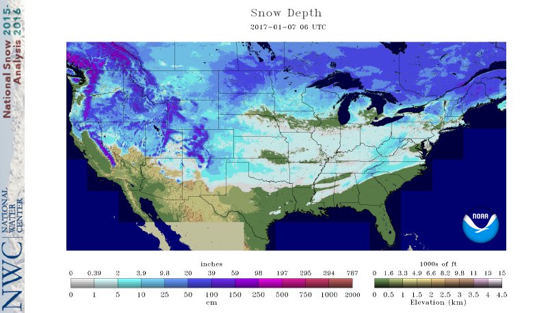 3.) Moderating Temperatures: Our air flow will back around to the southwest and this will help temperatures begin to moderate early next week (around freezing Monday and all the way to around 50 Tuesday). As the moderating trend gets underway, we may have to deal with a brief period of freezing drizzle/ freezing rain Monday evening.
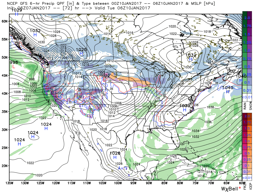 4.) Rainy Midweek: A more significant surge of moisture will arrive midweek and result in periods of moderate to heavy rain Wednesday PM into Thursday. Potential is present for 1″+ during this timeframe.
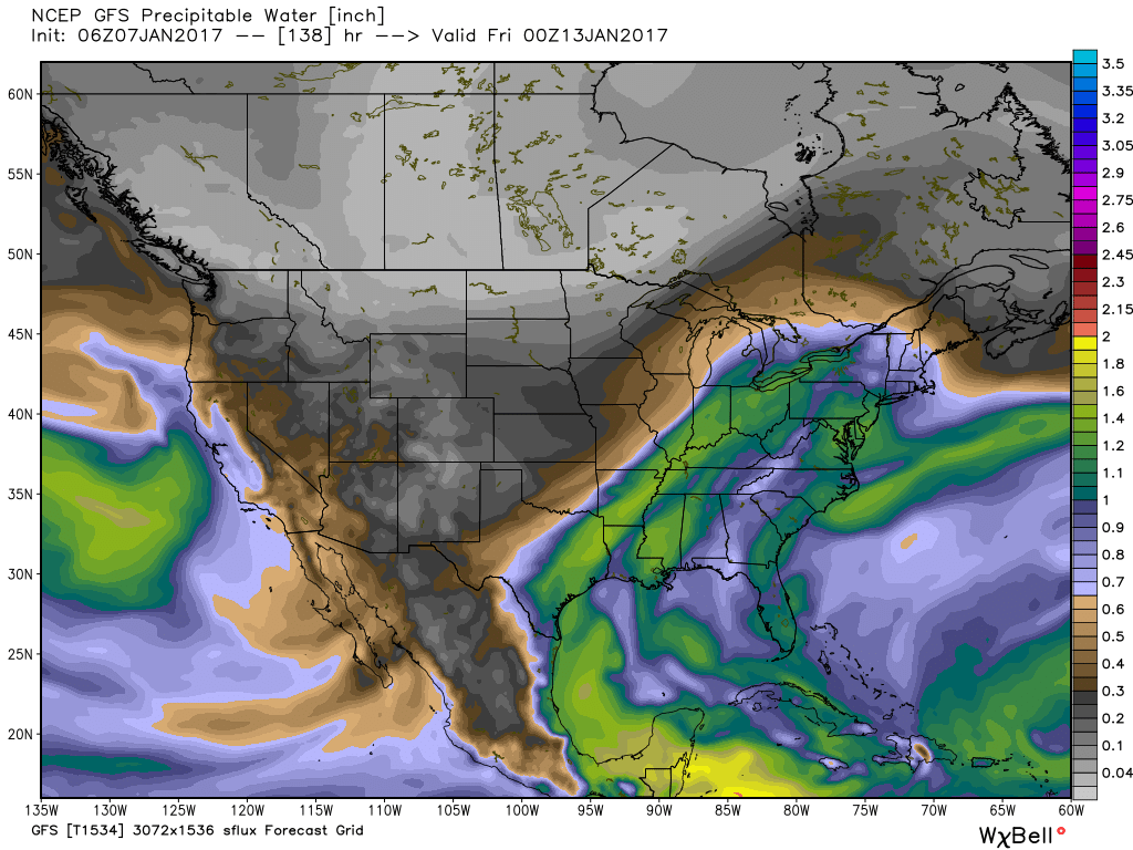 5.) Weekend Wintry “Fun And Games?” A tremendous battle will take place next weekend between a strong and sprawling arctic high pressure system and the southeast ridge. In between it’ll be fascinating to watch things unfold, and as you’d imagine, that includes Indiana. Despite the southeast ridge flexing it’s muscle, the concern here is that the shallow dense arctic air will “ooze” south and present an icy set-up for portions of the Ohio Valley and Mid West for the weekend. We still have some time to watch this, but the potential of significant icing is very much present for some and this will require a close eye through the week.