01.26.21 Weather Bulletin: Shot Of Southern Light Snow; Bigger Weekend Event?
Updated 01.26.21 @ 8:09a

Socked In…Low clouds and areas of drizzle will remain with us for the better part of the day. As colder air filters back in this evening, a few flurries may mix with the drizzle as the moisture departs.

Our attention will then shift to upper level energy that will race east Wednesday and Wednesday night. This feature will skirt the southern portion of the state and squeeze out some light snow Wednesday afternoon and early evening. “Light” is the key word, but places from Vincennes over to Madison and points south could accumulate around an inch of snow. A dusting to half an inch may make it as far north as Bloomington and surrounding areas, but the lack of moisture, combined with forward momentum with this system will make it tough to get anything meaningful for most of the region.

Colder air will filter into the state Wednesday night and should be enough to fire up scattered snow showers for all into Thursday morning. Sunshine will return Friday (the “calm before the (bigger) storm”).

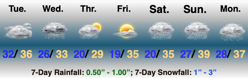
Saturday may open with early morning sunshine, but clouds will quickly thicken up and lower as low pressure heads this direction out of the central Plains. An overrunning event will ensue by Saturday afternoon. With cold air still entrenched, we’re talking about a big ole mix bag of sleet and snow to begin. This will require close attention as models have been trending colder as of late and the flavor of our weekend forecast will follow suit. The potential is there for several inches of snow/ sleet Saturday before precipitation possibly ends as drizzle Sunday morning. For now (especially given how the snow season has gone thus far) we’ll bracket for the possibility of 1″-3″, but just know this system has an upside. 🙂

Colder air will whip in here Sunday afternoon and Monday with wrap-around moisture ending as snow and snow showers. Stay tuned.
Early Afternoon Update On Today’s Wintry Mix…

Updated 01.25.21 @ 1:42p

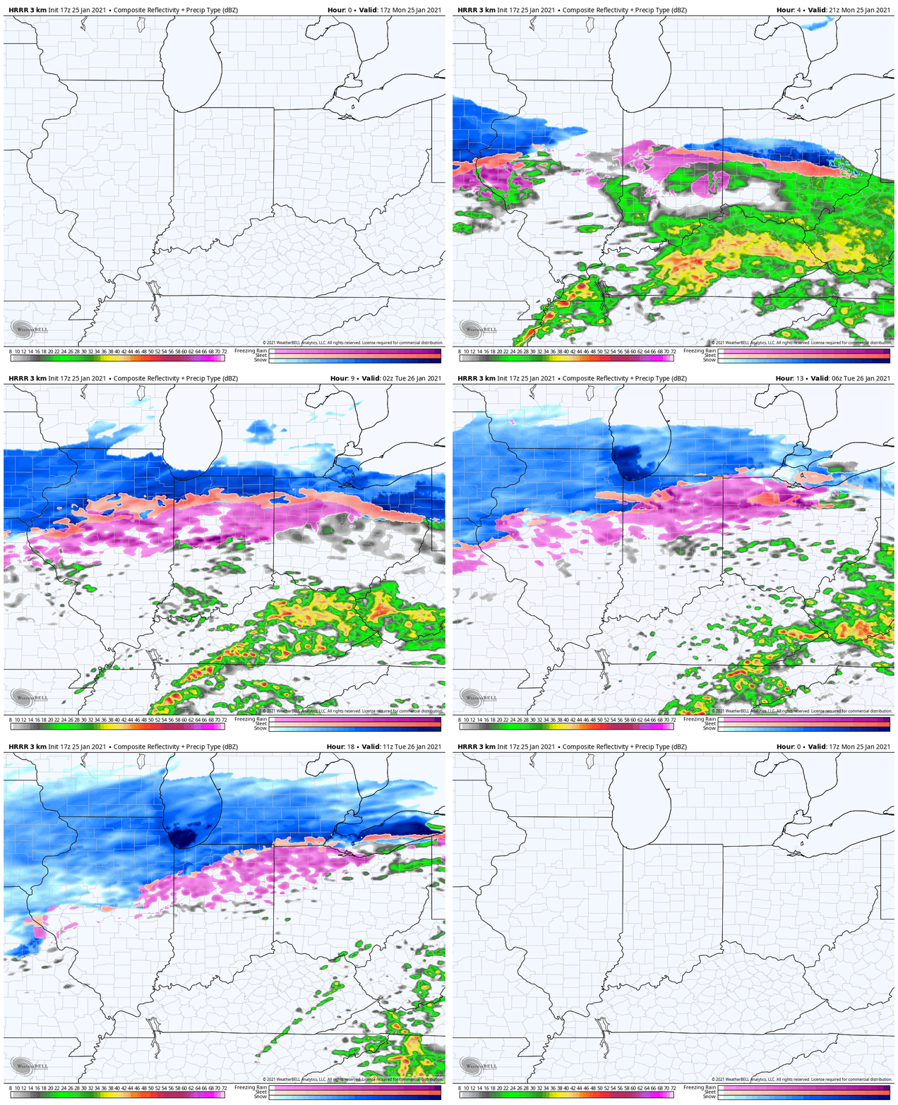
After a wintry mix that featured everything (and the kitchen sink ;-)) during the onset has predominantly transitioned over to sleet and freezing rain across immediate central Indiana. Look for this to continue for the next couple of hours before the 1st wave of significant moisture moves east by mid to late afternoon.

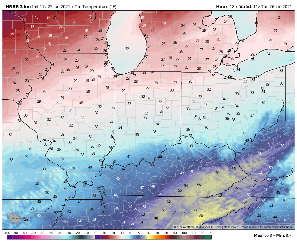
As we look forward, another wave of lighter precipitation will target the northern half of the state (especially from Indianapolis and points north) later this evening into Tuesday morning. Though precipitation should be lighter with this next wave, the concern is that it may still fall as “frozen” (sleet) or “freezing” (rain) during this time period, especially from the northern Indianapolis suburbs and points north as temperatures look to hover around, or just below, the freezing mark through the evening. The difference of just 1° truly will make a world of difference of the associated impacts regarding travel tonight and early Tuesday morning north of the city. You can see how high resolution guidance keeps the sub-freezing air locked in place just north of Indianapolis tonight.

For our clients in the salting and snow removal business, plan to remain busy during the overnight across the northern half of the state as this next wave of moisture moves in. An additional .10 to .25 (liquid equivalent) can be expected for central Indiana with liquid equivalent amounts of .25 to .50 across the northern 1/3 of the state.

More on this and what lies ahead for midweek in our evening video update. Stay safe out there, friends!

01.22.21 Weather Bulletin: Cold Weekend; Messy Open To The New Week Ahead…

Updated 01.22.21 @ 9:20a

Focus Is On Next Week…The 1st half of the weekend is easy as high pressure builds into the area, supplying a fresh batch of cold, dry air. Enjoy the sun while you’ve got it. (Don’t anticipate much in the vitamin D department next week). Saturday morning will be very cold (middle 10s for most with single digit ‘chills).

Clouds will thicken up Saturday PM and an initial wave of moisture will arrive into central Indiana Sunday morning. This lead wave of precipitation should be on the light side but with cold air in place, it’ll likely fall as a wintry mix of sleet and potentially freezing rain across the southern half of the state. Where the cold air is a little deeper further north, the predominant precipitation type should take on the form of light snow Sunday morning.

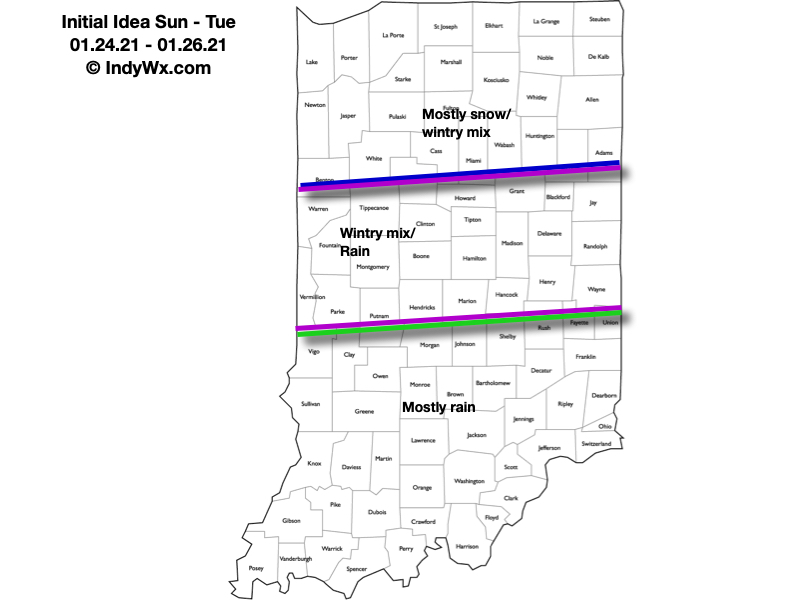
After a potential “lull” Sunday evening, another slug of moisture is inbound Sunday night and Monday. As surface low pressure tracks along the Ohio River during this time frame, this round of precipitation will be heavier and more organized. While this will still require fine tuning, our initial thinking is the form of precipitation will likely fall as the frozen variety across the northern 1/3 of the state with more mixing across immediate central Indiana, and predominantly liquid downstate. We’ll keep a very close eye on the data throughout the weekend, but our initial idea can be found below. Where the precipitation type is predominantly snow, this should be a “plowable” event. Stay tuned.

We’ll have to track another feature by the middle of next week. This could, too, deposit additional wintry conditions across the region, but we need to get through the lead system before trying to get too cute with the mid week feature.