Category: Wintry Mix

Saturday Morning Rambles…

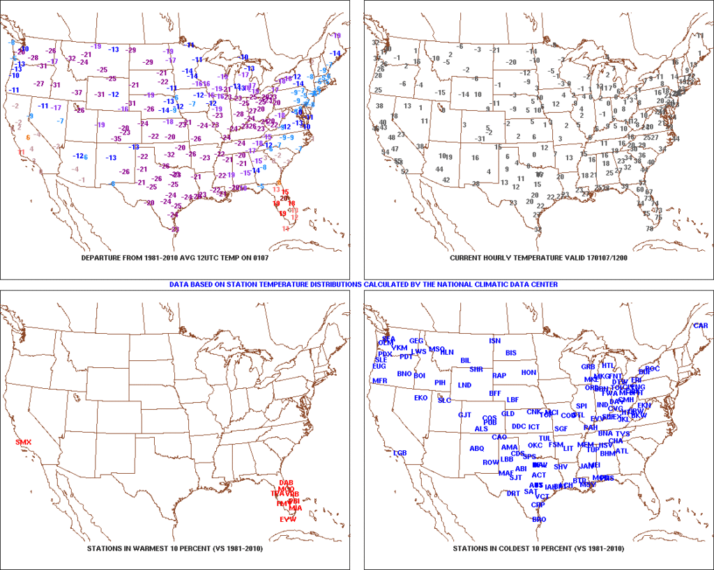
1.) Coast-to-coast cold:  The Lower 48 is waking up in an ice box this morning as widespread arctic air and below normal temperatures engulf the country (minus the FL peninsula this morning).  The arctic express will remain with us through the weekend, including temperatures once again tonight that threaten to dip into the sub-zero range across central Indiana.  Highs today will only reach the middle 10s and upper 10s to lower 20s Sunday.  Bundle up and stay warm.
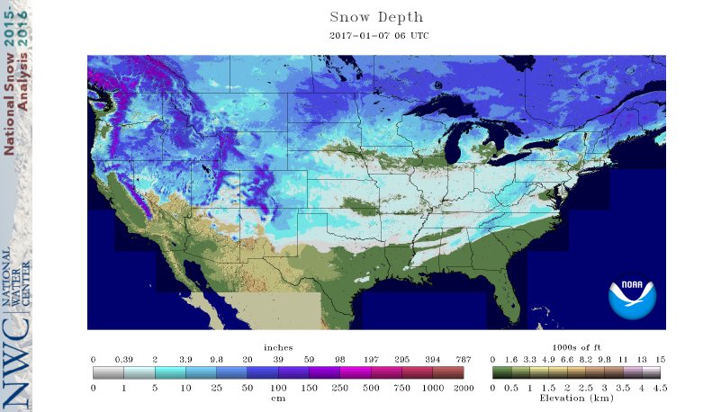
t02.) Expanding Snowpack:  65.4% of the country is covered in snow this morning.  The cold, arctic high suppressed the winter storm threat south as we alluded to in previous posts.  Places across the Deep South that aren’t used to wintry precipitation are waking up to snowy and icy conditions this morning, including MS, AL, GA, SC, and into the Mid Atlantic.  Heavier snowfall accumulated across east TN, including 5″-8″ in the high country.  Heavy snow also fell through western and central NC and Blizzard Warnings are up in rare areas including VA Beach this morning.
nsm_depth_2017010705_national3.) Moderating Temperatures:  Our air flow will back around to the southwest and this will help temperatures begin to moderate early next week (around freezing Monday and all the way to around 50 Tuesday).  As the moderating trend gets underway, we may have to deal with a brief period of freezing drizzle/ freezing rain Monday evening.
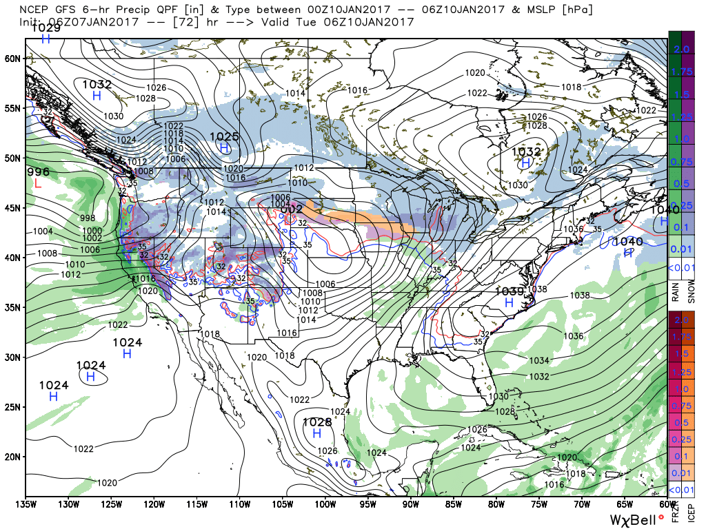
gfs_ptype_slp_conus2_134.) Rainy Midweek:  A more significant surge of moisture will arrive midweek and result in periods of moderate to heavy rain Wednesday PM into Thursday.  Potential is present for 1″+ during this timeframe.
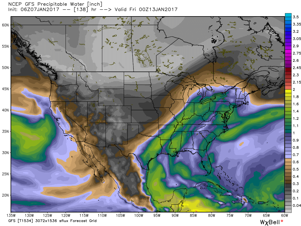
gfs_pwat_conus2_245.)  Weekend Wintry “Fun And Games?”  A tremendous battle will take place next weekend between a strong and sprawling arctic high pressure system and the southeast ridge.  In between it’ll be fascinating to watch things unfold, and as you’d imagine, that includes Indiana.  Despite the southeast ridge flexing it’s muscle, the concern here is that the shallow dense arctic air will “ooze” south and present an icy set-up for portions of the Ohio Valley and Mid West for the weekend.  We still have some time to watch this, but the potential of significant icing is very much present for some and this will require a close eye through the week.
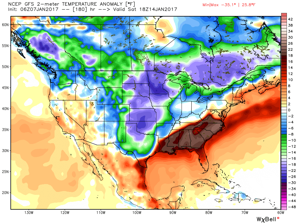
gfs_t2m_a_f_conus2_31

Permanent link to this article: https://indywx.com/2017/01/07/saturday-morning-rambles-9/

Unseasonably Warm; Wet Day After Christmas…

screen-shot-2016-12-26-at-8-33-12-amHighlights:

  • Unseasonably warm today
  • Showers and perhaps a t-storm by lunchtime
  • Turning more seasonable later this week

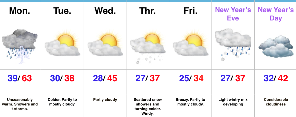
Wet At Times Today…A cold front will push across the state later this afternoon.  Ahead of the front, a warm southwesterly air flow will lead to a spring-like feel on this day after Christmas.  Coverage of showers will increase by late morning and around lunchtime, including the possibility of an embedded thunderstorm.  Once the front sweeps through the region, our winds will flip to the northwest and result in a cooler feel as early as tonight.  Tuesday will feature much more seasonable conditions.

Reinforcing chilly air will blow into town Thursday afternoon and with enough upper level energy around, we’ll mention scattered snow showers in our forecast.  Colder weather will be with us to close the week and head into New Year’s weekend.

Speaking of New Year’s, we still eye a storm system around New Year’s Eve.  Confidence is low in the overall set-up in regards to storm track and timing and fine tuning will be required.  For now, we’ll simply go with a developing light wintry mix Saturday and “sure up” the details later this week.

Upcoming 7-Day Precipitation Forecast:

  • Snowfall: Dusting
  • Rainfall: 0.50″ – 0.75″

Permanent link to this article: https://indywx.com/2016/12/26/unseasonably-warm-wet-day-after-christmas/

Changeable Weather Christmas To New Years…

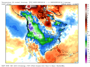
It’s hard to believe we’re only a few days from Christmas!  Through the 22nd, Indianapolis is running a whopping 6 degrees below average.  Cold rules across the Lower 48, month-to-date.

ncep_cfsr_noram_t2m_anomThis is, of course, is in stark contrast to December 2015.
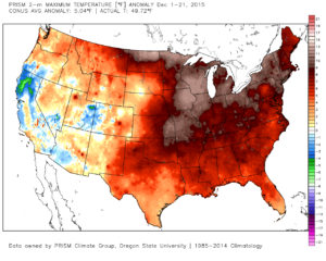
conus_mtd_t2max_anom_2015As we move forward, an active pattern awaits between now and the end of the year.  This comes after a few days to catch our breath, including moderating temperatures leading up to Christmas.
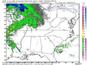
An initial wave of moisture will lift northeast and result in a rather gloomy day Friday with increasing rain chances Friday afternoon and evening.  Initially, precipitation won’t make it to the ground, but we should saturate the column enough that rain reaches the ground for most of central IN by evening.  Showers continue Friday night into the wee morning hours Christmas Eve.  (If traveling towards Chicago, a wintry mix and snow will be a good bet Friday PM).

hires_ref_ky_18Christmas Eve will feature overcast skies with areas of fog and drizzle, but the majority of the concentrated rain should fall south of the region.  Santa’s ride into central IN should be uneventful, weather-wise.
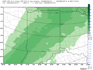
Christmas Day will start off with temperatures in the mid to upper 30s along with cloudy conditions and an increasingly gusty breeze that will shift out of the southeast to the south Christmas night.  Shower chances will be present by the evening before giving way to more widespread showers and embedded thunder overnight into Monday morning.  Temperatures will be stuck in the 40s most of the daytime Christmas before rising into the upper 50s predawn Monday.

gfs_ptype_slp_indy_17Temperatures will fall through the day Monday and we should run much closer to seasonable temperatures next week.  A couple of additional storm systems will have to be monitored for rain and snow prospects the middle of next week and again around New Year’s Eve/ Day.  Initially, we’ll be rather mild, but there may be more in the way of cold air readily available to make the storm system around New Years “more interesting” from a wintry perspective.
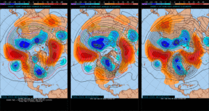
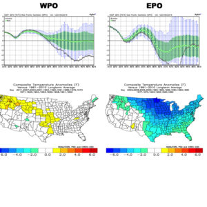
Longer term, we have to wonder if the negative EPO isn’t about to take control just past the New Year.  More and more data is coming around to the idea that the arctic hounds may (yet again) be on the attack early January… Time will tell and we’ll continue to keep a close eye on things.

test8

wpoepo

Permanent link to this article: https://indywx.com/2016/12/22/changeable-weather-christmas-to-new-years/

VIDEO: Rambling Around On A Wednesday Evening…

You must be logged in to view this content. Click Here to become a member of IndyWX.com for full access.  Already a member of IndyWx.com All-Access?  Log-in here.

Permanent link to this article: https://indywx.com/2016/12/21/video-rambling-around-on-a-wednesday-evening/

Icy Concerns Grow Again Tonight…

After a night of freezing rain, many roadways throughout central IN remain glazed over and hazardous as of this update.  If you absolutely don’t have to travel today, please don’t.  Allow road crews to do their job.  Additionally, we have growing concerns of a new round of freezing rain to sleet and eventually snow tonight.  Lingering moisture on roadways will result in “flash freeze” conditions and treacherous travel tonight into Sunday.

First, a tip of the hat to short-term modeling, including the NAM, for suggesting we’d have a very difficult time eroding the shallow arctic air at the surface across most of central IN today.  While we never bought into the mid/ upper 50s idea the GFS and Euro were once suggesting, we did initially think 40s were in store today.  Forget about it.  Mid to potentially upper 30s are the best we can do today and temperatures will crash this evening as not one, but two, arctic fronts push through central IN.  Even if we didn’t have additional precipitation inbound tonight, “flash freeze” conditions would develop from lingering moisture and lead to renewed problems on area roadways.  Throw in another wave of low pressure riding along the pressing arctic front and a whole slew of problems will develop yet again from a freezing and frozen precipitation perspective.

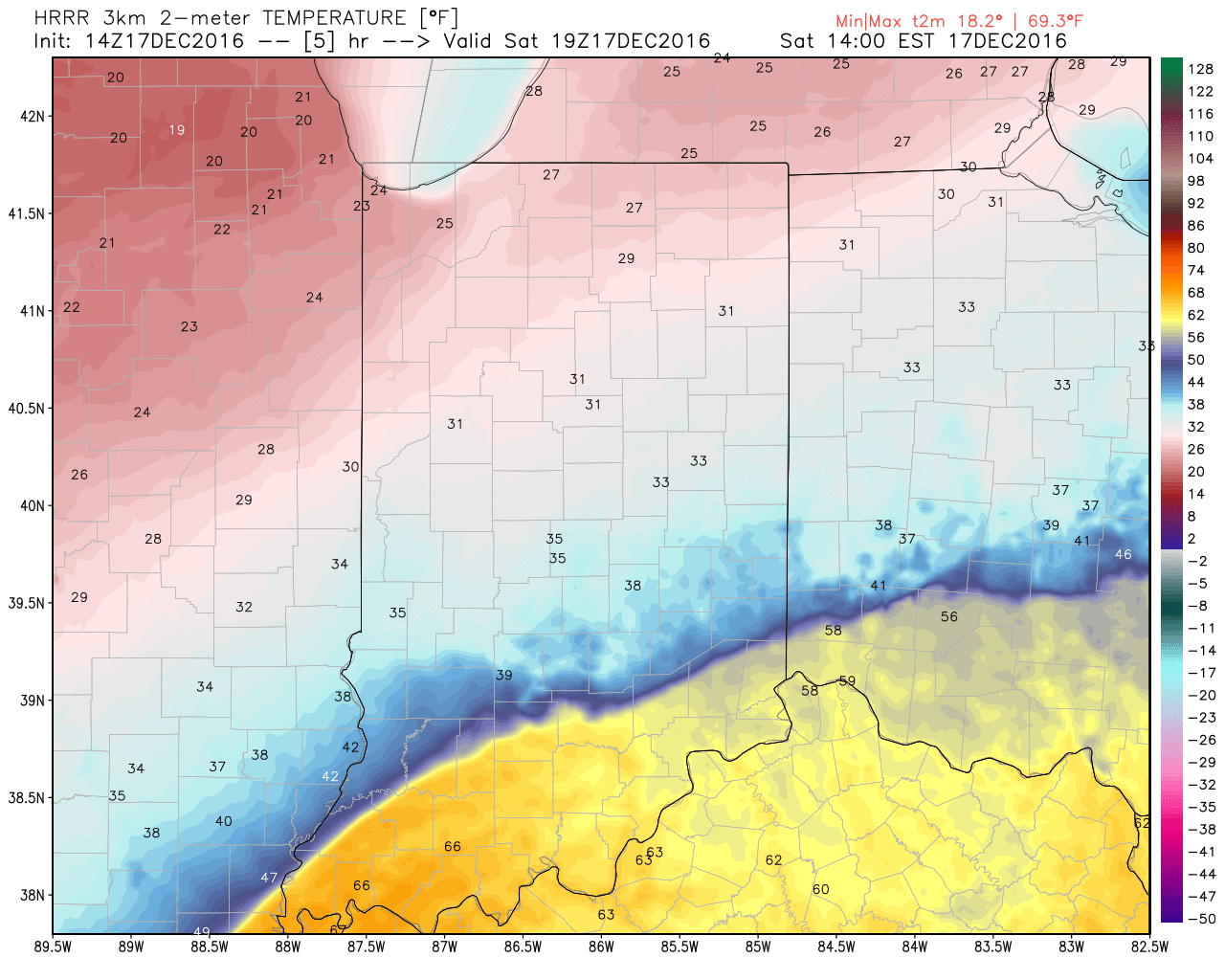
Note the incredible temperature gradient from downstate to central and northern Indiana early this afternoon.

hrrr_t2m_indy_6The heavy, dense, arctic air will win out as evening turns into nighttime.  Indianapolis is back to the freezing mark around 6p and into the 20s by 9p.
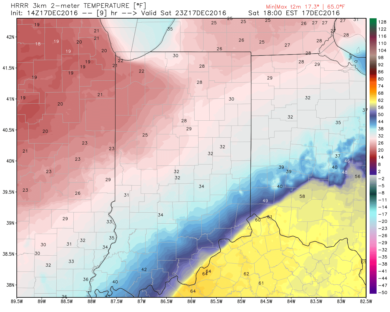
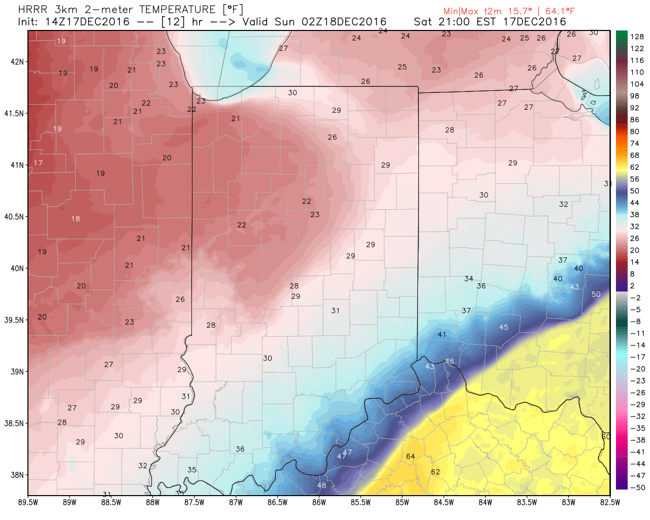
hrrr_t2m_indy_10

hrrr_t2m_indy_13Temperatures will continue to fall through the day Sunday and by Monday morning central Indiana will be in the single digits, with below zero readings across northern parts of the state.
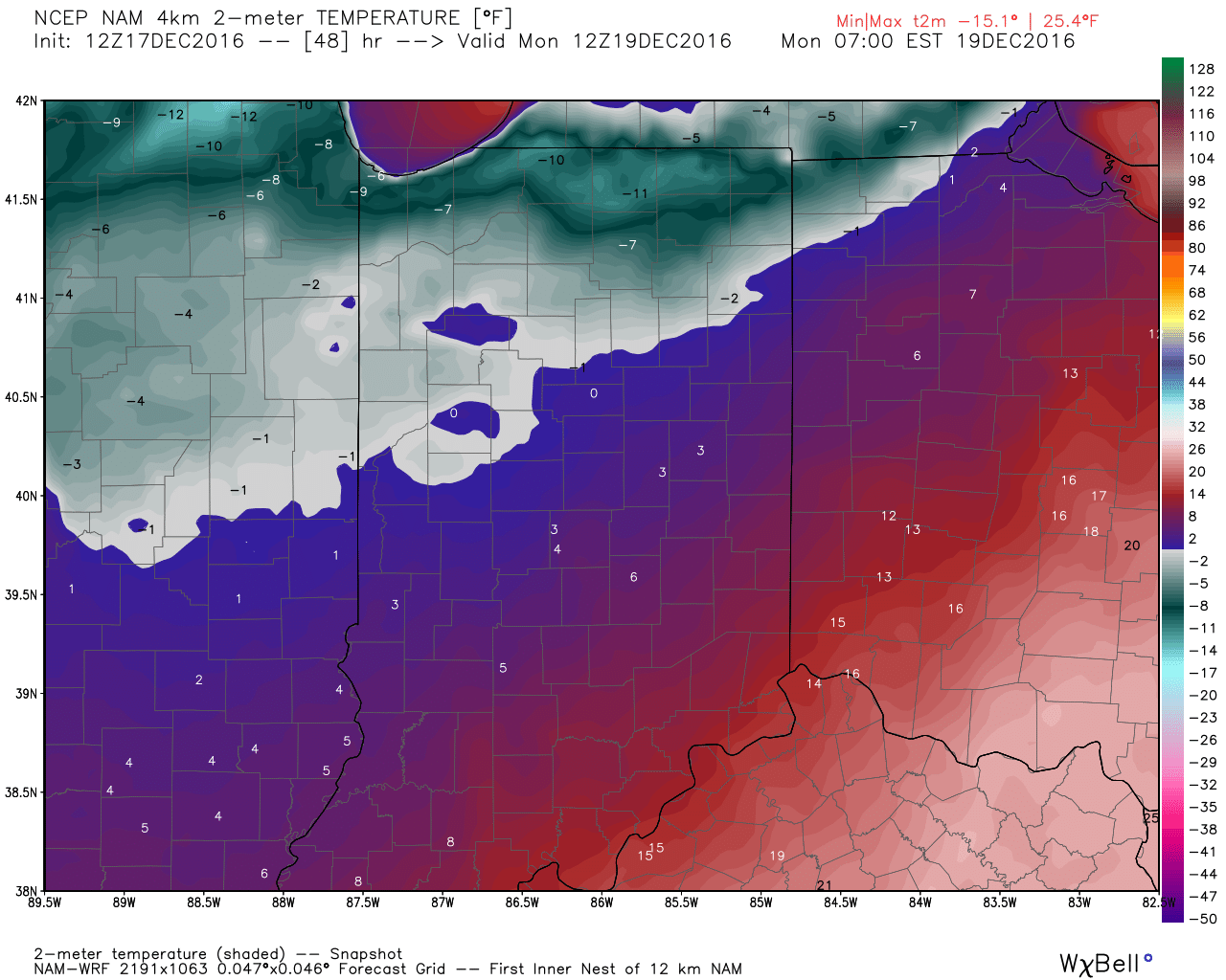
hires_t2m_indy_49Wind chill values of 10 to 20 degrees below zero will be common by Sunday night into Monday morning across central Indiana.
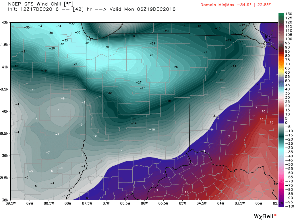
gfs_windchill_indy_8Areas of drizzle and freezing drizzle will continue across the region into the early afternoon, but begin to expand in coverage and intensity once again by evening.  Note the area of freezing rain expand across central IN, including Indianapolis, between 4p and 7p.
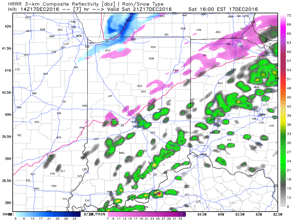
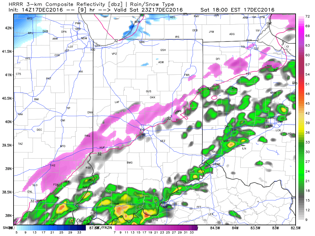
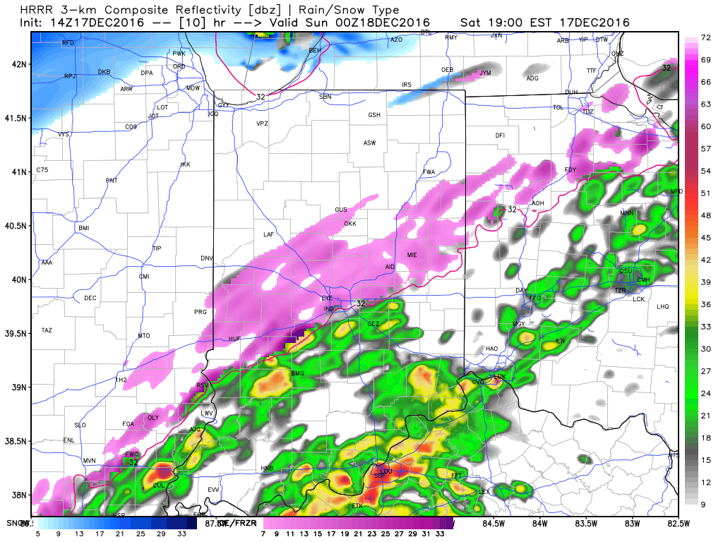
4p

6p

7pFreezing rain will eventually begin to mix with sleet and eventually transition to light snow during the overnight from northwest to southeast.  A coating of snow to less than 1″ is a good bet on the new icy glaze that develops tonight.
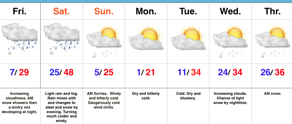
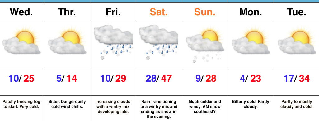
When you factor in the current hazardous conditions in place along with the fresh push of arctic air and precipitation tonight, it’s a good idea to hunker down inside and remain off area roadways.  We have big concerns of new travel problems developing by evening across central Indiana.  By this time tomorrow, our attention will turn to the bitterly cold air and dangerous wind chill values developing.

More later, including prospects of snow around Christmas.  As always, you can follow our updates on social media by following us on Twitter (@indywx) and Facebook.  Stay safe!


Permanent link to this article: https://indywx.com/2016/12/17/icy-concerns-grow-again-tonight/

Active Winter Pattern Rumbles Along…

screen-shot-2016-12-15-at-7-44-16-pmHighlights:

  • Busy weather weekend
  • Fresh shot of bitterly cold air
  • Christmas week snow chances

Buckle Up For A Busy Winter Pattern…Thursday featured the coldest December 15th high (13 degrees) in a whopping 27 years. Talk about impressive.  This was good for an amazing 26 degrees below average.  Let that sink in…

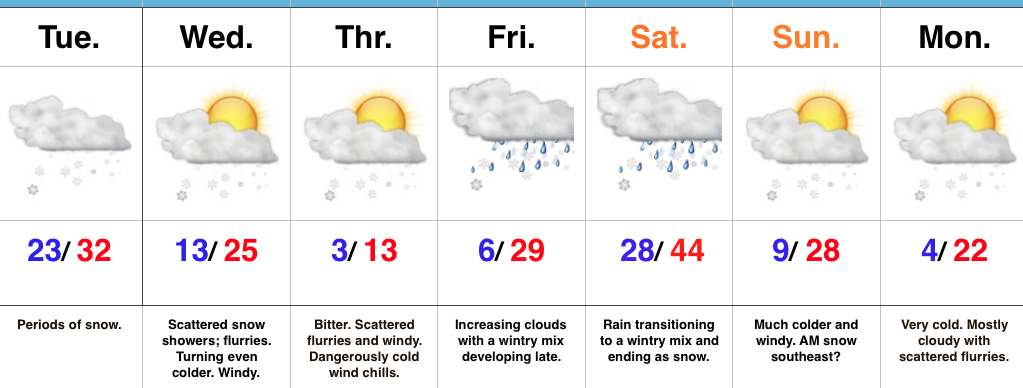
We’ll wrap up the work week and head into the busy weekend before Christmas with a new round of challenges.  A couple of warm fronts will lift north through central IN Friday.  Snow showers may accompany the first warm front early Friday before the second warm front lifts north Friday night.  This will result in more widespread wintry precipitation, likely to begin as a period of light snow before a quick transition to sleet and freezing drizzle during the overnight.  Temperatures will warm overnight Friday and precipitation will change to light rain Saturday morning.  That’s when our attention turns to the first of two cold fronts that will sweep through the state.  The first cold front will lead to a quick changeover to sleet and snow Saturday evening (thinking between 6p-8p as of now).  As a secondary wave of moisture moves northeast along the boundary, expect a light accumulation of snow Saturday night.  The second cold front (arctic) will blow through late Saturday night and early Sunday morning and lead to a frigid Sunday.  That 25 degree high you see Sunday will come at midnight as temperatures crash through the day.  Add in a stiff northwest wind and wind chill values will fall below zero (yet again) in the Sunday-Monday time frame.

We’ll briefly calm things down during the early Christmas week period and remain cold.  Our next storm system is slated for a mid week arrival and could deliver a round of accumulating snow Wednesday night into Thursday morning.  More on that after this weekend system.

Upcoming 7-Day Precipitation Forecast:

  • Snowfall: 2″ – 4″
  • Rainfall: 0.20″ – 0.40″

Permanent link to this article: https://indywx.com/2016/12/15/active-winter-pattern-rumbles-along/

Bitter Times Ahead; Weekend Storm…

screen-shot-2016-12-13-at-6-20-11-pmHighlights:

  • Bitterly cold
  • Weekend storm delivers a little bit of everything
  • Cold reloads over the weekend

Cold That Hurts…Tuesday was a snowy day across central IN. Most snow reports checked in around 3″, but there were a few “lucky” folks who accumulated north of 4″.  Not bad at all!

Two pieces of arctic air will invade mid week.  The first piece is arriving on the scenes as we type this forecast Tuesday evening.  It’ll send lows into the single digits to lower teens by Wednesday morning.  Patchy freezing fog will also be noted in spots.  Needless to say, don’t get too confident on area roadways.  Despite the phenomenal work central IN road crews do (seriously, thank you), there will be icy spots tonight and Wednesday morning.  Slow down!  🙂

A second surge of arctic air will arrive Wednesday afternoon and evening.  Everyone gets in on the single digit party Wednesday night and Thursday morning.  In fact, don’t be surprised by a few folks checking in with a below zero report here and there.  Winds will be strong and gusty and lead to wind chill values of 10-20 below zero into Thursday morning.  Heavy winter attire will be required.

Our attention then shifts to a developing weekend storm that will deliver a wintry mix late Friday followed by a transition to rain as temperatures zoom (briefly) into the 40s Saturday.  The milder surge won’t last long as arctic air oozes back into central parts of the state Saturday afternoon and evening.  As this is happening, a second wave of moisture will ride up along the arctic front.  We expect rain to mix with and change to a wintry mix of sleet and freezing rain before ending as snow Saturday night/ early Sunday morning.  This may be another accumulating wintry event and we’ll keep a close eye on things.

Cold, dry weather will be with us as we kick off Christmas week.  Speaking of Christmas week, the bitterly cold air will “relax,” but the pattern remains active.  Despite the relaxation in the frigid times, conditions will remain cold enough for wintry potential leading up to, or around, Christmas…

Upcoming 7-Day Precipitation Forecast:

  • Snowfall: 1″ – 3″
  • Rainfall:  0.25″ – 0.50″

Permanent link to this article: https://indywx.com/2016/12/13/bitter-times-ahead-weekend-storm/

VIDEO: Snowy Tuesday…

Quickly touching base on what’s going to be a snowy Tuesday.  It’s a busy pattern, as mentioned, folks, so hunker down.  Bitterly cold air sets up shop for mid week…

You must be logged in to view this content. Click Here to become a member of IndyWX.com for full access.  Already a member of IndyWx.com All-Access?  Log-in here.

Permanent link to this article: https://indywx.com/2016/12/13/video-snowy-tuesday/

Snowy Tuesday; Bitter Mid Week Ahead…

screen-shot-2016-12-12-at-5-55-48-pmHighlights:

  • Snowy Tuesday
  • Bitter Mid Week
  • Weekend Storm

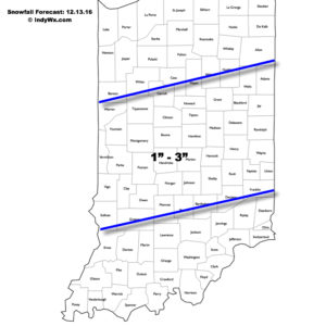
Accumulating Snow Event…Upper energy will combine with an approaching arctic front to lead to an accumulating snowfall event for many across central Indiana Tuesday.  We expect snow to increase in coverage and intensity just prior to sunrise before turning moderate to briefly heavy from mid to late morning on into the early afternoon hours.  In general, we paint a band of 1″-3″ through the heart of central Indiana, but do have some concerns localized banding features could result in a 4″ pop here and there (impossible to pinpoint the precise locations these bands may set-up across central IN as of this update).  Expect a messy morning commute.

121316snowfallforecastFresh arctic air will pour into the region tomorrow evening, along with a gusty NW wind.  Tuesday’s snow should be rather wet in nature so we don’t anticipate blowing/ drifting issues to result as the arctic hounds roar into town.  However, there will likely be periods of flurries and scattered snow showers as the bitterly cold air arrives in the Wednesday-Thursday time frame and this could lead to light additional coatings in spots.  The big weather story through mid and late week will be the bitter air.  “Air that hurts” is what we’re calling it and wind chill values will approach 20 degrees below zero Wednesday night/ Thursday morning.
Our next storm system is still slated to arrive for the weekend.  As of now we forecast snow and a wintry mix Friday evening.  This will then change to rain Saturday before arctic air quickly oozes back in here and leads to a potentially messy Saturday night-Sunday morning.  Rain will transition to freezing rain and sleet Saturday evening before ending as a period of snow.  It’s back to the ice box we’ve come to know all too well Sunday into Monday.

Upcoming 7-Day Precipitation Forecast:

  • Snowfall: 2″ – 5″
  • Rainfall: 0.50″

Permanent link to this article: https://indywx.com/2016/12/12/snowy-tuesday-bitter-mid-week-ahead/

Busy Winter Pattern Continues…

screen-shot-2016-12-10-at-8-24-08-amHighlights:

  • Snow arrives tonight for central; northern parts of the state
  • Even colder air coming
  • Pattern of storms and rumors of storms

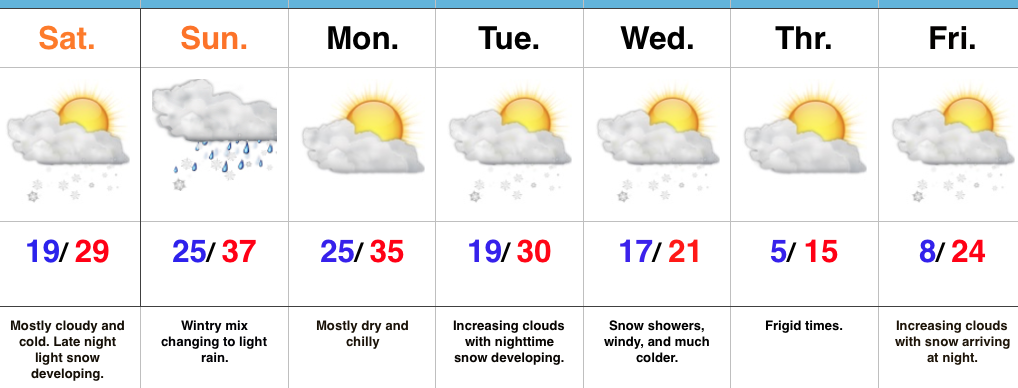
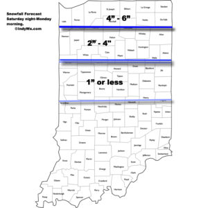
Snow Develops Tonight…Today is mostly dry and cold, including a mostly cloudy sky.  Clouds will lower and thicken this afternoon and give way to light snow late tonight across north-central Indiana and points north.  As milder air is pulled north Sunday, snow will transition to a wintry mix and eventually a cold light rain across central Indiana.  Further north, this will remain mostly snow before transitioning to a wintry mix.  Precipitation will end for everyone Sunday night.

Here’s the current thinking on storm total snowfall with this event. (Click to enlarge).

snowfallmap121116We’ll open the work week with dry and cold conditions, but all eyes will be on the next arctic front by this time.  It’ll blast through here the middle of the week with even colder air than what we’re currently “enjoying.” 🙂  Expect sub-zero wind chills mid week.  Snow showers and gusty winds remain in the mid week forecast and will require fine tuning as we draw closer.  A quick note, medium range modeling and beyond will really struggle in run-to-run consistency with such a pattern.  The slightest difference in handling respected upper air energy will lead to dramatic changes in the sensible weather the modeling paints.  There’s no sense in changing the forecast daily (or, in some cases, multiple times per day, only to change it back to where we began as time draws closer).

Finally, yet another winter weather maker awaits for the end of the week.  Clouds will be on the increase Friday with snow (or a wintry mix) developing at night.  It’s a busy, cold pattern…

Upcoming 7-Day Precipitation Forecast:

  • Snowfall: 1″ – 3″
  • Rainfall: 0.10″ – 0.25″

Permanent link to this article: https://indywx.com/2016/12/10/busy-winter-pattern-continues/

IndyWx.com