From time to time we like to post some of our AG weather reports here as opposed to our weekly updates via e-mail. (BTW, if you’re interested in more information around this feature, please e-mail bill@indywx.com).
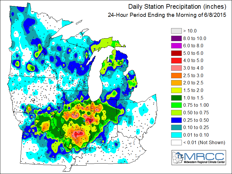
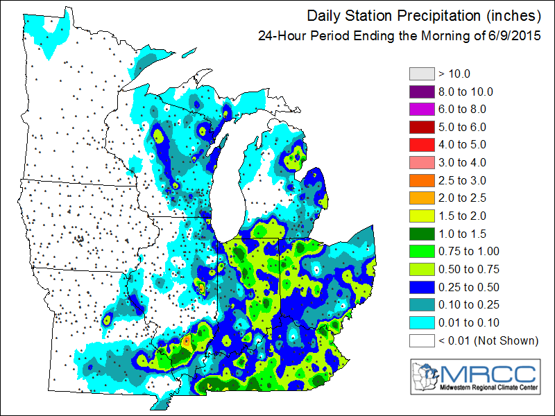
Rains the past couple of days have been beneficial for many areas that were dry in May. (Here’s a hint, there’s more where that came from).

 Unfortunately, some of that heavy rain came with hail damage- particularly across northern IN Monday afternoon.
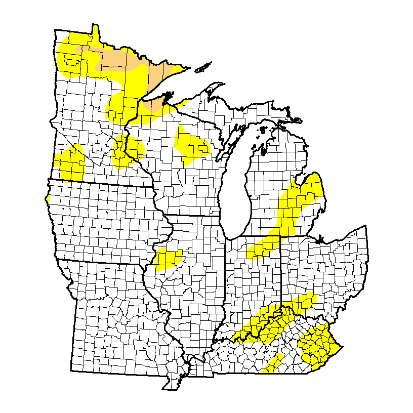
Abnormally dry conditions have continued to shrink over the region over the past couple weeks. May and early June is a crucial time in setting the tone for the summer/ early fall months ahead. This, of course, is fantastic news.
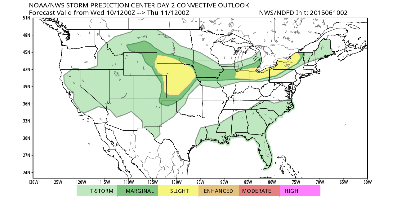
 As we progress ahead into the second half of the week, additional severe threats will present themselves. Similar to Monday, hail and damaging winds are of greatest concerns in our particular Ag-weather viewing area (#IAwx, #INwx, #ILwx, #OHwx).
Day 2- Wednesday
 Day 3- Thursday
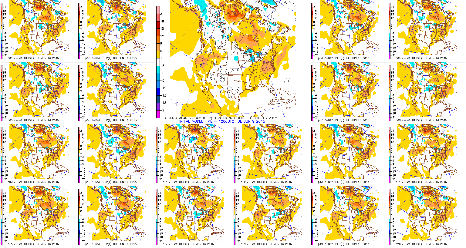
 As we move forward, a very warm to hot and humid pattern will settle in o/ the course of the next 7-14 days (and beyond). In looking at the latest European Weeklies (can’t post here due to licensing issues) the warmer than normal pattern and wetter than normal regime is likely to continue through the rest of the month. It’s not so much the high temperatures in terms of absolutes, but the combination of wet ground (humid and sultry) and warmer overnight lows that will really help power the warmer than normal period in the coming couple weeks.
 In the shorter term, heat will really expand across the region mid week, including many of the first 90 degree readings of the season for most folks. The European shows the ridge flexing it’s muscle yet again into early next week.
 A very humid time of things will continue, due to the recent wet times and more rain ahead. Aside from the storm threat(s) mid week, Friday into Saturday will also prove to offer a smattering of thunderstorms as a cold front moves in and stalls south before returning north Sunday.
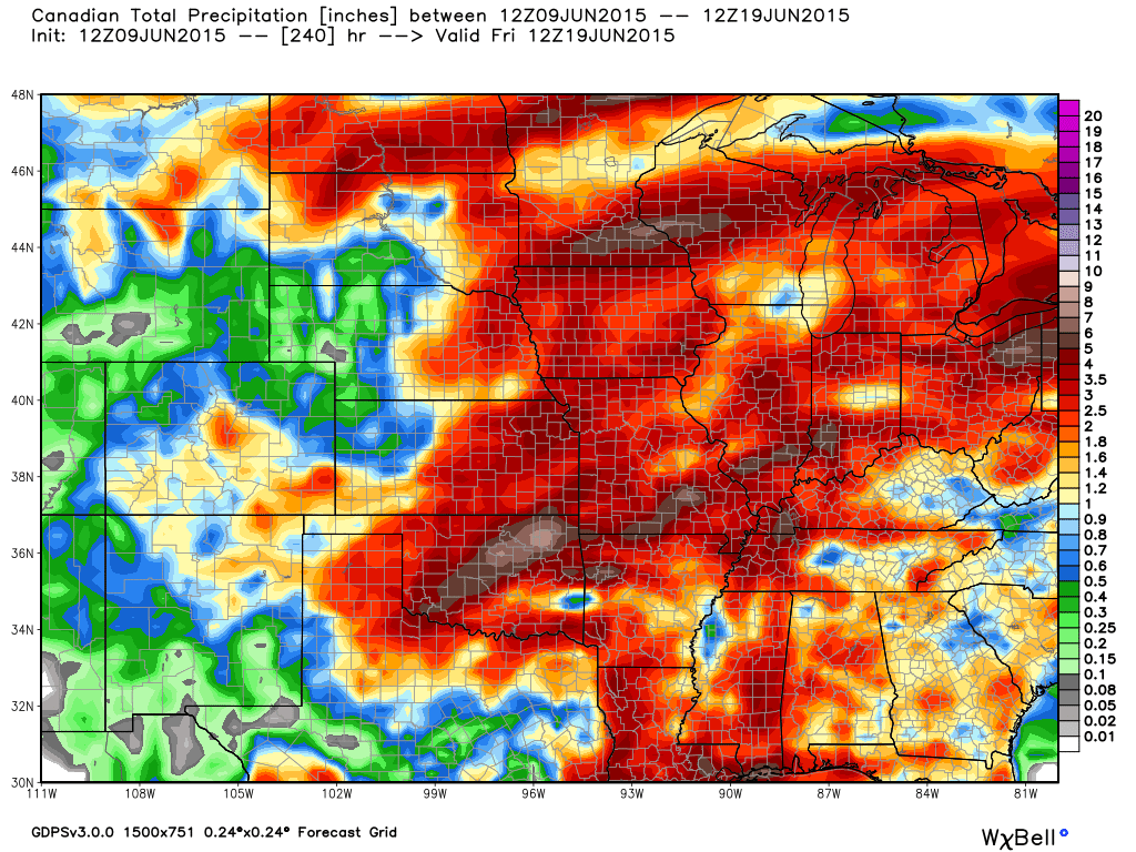
Upcoming 10-day rainfall numbers are respectable, including 2″-3″ totals for many, with locally heavier amounts a good bet where storms train.
 Note the wet pattern shown deeper into June off the CFSv2:
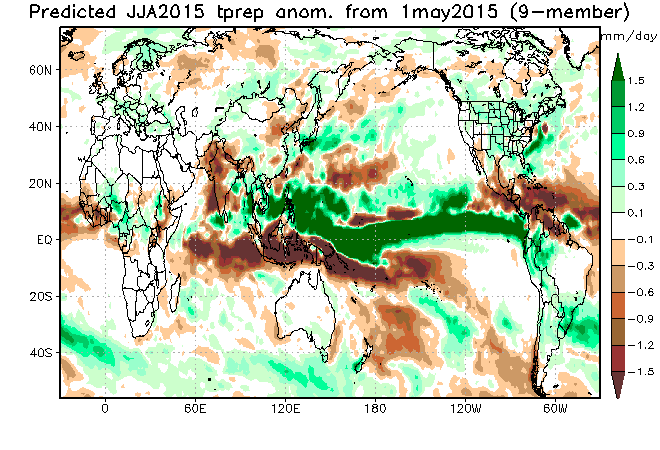
 The JAMSTEC shows the wet pattern into the heart of the summer (June, July, August) and would argue against any idea of major long-lasting heat for the heart of the summer.
 BTW- for you winter lovers out there, here’s a little something to entertain you. The JAMSTEC is onboard for another “fun” winter ahead. Factor in those warm NPAC anomalies and a weakening El Nino into the winter and the stage very well may be set for wintry fun and games… Long way to go here, however… 🙂


