You must be logged in to view this content. Click Here to become a member of IndyWX.com for full access. Already a member of IndyWx.com All-Access? Log-in here.
Category: Winter thoughts…
Permanent link to this article: https://indywx.com/welcome-to-meteorological-winter/
Nov 28
Iron Bowl Saturday: December Rambles…
This is a special day in the McMillan house. Iron Bowl Saturday only comes around one day a year… Needless to say, the Auburn flags have been on the vehicles since Wednesday, we’re decked out in our orange and blue, and game faces are on for this evening’s matchup. WAR EAGLE!
As we get set to flip the calendar to December, we wanted to post some latest thinking.
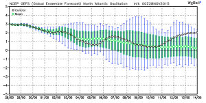
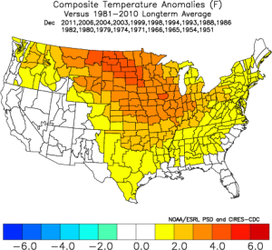
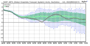
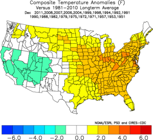
Let’s take a look at the latest teleconnections. As we’ve been talking, there’s a lot of “noise” in model land, including conflicting signals. The positive NAO and AO argue for warmer than average conditions, while the positive PNA suggests chillier than normal times should prevail.
We wanted to post the latest model predictions of each teleconnections, courtesy of Weatherbell.com. Additionally, courtesy of madusweather.com, here’s what each teleconnection “phase” would normally lead to in December.
NAO
AO
PNA
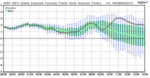
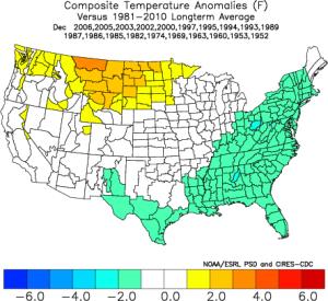 Simply based on the teleconnections, you would build a December forecast that would lean more warm than cold, as the short term positive AO and NAO should trump the positive PNA. As we look at the month, as a whole, the AO and NAO are forecast to trend more neutral, while the PNA remains solidly positive. Does this suggest colder air, relative to normal, would invade mid and late month? – Certainly something to watch.
Additionally, the latest Southern Oscillation Index (SOI), has begun to take a negative hit. This is after weeks of positive SOI values- relative to the base state.
While it takes a while to impact the pattern, locally, this negative hit does suggest mid and late month could be a bit more interesting from a wintry perspective. We shall see.
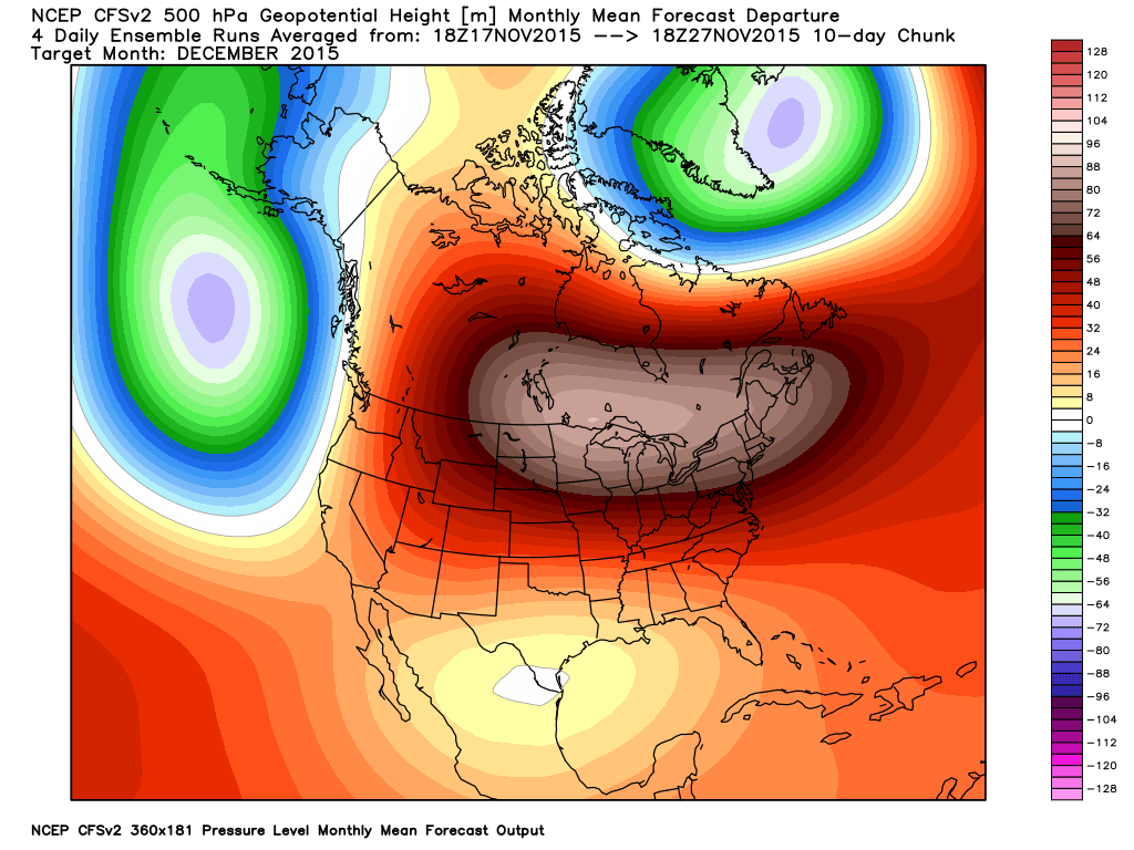
The CFSv2 remains very consistent on a warm month, relative to normal, particularly across the northern tier.
While we can’t post the European weeklies here, the latest run suggests colder, and stormy times around Christmas week. Now, we should also note the overall performance of the Weeklies hasn’t been as accurate compared to normal over the past few months, but it’s another interesting trend to keep an eye on.
The MJO will begin the month in Phase 3 before going into the “wheel house.” All-in-all, we don’t get a “hat tip” from the expected monthly MJO forecast, with the exception of Phase 3 to begin (warm phase).
 To sum up: Long range forecasting is always a gamble. Only the good Lord knows what the future holds. That said, there are times when we feel more confident about our long range, monthly outlooks, more so than normal.
We’ll lean warmer than normal for December (+ 1.5 at IND), and this really plays into our Winter Outlook (slow start expected with the emphasis on the cold and snow mid and late winter), but that doesn’t mean we’re expecting a “boring” month. Keep in mind November has been both warmer AND snowier than normal, with a very busy 2nd half of the month.
We’ll have plenty of challenges to handle as we rumble through the month no doubt, but we expect the positive AO and NAO to trump the positive PNA to start to the month. As we progress into mid and late month, we’ll have to be on alert for potential impacts of that significant SOI hit to open the month. We’ll also keep the Weeklies in check to see if the colder, stormy look Christmas week remains. It’ll be fun, as always.
To close, here’s one more emphatic WAR EAGLE from our home to yours! 🙂
Permanent link to this article: https://indywx.com/iron-bowl-saturday-december-rambles/
Nov 16
El Nino Update; Updated Winter Thoughts…
As we rumble closer to the start of meteorological winter, we wanted to provide some updated thinking around what lies ahead. Before we dig into some of the latest data and dissect the updated SST profile, here’s a recap of our winter outlook posted 10.17.15. You can read the complete outlook here.
- Worst of winter, from a cold and snow perspective, is during the back half of the season.
- Colder than average winter ahead by 1 deg. (F) on average.
- Slightly less snow than normal at 20″ (first flake to last flake).
At first glance upon looking at the latest SST profile, there aren’t many huge changes from (6) weeks ago. However, there are some interesting trends, mostly pertaining to El Nino region 1+2 versus 3.4.
 1.) In the most recent El Nino monthly recap, Region 1+2 cooled .09 degrees (F) from September to October. Meanwhile, Region 3.4 warmed .32 degrees (F) during the same period. This trend is interesting and something we think continues looking over the data. Central-based, Modoki El Nino events argue for a colder east across a more widespread basis.
2.) The warm, or positive PDO, continues. This argues for eastern cold. Remember the past two winters that ran colder than normal across our region? The positive PDO played a big role in powering those.
3.) Though admittedly much more of a wild card, the current SST configuration in the northern Atlantic continues to argue for a developing negative NAO as mid and late winter arrives. Personally we feel the NAO impact, locally, is felt more in the later winter period. A negative NAO would also argue for colder than normal.
The latest Sea Surface Temperature Constructed Analog (SSTCA) model is in and remains firm on the idea of a cold east and south.

The central and eastern regions are favored for colder than normal temperatures through meteorological winter.

The predominant upper air pattern shows central and western Canada ridging with southern and eastern troughiness- also a sign of an active southern stream (storm track).
As we move into the Thanksgiving and Christmas seasons, rest assured we’ll continue to keep close tabs on the “sensible” weather the evolving pattern will deal the region. As a whole, we feel confident we remain on the right track and think plenty of wintry “fun and games” lie ahead this year.
Here’s a photo from Christmas 2007 out in Breckenridge, CO with my brother. Could this be the scene for Christmas this year here? “I’m dreaming of a white Christmas…”
Permanent link to this article: https://indywx.com/el-nino-update-updated-winter-thoughts/
Nov 12
Very Windy Today; Next Big Storm Next Week…
- Very strong winds
- Dry times return
- Big storm next week
A cold front swept through the state during the predawn hours. While a few breaks of sunshine may be seen early this morning, low clouds will quickly spread back over the region.
Wind will be the big story today as we still think gusts over 50 MPH are a good bet throughout central parts of the state. Note the tight pressure gradient that remains in place across the region today into Friday. Friday won’t be AS windy as today, but still quite blustery.
 Our next big weather maker will arrive during the early to middle portions of next week. Model consensus continues to highlight a hefty rain event and thunderstorms. Early numbers would suggest 2″-3″ potential. More details on our next storm tomorrow and on Twitter (@IndyWx).
Before we close this morning, we wanted to post the updated JAMSTEC seasonal outlook for the upcoming winter. As a whole there aren’t a lot of changes from previous runs. (We like to see consistency :-)).
 Overall, it agrees with our forecast and strongly disagrees with any of those warm winter forecasts out there for the south and east. One note, just because the drier anomalies show up over the Ohio Valley (what you would typically expect during a moderate to strong El Nino event) doesn’t necessarily mean it’ll be a lower than normal snow season. Keep in mind, moisture content in snow is much less than rain.
After taking a look at things, I like where we stand with our Winter Outlook. One thing’s for sure, time will tell!
Permanent link to this article: https://indywx.com/very-windy-today-next-big-storm-next-week/
Nov 05
UPDATED SST CA Model Is In The House…
As promised, we wanted to provide some thoughts around the updated sea surface temperature constructed analog model that was released this morning. In short, there aren’t many huge differences from…
You must be logged in to view this content. Click Here to become a member of IndyWX.com for full access. Already a member of IndyWx.com All-Access? Log-in here.
Permanent link to this article: https://indywx.com/updated-sst-ca-model-is-in-the-house/

