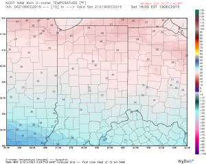
Finally, it’s a cold start to the day, and feels like a mid December morning should! Temperatures are running significantly behind where we were across the east this time yesterday.
 Highs today will only climb to around freezing across central Indiana. Add in a stiff NW breeze and wind chills will be colder. Grab the coat before heading out to finalize that Christmas shopping.
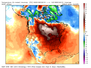
 This cold is coming in the face of what’s been a very warm month. Meteorological winter, as expected, has opened warmer than normal.
 By the way, we think changes towards colder loom mid and late January on. That likely carries us into spring this year with winter continuing.
Christmas week is coming into better focus now, and the “blend” of model solutions was, indeed, the best path to take. The European’s blow torch 70 degree idea was laughable. Still warmer than normal, Christmas morning should start in the middle 30s with highs in the upper 40s.
The lead up to Christmas will be an unsettled one after a dry weekend. Moisture returns Monday.
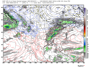 Another surge of moisture comes in advance of a cold front and associated area of low pressure Christmas Eve before colder air oozes in.
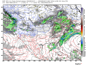 Christmas morning opens chilly, but dry, as high pressure is overhead.
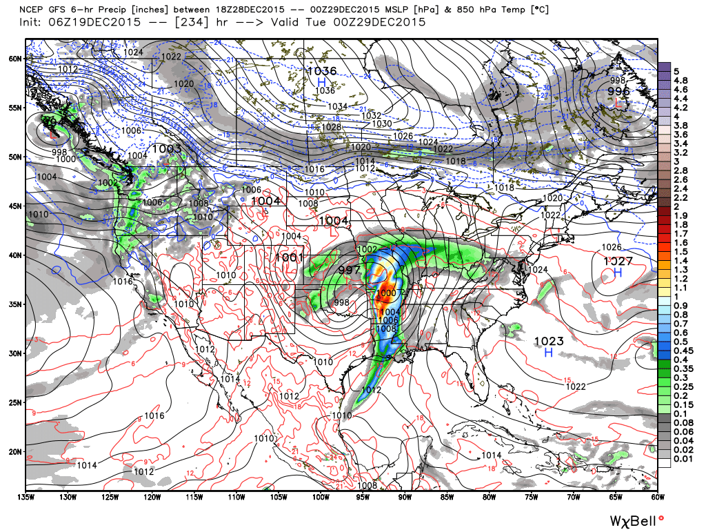
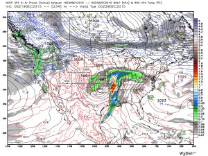
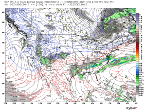 Looking ahead, an active close to 2015 appears to be in the cards. Model solutions at this distance have ranged from a major winter storm to a flooding rain threat. We’re not confident on either idea at this point. Without blocking, it’ll be mighty tough to get anything wintry from this storm, and we also note models have been overdoing rainfall totals in the 5-10 day range as of late. That said, is this the storm that can begin to set us up for the expected overall pattern change to winter coming in January?
Note the wild differences between the GFS, GEM, and European for the storm leading up to New Years.
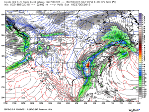
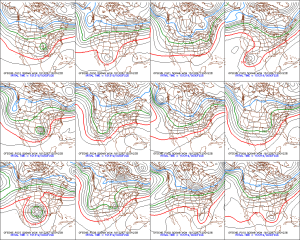
 When we turn to the ensembles to attempt to gain a clearer picture of what we can expect, we see they are of no help either.
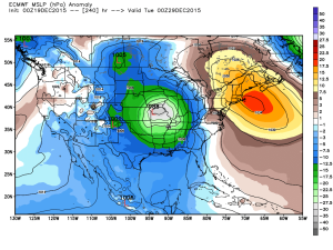
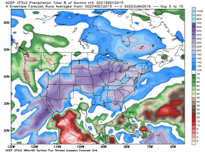
 Are we confident of a storm coming to wrap up 2015? Absolutely, but, again, far less confident on the specifics from this distance. An overall wetter than average pattern is likely, however.
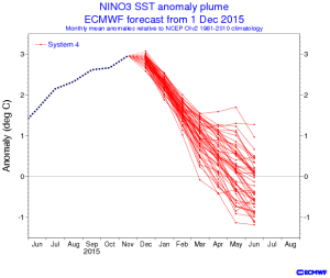
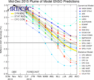
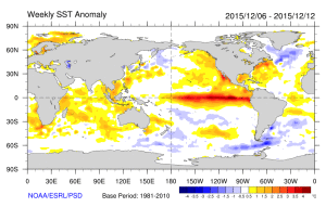
 To wrap things up this morning we still note a favorable SST profile for wintry conditions mid and late winter. In other words, hang in there winter fans. 🙂
 By the way, a major crash is coming that will send us into a La Nina by the second half of 2016. The implications this can have are vast, and include an active severe season and big time Atlantic tropical season.