Category: Winter Storm

More Active Changes In Store…

Thr.

Fri.

Sat.

Sun.

Mon.

Tue.

Wed.

 Status-weather-clouds-icon

 Status-weather-clouds-icon

 Status-weather-showers-day-icon

 Status-weather-snow-scattered-day-icon

 Status-weather-clouds-icon

 Status-weather-showers-scattered-icon

 Status-weather-snow-scattered-day-icon

13/ 39

32/ 60

33/ 51

27/ 38

21/ 38

30/ 40

19/ 35

– – –

– – –

Light

Light

– – –

Light

Light

Forecast Updated 03.13.14 @ 7:39a

Thankful For That March Sun…It’ll be a frigid start to your Thursday with many reports of lower teens across the region, including wind chill values around zero.  That said, that strong March sun angle will help temperatures zoom to near 40 with a mostly sunny sky Thursday afternoon.

We’ll do even better than that on Friday, once again with a mostly sunny sky.  We’ll introduce a strong southwest wind into the mix Friday, but this will be a warmer breeze so we’ll take the trade off, right?!  Needless to say, we’ll wrap up the work week with beautiful conditions!

Colder Weekend; Watching A Southern Storm…After another mostly pleasant Saturday, a cold front will blow through here Saturday afternoon.  At the same time, we’ll keep our eyes on a developing wet southern storm system.  Latest guidance keeps this storm south of our region, but we’ll keep an eye on things.  A light shower is possible Saturday morning.  Colder air will blow into town Saturday night and Sunday.

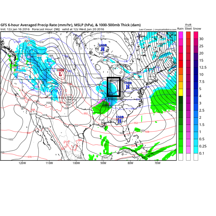
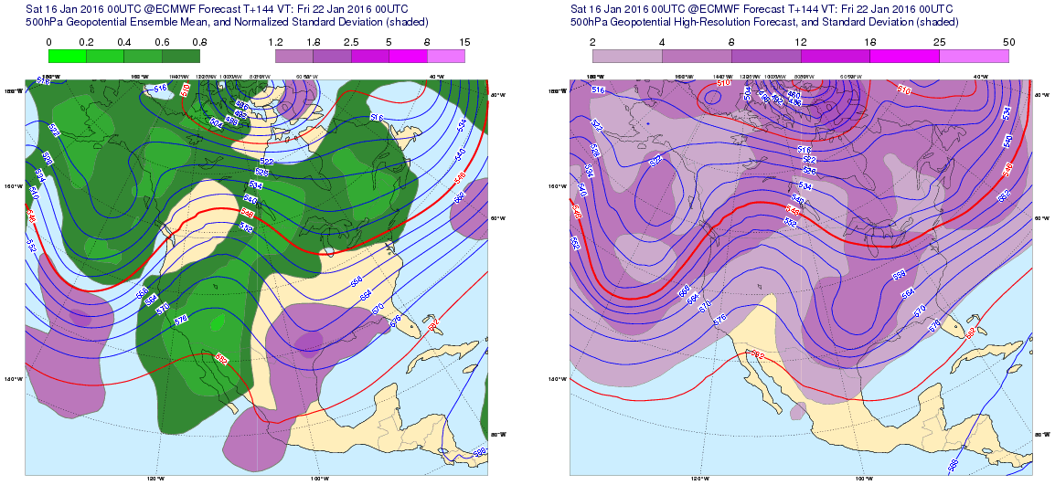
Headaches Next Week…Model solutions vary wildly for next week.  Case in point, the Wednesday afternoon run off the powerful European forecast model suggests a snow storm and cold conditions Tuesday into early Wednesday.  All the while, the GFS takes the storm along the Canadian border and results in a much warmer and drier solution here with highs near 60.  We’re leaning more towards the European in this situation, but not fully buying in just yet to the locked and loaded snow storm solution.

It’s important to note the GFS operational run doesn’t agree with it’s own ensembles so this is one of the main drivers with us at least “leaning” more towards the European solution at this juncture.  We’ll make sure that we keep a close eye on the Tuesday-Wednesday period and update accordingly.  For now we’re going with a rain-to-snow situation Tuesday with potentially accumulating snow falling Tuesday night into early Wednesday.

* This morning we note the European is onto a warmer solution, as well, but before we change our forecast all over the place, we prefer to look over afternoon data and will update things accordingly later this evening for next week.

Upcoming 7-Day Precipitation Forecast:

  • 7-Day Snowfall Forecast: 1-3″
  • 7-Day Rainfall Forecast: 0.25″

twic

For weather updates and more “behind the scenes” data on the go, be sure to Follow Us on Twitter @indywx or become a Friend of IndyWx.com on Facebook!

images

Permanent link to this article: https://indywx.com/more-active-changes-in-store/

Busy Morning; Quick Weather Word.

It’s an extremely busy morning here and we won’t have time to post the fresh 7-Day forecast until this evening.  After a round of thunderstorms overnight, precipitation has now transitioned…

You must be logged in to view this content. Click Here to become a member of IndyWX.com for full access.  Already a member of IndyWx.com All-Access?  Log-in here.

Permanent link to this article: https://indywx.com/busy-morning-quick-weather-word/

Catching Up After A Day Outside Enjoying This Weather…

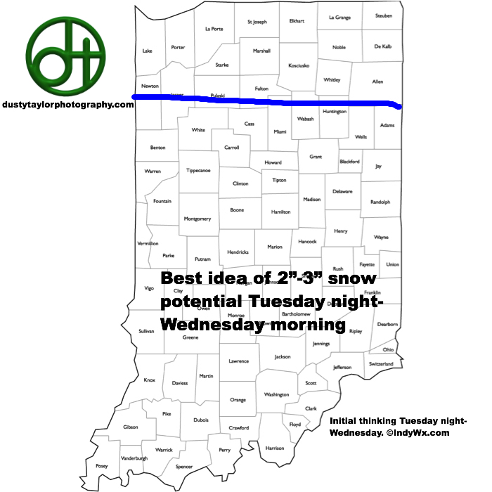
1.) We don’t really have any changes to the going snowfall accumulation forecast we have out concerning Wednesday.  We think Indianapolis accumulates 2″, with heavier amounts north of the city…

You must be logged in to view this content. Click Here to become a member of IndyWX.com for full access.  Already a member of IndyWx.com All-Access?  Log-in here.

Permanent link to this article: https://indywx.com/catching-up-after-a-day-outside-enjoying-this-weather/

Spring Tease Through Tuesday; Back To Winter Wednesday.

Mon.

Tue.

Wed.

Thr.

Fri.

Sat.

Sun.

 Status-weather-showers-day-icon

 Status-weather-clouds-icon

 Status-weather-snow-scattered-icon

 Status-weather-clouds-icon

 Status-weather-clouds-icon

 Status-weather-showers-day-icon

 Status-weather-clouds-icon

34/ 60

40/ 63

18/ 40

10/ 35

27/ 53

32/ 49

28/ 40

Light

– – –

Light

– – –

– – –

Light

– – –

Forecast Updated 03.10.14 @ 7:55a

Windy Warm Up…A weak weather system will scoot north of IND this morning, but may be close enough to push a couple of very light showers into our northern suburbs during the mid to late morning period.  We note the latest HRRR model does just that.  Precipitation amounts, if any, north of the city will be very light and not much more than a trace. Otherwise the big story today will be a gusty southwest wind and much warmer temperatures. We think highs zero in on the 60 degree mark by this afternoon as southwest winds gust over 30 MPH.

This then sets the stage for a “chamber of commerce” weather day Tuesday with lots of sunshine and temperatures in the lower 60s.

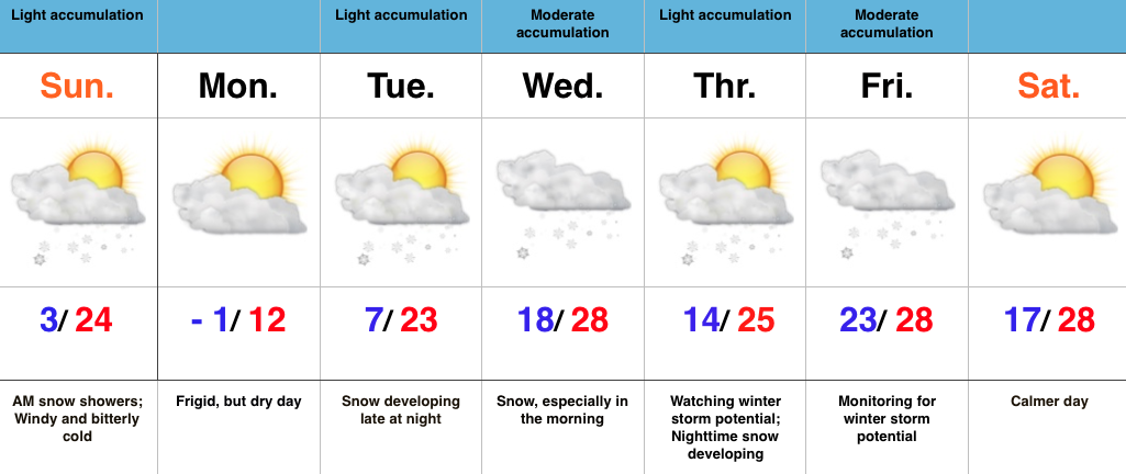
Wintry Trouble Brewing…We continue to monitor the “goings on” for an accumulating snow event in here on Wednesday.  Low pressure will scoot across southern portions of the state Wednesday morning and help spread what will initially be rain into the region during the wee morning hours.  As the low deepens heading east it’ll tap much colder air looming just north of our area and result in a transition from rain to snow Wednesday morning from north to south.  A heavy, wet snow is likely to fall during the mid to late morning hours before ending.  The other aspect of this system will be a very stiff northeast wind and this will lead to blowing and drifting problems for some. Our expected snowfall accumulation idea ranges from 2-5″ of heavy, wet snow north of the city with 2″, or less, anticipated for the city and points south.  We’ll fine tune these amounts later, but feel our initial idea remains a good one this morning.

Thursday will return to the dry theme though much colder than what the early week period was.

Questions Heading Into Next Weekend…Forecast models are having difficulty handling what’s going to be a very active northwest flow regime later in the weekend into the following week.  We’re concerned at least one of the systems diving in from Canada has the chance to phase with the southern stream and crank out another snow event for the Ohio Valley during the time frame mentioned above, but we’re not confident on which system this will be just yet.

Upcoming 7-Day Precipitation Forecast

  • 7-Day Snowfall Forecast: 2-5″
  • 7-Day Rainfall Forecast: 0.10″

twicFor weather updates and more “behind the scenes” data on the go, be sure to Follow Us on Twitter @indywx or become a Friend of IndyWx.com on Facebook!

images

Permanent link to this article: https://indywx.com/spring-tease-through-tuesday-back-to-winter-wednesday/

Sunday Afternoon Update: Awesome Stretch Of Weather Before Dramatic Changes.

Good Sunday afternoon!  We’re enjoying beautiful weather and conditions will only improve Monday into Tuesday.  That said, a potential winter storm looms Wednesday.  Additionally, we’re keeping a close eye on…

You must be logged in to view this content. Click Here to become a member of IndyWX.com for full access.  Already a member of IndyWx.com All-Access?  Log-in here.

Permanent link to this article: https://indywx.com/sunday-afternoon-update-awesome-stretch-of-weather-before-dramatic-changes/