The set-up:
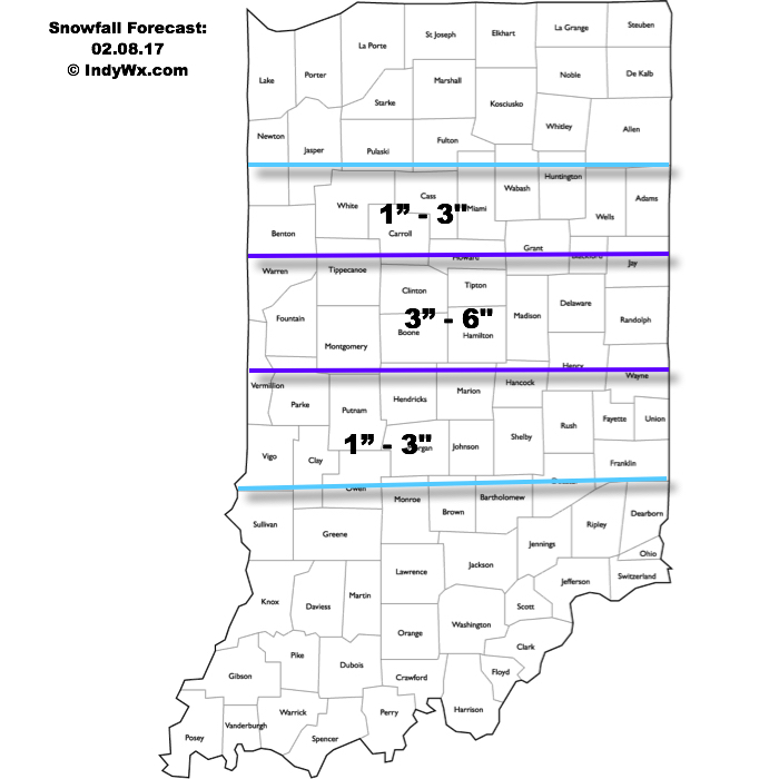
A cold front is stalled across TN and lower Ohio Valleys this morning. Meanwhile, upper level energy is moving out of the north-central Plains. This upper level energy will continue to slide southeast and “feed” a developing surface low along the stalled front by evening. Strong frontogenesis is forecast and this will aid in development of localized heavy snow bands and associated intense snowfall rates by afternoon, continuing into the evening. (If you’re interested in learning more about frontogenesis and it’s impact on winter weather, please read this fantastic paper). Here’s our updated snowfall forecast. Please note snow amounts won’t necessarily follow the clean lines below, but this is our best idea as of now.
 Timing:
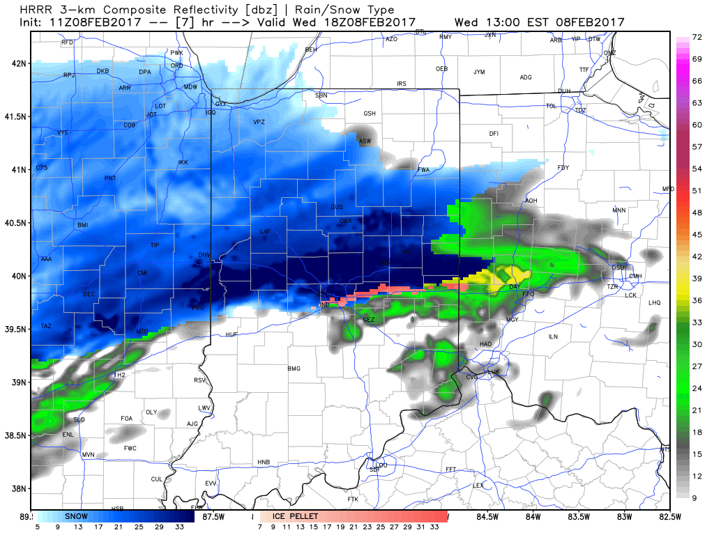
We expect initial light to moderate snow to impact northern areas this morning, but it’s not until this afternoon when the “real deal” begins. The onset of heavy snow will set-up just north of the city and the “bulls eye” with this event from a heavy snow perspective may very well paint itself across Indy’s northern suburbs, including several hours of heavy, wet snow from 12p-5p. Moderate to heavy snow will then shift south to encompass the city, itself, mid to late afternoon, including the rush hour. We highly recommend getting home early today if at all possible as the heaviest snowfall rates for the city, itself, will likely center on the evening rush. Things will likely be very, very messy for travel as heavy wet snow falls. In periods of heaviest snow, visibility near zero can be expected, especially just north of the city.
Forecast radar 1p, courtesy of Weatherbell.com.

Forecast radar 4p, courtesy of Weatherbell.com.

Forecast radar 6p, courtesy of Weatherbell.com.
Snowfall should begin to diminish and pull east between 7p-8p for most of central Indiana. Cold air will follow as lows tonight dip into the middle teens for most with a significant snowpack down. Highs Thursday will only top out around 20.
As always, be sure to follow us on social media (Twitter: @indywx, Facebook: IndyWx.com, Instagram: IndyWxCom) for more updates on the go! Be safe and happy snow to all!
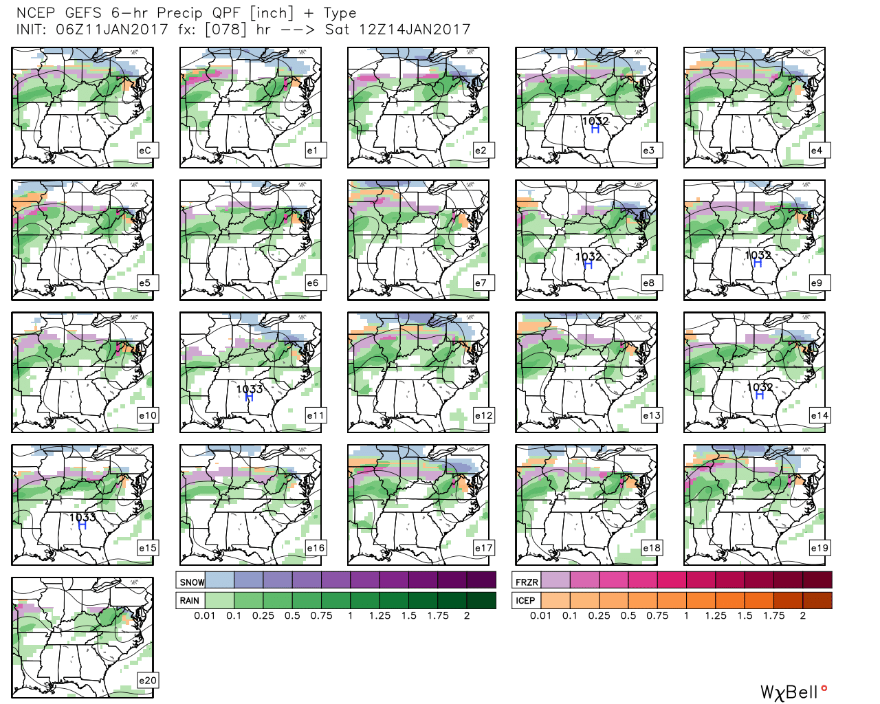 GFS ensemble members above show the overall good agreement on a central IN ice set-up for portions of the weekend.
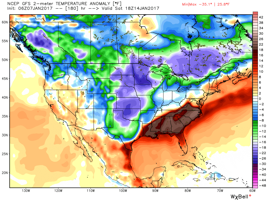
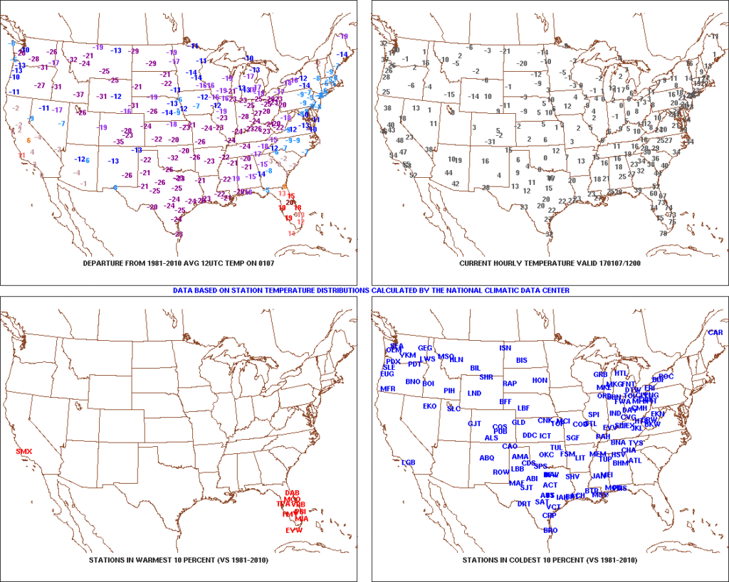 2.) Expanding Snowpack: 65.4% of the country is covered in snow this morning. The cold, arctic high suppressed the winter storm threat south as we alluded to in previous posts. Places across the Deep South that aren’t used to wintry precipitation are waking up to snowy and icy conditions this morning, including MS, AL, GA, SC, and into the Mid Atlantic. Heavier snowfall accumulated across east TN, including 5″-8″ in the high country. Heavy snow also fell through western and central NC and Blizzard Warnings are up in rare areas including VA Beach this morning.
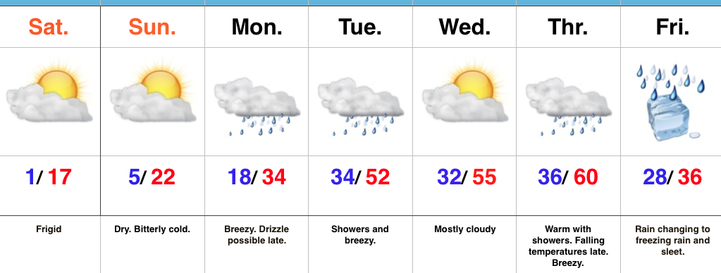
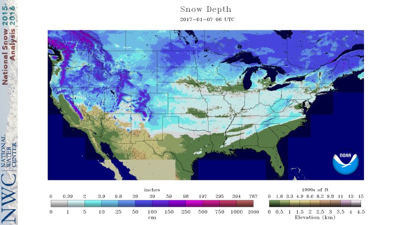 3.) Moderating Temperatures: Our air flow will back around to the southwest and this will help temperatures begin to moderate early next week (around freezing Monday and all the way to around 50 Tuesday). As the moderating trend gets underway, we may have to deal with a brief period of freezing drizzle/ freezing rain Monday evening.
 4.) Rainy Midweek: A more significant surge of moisture will arrive midweek and result in periods of moderate to heavy rain Wednesday PM into Thursday. Potential is present for 1″+ during this timeframe.
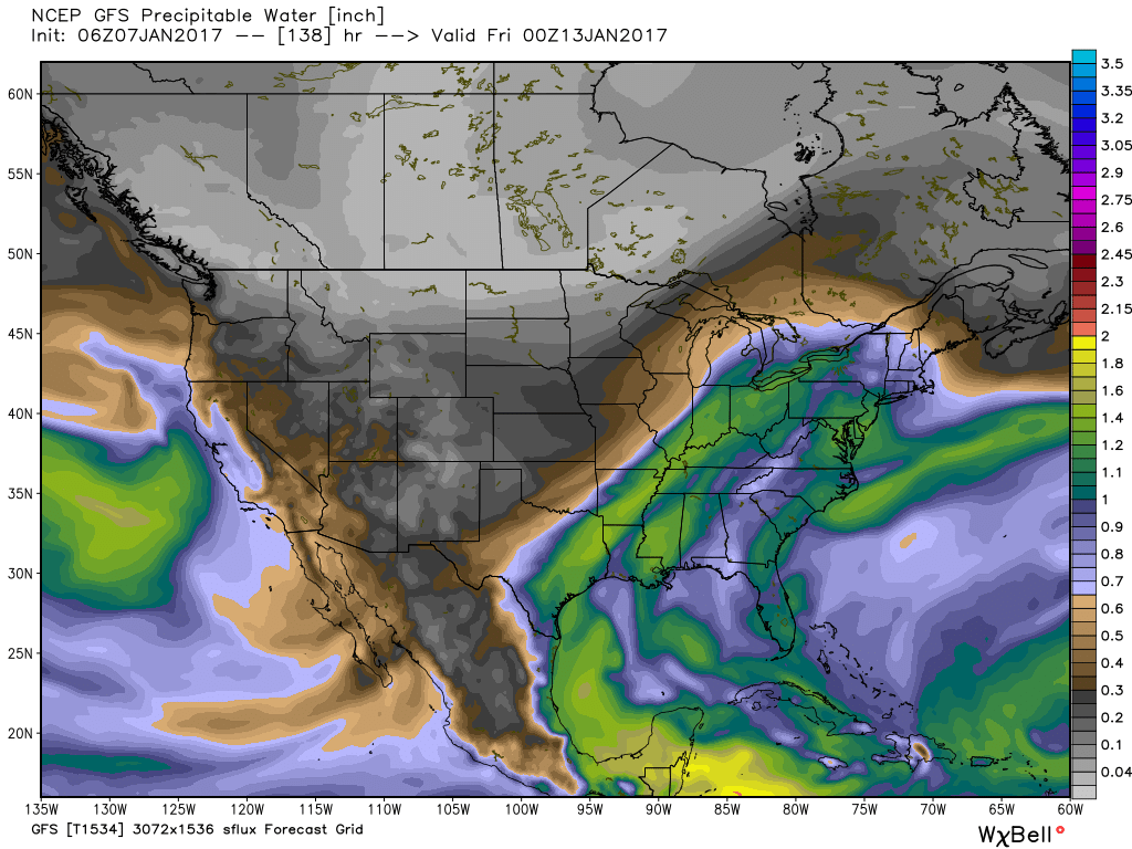 5.) Weekend Wintry “Fun And Games?” A tremendous battle will take place next weekend between a strong and sprawling arctic high pressure system and the southeast ridge. In between it’ll be fascinating to watch things unfold, and as you’d imagine, that includes Indiana. Despite the southeast ridge flexing it’s muscle, the concern here is that the shallow dense arctic air will “ooze” south and present an icy set-up for portions of the Ohio Valley and Mid West for the weekend. We still have some time to watch this, but the potential of significant icing is very much present for some and this will require a close eye through the week.