
 Highlights:
- Foggy days
- Late week winter storm
- Much colder air returns
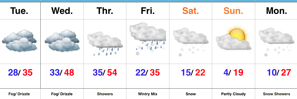
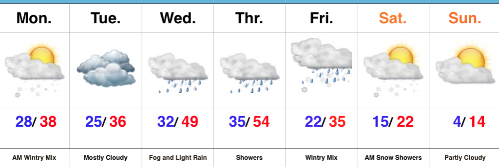
Low Beam Weather…Widespread low clouds, fog, and areas of drizzle will impact the region as we progress through the next couple days. If venturing out early this morning, be extra careful as sub-freezing temperatures combined with the moisture has created slick spots- particularly on side streets and sidewalks.
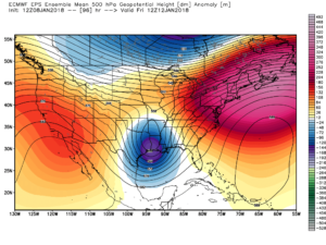
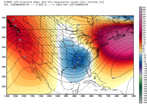
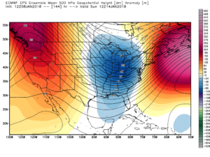
A southerly flow will take control briefly Wednesday evening into Thursday and help lead to a quick “thaw,” along with more widespread rain showers Thursday. This is in association with a cold front that will sink south through the state Thursday night into Friday morning. As this is taking place, an area of low pressure is expected to develop along the tail end of the cold front and track northeast. That low will spread moisture back into what will be an airmass turning much colder Friday into Saturday. The end result will be a potentially significant event of an icy mix (sleet and freezing rain) transitioning to snow Friday into Saturday. Much colder air will pour in here over the weekend and additional upper energy will result in widespread snow early next week.
If you have travel plans Friday into Saturday, please keep abreast of the latest forecast. A significant event looms, but we’re still a couple of days from being able to put the heaviest snow zone in “concrete.”
Upcoming 7-Day Precipitation Forecast:
- Snowfall: 3″ to 6″
- Rainfall: 0.50″ to 1.00″
 Highlights:
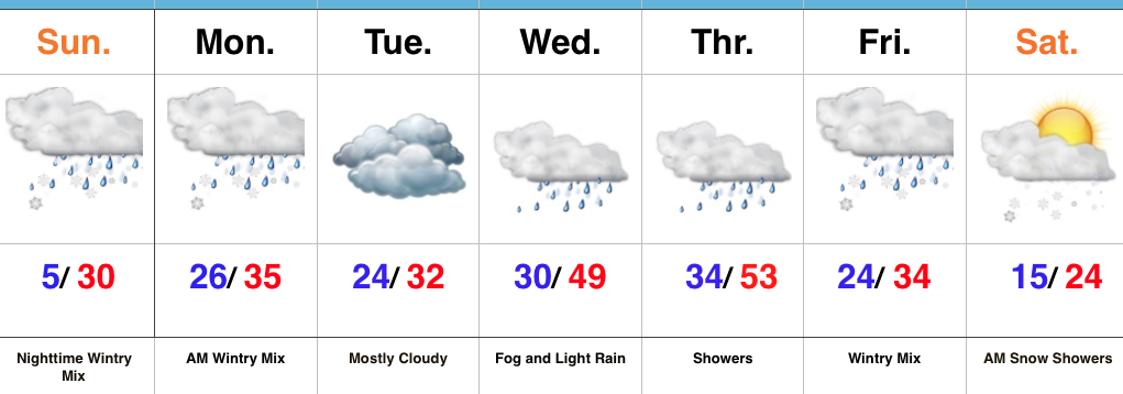 Highlights: