
You must be logged in to view this content. Click Here to become a member of IndyWX.com for full access. Already a member of IndyWx.com All-Access? Log-in here.
Category: Winter Storm
Permanent link to this article: https://indywx.com/video-ready-for-wintry-fun-and-games/
Dec 12
Latest Thoughts On Early Next Week; Long Range Update Into Early Jan…
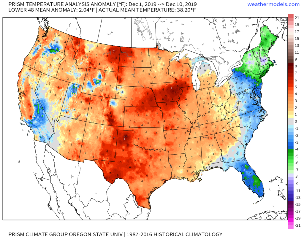
Through the 11th, December is running 1.6° above normal in Indianapolis. This milder than normal theme is rather widespread so far this month through the Lower 48.
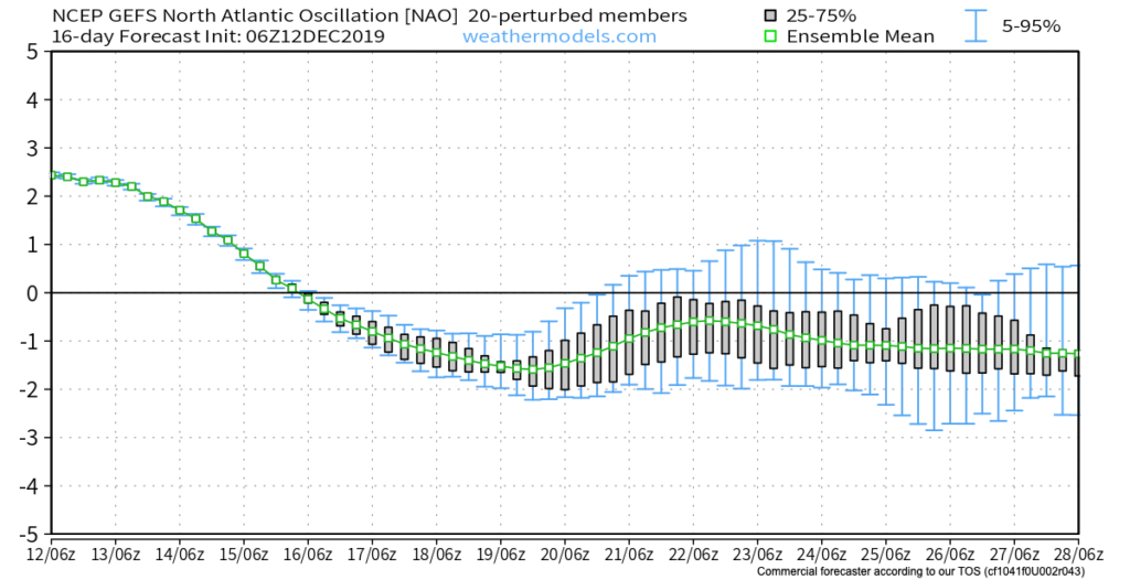
As we look ahead, there are continued reasons to believe the pattern will begin to go through more of a transition towards an ultimately more sustained cold pattern as January evolves. We think that transition really started early this week and will feature plenty of “back and forth” over the the next 2-3 weeks before settling into the more sustained cold regime. There will be storms and “rumors of storms” that we’ll have to track through the transitional period, including smack-dab in the heart of the holiday season this year.
The latest JMA Weeklies (update each Thursday morning) shows this “fight” over the next 1-3 weeks.

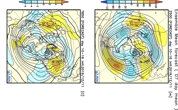
Without blocking in place, the way the JMA Weeklies handle the pattern is likely, but the Weeks 2-3 time period does have a chance to offer up a headache or two as the models may begin to adjust to an increasingly “blocky” time of things.
There are at least “hints” that some of the teleconnections that would promote more of a blocky pattern are beginning to align. We caution though that this does take time for these feature to mature and begin to ultimately have a greater impact on our pattern.

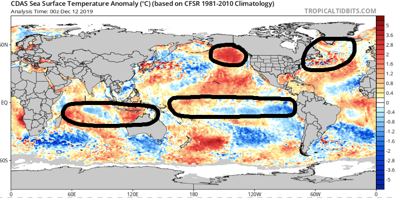
As we revisit the latest SST configuration, there’s continued reason to be very excited about this winter if you’re a fan of colder and snowier than normal conditions. We always knew December would be the tough month before the pattern settles into the mean winter pattern late December into March. Now, time to just sit back and watch things unfold. 🙂
Now, back to the short-term. Despite forecast models very much still in (2) separate worlds, we’ve dug into analogs and looked through countless similar patterns from the past. As model consensus develops (hopefully sooner rather than later), let’s see if they (speaking specifically to the GFS and European) converge on this similar solution for best chances of accumulating snow:
We still have many details to sort through and we caution that this system is far from being etched in stone. You’ll want to keep close tabs on latest developments over the next couple of days. With that said, we’re looking for potential wintry impacts here across central Indiana beginning Sunday night and continuing through Monday.
This evening’s video update will focus solely on the Sunday-Monday system, including the latest model developments from 12z. Have a great Thursday!
Permanent link to this article: https://indywx.com/latest-thoughts-on-early-next-week-long-range-update-into-early-jan/
Nov 11
VIDEO: Detailed Analysis Of Today’s Impactful Snow And Associated Lake Effect/ Record Cold To Follow…
You must be logged in to view this content. Click Here to become a member of IndyWX.com for full access. Already a member of IndyWx.com All-Access? Log-in here.
Permanent link to this article: https://indywx.com/video-detailed-analysis-of-todays-impactful-snow-and-associated-lake-effect-record-cold-to-follow/
Oct 13
Harvest ’19: Tis The Season For Changeable Weather Patterns…
*Starting November 1st, our weekly agriculture and harvest updates will transition to weekly winter storm outlooks. We’ll maintain a lot of the feedback y’all have provided with the new weekly winter products. Come next growing season, the weekly agriculture and severe weather updates will return.
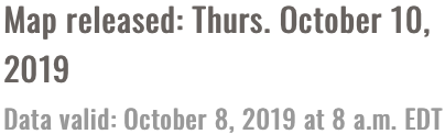
Forecast Period: 10.13.19 through 10.20.19
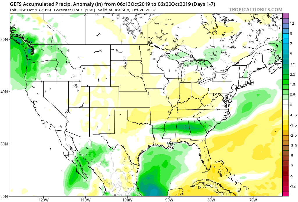
7-Day Precipitation: Below average precipitation is expected through the period.
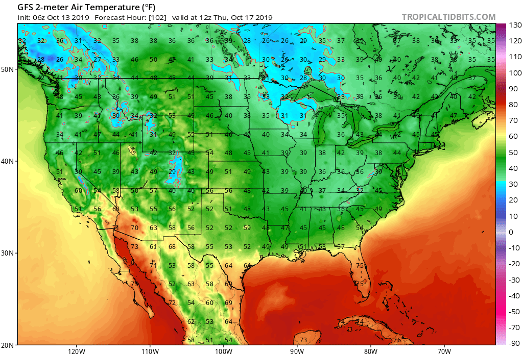
7-Day Temperatures: Below average temperatures are expected overall throughout the period.

Severe Weather: Severe weather isn’t anticipated through the period.
Frost/ Freeze: Many across the central and northern Ohio Valley have now recorded their first frost or freeze of the season. Additional frosty mornings are ahead during the upcoming forecast period with Thursday morning looking like the coldest as of now. The first frost and/ or freeze of the season will continue to advance southeast with the southern Appalachians likely putting an end to their growing season by Thursday morning.
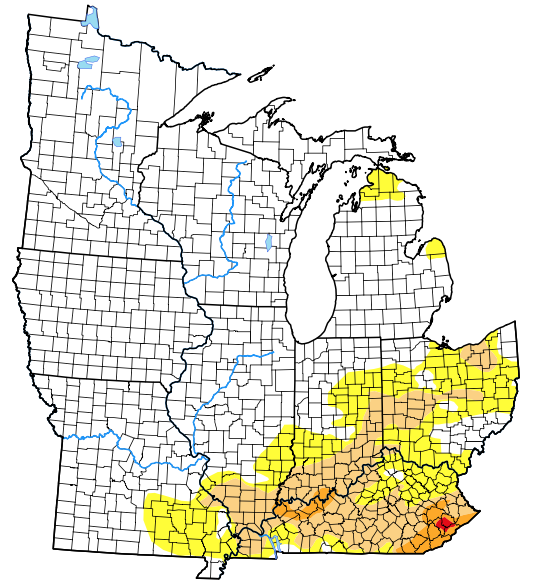
Drought Monitor: The southern and eastern portion of the Ohio Valley remains in either a drought or abnormally dry state. Unfortunately, heaviest rains with Friday’s cold front targeted areas west or north of these areas. While the upcoming week won’t provide significant relief, the drivers behind the pattern ahead promise to deliver more frequent and beneficial precipitation events in the next 2-3 weeks.
Summary: The upcoming 7-day period will feature a quiet and pleasant open to the week before a fast moving system passes Tuesday evening with a round of showers followed by a windy mid-week period. Strong and gusty northwest winds will drive another unseasonably chilly air mass into central Indiana Tuesday night through Thursday before our air flow backs around to the south into next weekend. This will provide for modifying temperatures Friday into Saturday.
Permanent link to this article: https://indywx.com/harvest-19-tis-the-season-for-changeable-weather-patterns/
Feb 20
Morning Video Update: Stormy Saturday Gives Way To Very Strong Winds Sunday; Looking Ahead To March…
You must be logged in to view this content. Click Here to become a member of IndyWX.com for full access. Already a member of IndyWx.com All-Access? Log-in here.
Permanent link to this article: https://indywx.com/morning-video-update-stormy-saturday-gives-way-to-very-strong-winds-sunday-looking-ahead-to-march/