As the calendar turns from July to August, we really begin to increase the amount of research into the upcoming winter season. While still a couple months out from publishing our official Winter Outlook, we did want to touch base on a couple of items.
 The early “baseline” of our ideas focuses on the likelihood of El Nino returning for the upcoming winter season. As we’ve stated many times in the past, each Nino event is different from one another and other ingredients (highlighted above) can play a significant role in ultimately determining the eventual outcome.
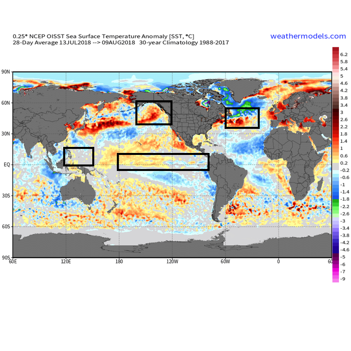
- Weak Modoki (central-based) Nino is expected this winter
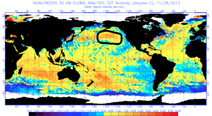
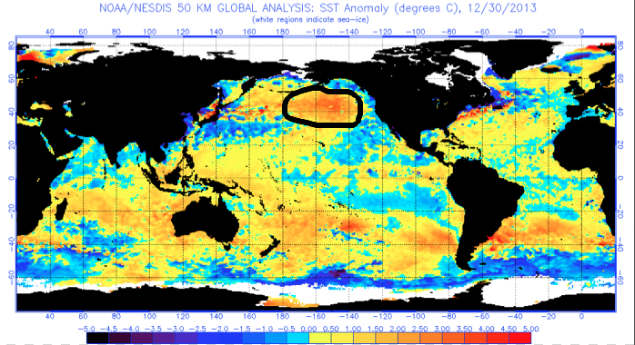
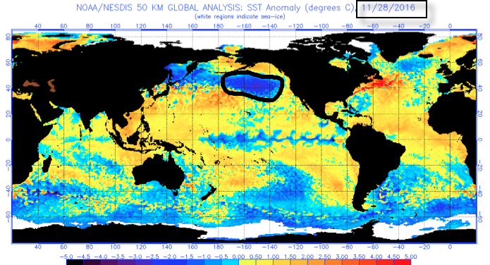
- SST configuration in the NPAC (north Pacific) is perhaps the most “intriguing” item at the moment
- Low solar/ QBO
Somewhat of a surprise is that the majority of longer range, seasonal data is aligning for a cold, stormy eastern winter. Included in the cold, stormy camp are the JAMSTEC, European, and CanSIPS. A few snap shots are included below…

JAMSTEC Sea Surface Temperature Anomalies for meteorological winter (December through February).
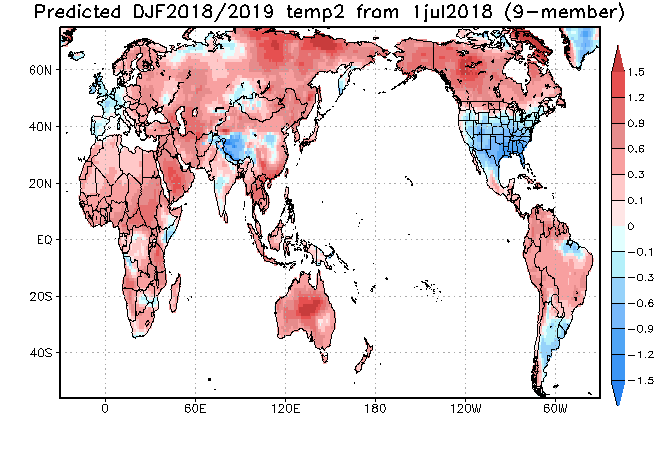
JAMSTEC Surface Temperature Anomalies for meteorological winter.
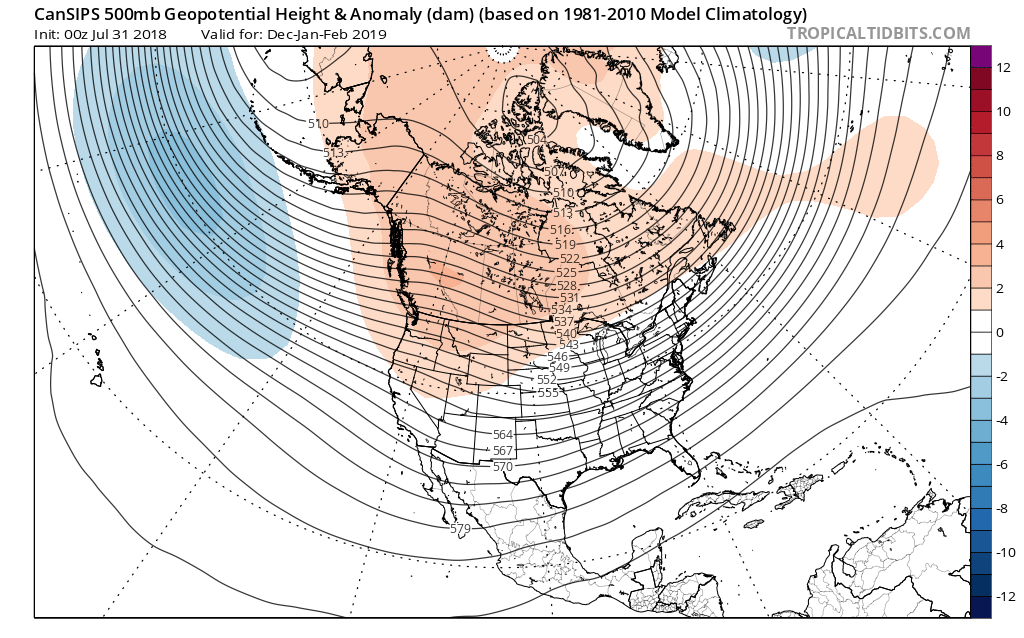
CanSIPS 500mb for meteorological winter.
The CFSv2 is siding with a warmer winter, but it appears as if the model is struggling with the coming Nino and “over-hyping” things. Accordingly, the model results in a blow torch winter. Again, remember, we’re leaning towards a weak, central-based event.

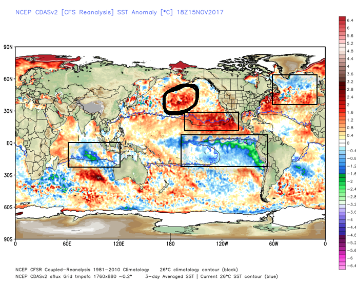
 That sea surface temperature configuration in the northern Pacific argues for western Canada ridging and downstream troughiness such as the JAMSTEC, European, and CanSIPS would imply.
Just wanted to touch base briefly on our early thinking before we release our official 2018-2019 IndyWx.com Winter Outlook in October.


 What makes seasonal forecasting so challenging (and fun :-)) are the multiple features that can impact a forecast. We’ve talked about the importance of ENSO (various types of Nino and Nina events) in past updates, as well as low solar and QBO. All of these moving parts and pieces are coming together in a manner that seems to be favoring more of a cold, wintry regime, locally, this year. Is that us saying another blockbuster 2013-2014 winter awaits? Absolutely not (there are other differences noted above with the SST configuration). However, it is suggesting that this winter will be absolutely nothing like the past couple…