Updated 04.07.24 @ 10:12a Pleasant conditions this morning will give way to an increasingly cloudy sky throughout the afternoon and evening and scattered storms will follow. It continues to appear…
You must be logged in to view this content. Click Here to become a member of IndyWX.com for full access. Already a member of IndyWx.com All-Access? Log-in here.
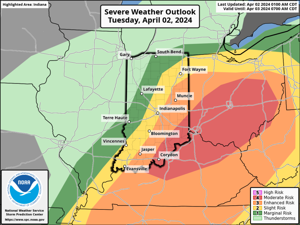
It’ll be important to remain weather-aware this afternoon as a final round of severe storms move through the state. Morning rain will come to an end soon and then we’ll see a “lull” in the action late morning. Upstream satellite images are concerning as it appears we’ll break into sunshine for a while late morning into early afternoon. This will quickly get to work on the atmosphere and aid in a turbulent time of things through the early and mid afternoon. In fact, as the Storm Prediction Center gets a look at the setup post-sunrise, it wouldn’t surprise us if each of the respective risk areas gets pulled back further west.
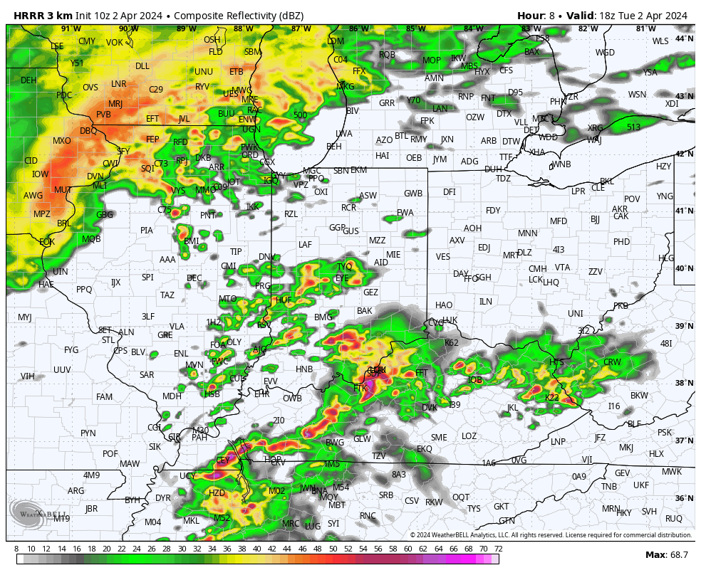
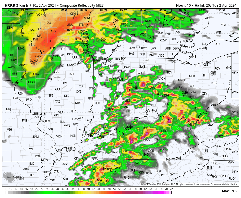
Regardless, storms will redevelop just after lunchtime across western Indiana and intensify on their journey east through the afternoon. By evening, most if not all of the activity will be out of the state.
All modes of severe weather will be possible area-wide today. We’re particularly worried about an elevated tornado outbreak across the Ohio Valley, especially if clearing takes hold for a while late morning. Take warnings seriously if and when they are issued, friends.
Forecast radar 1pForecast radar 3p
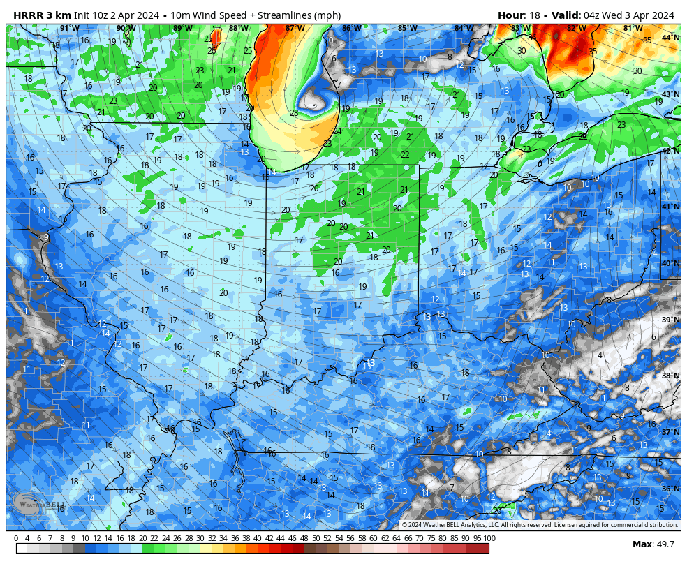
Strong westerly winds will take hold by evening, quickly pushing a colder and more stable airmass into town, thankfully.
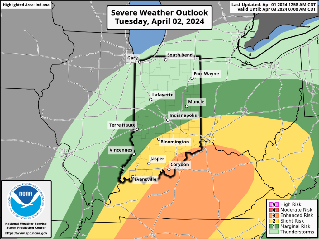
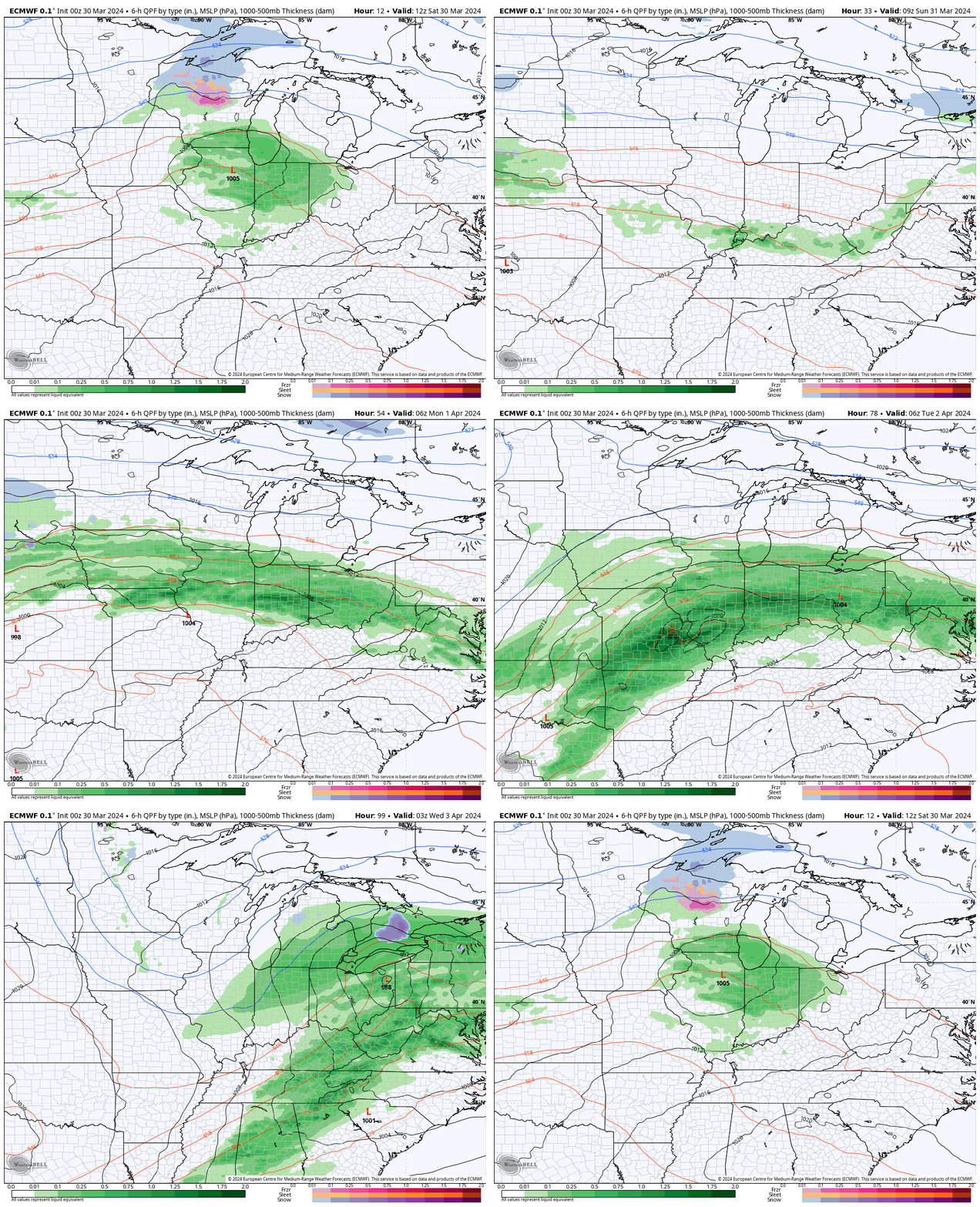
I. Things will turn quite active later tonight and into our Tuesday. Multiple rounds of heavy rain and strong thunderstorms will track across central Indiana. As heavy rain trains over the same area, localized flooding will develop Tuesday morning into the afternoon hours.
A threat of severe weather is also present, including large hail and even a couple tornadoes. Given the current parameters, it wouldn’t be a surprise if the fine folks at the Storm Prediction Center expand the current risk zones a bit further north for both the Day 1 and Day 2 outlooks. We’re still tracking a potential line of severe weather Tuesday PM after the multiple rounds in the morning. We’ll want to remain weather-aware tonight and Tuesday across central Indiana.
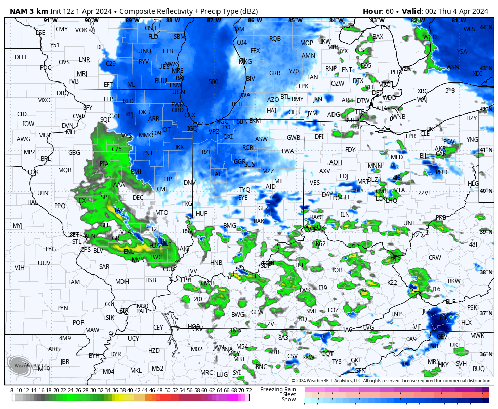
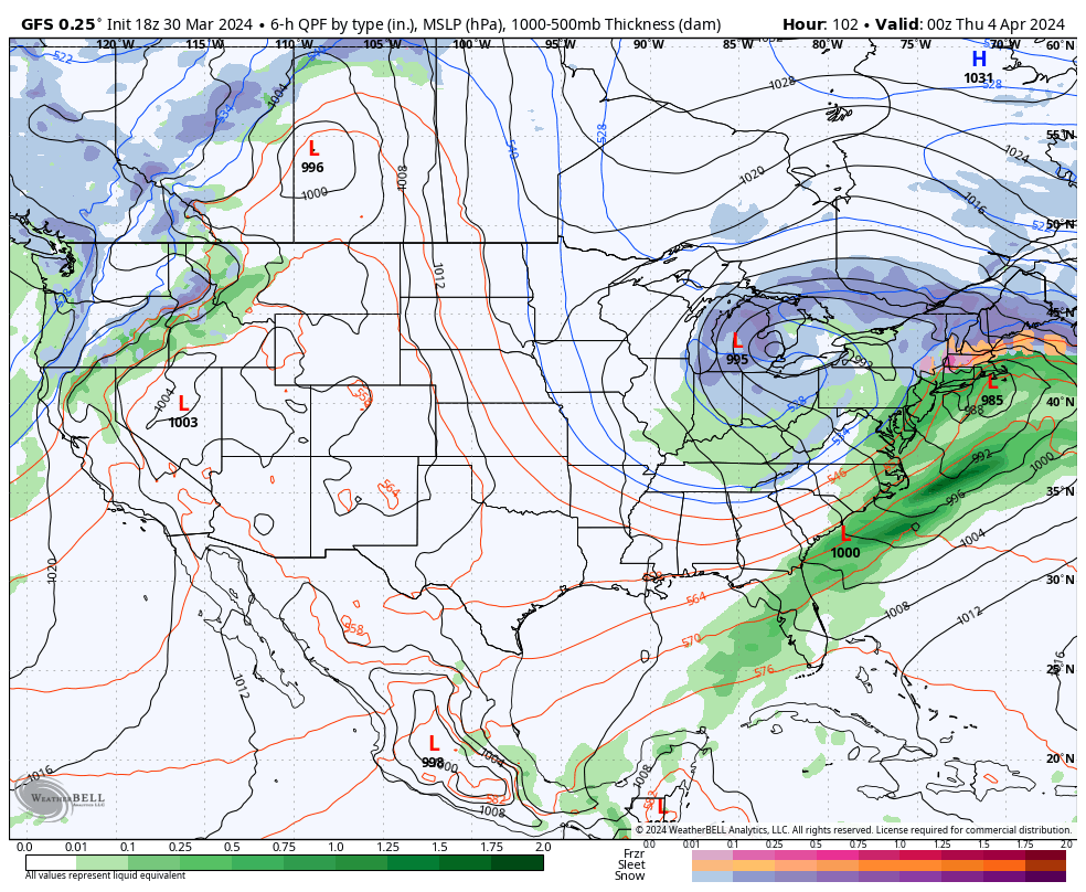
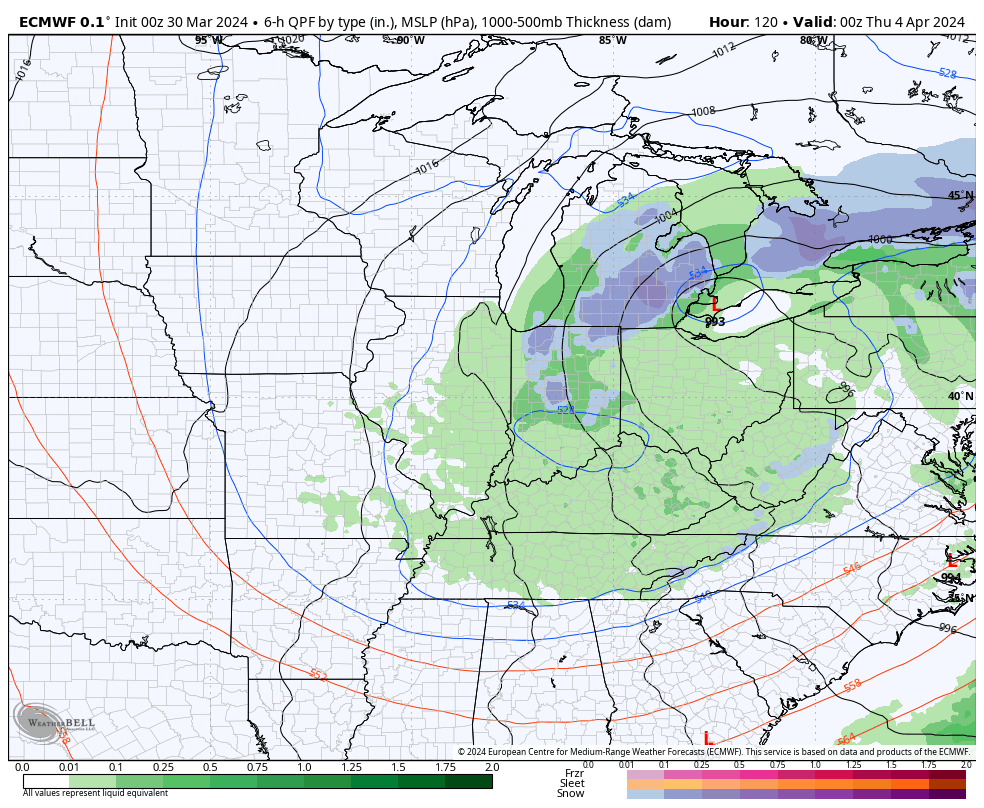
II. Much colder air will pour in here Wednesday and as the closed upper level low swings through the Great Lakes and Ohio Valley, a renewed area of precipitation will expand across the area Wednesday night into Thursday. Rain will mix with and even change to wet snow in spots across central Indiana during this time. Heavier wet snow bursts will lead to slushy accumulation on grassy surfaces.
Northwest winds will result in lowered visibility and a harsh feel (given the time of year) with wind chills into the 10s and 20s at times.
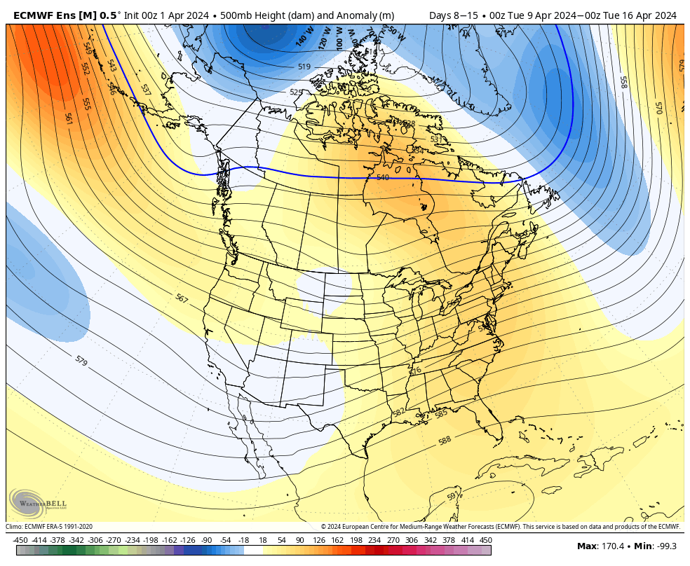
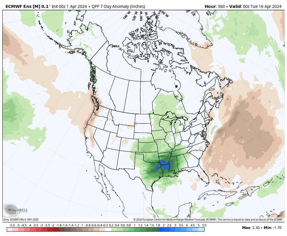
III. While we’ll briefly dry out in the 6-10 day, the pattern continues to present an active look down the road, including above normal rainfall projected in the Week 2 timeframe through the Plains and into the mid South and western Great Lakes region.
All in all, we don’t see any extended periods of dry weather on the horizon over the next few weeks as a whole.
There’s not much, if anything, to change regarding the setup and anticipated outcome of the Easter Sunday through Tuesday timeframe. Periods of heavy rain will get going Sunday PM and we’ll also need to watch for the threat of severe storms not only tomorrow afternoon/ evening but again Monday.
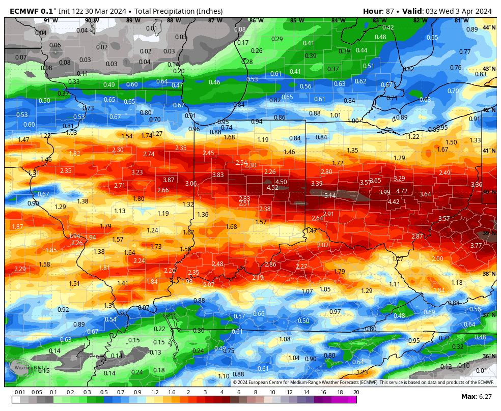
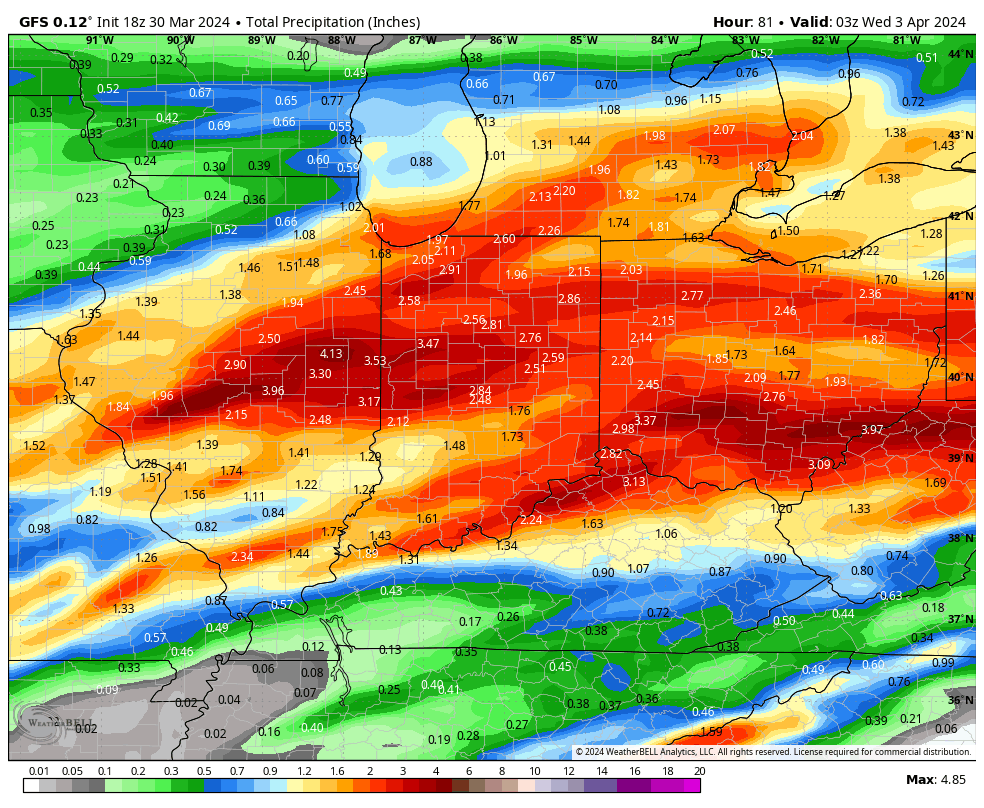
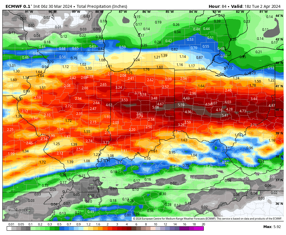
Midday models are latching onto a widespread 2”-4”+ event.
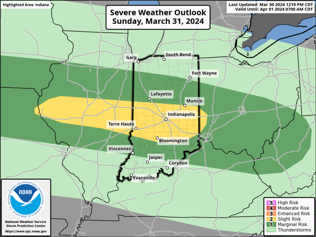
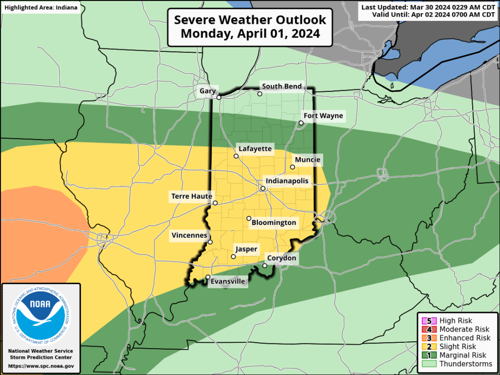
The Storm Prediction Center (SPC) has increased the threat area tomorrow afternoon. Large hail is greatest concern but an isolated tornado can’t be ruled out.
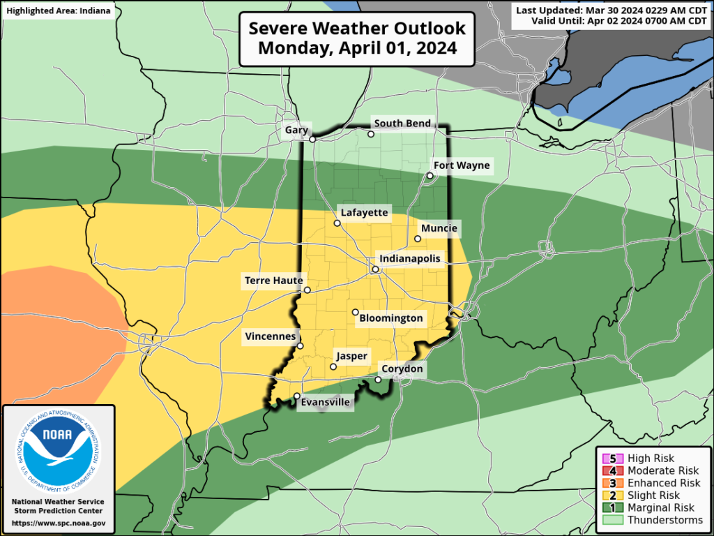
All modes of severe are on the table Monday, including tornado potential once again.
If all this wasn’t enough already, a much colder air mass will plunge into the region by midweek allowing rain to mix with and change to wet snow Wednesday evening into Thursday morning. The snow may even be heavy enough for slushy accumulations in spots.
Spring at its finest across the great Hoosier state…
The combination of a quasi-stationary frontal boundary, increasingly warm and humid air, and multiple waves of low pressure riding along the aforementioned boundary will lead to several rounds of locally heavy rain and also pose a strong to severe storm risk as we go through the early stages of the new week.
Precipitable water values (PWATs) will approach 1.5” to 2” at times early week (a tough feat to come by this time of year). This only raises confidence in the opportunity for this setup to generate periods of heavy, and eventually excessive, rainfall.
Widespread 3”+ totals can be expected by the time all is said and done, with locally heavier amounts.
If the heavy rain event wasn’t enough, we also need to be on guard for the threat of severe storms Sunday and Monday.
In particular, it’s Monday’s risk of severe that has us most concerned, including all modes (hail, wind, and a TOR threat). We recommend reviewing your family’s severe weather safety plan and make sure to have a way to receive any warnings that may be issued.
The heavy rain event will come to an end by Tuesday evening, but if we didn’t have enough to track already, we’ll add in the potential of rain to mix with wet snow Wednesday. Regardless, expect a much colder and blustery time of things as this bigger storm departs by midweek.