You must be logged in to view this content. Click Here to become a member of IndyWX.com for full access. Already a member of IndyWx.com All-Access? Log-in here.
Category: Windy
Permanent link to this article: https://indywx.com/2018/03/01/video-march-roaring-in-like-a-lion/
Feb 28
VIDEO: Widespread Rain Arrives Late Tonight; Colder Pattern Looms…
You must be logged in to view this content. Click Here to become a member of IndyWX.com for full access. Already a member of IndyWx.com All-Access? Log-in here.
Permanent link to this article: https://indywx.com/2018/02/28/video-widespread-rain-arrives-late-tonight-colder-pattern-looms/
Feb 26
Monday Morning Rambles: Pleasant Open To The Week…
I. High pressure will dominate the early part of the work week, helping to supply plentiful sunshine and seasonably mild temperatures. We’ll continue to enjoy the much-needed dry theme the weekend ended on!
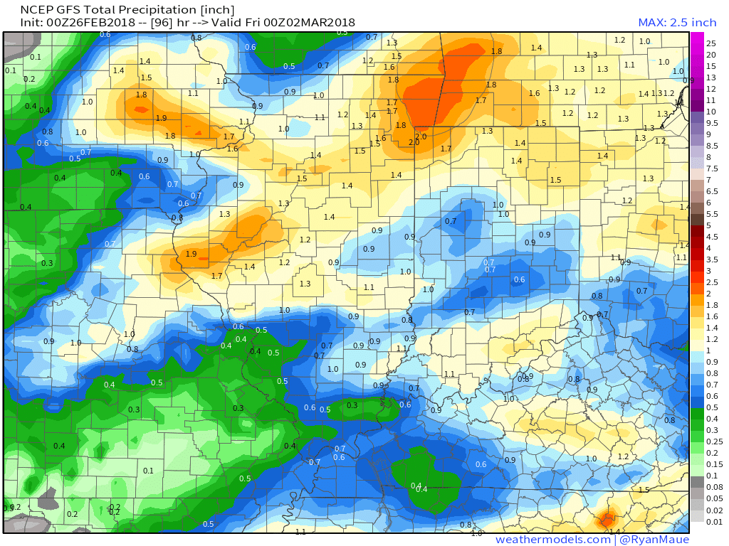
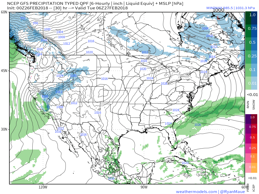 II. Our next weather maker will arrive midweek and provide a few showers Wednesday (not a huge deal from a precipitation perspective). However, as a deepening surface low tracks into the Great Lakes Thursday morning, a period of heavier rain and even thunder is possible. In general, this looks like a 0.50″ to 1.00″ type event.
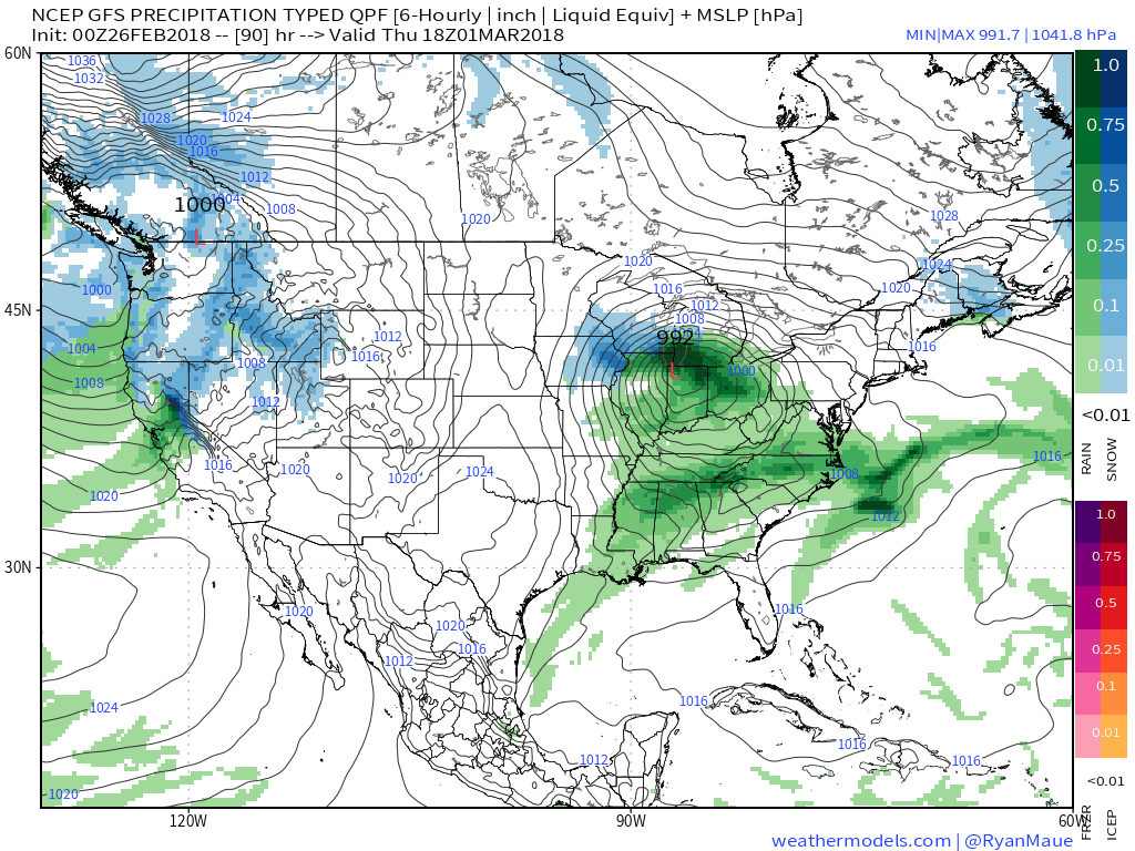
 III. Somewhat cooler air will whip in behind the low, allowing leftover precipitation to end as a couple wet snowflakes across the northern half of the state Friday morning. The bigger story will be the “bumpy” start to Friday with strong and gusty north winds.
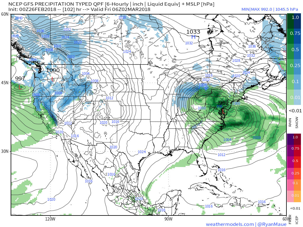 IV. High pressure returns for the weekend and with it will come a return of sunny skies. Though the mornings will be frosty, afternoon temperatures will “warm” to pleasant levels, especially with the increasingly strong early-March sun angle.
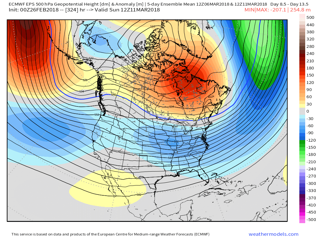
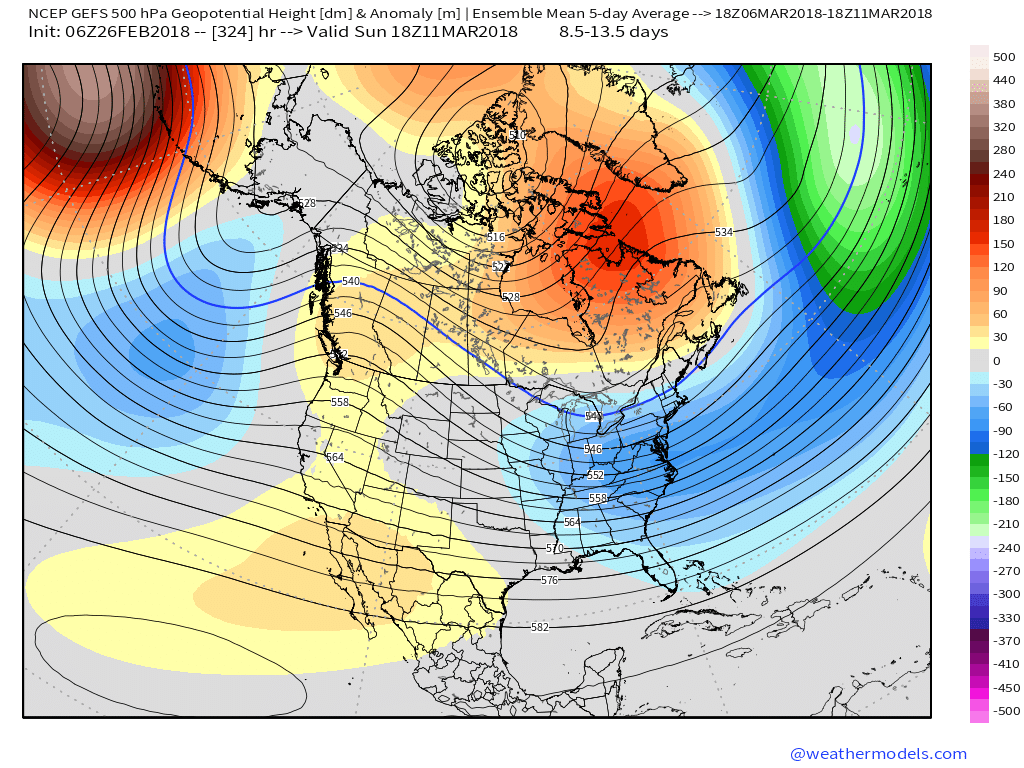
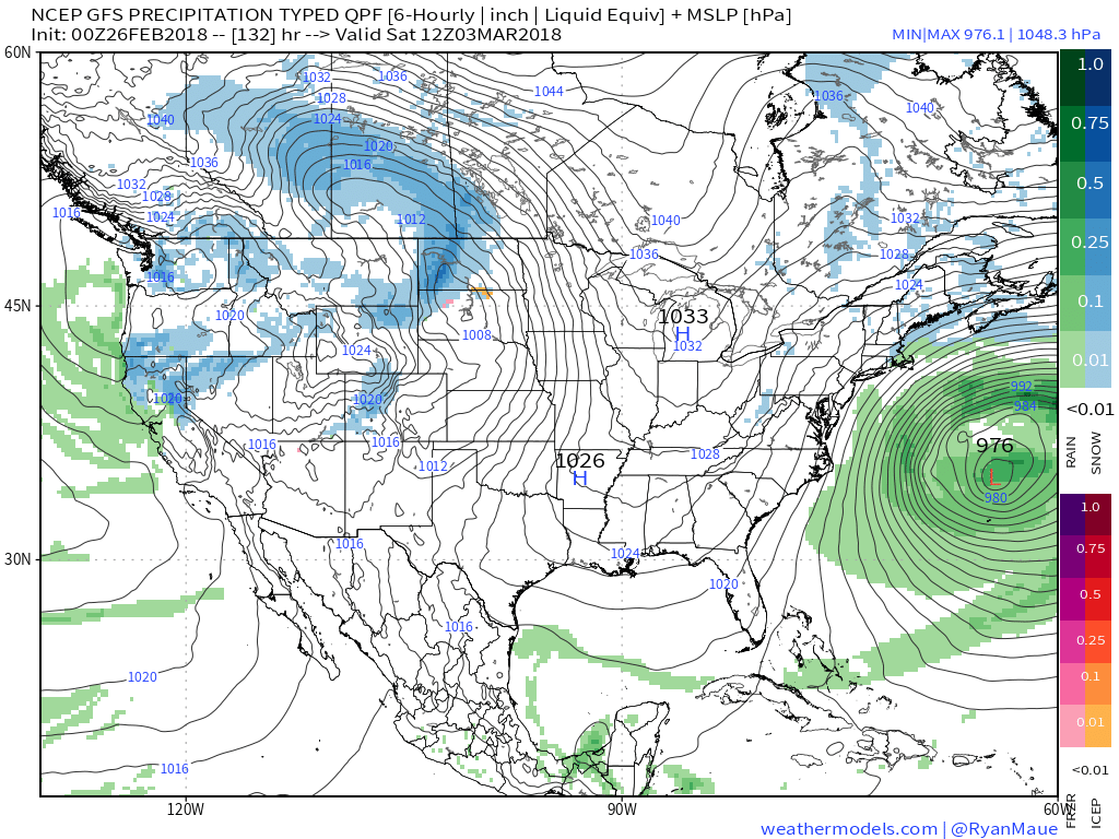 V. Looking ahead, let’s keep a close eye on the second week of March. Potential is present for a stormy period to emerge under the block. We note the GEFS and EPS (respective ensembles of the GFS and European models) are in relative agreement on a stormy, cold look during this time frame. While far too early for specifics, the potential is there for a rather widespread wintry event from the Plains into the Northeast.
Permanent link to this article: https://indywx.com/2018/02/26/monday-morning-rambles-pleasant-open-to-the-week/
Feb 04
VIDEO: Arctic Air Arrives This Afternoon; Snowy Open To The Week…
You must be logged in to view this content. Click Here to become a member of IndyWX.com for full access. Already a member of IndyWx.com All-Access? Log-in here.
Permanent link to this article: https://indywx.com/2018/02/04/video-arctic-air-arrives-this-afternoon-snowy-open-to-the-week/
Jan 29
VIDEO: See Ya’ Later January Thaw…
Here’s an update on the next couple of weeks. PS: Bo (bottom left in the video towards the beginning ;-)) is our 3rd and youngest Goldendoodle; he was (obviously) trying…
You must be logged in to view this content. Click Here to become a member of IndyWX.com for full access. Already a member of IndyWx.com All-Access? Log-in here.
Permanent link to this article: https://indywx.com/2018/01/29/video-see-ya-later-january-thaw/
Jan 29
Colder Times Return; Fast-Moving Pattern…
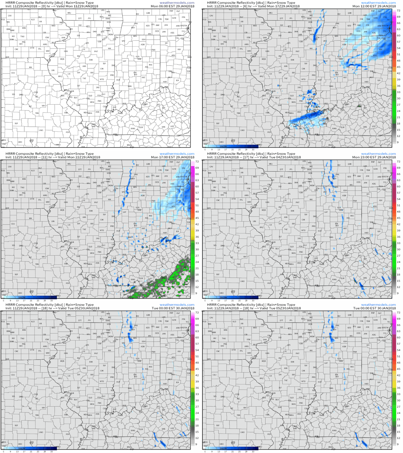
Upper level energy along with a bit of lake effect enhancement will lead to scattered snow showers late morning through the afternoon and into the early evening. We also note high resolution data picking up on a thin lake effect snow band rotating into the northern ‘burbs after the evening rush.
 Cold high pressure will settle overhead Tuesday and Wednesday and supply a return of dry times, complete with sunshine. We’ll turn breezy in advance of our next storm system Wednesday.
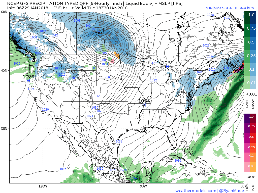 That next system will come in the form of a cold front that will settle south across the state Thursday. Light rain will overspread the region early in the day before mixing with and ending as light snow. This still doesn’t appear to be a significant event for our region at this time.
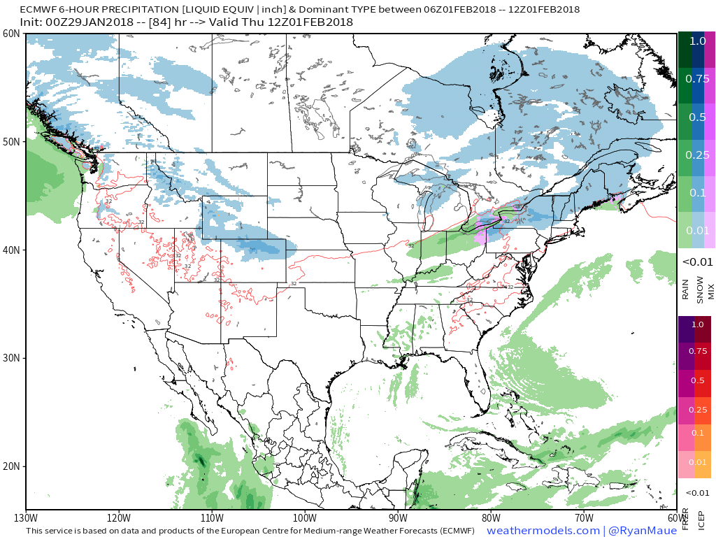 What may be a bigger deal is the event that looms this weekend. Clouds will increase during the day Saturday and a light mix of rain and snow should develop late Saturday night into Sunday morning before colder air wins out changing all precipitation over to snow.
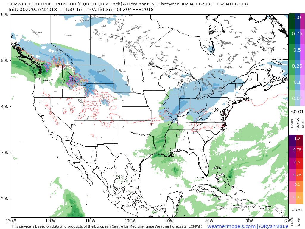 We’re getting into a pattern where the northern stream of the jet will dominate over the next 7-10 days (at least). Models will likely struggle handling individual systems and we’ll have to remain on our toes for the potential of last minute shifts with systems in such a pattern.
Permanent link to this article: https://indywx.com/2018/01/29/colder-times-return-fast-moving-pattern/
Jan 25
VIDEO: Pleasant Close To The Work Week; Wintry Changes Loom Next Week…
You must be logged in to view this content. Click Here to become a member of IndyWX.com for full access. Already a member of IndyWx.com All-Access? Log-in here.
Permanent link to this article: https://indywx.com/2018/01/25/video-pleasant-close-to-the-work-week-wintry-changes-loom-next-week/
Jan 23
Overall Mild Pattern Not Without Challenges…
I. Areas of light snow and freezing drizzle will continue into the overnight hours and on into Wednesday morning. Watch for slick spots overnight-Wednesday morning.
II. Clouds will finally begin to erode Wednesday night and set us up for plentiful sunshine Thursday. Along with the increasing sunshine, a southwesterly air flow will develop and assist with providing a new “warming” trend as we close the work week. Mid-40s are ahead Thursday and lower-50s Friday. A “big hair warning” is officially in effect Friday as winds gust between 30-40 MPH Friday. 🙂
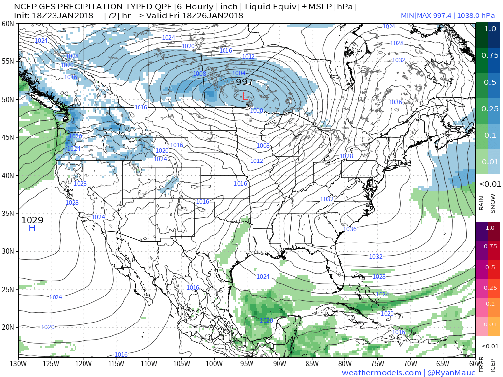
III. Our next storm system arrives on the scene overnight Friday into Saturday with light rain.
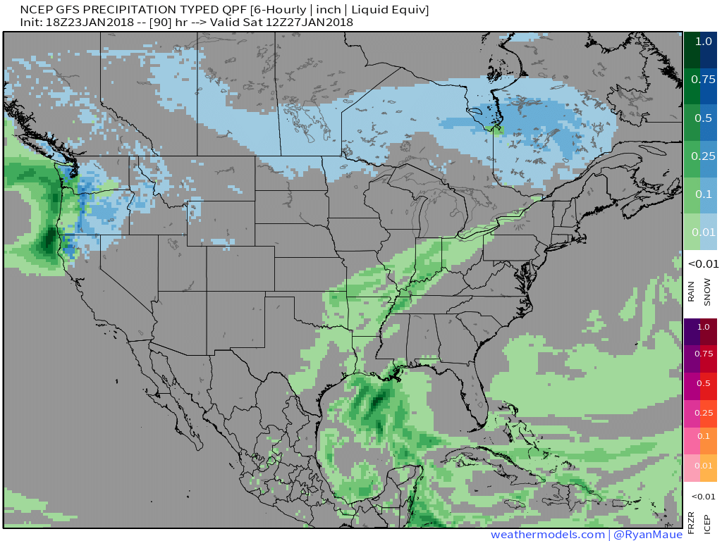
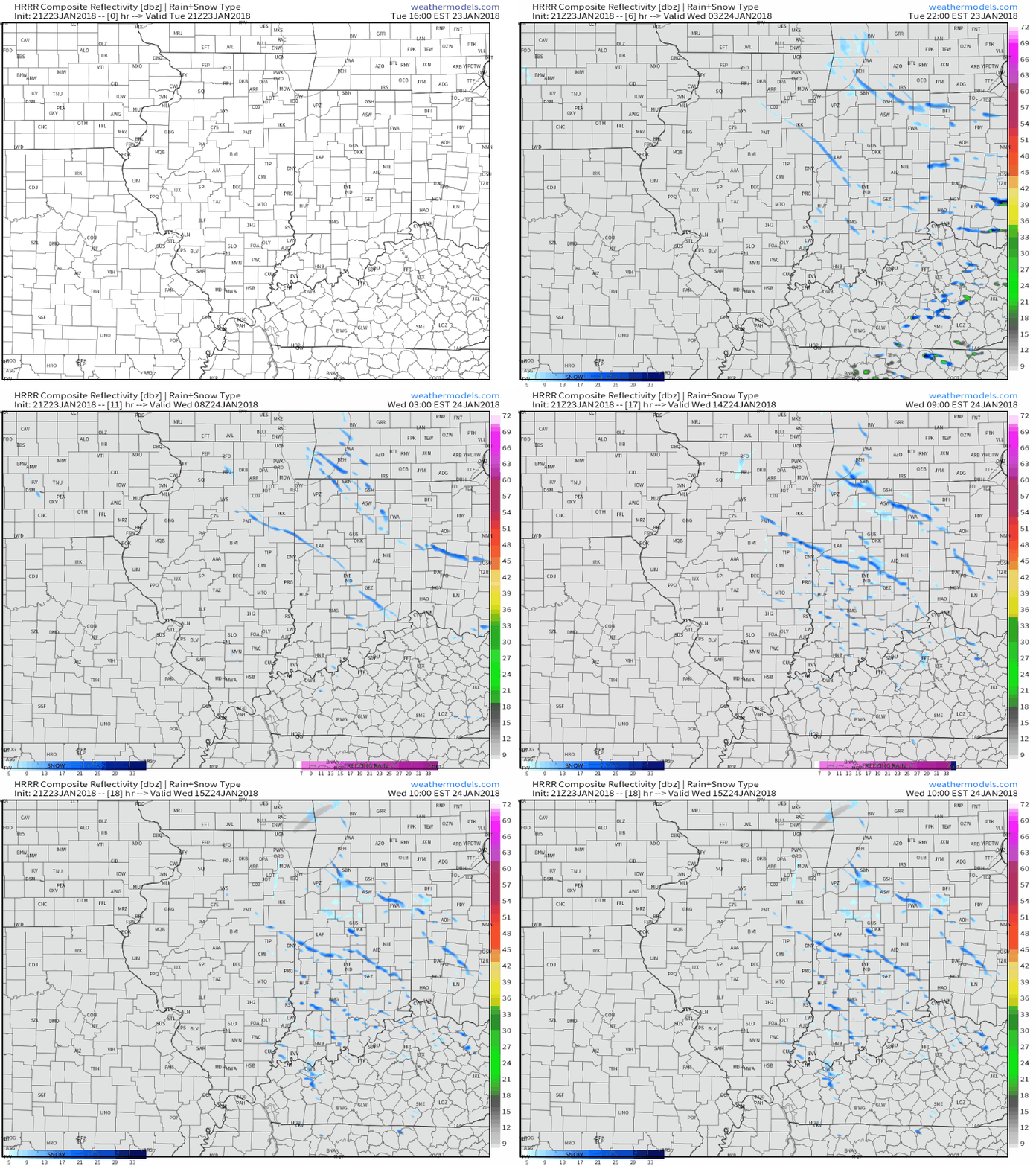
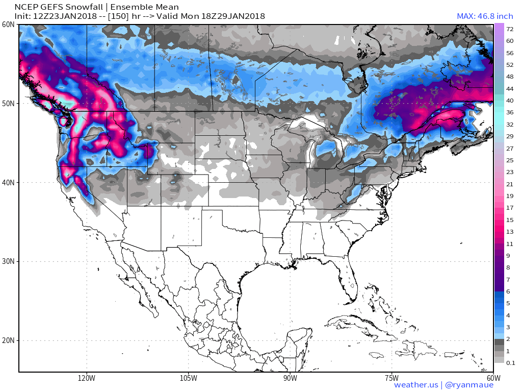
IV. We’re also monitoring the possibility of a “sneaky” snow maker Sunday night into Monday in a fast northwest flow. Light snow will impact portions of the Ohio Valley, but we’ll have to fine tune things over the next few days with respect to specific track and placement of the swath of accumulating snow. Stay tuned!
Permanent link to this article: https://indywx.com/2018/01/23/overall-mild-pattern-not-without-challenges/
Jan 23
VIDEO: Wintry Conditions Return Today; PM Snow Squalls?
You must be logged in to view this content. Click Here to become a member of IndyWX.com for full access. Already a member of IndyWx.com All-Access? Log-in here.
Permanent link to this article: https://indywx.com/2018/01/23/video-wintry-conditions-return-today-pm-snow-squalls/
Jan 22
VIDEO: Spring-Like Feel, Complete With Thunder…
You must be logged in to view this content. Click Here to become a member of IndyWX.com for full access. Already a member of IndyWx.com All-Access? Log-in here.
Permanent link to this article: https://indywx.com/2018/01/22/video-spring-like-feel-complete-with-thunder/
